
Georgia State Route 45
Encyclopedia
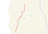
State Route 45 is a north–south state route located in the southwestern part of the U.S. state
of Georgia
. The route travels from U.S. Route 84
/State Route 38 east of Donalsonville
north to U.S. Route 280
/State Route 27 in Plains
.
/State Route 1/State Route 91 west of Colquitt
. The four routes, cosigned
, travel east to Colquitt, where State Route 45 departs and continues north. After brief cosignages with State Route 62 and State Route 216 in and around Arlington
, State Route 45 continues to the northeast, to Morgan
, where it is briefly cosigned with State Route 37. The route continues north from Morgan to U.S. Route 82
/State Route 50. The three routes cosign east to Dawson, where State Route 45 departs and continues north, cosigned with State Route 520. Just north of Dawson, State Route 45 departs State Route 520 and continues north to its northern terminus at U.S. Route 280/State Route 27 at Plains.
State Route 45 is a rural route, and as such, sees very little traffic. The route sees an Average Annual Daily Traffic of less than 2,000 vehicles except when cosigned with U.S. Routes 27 and 82, and State Route 520. Between Morgan and Dawson, the Average Annual Daily Traffic is as low as 400 vehicles.
State Route 45 Connector is a short connector route connecting the town square
in Colquitt with U.S. Route 27/State Route 1 to the south.
U.S. state
A U.S. state is any one of the 50 federated states of the United States of America that share sovereignty with the federal government. Because of this shared sovereignty, an American is a citizen both of the federal entity and of his or her state of domicile. Four states use the official title of...
of Georgia
Georgia (U.S. state)
Georgia is a state located in the southeastern United States. It was established in 1732, the last of the original Thirteen Colonies. The state is named after King George II of Great Britain. Georgia was the fourth state to ratify the United States Constitution, on January 2, 1788...
. The route travels from U.S. Route 84
U.S. Route 84
U.S. Route 84 is an east–west United States highway. It started as a short Georgia-Alabama route in the original 1926 scheme, but now extends all the way to Colorado. The highway's eastern terminus is a short distance east of Midway, Georgia, at an intersection with I-95. The road continues...
/State Route 38 east of Donalsonville
Donalsonville, Georgia
Donalsonville is a city in Seminole County, Georgia, United States. The population was 2,796 at the 2000 census. The city is the county seat of Seminole County.-History:...
north to U.S. Route 280
U.S. Route 280
U.S. Route 280 is a spur of U.S. Highway 80. It currently runs for 392 miles from Blichton, Georgia at U.S. Highway 80 to Birmingham, Alabama at I-20/I-59. For much of its route, U.S. 280 travels through rural areas and smaller cities in southern Georgia and east central Alabama. Once the...
/State Route 27 in Plains
Plains, Georgia
Plains is a city in Sumter County, Georgia, United States. The population was 776 at the 2010 census. It is part of the Americus Micropolitan Statistical Area.-Notable people:...
.
Route description
From its southern terminus at U.S. Route 84/State Route 38 east of Donalsonville, State Route 45 travels north to U.S. Route 27U.S. Route 27
U.S. Route 27 is a north–south United States highway in the southern and midwestern United States. The southern terminus is at US 1 in Miami, Florida. The northern terminus is at Interstate 69 in Fort Wayne, Indiana...
/State Route 1/State Route 91 west of Colquitt
Colquitt, Georgia
Colquitt is a city in Miller County, in the southwestern portion of the U.S. state of Georgia. The population was 1,939 at the 2000 census. Colquitt is the county seat of Miller County, a role it has held since just after Miller County was created by the Georgia Legislature in 1856...
. The four routes, cosigned
Concurrency (road)
A concurrency, overlap, or coincidence in a road network is an instance of one physical road bearing two or more different highway, motorway, or other route numbers...
, travel east to Colquitt, where State Route 45 departs and continues north. After brief cosignages with State Route 62 and State Route 216 in and around Arlington
Arlington, Georgia
Arlington is a city in Calhoun County and Early County, Georgia, United States. The population was 1,602 at the 2000 census.-Geography:Arlington is located at ....
, State Route 45 continues to the northeast, to Morgan
Morgan, Georgia
Morgan is a city in Calhoun County, Georgia, United States. The population was 1,464 at the 2000 census. The city is the county seat of Calhoun County.-Geography:Morgan is located at ....
, where it is briefly cosigned with State Route 37. The route continues north from Morgan to U.S. Route 82
U.S. Route 82
U.S. Route 82 is an east–west United States highway in the southern United States. What started as a 1932 addition to the system across central Mississippi and southern Arkansas eventually became a 1,609 mile route extending from the White Sands of New Mexico to Georgia's Atlantic coast.The...
/State Route 50. The three routes cosign east to Dawson, where State Route 45 departs and continues north, cosigned with State Route 520. Just north of Dawson, State Route 45 departs State Route 520 and continues north to its northern terminus at U.S. Route 280/State Route 27 at Plains.
State Route 45 is a rural route, and as such, sees very little traffic. The route sees an Average Annual Daily Traffic of less than 2,000 vehicles except when cosigned with U.S. Routes 27 and 82, and State Route 520. Between Morgan and Dawson, the Average Annual Daily Traffic is as low as 400 vehicles.
Related routes
State Route 45 Alternate is a short alternative route to the State Route 45 mainline in downtown Arlington.State Route 45 Connector is a short connector route connecting the town square
Town square
A town square is an open public space commonly found in the heart of a traditional town used for community gatherings. Other names for town square are civic center, city square, urban square, market square, public square, and town green.Most town squares are hardscapes suitable for open markets,...
in Colquitt with U.S. Route 27/State Route 1 to the south.