

Fairchilds, Texas
Encyclopedia
Fairchilds is a village in Fort Bend County
, Texas
within the Houston–Sugar Land–Baytown
metropolitan area. The population was 678 at the 2000 census.
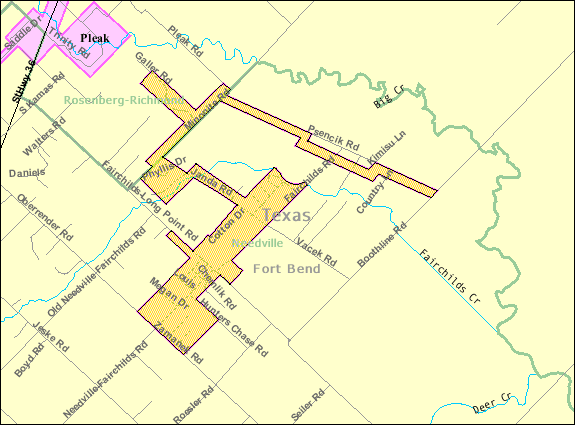 Fairchilds is located at 29°26′47"N 95°46′45"W (29.446300, -95.779208).
According to the United States Census Bureau
, the village has a total area of 2.2 square miles (5.7 km²), all of it land.
of 2000, there were 678 people, 211 households, and 181 families residing in the village. The population density
was 306.1 people per square mile (118.5/km²). There were 226 housing units at an average density of 102.0/sq mi (39.5/km²). The racial makeup of the village was 89.97% White, 2.21% African American, 0.15% Native American, 0.29% Asian, 6.05% from other races
, and 1.33% from two or more races. Hispanic or Latino of any race were 19.17% of the population.
There were 211 households out of which 49.3% had children under the age of 18 living with them, 76.3% were married couples
living together, 7.1% had a female householder with no husband present, and 14.2% were non-families. 11.4% of all households were made up of individuals and 3.3% had someone living alone who was 65 years of age or older. The average household size was 3.21 and the average family size was 3.52.
In the village the population was spread out with 32.3% under the age of 18, 6.9% from 18 to 24, 31.1% from 25 to 44, 22.1% from 45 to 64, and 7.5% who were 65 years of age or older. The median age was 33 years. For every 100 females there were 98.8 males. For every 100 females age 18 and over, there were 94.5 males.
The median income for a household in the village was $52,500, and the median income for a family was $58,942. Males had a median income of $34,773 versus $26,010 for females. The per capita income
for the village was $16,653. About 1.6% of families and 4.4% of the population were below the poverty line, including 7.7% of those under age 18 and none of those age 65 or over.
. Needville High School
serves the community.
Fort Bend County, Texas
Fort Bend County is a county located along the Gulf Coast region in the U.S. state of Texas within the Houston–Sugar Land–Baytown metropolitan area. In 2000 its population was 354,452, while the 2010 U.S...
, Texas
Texas
Texas is the second largest U.S. state by both area and population, and the largest state by area in the contiguous United States.The name, based on the Caddo word "Tejas" meaning "friends" or "allies", was applied by the Spanish to the Caddo themselves and to the region of their settlement in...
within the Houston–Sugar Land–Baytown
Greater Houston
Houston–Sugar Land–Baytown is a 10-county metropolitan area defined by the Office of Management and Budget. It is located along the Gulf Coast region in the U.S. state of Texas...
metropolitan area. The population was 678 at the 2000 census.
Geography
According to the United States Census Bureau
United States Census Bureau
The United States Census Bureau is the government agency that is responsible for the United States Census. It also gathers other national demographic and economic data...
, the village has a total area of 2.2 square miles (5.7 km²), all of it land.
Demographics
As of the censusCensus
A census is the procedure of systematically acquiring and recording information about the members of a given population. It is a regularly occurring and official count of a particular population. The term is used mostly in connection with national population and housing censuses; other common...
of 2000, there were 678 people, 211 households, and 181 families residing in the village. The population density
Population density
Population density is a measurement of population per unit area or unit volume. It is frequently applied to living organisms, and particularly to humans...
was 306.1 people per square mile (118.5/km²). There were 226 housing units at an average density of 102.0/sq mi (39.5/km²). The racial makeup of the village was 89.97% White, 2.21% African American, 0.15% Native American, 0.29% Asian, 6.05% from other races
Race (United States Census)
Race and ethnicity in the United States Census, as defined by the Federal Office of Management and Budget and the United States Census Bureau, are self-identification data items in which residents choose the race or races with which they most closely identify, and indicate whether or not they are...
, and 1.33% from two or more races. Hispanic or Latino of any race were 19.17% of the population.
There were 211 households out of which 49.3% had children under the age of 18 living with them, 76.3% were married couples
Marriage
Marriage is a social union or legal contract between people that creates kinship. It is an institution in which interpersonal relationships, usually intimate and sexual, are acknowledged in a variety of ways, depending on the culture or subculture in which it is found...
living together, 7.1% had a female householder with no husband present, and 14.2% were non-families. 11.4% of all households were made up of individuals and 3.3% had someone living alone who was 65 years of age or older. The average household size was 3.21 and the average family size was 3.52.
In the village the population was spread out with 32.3% under the age of 18, 6.9% from 18 to 24, 31.1% from 25 to 44, 22.1% from 45 to 64, and 7.5% who were 65 years of age or older. The median age was 33 years. For every 100 females there were 98.8 males. For every 100 females age 18 and over, there were 94.5 males.
The median income for a household in the village was $52,500, and the median income for a family was $58,942. Males had a median income of $34,773 versus $26,010 for females. The per capita income
Per capita income
Per capita income or income per person is a measure of mean income within an economic aggregate, such as a country or city. It is calculated by taking a measure of all sources of income in the aggregate and dividing it by the total population...
for the village was $16,653. About 1.6% of families and 4.4% of the population were below the poverty line, including 7.7% of those under age 18 and none of those age 65 or over.
Education
Fairchilds residents are zoned to schools in the Needville Independent School DistrictNeedville Independent School District
Needville Independent School District is a public school district based in Needville, Texas .In addition to Needville, the district also serves the town of Fairchilds and the unincorporated communities of Guy and Long Point...
. Needville High School
Needville High School
Needville High School is a public secondary school located in Needville, Texas, United States. The school serves residents of Needville, Fairchilds, and the unincorporated communities of Guy and Long Point...
serves the community.