

Extreme points of Luxembourg
Encyclopedia
This is a list of the extreme points of Luxembourg
, the points that are farther north
, south
, east
or west
, higher or lower
than any other location on the territory of the state.
Luxembourg
Luxembourg , officially the Grand Duchy of Luxembourg , is a landlocked country in western Europe, bordered by Belgium, France, and Germany. It has two principal regions: the Oesling in the North as part of the Ardennes massif, and the Gutland in the south...
, the points that are farther north
North
North is a noun, adjective, or adverb indicating direction or geography.North is one of the four cardinal directions or compass points. It is the opposite of south and is perpendicular to east and west.By convention, the top side of a map is north....
, south
South
South is a noun, adjective, or adverb indicating direction or geography.South is one of the four cardinal directions or compass points. It is the opposite of north and is perpendicular to east and west.By convention, the bottom side of a map is south....
, east
East
East is a noun, adjective, or adverb indicating direction or geography.East is one of the four cardinal directions or compass points. It is the opposite of west and is perpendicular to north and south.By convention, the right side of a map is east....
or west
West
West is a noun, adjective, or adverb indicating direction or geography.West is one of the four cardinal directions or compass points. It is the opposite of east and is perpendicular to north and south.By convention, the left side of a map is west....
, higher or lower
Altitude
Altitude or height is defined based on the context in which it is used . As a general definition, altitude is a distance measurement, usually in the vertical or "up" direction, between a reference datum and a point or object. The reference datum also often varies according to the context...
than any other location on the territory of the state.
Latitude and longitude
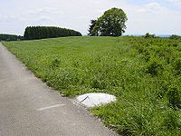
- Northernmost point — near HuldangeHuldangeHuldange is a small town in the commune of Troisvierges, in far northern Luxembourg. , the town has a population of 353. Nearby is the source of the Clerve....
(50°10′58.6"N 6°1′28.66"E). - Southernmost point — near RumelangeRumelangeRumelange is a commune with city status in south-western Luxembourg, on the border with France., the town of Rumelange, which lies in the east of the commune, has a population of 4,818. It is also the site of some of the underground iron mines no longer in operation...
(49°27′N 6°02′E). - Easternmost point — on SauerSauerThe Sauer or Sûre is a river in Belgium, Luxembourg and Germany. A left tributary of the river Moselle, its total length is 173 km....
River near RosportRosportRosport is a commune and small town in eastern Luxembourg. It is part of the canton of Echternach, which is part of the district of Grevenmacher., the town of Rosport, which lies in the north-east of the commune, has a population of 656...
(49°49′N 6°32′E). - Westernmost point — near SurréSurréSurré is a village in the commune of Boulaide, in north-western Luxembourg. , the village has a population of 180....
(49°54′N 5°44′E).
Altitude
- Highest point — KneiffKneiffKneiff is a hill in the commune of Troisvierges, in northern Luxembourg, near the tripoint shared with Belgium and Germany. At 560 metres, it is the highest point in the country; it is 1 m taller than Buurgplaatz, which is often erroneously considered Luxembourg's highest point. It lies close to...
, in TroisviergesTroisviergesTroisvierges is a commune and town in northern Luxembourg, in the canton of Clervaux. The two highest hills in Luxembourg, the Kneiff and Buurgplaatz , are located in the commune....
(560 mMM is the thirteenth letter of the basic modern Latin alphabet.-History:The letter M is derived from the Phoenician Mem, via the Greek Mu . Semitic Mem probably originally pictured water...
) (50°09.439′N 6°02.220′E). - Lowest point — confluence of Sauer and MoselleMoselleMoselle is a department in the east of France named after the river Moselle.- History :Moselle is one of the original 83 departments created during the French Revolution on March 4, 1790...
Rivers, in WasserbilligWasserbilligWasserbillig is a town in the commune of Mertert, in eastern Luxembourg. , Wasserbillig has 2,186 inhabitants, which makes it the largest town in Mertert. It lies at the confluence of the rivers Moselle and Sauer, which form the border with Germany at the town...
(132 mMM is the thirteenth letter of the basic modern Latin alphabet.-History:The letter M is derived from the Phoenician Mem, via the Greek Mu . Semitic Mem probably originally pictured water...
) (49.713°N 6.5065°E).