
Essex Way
Encyclopedia
The Essex Way is a waymarked long-distance footpath 81 miles long, along footpaths and roads in Essex
, England
.
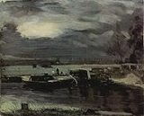
The trail starts in Epping
in the south-west, crosses Dedham
Vale and Constable
country to finish at the port of Harwich
on the Stour
estuary.
It leads you through ancient woodland
s, open farmland, tree-lined river valleys and leafy green lanes, unveiling historic towns and villages along the way.
Look out for the special Essex Way plaques and direction arrows. The original CPRE signs were dark green, but most of these have now been replaced with Essex County Council plaques depicting two poppies on a white background. These are attached to fingerposts, stiles, gates, footbridges and posts. The Essex Way is clearly signposted and waymarked in both directions, although it isn't clear if you start at the Harwich end that you need to start by heading towards the sea front and then turn right, so the maps in the guidebook are fairly essential in that instance. The waymarks, together with the maps in the guidebook, make the walk easy to follow. The guidebook illustrates points of interest along the way and includes an accommodation guide for the whole route.
The Essex Way crosses three other long-distance footpaths including St Peter's Way (a 45 miles (72.4 km) walk from Chipping Ongar
to Bradwell-on-Sea
), the Three Forests Way (a 60 miles (96.6 km) circular walk linking Epping, Hatfield and Hainhault forests) and the Essex Clayway (a 28 miles (45.1 km) route linking the Essex Way at Coggeshall
to St Peter's Way at Mundon).
1:25,000 "Explorer Maps" : Epping Forest & Lee Valley No. 174,
Chelmsford and The Rodings No.183, Braintree and Saffron Waldon No.195,
Sudbury, Hadleigh.
Essex
Essex is a ceremonial and non-metropolitan county in the East region of England, and one of the home counties. It is located to the northeast of Greater London. It borders with Cambridgeshire and Suffolk to the north, Hertfordshire to the west, Kent to the South and London to the south west...
, England
England
England is a country that is part of the United Kingdom. It shares land borders with Scotland to the north and Wales to the west; the Irish Sea is to the north west, the Celtic Sea to the south west, with the North Sea to the east and the English Channel to the south separating it from continental...
.
The trail starts in Epping
Epping
Epping is a small market town and civil parish in the Epping Forest district of the County of Essex, England. It is located north-east of Loughton, south of Harlow and north-west of Brentwood....
in the south-west, crosses Dedham
Dedham, Essex
Dedham is a village within the borough of Colchester in northeast Essex, England, situated on the River Stour and on the border of Essex and Suffolk...
Vale and Constable
John Constable
John Constable was an English Romantic painter. Born in Suffolk, he is known principally for his landscape paintings of Dedham Vale, the area surrounding his home—now known as "Constable Country"—which he invested with an intensity of affection...
country to finish at the port of Harwich
Harwich
Harwich is a town in Essex, England and one of the Haven ports, located on the coast with the North Sea to the east. It is in the Tendring district. Nearby places include Felixstowe to the northeast, Ipswich to the northwest, Colchester to the southwest and Clacton-on-Sea to the south...
on the Stour
River Stour, Suffolk
The River Stour is a river in East Anglia, England. It is 76 km long and forms most of the county boundary between Suffolk to the north, and Essex to the south. It rises in eastern Cambridgeshire, passes to the east of Haverhill, through Cavendish, Sudbury and the Dedham Vale, and joins the...
estuary.
It leads you through ancient woodland
Ancient woodland
Ancient woodland is a term used in the United Kingdom to refer specifically to woodland that has existed continuously since 1600 or before in England and Wales . Before those dates, planting of new woodland was uncommon, so a wood present in 1600 was likely to have developed naturally...
s, open farmland, tree-lined river valleys and leafy green lanes, unveiling historic towns and villages along the way.
Look out for the special Essex Way plaques and direction arrows. The original CPRE signs were dark green, but most of these have now been replaced with Essex County Council plaques depicting two poppies on a white background. These are attached to fingerposts, stiles, gates, footbridges and posts. The Essex Way is clearly signposted and waymarked in both directions, although it isn't clear if you start at the Harwich end that you need to start by heading towards the sea front and then turn right, so the maps in the guidebook are fairly essential in that instance. The waymarks, together with the maps in the guidebook, make the walk easy to follow. The guidebook illustrates points of interest along the way and includes an accommodation guide for the whole route.
The Essex Way crosses three other long-distance footpaths including St Peter's Way (a 45 miles (72.4 km) walk from Chipping Ongar
Chipping Ongar
Chipping Ongar is a small market town, and a civil parish called Ongar, in the Epping Forest district of the county of Essex, England. It is located East of Epping, South-East of Harlow and North-West of Brentwood.-Geography:...
to Bradwell-on-Sea
Bradwell-on-Sea
Bradwell-on-Sea is a village in Essex, England. The village is on the Dengie peninsula. It is located about north-northeast of Southminster and is east from the county town of Chelmsford. The village is in the District of Maldon in the parliamentary constituency of Maldon whose boundaries were...
), the Three Forests Way (a 60 miles (96.6 km) circular walk linking Epping, Hatfield and Hainhault forests) and the Essex Clayway (a 28 miles (45.1 km) route linking the Essex Way at Coggeshall
Coggeshall
Coggeshall is a small market town of 3,919 residents in Essex, England, situated between Colchester and Braintree on the Roman road of Stane Street , and intersected by the River Blackwater. It is known for its almost 300 listed buildings and formerly extensive antique trade...
to St Peter's Way at Mundon).
History
The Essex Way was conceived as a result of a competition organised by the CPRE in 1972.Maps
Ordnance SurveyOrdnance Survey
Ordnance Survey , an executive agency and non-ministerial government department of the Government of the United Kingdom, is the national mapping agency for Great Britain, producing maps of Great Britain , and one of the world's largest producers of maps.The name reflects its creation together with...
1:25,000 "Explorer Maps" : Epping Forest & Lee Valley No. 174,
Chelmsford and The Rodings No.183, Braintree and Saffron Waldon No.195,
Sudbury, Hadleigh.