

Erlestoke
Encyclopedia
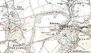
Erlestoke is a village and civil parish about 6 miles (9.7 km) southwest of the market town
of Devizes
in Wiltshire
.
, a Member of Parliament
for Devizes
. Between the 1780s and the 1810s Smith was responsible for replacing the existing Elizabethan house with one higher up the hill east of the village, landscaping the park, and moving the houses of the village to the current High Street, where he added picturesque estate cottages incorporating pieces of sculpture and architectural fragments from the old manor house
.
Erlestoke House was seriously damaged by a fire in 1950. It is now part of HM Prison Erlestoke
.
unitary authority
, which is responsible for all significant local government
functions.
Erlestoke was in the District of Kennet until the four Wiltshire district councils were dissolved in 2009.
 Position:
Market town
Market town or market right is a legal term, originating in the medieval period, for a European settlement that has the right to host markets, distinguishing it from a village and city...
of Devizes
Devizes
Devizes is a market town and civil parish in Wiltshire, England. The town is about southeast of Chippenham and about east of Trowbridge.Devizes serves as a centre for banks, solicitors and shops, with a large open market place where a market is held once a week...
in Wiltshire
Wiltshire
Wiltshire is a ceremonial county in South West England. It is landlocked and borders the counties of Dorset, Somerset, Hampshire, Gloucestershire, Oxfordshire and Berkshire. It contains the unitary authority of Swindon and covers...
.
History
The current form of the village of Erlestoke is largely due to Joshua SmithJoshua Smith (English politician)
Joshua Smith was an English politician. He was Member of Parliament for Devizes in Wiltshire from 1788 to 1818.- References :...
, a Member of Parliament
Member of Parliament
A Member of Parliament is a representative of the voters to a :parliament. In many countries with bicameral parliaments, the term applies specifically to members of the lower house, as upper houses often have a different title, such as senate, and thus also have different titles for its members,...
for Devizes
Devizes
Devizes is a market town and civil parish in Wiltshire, England. The town is about southeast of Chippenham and about east of Trowbridge.Devizes serves as a centre for banks, solicitors and shops, with a large open market place where a market is held once a week...
. Between the 1780s and the 1810s Smith was responsible for replacing the existing Elizabethan house with one higher up the hill east of the village, landscaping the park, and moving the houses of the village to the current High Street, where he added picturesque estate cottages incorporating pieces of sculpture and architectural fragments from the old manor house
Manor house
A manor house is a country house that historically formed the administrative centre of a manor, the lowest unit of territorial organisation in the feudal system in Europe. The term is applied to country houses that belonged to the gentry and other grand stately homes...
.
Erlestoke House was seriously damaged by a fire in 1950. It is now part of HM Prison Erlestoke
Erlestoke (HM Prison)
HM Prison Erlestoke is a Category C men's prison, located in the village of Erlestoke in Wiltshire, England. Erlestoke is operated by Her Majesty's Prison Service, and is the only prison in Wiltshire.-History:...
.
Local government
Erlestoke has an elected parish council. It is in the area of Wiltshire CouncilWiltshire Council
Wiltshire Council is the unitary authority for most of the county of Wiltshire, in the West of England, the successor authority to Wiltshire County Council and to four districts—Kennet, North Wiltshire, Salisbury, and West Wiltshire—all of which had been created in 1973 and were...
unitary authority
Unitary authority
A unitary authority is a type of local authority that has a single tier and is responsible for all local government functions within its area or performs additional functions which elsewhere in the relevant country are usually performed by national government or a higher level of sub-national...
, which is responsible for all significant local government
Local government
Local government refers collectively to administrative authorities over areas that are smaller than a state.The term is used to contrast with offices at nation-state level, which are referred to as the central government, national government, or federal government...
functions.
Erlestoke was in the District of Kennet until the four Wiltshire district councils were dissolved in 2009.
Location
Sources
- Map 'Explorer 143', published by the Ordnance SurveyOrdnance SurveyOrdnance Survey , an executive agency and non-ministerial government department of the Government of the United Kingdom, is the national mapping agency for Great Britain, producing maps of Great Britain , and one of the world's largest producers of maps.The name reflects its creation together with...
, ISBN 0-319-23557-2, revised 2004.
External links
- Wiltshire Council Website page on Erlestoke, retrieved 23:00 Oct 24, 2004 (UTC)
- Office for National Statistics (ONS) - List of English parishes, retrieved 14:00 Oct 3, 2004 (UTC).