

Engenheiro Navarro
Encyclopedia
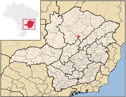
Minas Gerais
Minas Gerais is one of the 26 states of Brazil, of which it is the second most populous, the third richest, and the fourth largest in area. Minas Gerais is the Brazilian state with the largest number of Presidents of Brazil, the current one, Dilma Rousseff, being one of them. The capital is the...
. Its population as of 2007 was 7,079 people living in a total area of 632 km². The city belongs to the mesoregion
Mesoregion (Brazil)
Mesoregions are subdivisions of Brazilian states, grouping together various municipalities in proximity and with common characteristics. They were created by the Brazilian Institute of Geography and Statistics for statistical purposes and do not, therefore, constitute an administrative area....
of North of Minas and to the microregion
Microregion (Brazil)
Microregions are legally defined administrative areas in Brazil consisting of groups of municipalities bordering urban areas. Microregions are grouped together into mesoregions....
of Bocaiúva
Bocaiúva
Bocaiúva is a Brazilian municipality located in the northwest of the state of Minas Gerais. Its population as of 2007 was 44,657 people living in a total area of 3,232 km². The city belongs to the mesoregion of North of Minas and to the microregion of Bocaiúva...
. It became a municipality in 1962.
Engenheiro Navarro is located at an elevation 637 meters on the railroad line that links Belo Horizonte
Belo Horizonte
Belo Horizonte is the capital of and largest city in the state of Minas Gerais, located in the southeastern region of Brazil. It is the third largest metropolitan area in the country...
to Montes Claros
Montes Claros
Montes Claros is a city located in northern Minas Gerais state, in Brazil. The estimated population in 2010 was 412,284 inhabitants and the total area of the municipality was 3,470 km²...
. This line is no longer used for passenger traffic. Highway BR-135, which links Montes Claros to the state boundary with Goiás
Goiás
Goiás is a state of Brazil, located in the central part of the country. The name Goiás comes from the name of an indigenous community...
passes at a distance of 4 kilometers to the east. The distance to Bocaiúva
Bocaiúva
Bocaiúva is a Brazilian municipality located in the northwest of the state of Minas Gerais. Its population as of 2007 was 44,657 people living in a total area of 3,232 km². The city belongs to the mesoregion of North of Minas and to the microregion of Bocaiúva...
is 35 km; the distance to Montes Claros
Montes Claros
Montes Claros is a city located in northern Minas Gerais state, in Brazil. The estimated population in 2010 was 412,284 inhabitants and the total area of the municipality was 3,470 km²...
is 85 km; and the distance to Belo Horizonte
Belo Horizonte
Belo Horizonte is the capital of and largest city in the state of Minas Gerais, located in the southeastern region of Brazil. It is the third largest metropolitan area in the country...
is 347 km. Neighboring municipalities are: Bocaiúva
Bocaiúva
Bocaiúva is a Brazilian municipality located in the northwest of the state of Minas Gerais. Its population as of 2007 was 44,657 people living in a total area of 3,232 km². The city belongs to the mesoregion of North of Minas and to the microregion of Bocaiúva...
(N) and (E); Joaquim Felício
Joaquim Felício
Joaquim Felício is a Brazilian municipality located in the northeast of the state of Minas Gerais. Its population as of 2007 was 3,937 living in a total area of 791 km². The city belongs to the statistical mesoregion of Central Mineira and to the statistical microregion of Curvelo. It became a...
(S); Francisco Dumont
Francisco Dumont
Francisco Dumont is a Brazilian municipality located in the north of the state of Minas Gerais. Its population as of 2007 was 4,759 people living in a total area of 1,553 km². The city belongs to the mesoregion of North of Minas and to the microregion of Bocaiúva. It became a municipality in 1962...
and Claro dos Poções
Claro dos Poções
Claro dos Poções is a Brazilian municipality located in the north of the state of Minas Gerais. In 2007 the population was 8,131 in a total area of 706 km². It became a municipality in 1962.-Location and distances:...
(W).
The main economic activities are cattle raising, services, and agriculture. The GDP in 2005 was R$23 million, with 14 million in services, 2 million in industry, and 5 million in agriculture. There were 268 rural producers on 40,000 hectares of land. The main crops were cotton, sugarcane, beans, and corn. There were 27,000 head of cattle (2006).
- Municipal Human Development IndexHuman Development IndexThe Human Development Index is a composite statistic used to rank countries by level of "human development" and separate "very high human development", "high human development", "medium human development", and "low human development" countries...
: 0.686 (2000) - State ranking: 606 out of 853 municipalities as of 2000
- National ranking: 3,220 out of 5,138 municipalities as of 2000
- Literacy rate: 73%
- Life expectancy: 72 (average of males and females)
- Degree of urbanization: 66.53% (2000)
- Percentage of urban houses with sewage connections: 1.70%
The highest ranking municipality in Minas Gerais in 2000 was Poços de Caldas
Poços de Caldas
Poços de Caldas is a city and municipality in south-western Minas Gerais state, Brazil, in the microregion of the same name. Its estimated population in 2009 was 151,449 inhabitants...
with 0.841, while the lowest was Setubinha
Setubinha
Setubinha is a municipality in the northeast of the Brazilian state of Minas Gerais. As of 2007 the population was 10,834 in a total area of 536 km². The elevation is 729 metres. It is part of the IBGE statistical microregion of Teófilo Otoni...
with 0.568. Nationally the highest was São Caetano do Sul
São Caetano do Sul
São Caetano do Sul is a city in São Paulo state in Brazil, located in the Greater São Paulo Metropolitan Area. It is the city with the highest per capita income in Brazil and it also has the highest Human Development Index .-Geography:São Caetano do Sul is located on a plateau that is part of the...
in São Paulo with 0.919, while the lowest was Setubinha. In more recent statistics (considering 5,507 municipalities) Manari in the state of Pernambuco
Pernambuco
Pernambuco is a state of Brazil, located in the Northeast region of the country. To the north are the states of Paraíba and Ceará, to the west is Piauí, to the south are Alagoas and Bahia, and to the east is the Atlantic Ocean. There are about of beaches, some of the most beautiful in the...
has the lowest rating in the country--0,467--putting it in last place.
See also
- List of municipalities in Minas Gerais