
Earhart Expressway
Encyclopedia
The Earhart Expressway, named for Frederick Earhart
, is a state highway
located in both Jefferson Parish
and Orleans Parish, Louisiana. It is also designated as Louisiana Highway 3139 or LA 3139. Although it is an odd-numbered highway and it is bannered north/south, it travels in a more east-to-west direction.
(Dickory Avenue) in Jefferson Parish and Monroe Street in New Orleans. In Jefferson Parish, Earhart Expressway is a limited-access freeway, with three lanes in each direction, although with no paved shoulder. A full interchange occurs at LA 3152
(Clearview Parkway); otherwise, exits only occur from the west-bound lanes, and marked on-ramps only serve the east-bound direction (an unmarked on-ramp enters the westbound lanes from L&A Road behind the Kansas City Southern railroad yard). The posted speed limit
is 50 mph (80 km/h) along the winding route. Once it enters Orleans Parish, Earhart Expressway changes into Earhart Boulevard and becomes a divided, four lane street. The Expressway is used as a relatively uncongested route for commuters, as well as an alternate to Interstate 10
or Airline Drive to reach New Orleans International Airport
.
Fred A. Earhart
Fred A. Earhart was briefly acting mayor of New Orleans for one day on July 15, 1936.A pharmacist, Earhart was the Twelfth Ward leader of the Regular Democratic Organization political machine. He was an Old Regular state senator for the Twelfth Ward from 1912 into the 1920s...
, is a state highway
State highway
State highway, state road or state route can refer to one of three related concepts, two of them related to a state or provincial government in a country that is divided into states or provinces :#A...
located in both Jefferson Parish
Jefferson Parish, Louisiana
Jefferson Parish is a parish in Louisiana, United States that includes most of the suburbs of New Orleans. The seat of parish government is Gretna....
and Orleans Parish, Louisiana. It is also designated as Louisiana Highway 3139 or LA 3139. Although it is an odd-numbered highway and it is bannered north/south, it travels in a more east-to-west direction.
Route description
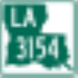
Earhart Expressway travels 4.82 miles (7.76 km) between LA 3154Louisiana Highway 3154
Louisiana Highway 3154 is a state highway in Louisiana that serves Jefferson Parish. LA 3154 spans in a south to north direction and is known locally as Hickory Avenue, Gardner Street, Robert Street, and Dickory Avenue.-Route description:...
(Dickory Avenue) in Jefferson Parish and Monroe Street in New Orleans. In Jefferson Parish, Earhart Expressway is a limited-access freeway, with three lanes in each direction, although with no paved shoulder. A full interchange occurs at LA 3152
Louisiana Highway 3152
Louisiana Highway 3152 is a state highway in Louisiana that serves Jefferson Parish. LA 3152 spans in a south to north direction and is known locally as Clearview Parkway.-Route description:...
(Clearview Parkway); otherwise, exits only occur from the west-bound lanes, and marked on-ramps only serve the east-bound direction (an unmarked on-ramp enters the westbound lanes from L&A Road behind the Kansas City Southern railroad yard). The posted speed limit
Speed limit
Road speed limits are used in most countries to regulate the speed of road vehicles. Speed limits may define maximum , minimum or no speed limit and are normally indicated using a traffic sign...
is 50 mph (80 km/h) along the winding route. Once it enters Orleans Parish, Earhart Expressway changes into Earhart Boulevard and becomes a divided, four lane street. The Expressway is used as a relatively uncongested route for commuters, as well as an alternate to Interstate 10
Interstate 10
Interstate 10 is the fourth-longest Interstate Highway in the United States, after I-90, I-80, and I-40. It is the southernmost east–west, coast-to-coast Interstate Highway, although I-4 and I-8 are further south. It stretches from the Pacific Ocean at State Route 1 in Santa Monica,...
or Airline Drive to reach New Orleans International Airport
Louis Armstrong New Orleans International Airport
Louis Armstrong New Orleans International Airport is a Class B public use international airport in Jefferson Parish, Louisiana, United States. It is owned by the City of New Orleans and is located 10 nautical miles west of its central business district. The airport's address is 900 Airline Drive...
.
Earhart Boulevard
In Orleans Parish, Earhart loses its expressway designation at Monroe Street., which is about 0.5 mile (0.80467 km) from the parish line. However, Earhart Boulevard continues eastward towards Downtown until it intersects with South Claiborne Avenue, where it becomes Calliope Street.Junction List
| Parish | Location | Destinations | Notes |
|---|---|---|---|
| Orleans | New Orleans | ||
| Earhart Boulevard ends and Earhart Expressway begins | |||
| Jefferson Jefferson Parish, Louisiana Jefferson Parish is a parish in Louisiana, United States that includes most of the suburbs of New Orleans. The seat of parish government is Gretna.... |
Metairie Metairie, Louisiana Metairie is a census-designated place in Jefferson Parish, Louisiana, United States and is a major part of the New Orleans Metropolitan Area. Metairie is the largest community in Jefferson Parish. It is an unincorporated area that would be larger than most of the state's cities if it were... |
L and A Road | Northbound entrance (unsigned) |
| Deckbar Avenue | Northbound exit and southbound entrance | ||
| Cleary Avenue to | Northbound exit and southbound entrance | ||
| Harahan Harahan, Louisiana Harahan is a city in Jefferson Parish, Louisiana, United States, and a suburb of New Orleans. The population was 9,885 at the 2000 census.Harahan was named in honor of James Theodore Harahan, president of the Illinois Central Railroad from 1906-1911... |
North end of freeway | ||