

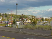
Duluth Heights
Encyclopedia
Neighborhoods of Duluth, Minnesota
The city of Duluth, overlooking Lake Superior in the U.S. state of Minnesota has several distinct neighborhoods.- Central :*Canal Park*Central Hillside*Downtown Duluth*East Hillside*Park Point- Eastern Duluth :*Chester Park / UMD*Congdon Park...
(in terms of area) in the city of Duluth
Duluth, Minnesota
Duluth is a port city in the U.S. state of Minnesota and is the county seat of Saint Louis County. The fourth largest city in Minnesota, Duluth had a total population of 86,265 in the 2010 census. Duluth is also the second largest city that is located on Lake Superior after Thunder Bay, Ontario,...
, Minnesota
Minnesota
Minnesota is a U.S. state located in the Midwestern United States. The twelfth largest state of the U.S., it is the twenty-first most populous, with 5.3 million residents. Minnesota was carved out of the eastern half of the Minnesota Territory and admitted to the Union as the thirty-second state...
, United States
United States
The United States of America is a federal constitutional republic comprising fifty states and a federal district...
.
Central Entrance
Minnesota State Highway 194
Minnesota State Highway 194 is a highway in northeast Minnesota, which runs from its intersection with U.S. Highway 2 in Solway Township and continues east to its eastern terminus at its Mesaba Avenue interchange with Interstate Highway 35 in downtown Duluth. For part of its route, it runs...
, Arlington Avenue, and Arrowhead Road are three of the main arterial routes in Duluth Heights.
Miller Creek, Coffee Creek, Buckingham Creek, and the West Branch of Chester Creek, all flow through the Duluth Heights neighborhood.
According to the city's map, the Duluth International Airport
Duluth International Airport
Duluth International Airport is a city-owned, public-use airport located five nautical miles northwest of the central business district of Duluth, a city in St. Louis County, Minnesota, United States. It serves the Duluth-Superior area including Superior, Wisconsin...
lies within the boundaries of Duluth Heights.
History
As late as forty years ago, Duluth Heights was primarily undeveloped and rural, but the arrival of the Miller Hill MallMiller Hill Mall
Miller Hill Mall is a shopping mall located in Duluth, Minnesota, USA. It is located on U.S. Highway 53 where it intersects Trinity Road. The mall, owned by Simon Property Group, features JCPenney, Sears and Younkers as its anchor stores, as well as Barnes & Noble and DSW Shoe Warehouse, with more...
brought a large number of businesses both in the building and outside, some migrating from the city's old Downtown
Downtown Duluth
The Downtown of Duluth, Minnesota, United States; is situated between Mesaba Avenue and 4th Avenue East; and located on Michigan, Superior, First, Second, and Third Streets.The downtown area is easily accessible from Interstate Highway 35....
district, forming the U.S. Highway 53
U.S. Route 53
U.S. Route 53 is a north–south U.S. highway that runs for 403 miles from La Crosse, Wisconsin to northern Minnesota. It is the primary north–south route in northwestern Wisconsin, serving as a vital link between I-94 at Eau Claire, Wisconsin and the city of Duluth, Minnesota...
or Miller Trunk
Miller Trunk Corridor
The Highway 53 or Miller Trunk Corridor refers to a large agglomeration of retail development in Duluth, Minnesota on and around U.S. Highway 53, and by extension, State Highway 194 , and parts of the Arrowhead, Haines, and Maple Grove Roads...
corridor. The area is more suburban
Suburb
The word suburb mostly refers to a residential area, either existing as part of a city or as a separate residential community within commuting distance of a city . Some suburbs have a degree of administrative autonomy, and most have lower population density than inner city neighborhoods...
in appearance than many other areas in Duluth.
Adjacent Neighborhoods
- KenwoodKenwood (Duluth)Kenwood is a neighborhood in Duluth, Minnesota, United States.Kenwood Avenue and Arrowhead Road are two of the main arterial routes in the community.-Notes:...
(east) - Piedmont HeightsPiedmont Heights (Duluth)Piedmont Heights is a neighborhood in Duluth, Minnesota, United States.Piedmont Avenue, Chambersburg Avenue, and Morris Thomas Road are three of the main arterial routes in the community. The neighborhood is located between Skyline Parkway and Haines Road....
(west) - City of HermantownHermantown, MinnesotaAs of the census of 2000, there were 7,448 people, 2,726 households, and 2,077 families residing in the city. The population density was 216.9 people per square mile . There were 2,822 housing units at an average density of 82.2 per square mile...
(north) - Central HillsideCentral Hillside (Duluth)Central Hillside is a neighborhood in Duluth, Minnesota, United States; located directly uphill from the city's downtown. The neighborhood offers an excellent view of the city and lake....
(south)
See also
- Duluth, MinnesotaDuluth, MinnesotaDuluth is a port city in the U.S. state of Minnesota and is the county seat of Saint Louis County. The fourth largest city in Minnesota, Duluth had a total population of 86,265 in the 2010 census. Duluth is also the second largest city that is located on Lake Superior after Thunder Bay, Ontario,...
- U.S. Highway 53U.S. Route 53U.S. Route 53 is a north–south U.S. highway that runs for 403 miles from La Crosse, Wisconsin to northern Minnesota. It is the primary north–south route in northwestern Wisconsin, serving as a vital link between I-94 at Eau Claire, Wisconsin and the city of Duluth, Minnesota...
- U.S. Highway 53 – Miller Trunk corridorMiller Trunk CorridorThe Highway 53 or Miller Trunk Corridor refers to a large agglomeration of retail development in Duluth, Minnesota on and around U.S. Highway 53, and by extension, State Highway 194 , and parts of the Arrowhead, Haines, and Maple Grove Roads...
- Highway 194 – Central EntranceMinnesota State Highway 194Minnesota State Highway 194 is a highway in northeast Minnesota, which runs from its intersection with U.S. Highway 2 in Solway Township and continues east to its eastern terminus at its Mesaba Avenue interchange with Interstate Highway 35 in downtown Duluth. For part of its route, it runs...
- Arlington Avenue
- Arrowhead Road