
Districts of Lima
Encyclopedia
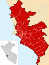
The province of Lima
is divided into forty three districts of Lima which are administered by the Metropolitan Municipality of Lima The city proper (urban area) of Lima
is generally considered to be formed by thirty of these districts. The remaining thirteen districts consist of mostly rural and sparsely populated desert and mountainous areas. Of these peripheral districts, many of the coastal ones serve as beach resorts and their population —which is considerably smaller than that of the urban
districts— increases during the summer months.
 Area and population information on the following list has been retrieved from official data by the Peruvian National Institute of Statistics and Informatics
. Demographic data is based on the 2005 Census
carried out from 18 July through 20 August 2005. Population density is given to one decimal place in persons per square kilometer. UBIGEO numbers are codes used by INEI to identify national administrative subdivisions. Foundation dates have been retrieved from a compilation by the Peruvian Congress
published in 2000.
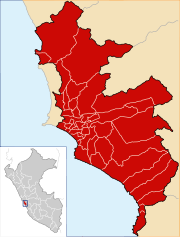
Lima Province
Lima Province is located in the central coast of Peru and is the only province in the country not belonging to any of the twenty-five regions. Its capital is Lima, which is also the nation's capital....
is divided into forty three districts of Lima which are administered by the Metropolitan Municipality of Lima The city proper (urban area) of Lima
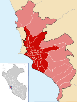
Lima
Lima is the capital and the largest city of Peru. It is located in the valleys of the Chillón, Rímac and Lurín rivers, in the central part of the country, on a desert coast overlooking the Pacific Ocean. Together with the seaport of Callao, it forms a contiguous urban area known as the Lima...
is generally considered to be formed by thirty of these districts. The remaining thirteen districts consist of mostly rural and sparsely populated desert and mountainous areas. Of these peripheral districts, many of the coastal ones serve as beach resorts and their population —which is considerably smaller than that of the urban
Urban area
An urban area is characterized by higher population density and vast human features in comparison to areas surrounding it. Urban areas may be cities, towns or conurbations, but the term is not commonly extended to rural settlements such as villages and hamlets.Urban areas are created and further...
districts— increases during the summer months.
Districts of Lima
Instituto Nacional de Estadística e Informática
The Instituto Nacional de Estadística e Informática is a semi-autonomous Peruvian government agency which coordinates, compiles, and evaluates statistical information for the country...
. Demographic data is based on the 2005 Census
Peru 2005 Census
#The Peru 2005 Census was a detailed enumeration of the Peruvian population. It was conducted by the Instituto Nacional de Estadística e Informática from July 18 through August 20, 2005. Its full name in Spanish is X Censo de Población y V de Vivienda . The previous census performed in Peru was the...
carried out from 18 July through 20 August 2005. Population density is given to one decimal place in persons per square kilometer. UBIGEO numbers are codes used by INEI to identify national administrative subdivisions. Foundation dates have been retrieved from a compilation by the Peruvian Congress
Congress of Peru
The Congress of the Republic of Peru or the National Congress of Peru is the unicameral body that assumes legislative power in Peru.Congress consists of 130 members of congress , who are elected for five year periods in office on a proportional representation basis...
published in 2000.
| Districts Districts of Peru The districts of Peru are the third-level country subdivisions of Peru. They are subdivisions of the provinces, which in turn are subdivisions of the larger regions or departments... |
UBIGEO UBIGEO Ubigeo is the coding system for geographical locations in Peru used by the National Statistics Institute to code the first-level administrative subdivision: regions , the second-level administrative subdivision: provinces Ubigeo is the coding system for geographical locations (Spanish: Código... |
Area (km²) |
Population |
Population density (/km²) |
Created |
Postal code |
Location |
|---|---|---|---|---|---|---|---|
| Ancón Ancón District Ancón is a district of northern Lima Province in Peru. It is a popular beach resort, visited every summer by hundreds of people from Lima.Officially established as a district on October 29, 1874, the current mayor of Ancón is Jaime Jesús Pajuelo Torres. The district's postal code is... |
150102 | 29 October 1874 | 02 | 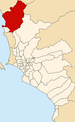 |
|||
| Ate Ate District Ate, also known as Ate-Vitarte, is a district of the Lima Province in Peru. Located in the eastern part of the province, it is one of the districts that comprise the city of Lima.-Geography:The district has a total land area of 77.72 km²... |
150103 | 2 January 1857 | 03 | 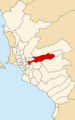 |
|||
| Barranco | 150104 | 26 October 1874 | 04 | 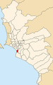 |
|||
| Breña | 150105 | 15 July 1949 | 05 |  |
|||
| Carabayllo | 150106 | 4 August 1821 | 06 | 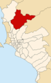 |
|||
| Chaclacayo | 150107 | 24 April 1940 | 08 |  |
|||
| Chorrillos | 150108 | 2 January 1857 | 09 | 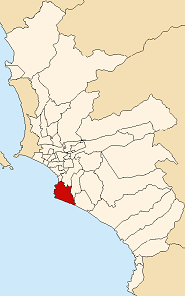 |
|||
| Cieneguilla | 150109 | 3 March 1970 | 40 | 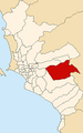 |
|||
| Comas | 150110 | 12 December 1961 | 07 | 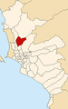 |
|||
| El Agustino | 150111 | 6 January 1965 | 10 | 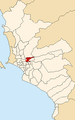 |
|||
| Independencia Independencia District, Lima Independencia is a district of the Lima Province in Peru. It is part of city of Lima.Officially established as a district on March 16, 1964, the current mayor of Independencia is Lovell Yomond Vargas. The district's postal code is 28.... |
150112 | 16 March 1964 | 28 | 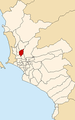 |
|||
| Jesús María | 150113 | 13 December 1963 | 11 |  |
|||
| La Molina | 150114 | 6 February 1962 | 12 |  |
|||
| La Victoria | 150115 | 16 August 1921 | 13 | 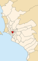 |
|||
| Lima Lima District Lima is a district of the Lima Province in Peru. It is not where the inner city zone of Lima, the country's capital city, is located, San Isidro District being such area in Lima.... |
150101 | 2 January 1857 | 01 | 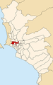 |
|||
| Lince | 150116 | 20 May 1936 | 14 |  |
|||
| Los Olivos | 150117 | 7 April 1989 | 39 | 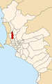 |
|||
| Lurigancho | 150118 | 2 January 1857 | 15 | 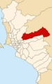 |
|||
| Lurín Lurín District The Peruvian district of Lurín is one of the 43 that make up the Lima Province.-Boundaries:It borders on the north with the districts of Pachacamac, Villa María del Triunfo, and Villa el Salvador, to the east also with the Pachacamac District, to the south with Punta Hermosa, and to the west with... |
150119 | 2 January 1857 | 16 |  |
|||
| Magdalena del Mar Magdalena del Mar Magdalena del Mar, commonly known simply as Magdalena, is a seaside district of the Lima Province in Peru and one of the districts that comprise the city of Lima. Its current mayor is Francis James Allison Oyague... |
150120 | 10 May 1920 | 17 | 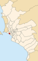 |
|||
| Miraflores Miraflores District Miraflores is a district of the Lima Province in Peru. Known for its shopping areas, gardens, flower-filled parks and beaches, it is one of the upscale districts that make up the city of Lima.... |
150122 | 2 January 1857 | 18 | .png) |
|||
| Pachacamac Pachacamac District The Pachacamac District is one of 43 districts of the Lima Province in Peru. The capital of the district is the village of Pachacamac. Its main asset is the archaeological Inca site Pachacamac.-History:... |
150123 | 2 January 1857 | 19 | 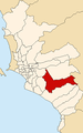 |
|||
| Pucusana Pucusana District Pucusana is a district in southern Lima Province in Peru. It is bordered by the Pacific Ocean on the west, the district of Santa María del Mar on the north, the Chilca District of the Cañete Province on the east, and the Pacific Ocean on the south.... |
150124 | 22 January 1943 | 20 | 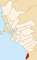 |
|||
| Pueblo Libre | 150121 | 2 January 1857 | 21 |  |
|||
| Puente Piedra Puente Piedra District The Peruvian district of Puente Piedra is one of the 43 districts in the Lima Province.The district was founded on February 14, 1927 by Law Nº 5675. It has an area of 71.18 square kilometers and a population of more than 200,000.-Boundaries:... |
150125 | 14 February 1927 | 22 | 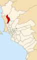 |
|||
| Punta Hermosa | 150126 | 7 April 1954 | 24 | 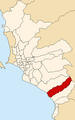 |
|||
| Punta Negra | 150127 | 7 April 1954 | 23 | 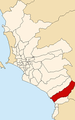 |
|||
| Rímac Rímac District Rímac is a district in the Lima Province, Peru. It lies directly to the north of downtown Lima, to which it is connected by six bridges over the Rímac River. The district also borders the Independencia, San Martín de Porres, and San Juan de Lurigancho districts... |
150128 | 16 August 1921 | 25 | 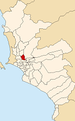 |
|||
| San Bartolo San Bartolo District San Bartolo is a district in southern Lima Province in Peru. It is bordered by the Pacific Ocean on the west, the district of Punta Negra on the north, the Huarochirí Province on the east, and the Santa María del Mar District on the south.... |
150129 | 5 May 1946 | 26 | 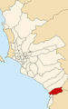 |
|||
| San Borja | 150130 | 1 June 1983 | 41 | 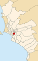 |
|||
| San Isidro | 150131 | 24 April 1931 | 27 | 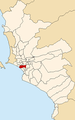 |
|||
| San Juan de Lurigancho | 150132 | 13 January 1967 | 36 | 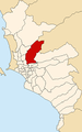 |
|||
| San Juan de Miraflores | 150133 | 12 January 1965 | 29 | 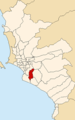 |
|||
| San Luis San Luis District, Lima San Luis is a district of the Lima Province in Peru. It is part of city of Lima.Officially established as a district on May 30, 1968, the current mayor of San Luis is Fernando Javier Durand Mejía. The district's postal code is 30.... |
150134 | 30 May 1968 | 30 |  |
|||
| San Martín de Porres | 150135 | 22 May 1950 | 31 | 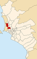 |
|||
| San Miguel San Miguel District, Lima San Miguel, is a district in western Lima, Peru. It is bordered by the districts of Bellavista and downtown Lima on the north; Pueblo Libre, Magdalena del Mar and downtown Lima on the east; the Pacific Ocean on the south; and the La Perla district on the west.... |
150136 | 10 May 1920 | 32 | 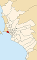 |
|||
| Santa Anita Santa Anita District Santa Anita is a district of the Lima Province in Peru. It is part of city of Lima.Officially established as a district on October 25, 1989 from parts of Ate and El Agustino separated by the Rio Surco, a ditch which went all the way to Santiago de Surco. The current mayor of Santa Anita is Osiris... |
150137 | 26 October 1989 | 43 |  |
|||
| Santa María del Mar District | 150138 | 16 January 1962 | 37 | 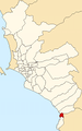 |
|||
| Santa Rosa | 150139 | 7 February 1962 | 38 | 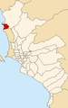 |
|||
| Santiago de Surco | 150140 | 16 December 1929 | 33 | 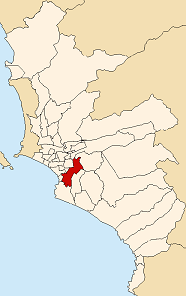 |
|||
| Surquillo | 150141 | 15 July 1949 | 34 |  |
|||
| Villa El Salvador Villa El Salvador Villa El Salvador is an urban, largely residential district on the outskirts of Lima, Peru. It borders the district of Chorrillos on the east; the Pacific Ocean on the southwest; Lurín on the southeast; Villa María del Triunfo on the east and San Juan de Miraflores on the north.- History :It began... |
150142 | 1 June 1983 | 42 |  |
|||
| Villa María del Triunfo | 150143 | 28 December 1961 | 35 |  |