
Dick Johnson Township, Clay County, Indiana
Encyclopedia
Dick Johnson Township is one of eleven townships
in Clay County, Indiana
. As of the 2000 census
, its population was 1,338.
(This list is based on USGS data and may include former settlements.)
Township (United States)
A township in the United States is a small geographic area. Townships range in size from 6 to 54 square miles , with being the norm.The term is used in three ways....
in Clay County, Indiana
Clay County, Indiana
Clay County is a county located in the U.S. state of Indiana. As of 2010, the population was 26,890. The county seat is Brazil. Clay County is included in the Terre Haute, Indiana, Metropolitan Statistical Area.- History :Clay County was formed in 1825...
. As of the 2000 census
United States Census, 2000
The Twenty-second United States Census, known as Census 2000 and conducted by the Census Bureau, determined the resident population of the United States on April 1, 2000, to be 281,421,906, an increase of 13.2% over the 248,709,873 persons enumerated during the 1990 Census...
, its population was 1,338.
Geography
Dick Johnson Township covers an area of 21.61 square miles (56 km²); 0.1 square mile (0.258998811 km²) (0.46 percent) of this is water.Unincorporated towns
- Bee RidgeBee Ridge, IndianaBee Ridge is an unincorporated community in Dick Johnson Township, Clay County, Indiana. It is part of the Terre Haute Metropolitan Statistical Area....
- PerthPerth, IndianaPerth is an unincorporated town in Dick Johnson Township, Clay County, Indiana. It is part of the Terre Haute Metropolitan Statistical Area.-Geography:Perth is located at ....
- Wickville
(This list is based on USGS data and may include former settlements.)
Adjacent townships
- Raccoon Township, Parke CountyRaccoon Township, Parke County, IndianaRaccoon Township is one of thirteen townships in Parke County, Indiana, USA. As of the 2000 census, its population was 771.-Geography:According to the United States Census Bureau, Raccoon Township covers an area of ; of this, is land and is water.-Unincorporated towns:* Bridgeton at * Catlin...
(north) - Jackson Township, Parke CountyJackson Township, Parke County, IndianaJackson Township is one of thirteen townships in Parke County, Indiana, USA. As of the 2000 census, its population was 758.-Geography:According to the United States Census Bureau, Jackson Township covers an area of ; of this, is land and is water.-Unincorporated towns:* Alma Lake at *...
(northeast) - Van Buren TownshipVan Buren Township, Clay County, IndianaVan Buren Township is one of eleven townships in Clay County, Indiana. As of the 2000 census, its population was 3,144.-Geography:Van Buren Township covers an area of ; of this is water.-Cities and towns:* Carbon* Harmony* Knightsville...
(east) - Brazil TownshipBrazil Township, Clay County, IndianaBrazil Township is one of eleven townships in Clay County, Indiana. As of the 2000 census, its population was 8,516.-Geography:Brazil Township covers an area of ; of this is water.-Unincorporated towns:* Donaldsonville* Shady Lane...
(southeast) - Posey TownshipPosey Township, Clay County, IndianaPosey Township is one of eleven townships in Clay County, Indiana. As of the 2000 census, its population was 3,984.-Geography:Posey Township covers an area of ; of this is water.-Cities and towns:* Brazil * Staunton...
(south) - Nevins Township, Vigo CountyNevins Township, Vigo County, IndianaNevins Township is one of twelve townships in Vigo County, Indiana, USA. As of the 2000 census, its population was 2,224.-Geography:According to the United States Census Bureau, Nevins Township covers an area of ; of this, is land and is water.-Unincorporated communities:* Coal Bluff* Cobb*...
(west)
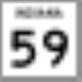
Major highways
-
 Indiana State Road 59Indiana State Road 59State Road 59 is a north–south road in Central Indiana that covers a distance of about through five counties.-Route description:State Road 59 begins at State Road 58 and heads north towards Sandborn. In Sandborn SR 59 has intersection with State Road 67...
 -
 Indiana State Road 340Indiana State Road 340State Road 340 in the U.S. state of Indiana is a minor route in Clay County.-Route description:The road begins at U.S. Route 40 in the small town of Cloverland and travels about east to Brazil where it re-joins US 40. It stays within about of US 40 for its entire length.-Major intersections:...