
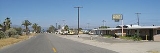
Desert Shores, California
Encyclopedia
Desert Shores is a census-designated place
(CDP) in Imperial County
, California
. It is located on Salton Sea
36 miles (58 km) west-northwest of Calipatria
. It is part of the El Centro, California
Metropolitan Statistical Area. The population was 1,104 at the 2010 census, up from 792 at the 2000 census.
, the CDP has a total area of 0.7 square miles (1.8 km²), all of it land.
was 1,619.9 people per square mile (625.5/km²). The racial makeup of Desert Shores was 709 (64.2%) White, 8 (0.7%) African American, 26 (2.4%) Native American, 4 (0.4%) Asian, 1 (0.1%) Pacific Islander, 307 (27.8%) from other races
, and 49 (4.4%) from two or more races. Hispanic or Latino of any race were 848 persons (76.8%).
The Census reported that 1,104 people (100% of the population) lived in households, 0 (0%) lived in non-institutionalized group quarters, and 0 (0%) were institutionalized.
There were 344 households, out of which 167 (48.5%) had children under the age of 18 living in them, 181 (52.6%) were opposite-sex married couples
living together, 37 (10.8%) had a female householder with no husband present, 27 (7.8%) had a male householder with no wife present. There were 29 (8.4%) unmarried opposite-sex partnerships
, and 1 (0.3%) same-sex married couples or partnerships. 80 households (23.3%) were made up of individuals and 42 (12.2%) had someone living alone who was 65 years of age or older. The average household size was 3.21. There were 245 families
(71.2% of all households); the average family size was 3.84.
The population was spread out with 352 people (31.9%) under the age of 18, 124 people (11.2%) aged 18 to 24, 263 people (23.8%) aged 25 to 44, 218 people (19.7%) aged 45 to 64, and 147 people (13.3%) who were 65 years of age or older. The median age was 29.9 years. For every 100 females there were 108.7 males. For every 100 females age 18 and over, there were 98.4 males.
There were 421 housing units at an average density of 617.7 per square mile (238.5/km²), of which 225 (65.4%) were owner-occupied, and 119 (34.6%) were occupied by renters. The homeowner vacancy rate was 4.2%; the rental vacancy rate was 2.4%. 704 people (63.8% of the population) lived in owner-occupied housing units and 400 people (36.2%) lived in rental housing units.
of 2000, there were 792 people, 279 households, and 181 families residing in the CDP. The population density
was 1,208.4 people per square mile (463.3/km²). There were 406 housing units at an average density of 619.5 per square mile (237.5/km²). The racial makeup of the CDP was 73.5% White
, 1.4% Black
or African American
, 0.9% Native American
, 0.3% Asian
, 21.1% from other races
, and 2.9% from two or more races. 60.9% of the population were Hispanic
or Latino
of any race.
There were 279 households out of which 28.3% had children under the age of 18 living with them, 50.5% were married couples
living together, 5.4% had a female householder with no husband present, and 35.1% were non-families. 29.0% of all households were made up of individuals and 18.3% had someone living alone who was 65 years of age or older. The average household size was 2.8 and the average family size was 3.6.
In the CDP the population was spread out with 26.9% under the age of 18, 8.5% from 18 to 24, 25.4% from 25 to 44, 18.8% from 45 to 64, and 20.5% who were 65 years of age or older. The median age was 37 years. For every 100 females there were 128.2 males. For every 100 females age 18 and over, there were 125.3 males.
The median income for a household in the CDP was $24,712, and the median income for a family was $29,550. Males had a median income of $26,176 versus $19,375 for females. The per capita income
for the CDP was $8,352. About 12.0% of families and 7.9% of the population were below the poverty line, including none of those under age 18 and 14.9% of those age 65 or over.
The SCSD has seven services that it is authorized to provide:
1. Collect, treat, or dispose of sewage.
2. Collect, transfer, and dispose of solid waste.
3. Provide fire protection.
4. Acquire, construct recreational facilities.
5. Organize, promote community recreation.
6. Acquire, construct, and improve street lighting and landscaping.
7. Provide emergency medical services.
Aside from acting as the architectural committee for architectural compliance with the Covenants, Conditions, and Restrictions (CC&R’s) of the 80 plus tracts within the district the SCSD has no land use authority under existing law, that responsibility falls on the County of Imperial Board of Supervisors.
Desert Shores is located in the 40th Senate
District, represented by Democrat
Denise Moreno Ducheny
, and in the 80th Assembly
District, represented by Republican
Bonnie Garcia
. Federally, Desert Shores is located in California's 51st congressional district
, which has a Cook PVI
of D +7 and is represented by Democrat Bob Filner
.
Census-designated place
A census-designated place is a concentration of population identified by the United States Census Bureau for statistical purposes. CDPs are delineated for each decennial census as the statistical counterparts of incorporated places such as cities, towns and villages...
(CDP) in Imperial County
Imperial County, California
Imperial County is a county located in the Imperial Valley, in the far southeast of the U.S. state of California, bordering both Arizona and Mexico. It is part of the El Centro Metropolitan Area, which encompasses all of Imperial County. The population as of 2000 was 142,361. The county seat is the...
, California
California
California is a state located on the West Coast of the United States. It is by far the most populous U.S. state, and the third-largest by land area...
. It is located on Salton Sea
Salton Sea
The Salton Sea is a shallow, saline, endorheic rift lake located directly on the San Andreas Fault, predominantly in California's Imperial Valley. The lake occupies the lowest elevations of the Salton Sink in the Colorado Desert of Imperial and Riverside counties in Southern California. Like Death...
36 miles (58 km) west-northwest of Calipatria
Calipatria, California
Calipatria is a city in Imperial County, California. Calipatria is located north of El Centro, It is part of the El Centro Metropolitan Area. The population was 7,705 at the 2010 census, up from 7,289 at the 2000 census, including 4000 inmates at Calipatria State Prison...
. It is part of the El Centro, California
El Centro, California
El Centro is a city in and county seat of Imperial County, the largest city in the Imperial Valley and the east anchor of the Southern California Border Region, and the core urban area and principal city of the El Centro metropolitan area which encompasses all of Imperial County. El Centro is also...
Metropolitan Statistical Area. The population was 1,104 at the 2010 census, up from 792 at the 2000 census.
Geography
Desert Shores is located at 33°24′15"N 116°02′23"W. According to the United States Census BureauUnited States Census Bureau
The United States Census Bureau is the government agency that is responsible for the United States Census. It also gathers other national demographic and economic data...
, the CDP has a total area of 0.7 square miles (1.8 km²), all of it land.
2010
The 2010 United States Census reported that Desert Shores had a population of 1,104. The population densityPopulation density
Population density is a measurement of population per unit area or unit volume. It is frequently applied to living organisms, and particularly to humans...
was 1,619.9 people per square mile (625.5/km²). The racial makeup of Desert Shores was 709 (64.2%) White, 8 (0.7%) African American, 26 (2.4%) Native American, 4 (0.4%) Asian, 1 (0.1%) Pacific Islander, 307 (27.8%) from other races
Race (United States Census)
Race and ethnicity in the United States Census, as defined by the Federal Office of Management and Budget and the United States Census Bureau, are self-identification data items in which residents choose the race or races with which they most closely identify, and indicate whether or not they are...
, and 49 (4.4%) from two or more races. Hispanic or Latino of any race were 848 persons (76.8%).
The Census reported that 1,104 people (100% of the population) lived in households, 0 (0%) lived in non-institutionalized group quarters, and 0 (0%) were institutionalized.
There were 344 households, out of which 167 (48.5%) had children under the age of 18 living in them, 181 (52.6%) were opposite-sex married couples
Marriage
Marriage is a social union or legal contract between people that creates kinship. It is an institution in which interpersonal relationships, usually intimate and sexual, are acknowledged in a variety of ways, depending on the culture or subculture in which it is found...
living together, 37 (10.8%) had a female householder with no husband present, 27 (7.8%) had a male householder with no wife present. There were 29 (8.4%) unmarried opposite-sex partnerships
POSSLQ
POSSLQ is an abbreviation for "Persons of Opposite Sex Sharing Living Quarters," a term coined in the late 1970s by the United States Census Bureau as part of an effort to more accurately gauge the prevalence of cohabitation in American households....
, and 1 (0.3%) same-sex married couples or partnerships. 80 households (23.3%) were made up of individuals and 42 (12.2%) had someone living alone who was 65 years of age or older. The average household size was 3.21. There were 245 families
Family (U.S. Census)
A family or family household is defined by the United States Census Bureau for statistical purposes as "a householder and one or more other people related to the householder by birth, marriage, or adoption. They do not include same-sex married couples even if the marriage was performed in a state...
(71.2% of all households); the average family size was 3.84.
The population was spread out with 352 people (31.9%) under the age of 18, 124 people (11.2%) aged 18 to 24, 263 people (23.8%) aged 25 to 44, 218 people (19.7%) aged 45 to 64, and 147 people (13.3%) who were 65 years of age or older. The median age was 29.9 years. For every 100 females there were 108.7 males. For every 100 females age 18 and over, there were 98.4 males.
There were 421 housing units at an average density of 617.7 per square mile (238.5/km²), of which 225 (65.4%) were owner-occupied, and 119 (34.6%) were occupied by renters. The homeowner vacancy rate was 4.2%; the rental vacancy rate was 2.4%. 704 people (63.8% of the population) lived in owner-occupied housing units and 400 people (36.2%) lived in rental housing units.
2000
As of the censusCensus
A census is the procedure of systematically acquiring and recording information about the members of a given population. It is a regularly occurring and official count of a particular population. The term is used mostly in connection with national population and housing censuses; other common...
of 2000, there were 792 people, 279 households, and 181 families residing in the CDP. The population density
Population density
Population density is a measurement of population per unit area or unit volume. It is frequently applied to living organisms, and particularly to humans...
was 1,208.4 people per square mile (463.3/km²). There were 406 housing units at an average density of 619.5 per square mile (237.5/km²). The racial makeup of the CDP was 73.5% White
Race (United States Census)
Race and ethnicity in the United States Census, as defined by the Federal Office of Management and Budget and the United States Census Bureau, are self-identification data items in which residents choose the race or races with which they most closely identify, and indicate whether or not they are...
, 1.4% Black
Race (United States Census)
Race and ethnicity in the United States Census, as defined by the Federal Office of Management and Budget and the United States Census Bureau, are self-identification data items in which residents choose the race or races with which they most closely identify, and indicate whether or not they are...
or African American
Race (United States Census)
Race and ethnicity in the United States Census, as defined by the Federal Office of Management and Budget and the United States Census Bureau, are self-identification data items in which residents choose the race or races with which they most closely identify, and indicate whether or not they are...
, 0.9% Native American
Race (United States Census)
Race and ethnicity in the United States Census, as defined by the Federal Office of Management and Budget and the United States Census Bureau, are self-identification data items in which residents choose the race or races with which they most closely identify, and indicate whether or not they are...
, 0.3% Asian
Race (United States Census)
Race and ethnicity in the United States Census, as defined by the Federal Office of Management and Budget and the United States Census Bureau, are self-identification data items in which residents choose the race or races with which they most closely identify, and indicate whether or not they are...
, 21.1% from other races
Race (United States Census)
Race and ethnicity in the United States Census, as defined by the Federal Office of Management and Budget and the United States Census Bureau, are self-identification data items in which residents choose the race or races with which they most closely identify, and indicate whether or not they are...
, and 2.9% from two or more races. 60.9% of the population were Hispanic
Race (United States Census)
Race and ethnicity in the United States Census, as defined by the Federal Office of Management and Budget and the United States Census Bureau, are self-identification data items in which residents choose the race or races with which they most closely identify, and indicate whether or not they are...
or Latino
Race (United States Census)
Race and ethnicity in the United States Census, as defined by the Federal Office of Management and Budget and the United States Census Bureau, are self-identification data items in which residents choose the race or races with which they most closely identify, and indicate whether or not they are...
of any race.
There were 279 households out of which 28.3% had children under the age of 18 living with them, 50.5% were married couples
Marriage
Marriage is a social union or legal contract between people that creates kinship. It is an institution in which interpersonal relationships, usually intimate and sexual, are acknowledged in a variety of ways, depending on the culture or subculture in which it is found...
living together, 5.4% had a female householder with no husband present, and 35.1% were non-families. 29.0% of all households were made up of individuals and 18.3% had someone living alone who was 65 years of age or older. The average household size was 2.8 and the average family size was 3.6.
In the CDP the population was spread out with 26.9% under the age of 18, 8.5% from 18 to 24, 25.4% from 25 to 44, 18.8% from 45 to 64, and 20.5% who were 65 years of age or older. The median age was 37 years. For every 100 females there were 128.2 males. For every 100 females age 18 and over, there were 125.3 males.
The median income for a household in the CDP was $24,712, and the median income for a family was $29,550. Males had a median income of $26,176 versus $19,375 for females. The per capita income
Per capita income
Per capita income or income per person is a measure of mean income within an economic aggregate, such as a country or city. It is calculated by taking a measure of all sources of income in the aggregate and dividing it by the total population...
for the CDP was $8,352. About 12.0% of families and 7.9% of the population were below the poverty line, including none of those under age 18 and 14.9% of those age 65 or over.
Local
Desert Shores and its neighboring community of Salton City are governed by the Salton Community Services District (SCSD) which is a special district per California Government Code. The legislative body of the SCSD is a five member Board of Directors who are elected by the registered voters in the district every two years.The SCSD has seven services that it is authorized to provide:
1. Collect, treat, or dispose of sewage.
2. Collect, transfer, and dispose of solid waste.
3. Provide fire protection.
4. Acquire, construct recreational facilities.
5. Organize, promote community recreation.
6. Acquire, construct, and improve street lighting and landscaping.
7. Provide emergency medical services.
Aside from acting as the architectural committee for architectural compliance with the Covenants, Conditions, and Restrictions (CC&R’s) of the 80 plus tracts within the district the SCSD has no land use authority under existing law, that responsibility falls on the County of Imperial Board of Supervisors.
State and federal
In the state legislatureCalifornia State Legislature
The California State Legislature is the state legislature of the U.S. state of California. It is a bicameral body consisting of the lower house, the California State Assembly, with 80 members, and the upper house, the California State Senate, with 40 members...
Desert Shores is located in the 40th Senate
California State Senate
The California State Senate is the upper house of the California State Legislature. There are 40 state senators. The state legislature meets in the California State Capitol in Sacramento. The Lieutenant Governor is the ex officio President of the Senate and may break a tied vote...
District, represented by Democrat
Democratic Party (United States)
The Democratic Party is one of two major contemporary political parties in the United States, along with the Republican Party. The party's socially liberal and progressive platform is largely considered center-left in the U.S. political spectrum. The party has the lengthiest record of continuous...
Denise Moreno Ducheny
Denise Moreno Ducheny
Denise Moreno Ducheny is a California State Senator who represents Senate District 40, which includes southern San Diego County, part of Riverside County, and all of Imperial County. Ducheny is a Democrat. She lives with her husband, Al, in San Diego, California.-Background:Ducheny was born in...
, and in the 80th Assembly
California State Assembly
The California State Assembly is the lower house of the California State Legislature. There are 80 members in the Assembly, representing an approximately equal number of constituents, with each district having a population of at least 420,000...
District, represented by Republican
Republican Party (United States)
The Republican Party is one of the two major contemporary political parties in the United States, along with the Democratic Party. Founded by anti-slavery expansion activists in 1854, it is often called the GOP . The party's platform generally reflects American conservatism in the U.S...
Bonnie Garcia
Bonnie Garcia
Bonnie Garcia was the representative of California's 80th Assembly District, serving eastern Riverside County and all of Imperial County....
. Federally, Desert Shores is located in California's 51st congressional district
California's 51st congressional district
California's 51st congressional district is a congressional district in the U.S. state of California. The district includes all of Imperial County and the extreme southern portions of San Diego County that run across the U.S.-Mexico border...
, which has a Cook PVI
Cook Partisan Voting Index
The Cook Partisan Voting Index , sometimes referred to as simply the Partisan Voting Index , is a measurement of how strongly an American congressional district or state leans toward one political party compared to the nation as a whole...
of D +7 and is represented by Democrat Bob Filner
Bob Filner
Robert Earl Filner is the U.S. Representative for , and previously the 50th, serving since 1993, and Chairman of the House Committee on Veterans' Affairs since 2007. He is a member of the Democratic Party...
.
External links
- Salton Sea West is a non-commercial website with a large library of government documents pertaining to Desert Shores