
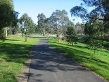
Dandenong Creek Trail
Encyclopedia

Cycling
Cycling, also called bicycling or biking, is the use of bicycles for transport, recreation, or for sport. Persons engaged in cycling are cyclists or bicyclists...
and pedestrian
Pedestrian
A pedestrian is a person traveling on foot, whether walking or running. In some communities, those traveling using roller skates or skateboards are also considered to be pedestrians. In modern times, the term mostly refers to someone walking on a road or footpath, but this was not the case...
s, which follows Dandenong Creek
Dandenong Creek
Dandenong Creek, originally known as Narra Narrawong, runs from the Dandenong Ranges in the Dandenong Ranges National Park, in the eastern suburbs of Melbourne, Australia, through the urban areas of Boronia and The Basin, eventually meeting Mordialloc Creek and the manmade Patterson River...
through the outer eastern and south-eastern suburbs of Melbourne
Melbourne
Melbourne is the capital and most populous city in the state of Victoria, and the second most populous city in Australia. The Melbourne City Centre is the hub of the greater metropolitan area and the Census statistical division—of which "Melbourne" is the common name. As of June 2009, the greater...
, Victoria
Victoria (Australia)
Victoria is the second most populous state in Australia. Geographically the smallest mainland state, Victoria is bordered by New South Wales, South Australia, and Tasmania on Boundary Islet to the north, west and south respectively....
, Australia
Australia
Australia , officially the Commonwealth of Australia, is a country in the Southern Hemisphere comprising the mainland of the Australian continent, the island of Tasmania, and numerous smaller islands in the Indian and Pacific Oceans. It is the world's sixth-largest country by total area...
.
Following the Path
The path starts in Kilsyth SouthKilsyth South, Victoria
Kilsyth South is a suburb in Melbourne, Victoria, Australia, 32 km east from Melbourne's central business district. Its Local Government Area is the City of Maroondah. At the 2006 Census, Kilsyth South had a population of 3033.-References:...
at the end of Chandlers Lane, 600m off Liverpool Road but can be accessed at Colchester Road by a path that runs from the The Basin
The Basin, Victoria
The Basin is a suburb in Melbourne, Victoria, Australia, 31 km east from Melbourne's central business district. Its Local Government Area is the City of Knox...
that runs beside Mountain Highway
Mountain Highway
Mountain Highway is a 18 km highway in Eastern Melbourne. Mountain Highway starts from Burwood Highway and runs through The Basin, then uphill to Sassafras. For most of its length it is dual carriageway, with 2 or 3 lanes in each Direction. From Burwood Highway to Forest Road in the suburb of The...
and Colchester Road.
About 3.6 km further on and after Bayswater Rd and on the west side of Bayswater Oval the trail crosses a footbridge. Travellers coming from the opposite direction, should ensure they cross the footbridge, rather than following the white guidelines on the pavement. Following the guidelines leads to the old steam engine at Jim Abernethy Memorial Drv.
Continuing west on the Dandenong Creek Trail, a tunnel goes under the Belgrave railway line. 70m immediately before the underpass, there is a footbridge to the right (north). This is the start of the Tarralla Creek Trail
Tarralla Creek Trail
The Tarralla Creek Trail is a shared use path for cyclists and pedestrians, which follows Tarralla Creek , in the outer eastern suburb of Croydon in Melbourne, Victoria, Australia.-Following the path:...
. Just before the underpass on the left (south) is a turnoff to the upper section of the Belgrave Rail Trail. On the far side of the tunnel and 900m on, is a footbridge on the right (north). This is the turnoff to the lower section of the Belgrave Rail Trail. Another 650 is a turnoff to the left. It leads to Waldheim Rd and then joins the Stud Rd path. This 1.5 km stretch is effectively a major intersection for trails and is unsigned - see confusing intersections
Magic Roundabout (Swindon)
The Magic Roundabout in Swindon, England was constructed in 1972 and consists of five mini-roundabouts arranged in a circle. It is located near the County Ground, home of Swindon Town F.C. Its name comes from the popular children's television series The Magic Roundabout...
.
The trail continues on under EastLink
EastLink, Melbourne
EastLink is a A$2.5 billion tolled freeway linking a large area through the eastern and south-eastern suburbs of Melbourne, Australia. It is a part of Melbourne's Metropolitan Ring Road project....
and then starts to head south. It goes through an underpass at Boronia Rd.
The trail through Koomba Park has been upgraded to concrete as this section will be shared with the EastLink Trail
EastLink Trail
The EastLink Trail is a shared use path for cyclists and pedestrians, which follows the EastLink tollway for most of its length from Ringwood to Dandenong, in the outer eastern suburbs of Melbourne, Victoria, Australia.-Following the path:...
. Unfortunately this upgrade has now made the turnoff to the Dandenong Creek Trail at the south end of the park difficult to identify. Immediately after the picnic pavilion, before reaching Mountain Highway, turn right off the concrete onto a gravel path.
Just before Burwood Highway the trail passes along some boardwalks. Cross over Burwood Highway to the largest hardware store in the Southern Hemisphere just on the right (west), with the local tip just behind. Just past the tip, two trails lead off to the left (east). They arrive at a lookout tower with a somewhat limited view. Cyclists can use its ramps to ride to the top.
At High Street Rd the path does a zig zag and continues through to Napier Park Reserve. It appears to come to a dead end with the Glenvale Tennis courts directly ahead (south) at Shepherd Rd. Turn left (east) down Shepherd Rd to its far end where the trail resumes.
Turning right and heading up Shepherd Rd to the west, leads to Glen Waverley station using some quiet back streets that are signed, via a 2.6 km long council designated bicycle route.
The Dandenong Creek Trail soon arrives at an intersection with numerous signs and a map in a display cabinet shielded from the weather. Straight ahead (towards the east) is the west end of the Blind Creek Trail
Blind Creek Trail
The Blind Creek Trail is a shared-use path for cyclists and pedestrians, which follows the Blind Creek from the Dandenong Creek Trail in Wantirna South to the Ringwood - Belgrave Rail Trail in Boronia, in the outer eastern suburbs of Melbourne, Victoria, Australia.This trail is one of the major...
. To the left (north) is a dead end trail to Nortons Park. Turn right (south) and continue past the map cabinet on the left.
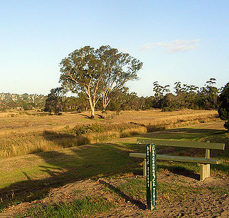
Open fields on the left, trees on the right and 1.6 km later, the trail crosses a footbridge at the most northern end of the Jells Park
Jells Park
Jells Park is a public park in Wheelers Hill, a suburb to the south-east of Melbourne, Victoria, Australia. Opening on 30 April 1976, the park attracts in excess of 700,000 visitors a year. The park is in excess of 127 hectares and contains 9 kilometres of bike paths. The Dandenong Creek Trail runs...
wildlife lake. There is a small tee intersection at this point. Turn left and head south, passing along the west side of the lake. Travellers coming from the opposite direction, need to make sure they turn right at the tee intersection, not left (west) and cross the footbridge.
At the southern end of the lake, the Scotchmans Creek Trail
Scotchmans Creek Trail
The Scotchmans Creek Trail is a shared use path for cyclists and pedestrians, which follows Scotchmans Creek through the eastern suburbs of Melbourne, Victoria, Australia....
peels off to the right (west). Onwards and cross under Ferntree Gully Rd - watch out for water on the path here. From here the Ferny Creek Trail
Ferny Creek Trail
The Ferny Creek Trail is a shared use path for cyclists and pedestrians, which follows Ferny and Corhanwarrabul Creeks through the suburbs of Knoxfield and Ferntree Gully in Melbourne, Victoria, Australia....
can be reached by travelling along 3.6 km of road: east along Ferntree Gully Rd and then south along Stud Rd. Both these roads have heavy traffic.
1.3 km on at Mulgrave reserve, just north of Wellingtom Rd, it is possible to get confused at the carpark at the north end of the reserve. Heading south, do a sharp left turn. Travellers coming from the opposite direction, should do a sharp right turn into the bushes. In either case just stick to the NE corner of the carpark. (Improvements associated with the Eastlink tollway and trail have provided a well signposted detour as an alternative route here.)
Under the Wellington Rd underpass, under EastLink then past the dead end of Police Rd. The trail narrows between the creek and some houses and 600m from Police Rd opens out onto Tirhatuan Park. There are a few paths through the park but it is easier to just follow the creek and skirt the park on its east side.
Onwards past: Stud Rd, Brady Rd, Monash Freeway
Monash Freeway
Monash Freeway is an urban freeway in Victoria, Australia linking Melbourne's CBD to its southeastern suburbs and the Gippsland region. The entire stretch of the Monash Freeway bears the designation...
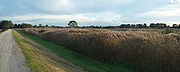
, Heatherton Rd, east end of David St (see photo), Kidds Rd and McCrae St - all straightforward. At McCrae St, south of the Thomas P. Carroll Reserve, a shortish on road section leads to the Hallam Bypass Trail
Hallam Bypass Trail
The Hallam Bypass Trail is a shared use path for cyclists and pedestrians running along the Hallam Bypass between Doveton and Berwick in the outer eastern suburbs of Melbourne, Victoria, Australia.The trail was completed in 2003.-Route:...
.
Another 1.1 km at Lonsdale St, a short diversion leads to Dandenong Station. The creek develops from a creek to more of a canal as it approaches the bay. The path further on is straighforward except for the chance of confusion, where a footbridge crosses Eumemmerring Creek
Bangholme, Victoria
Bangholme is a suburb in Melbourne, Victoria, Australia, 31 km south-east from Melbourne's central business district and adjacent to the urban area. Its Local Government Area is the City of Greater Dandenong...
, just after crossing EastLink for the third time. Just loop over the bridge but maintain the original south westerly direction. Downstream from Eumemmerring creek, the stream becomes the Patterson River.
The creek widens with large wetland areas and the Eastern Treatment Plant
Eastern Treatment Plant
The Eastern Treatment Plant of Melbourne Water is a sewage treatment plant that serves much of the city of Melbourne, the state capital of Victoria, south-eastern Australia. The plant is at Bangholme, 31 km south-east of Melbourne’s central business district and adjacent to its south-eastern...
to the south. The trail travels along an artificial embankment as it passes to the south of National Water Sports Centre near Patterson Lakes
Patterson Lakes, Victoria
Patterson Lakes is a suburb in outer south-east Melbourne, Victoria, Australia, and is located 32 km south-east of Melbourne's central business district. Its Local Government Area is the City of Kingston. In the 2006 Census Patterson Lakes had a population of 7,235 people.Patterson Lakes consists...
.
650m from the mouth of the Patterson River, the trail meets the Bayside Trail at Launching Way.
Landmarks
Dandenong CreekDandenong Creek
Dandenong Creek, originally known as Narra Narrawong, runs from the Dandenong Ranges in the Dandenong Ranges National Park, in the eastern suburbs of Melbourne, Australia, through the urban areas of Boronia and The Basin, eventually meeting Mordialloc Creek and the manmade Patterson River...
, Koomba Park
Koomba Park
Koomba Park is one of the parks comprising the Dandenong Valley Parklands in the eastern suburbs of Melbourne, Australia. It consists of 92 hectares, of which 33 hectares is publicly accessible, and is bounded by the Dandenong Creek, Boronia Road, EastLink, Mountain Highway and Burwood Highway in a...
, Jells Park
Jells Park
Jells Park is a public park in Wheelers Hill, a suburb to the south-east of Melbourne, Victoria, Australia. Opening on 30 April 1976, the park attracts in excess of 700,000 visitors a year. The park is in excess of 127 hectares and contains 9 kilometres of bike paths. The Dandenong Creek Trail runs...
, Dandenong Valley Wetlands, Port Phillip Bay, frequent sporting and recreational grounds.
Connections
The Dandenong Creek Trail connects to numerous other paths:To the Tarralla Creek Trail
Tarralla Creek Trail
The Tarralla Creek Trail is a shared use path for cyclists and pedestrians, which follows Tarralla Creek , in the outer eastern suburb of Croydon in Melbourne, Victoria, Australia.-Following the path:...
, Belgrave Rail Trail
Belgrave Rail Trail
The Ringwood - Belgrave Rail Trail is a shared-use path for cyclists and pedestrians, which follows the Belgrave railway line from the Mullum Mullum Creek Trail in Ringwood to Belgrave railway station in Belgrave, in the outer eastern suburbs of Melbourne, Victoria, Australia.This trail is known to...
and Blind Creek Trail
Blind Creek Trail
The Blind Creek Trail is a shared-use path for cyclists and pedestrians, which follows the Blind Creek from the Dandenong Creek Trail in Wantirna South to the Ringwood - Belgrave Rail Trail in Boronia, in the outer eastern suburbs of Melbourne, Victoria, Australia.This trail is one of the major...
in the north. Centrally to the Scotchmans Creek Trail
Scotchmans Creek Trail
The Scotchmans Creek Trail is a shared use path for cyclists and pedestrians, which follows Scotchmans Creek through the eastern suburbs of Melbourne, Victoria, Australia....
and the EastLink
EastLink, Melbourne
EastLink is a A$2.5 billion tolled freeway linking a large area through the eastern and south-eastern suburbs of Melbourne, Australia. It is a part of Melbourne's Metropolitan Ring Road project....
trail. In the south at Dandenong
Dandenong, Victoria
Dandenong is a suburb and major urban centre in metropolitan Melbourne, Victoria, Australia, 30 km south-east from Melbourne's central business district. Situated on Dandenong Creek and mostly flat land at the foothills of Mount Dandenong, it is the main administrative centre for the City of...
, it connects to the Hallam Bypass Trail
Hallam Bypass Trail
The Hallam Bypass Trail is a shared use path for cyclists and pedestrians running along the Hallam Bypass between Doveton and Berwick in the outer eastern suburbs of Melbourne, Victoria, Australia.The trail was completed in 2003.-Route:...
, the Dandenong South Trail and finally the Bayside Trail at Carrum
Carrum, Victoria
Carrum is a suburb in Melbourne, Victoria, Australia, south-east from Melbourne's central business district. Its Local Government Area is the City of Kingston...
.
Another path leads through to Waldheim Rd and then joins Stud Rd at Mountain Highway
Mountain Highway
Mountain Highway is a 18 km highway in Eastern Melbourne. Mountain Highway starts from Burwood Highway and runs through The Basin, then uphill to Sassafras. For most of its length it is dual carriageway, with 2 or 3 lanes in each Direction. From Burwood Highway to Forest Road in the suburb of The...
. It continues down Stud Rd to Burwood Highway
Burwood Highway
Burwood Highway is a major transportation link with Melbourne's eastern suburbs. It begins in the suburb of Kooyong, Melbourne at the junction of the Monash Freeway as Toorak Road between Monash Freeway and Warrigal Road, and finishes in Belgrave, Victoria in the Dandenong Ranges...
, at Knox City Shopping Centre
Knox City Shopping Centre
Knox City Shopping Centre is a super-regional shopping centre and outdoor entertainment complex located in the outer eastern suburb of Wantirna South in the city of Melbourne, Australia. The centre opened on November 9, 1977 with an initial 88 stores and 2300 parking spaces...
, where the Blind Creek Trail
Blind Creek Trail
The Blind Creek Trail is a shared-use path for cyclists and pedestrians, which follows the Blind Creek from the Dandenong Creek Trail in Wantirna South to the Ringwood - Belgrave Rail Trail in Boronia, in the outer eastern suburbs of Melbourne, Victoria, Australia.This trail is one of the major...
can be found.
North end at 37.8419°S 145.311°E.
South end at 38.073092°S 145.122138°E.