
Clay Township, Decatur County, Indiana
Encyclopedia
Clay Township is one of nine townships
in Decatur County, Indiana
. As of the 2000 census
, its population was 1,266.
(This list is based on USGS data and may include former settlements.)
Township (United States)
A township in the United States is a small geographic area. Townships range in size from 6 to 54 square miles , with being the norm.The term is used in three ways....
in Decatur County, Indiana
Decatur County, Indiana
As of the census of 2000, there were 24,555 people, 9,389 households, and 6,882 families residing in the county. The population density was 66 people per square mile . There were 9,992 housing units at an average density of 27 per square mile...
. As of the 2000 census
United States Census, 2000
The Twenty-second United States Census, known as Census 2000 and conducted by the Census Bureau, determined the resident population of the United States on April 1, 2000, to be 281,421,906, an increase of 13.2% over the 248,709,873 persons enumerated during the 1990 Census...
, its population was 1,266.
Geography
Clay Township covers an area of 50.78 square miles (131.5 km²); 0.07 square mile (0.1812991677 km²) (0.14 percent) of this is water.Unincorporated towns
- BurneyBurney, IndianaBurney is an unincorporated town in Clay Township, Decatur County, Indiana....
- EwingtonEwington, IndianaEwington is an unincorporated community in Clay Township, Decatur County, Indiana....
- HoraceHorace, IndianaHorace is an unincorporated town in Clay Township, Decatur County, Indiana....
- MilfordMilford, IndianaMilford could refer to:*Milford, Decatur County, Indiana*Milford, Kosciusko County, Indiana*Former name of Green Hill, Indiana...
(This list is based on USGS data and may include former settlements.)
Adjacent townships
- Adams TownshipAdams Township, Decatur County, IndianaAdams Township is one of nine townships in Decatur County, Indiana. As of the 2000 census, its population was 1,910.-Geography:Adams Township covers an area of ; of this is water.-Unincorporated towns:* Adams* Downeyville* Germantown...
(northeast) - Washington TownshipWashington Township, Decatur County, IndianaWashington Township is one of nine townships in Decatur County, Indiana. As of the 2000 census, its population was 12,206.-Geography:Washington Township covers an area of ; of this is water.-Unincorporated towns:* Craig* Knarr Corner...
(east) - Sand Creek TownshipSand Creek Township, Decatur County, IndianaSand Creek Township is one of nine townships in Decatur County, Indiana. As of the 2000 census, its population was 3,061.-Geography:Sand Creek Township covers an area of ; of this is water.-Unincorporated towns:* Gaynorsville* Harper...
(southeast) - Jackson TownshipJackson Township, Decatur County, IndianaJackson Township is one of nine townships in Decatur County, Indiana. As of the 2000 census, its population was 1,040.-Geography:Jackson Township covers an area of ; of this is water.-Unincorporated towns:* Alert* Forest Hill* Sardinia...
(south) - Clifty Township, Bartholomew CountyClifty Township, Bartholomew County, IndianaClifty Township is one of twelve townships in Bartholomew County, Indiana, USA. As of the 2000 census, its population was 1,200.-Geography:According to the United States Census Bureau, Clifty Township covers an area of ; of this, or 0.05 percent is water....
(southwest) - Haw Creek Township, Bartholomew CountyHaw Creek Township, Bartholomew County, IndianaHaw Creek Township is one of twelve townships in Bartholomew County, Indiana, USA. As of the 2000 census, its population was 4,015.-Geography:...
(west) - Noble Township, Shelby CountyNoble Township, Shelby County, IndianaNoble Township is one of fourteen townships in Shelby County, Indiana. As of the 2000 census, its population was 1,438.-External links:* *...
(northwest)
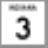
Major highways
-
 Indiana State Road 3Indiana State Road 3State Road 3 in the U.S. State of Indiana is a discontinuous state road running through east central Indiana from near the Michigan state line to near the Ohio River...
 -
 Indiana State Road 46Indiana State Road 46State Road 46 in the U.S. State of Indiana is an east–west state highway in the southern half of Indiana.-Route description:The western terminus of SR 46 is at U.S. Route 40 in central Vigo County, just east of Terre Haute...