
Clare, New York
Encyclopedia
Town
A town is a human settlement larger than a village but smaller than a city. The size a settlement must be in order to be called a "town" varies considerably in different parts of the world, so that, for example, many American "small towns" seem to British people to be no more than villages, while...
in St. Lawrence County
St. Lawrence County, New York
St. Lawrence County is a county located in the U.S. state of New York. As of the 2010 census, the population was 111,944. The county seat is Canton. The county is named for the Saint Lawrence River, which in turn was named for the Catholic saint on whose Feast day the river was discovered by...
, New York
New York
New York is a state in the Northeastern region of the United States. It is the nation's third most populous state. New York is bordered by New Jersey and Pennsylvania to the south, and by Connecticut, Massachusetts and Vermont to the east...
, United States
United States
The United States of America is a federal constitutional republic comprising fifty states and a federal district...
. The population was 112 at the 2000 census.
The Town of Clare is in the south-central part of the county and is south of the Village of Canton
Canton (village), New York
Canton is a village in St. Lawrence County, New York, United States. The village is centrally located in both the town of Canton and the county of St. Lawrence. The population was 5,882 at the 2000 census. It is the county seat of St. Lawrence County...
, the county seat.
History
The Town of Clare, formed in 1880 from part of the Town of PeirrepontPierrepont, New York
Pierrepont is a town and hamlet in St. Lawrence County, New York, in the United States. As of the 2000 census, the town population was 2,674. It was named after Hezekiah Pierrepont, the early owner of much of the town's territory. The Town of Pierrepont is centrally located in the county and is...
, was the last town formed in the county. Madam De Stael
Anne Louise Germaine de Staël
Anne Louise Germaine de Staël-Holstein , commonly known as Madame de Staël, was a French-speaking Swiss author living in Paris and abroad. She influenced literary tastes in Europe at the turn of the 19th century.- Childhood :...
, a French author, at one time invested in the town lands, on the advice of her friend Gouverneur Morris
Gouverneur Morris
Gouverneur Morris , was an American statesman, a Founding Father of the United States, and a native of New York City who represented Pennsylvania in the Constitutional Convention of 1787. He was a signatory to the Articles of Confederation. Morris was also an author of large sections of the...
, while it was still part of Pierrepont.
A history in 1894 indicated that almost no business existed in the town, and there were no organized churches.
Geography
According to the United States Census BureauUnited States Census Bureau
The United States Census Bureau is the government agency that is responsible for the United States Census. It also gathers other national demographic and economic data...
, the town has a total area of 97.3 square miles (252 km²), of which, 96.6 square miles (250.2 km²) of it is land and 0.6 square miles (1.6 km²) of it (0.67%) is water.
The town is in the Adirondack Park, and two branches of the Grasse River
Grasse River
The Grasse River or Grass River is a river in northern New York, in the United States...
flow through the town.
Demographics
As of the censusCensus
A census is the procedure of systematically acquiring and recording information about the members of a given population. It is a regularly occurring and official count of a particular population. The term is used mostly in connection with national population and housing censuses; other common...
of 2000, there were 112 people, 46 households, and 32 families residing in the town. The population density
Population density
Population density is a measurement of population per unit area or unit volume. It is frequently applied to living organisms, and particularly to humans...
was 1.2 people per square mile (0.4/km²). There were 106 housing units at an average density of 1.1 per square mile (0.4/km²). The racial makeup of the town was 95.54% White, 1.79% Native American, 0.89% from other races
Race (United States Census)
Race and ethnicity in the United States Census, as defined by the Federal Office of Management and Budget and the United States Census Bureau, are self-identification data items in which residents choose the race or races with which they most closely identify, and indicate whether or not they are...
, and 1.79% from two or more races. Hispanic or Latino of any race were 0.89% of the population.
There were 46 households out of which 28.3% had children under the age of 18 living with them, 65.2% were married couples
Marriage
Marriage is a social union or legal contract between people that creates kinship. It is an institution in which interpersonal relationships, usually intimate and sexual, are acknowledged in a variety of ways, depending on the culture or subculture in which it is found...
living together, 4.3% had a female householder with no husband present, and 28.3% were non-families. 26.1% of all households were made up of individuals and 8.7% had someone living alone who was 65 years of age or older. The average household size was 2.43 and the average family size was 2.91.
In the town the population was spread out with 24.1% under the age of 18, 6.3% from 18 to 24, 28.6% from 25 to 44, 27.7% from 45 to 64, and 13.4% who were 65 years of age or older. The median age was 43 years. For every 100 females there were 111.3 males. For every 100 females age 18 and over, there were 107.3 males.
The median income for a household in the town was $26,667, and the median income for a family was $36,250. Males had a median income of $25,625 versus $50,833 for females. The per capita income
Per capita income
Per capita income or income per person is a measure of mean income within an economic aggregate, such as a country or city. It is calculated by taking a measure of all sources of income in the aggregate and dividing it by the total population...
for the town was $14,453. There were 6.7% of families and 12.8% of the population living below the poverty line, including 6.5% of under eighteens and none of those over 64.
Communities and locations in Clare
- Brouses Corners – a location north of Clare village on County Road 27 (Clare Road).
- Canton Farm – A location in the easterm part of Clare by the Grass River.
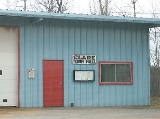
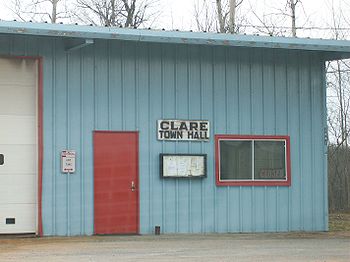
- Clare – The hamletHamlet (place)A hamlet is usually a rural settlement which is too small to be considered a village, though sometimes the word is used for a different sort of community. Historically, when a hamlet became large enough to justify building a church, it was then classified as a village...
of Clare is in the northwest part of the town on County Road 27. - Clarksboro – A location south of Clare village in the eastern part of Clare.
- Moores Landing Strip (1E8) – A small grass runway airport south of Clare village.
- Newbridge – A hamlet in the southwest part of the town.
- Lampson Falls – A gorgeous collection of waterfalls down a nice trail right on 27.