
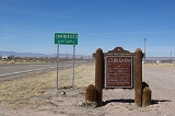
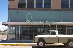
Carrizozo, New Mexico
Encyclopedia
County seat
A county seat is an administrative center, or seat of government, for a county or civil parish. The term is primarily used in the United States....
of Lincoln County
Lincoln County, New Mexico
-2010:Whereas according to the 2010 U.S. Census Bureau:*85.1% White*0.5% Black*2.4% Native American*0.4% Asian*0.0% Native Hawaiian or Pacific Islander*2.5% Two or more races*9.1% Other races*29.8% Hispanic or Latino -2000:...
, New Mexico
New Mexico
New Mexico is a state located in the southwest and western regions of the United States. New Mexico is also usually considered one of the Mountain States. With a population density of 16 per square mile, New Mexico is the sixth-most sparsely inhabited U.S...
, United States
United States
The United States of America is a federal constitutional republic comprising fifty states and a federal district...
. The population was 1,036 at the 2000 census.
Geography
Carrizozo is located at 33°38′38"N 105°52′39"W (33.643946, -105.877435).According to the United States Census Bureau
United States Census Bureau
The United States Census Bureau is the government agency that is responsible for the United States Census. It also gathers other national demographic and economic data...
, the town has a total area of 2.7 square miles (7 km²), all of it land.
See Carrizozo Malpais
Carrizozo Malpais
The Carrizozo Malpais is a large lava flow on the west side of Carrizozo, New Mexico, on the northern part of the Tularosa Basin between Sierra Blanca to the southeast and the Oscura Mountains to the west....
for information on volcanic activity in this area.
Demographics
As of the censusCensus
A census is the procedure of systematically acquiring and recording information about the members of a given population. It is a regularly occurring and official count of a particular population. The term is used mostly in connection with national population and housing censuses; other common...
of 2000, there were 1,036 people, 435 households, and 264 families residing in the town. The population density
Population density
Population density is a measurement of population per unit area or unit volume. It is frequently applied to living organisms, and particularly to humans...
was 382.1 people per square mile (147.6/km²). There were 514 housing units at an average density of 189.6 per square mile (73.2/km²). The racial makeup of the town was 74.81% White, 0.68% African American, 1.83% Native American, 0.10% Pacific Islander, 19.21% from other races
Race (United States Census)
Race and ethnicity in the United States Census, as defined by the Federal Office of Management and Budget and the United States Census Bureau, are self-identification data items in which residents choose the race or races with which they most closely identify, and indicate whether or not they are...
, and 3.38% from two or more races. Hispanic or Latino of any race were 53.47% of the population.
There were 435 households out of which 23.0% had children under the age of 18 living with them, 45.3% were married couples
Marriage
Marriage is a social union or legal contract between people that creates kinship. It is an institution in which interpersonal relationships, usually intimate and sexual, are acknowledged in a variety of ways, depending on the culture or subculture in which it is found...
living together, 12.4% had a female householder with no husband present, and 39.1% were non-families. 35.6% of all households were made up of individuals and 18.9% had someone living alone who was 65 years of age or older. The average household size was 2.18 and the average family size was 2.79.
In the town the population was spread out with 20.9% under the age of 18, 5.3% from 18 to 24, 24.8% from 25 to 44, 27.5% from 45 to 64, and 21.4% who were 65 years of age or older. The median age was 44 years. For every 100 females there were 107.6 males. For every 100 females age 18 and over, there were 103.7 males.
The median income for a household in the town was $22,647, and the median income for a family was $29,625. Males had a median income of $24,583 versus $17,708 for females. The per capita income
Per capita income
Per capita income or income per person is a measure of mean income within an economic aggregate, such as a country or city. It is calculated by taking a measure of all sources of income in the aggregate and dividing it by the total population...
for the town was $12,243. About 21.0% of families and 26.8% of the population were below the poverty line, including 40.4% of those under age 18 and 25.0% of those age 65 or over.
Points of interest
- Lincoln National ForestLincoln National ForestThe Lincoln National Forest is a protected national forest in the State of New Mexico in the southwestern United States. It was established in 1902 and covers 1,103,828 acres...
(southeast of the city via U.S. Route 380U.S. Route 380U.S. Route 380 is an east–west United States highway. The highway's eastern terminus is in Greenville, Texas at an intersection with Interstate 30, of which the easternmost 3–4 miles are co-located with US 69 in a loop around the west and south sides of Greenville. Its western terminus is at...
and NM 37New Mexico State Highway 37State Road 37 is a long state road that runs north–south through the Sacramento Mountains, which are part of the Lincoln National Forest in Lincoln County, New Mexico, in the U.S. state of New Mexico. Its southern terminus is at NM 48 several miles north of the town of Ruidoso, New...
) - Valley of Fires Recreation Area (west-northwest of the city via U.S. Route 380U.S. Route 380U.S. Route 380 is an east–west United States highway. The highway's eastern terminus is in Greenville, Texas at an intersection with Interstate 30, of which the easternmost 3–4 miles are co-located with US 69 in a loop around the west and south sides of Greenville. Its western terminus is at...
)
Major highways
Carrizozo is located at the intersection of two U.S. highways:- U.S. Route 54U.S. Route 54U.S. Route 54 is an east–west United States highway that runs northeast-southwest for 1,197 miles from western Illinois to El Paso, Texas. It enters and leaves Texas twice...
- U.S. Route 380U.S. Route 380U.S. Route 380 is an east–west United States highway. The highway's eastern terminus is in Greenville, Texas at an intersection with Interstate 30, of which the easternmost 3–4 miles are co-located with US 69 in a loop around the west and south sides of Greenville. Its western terminus is at...