
Carlisle, Ohio
Encyclopedia
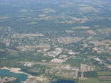
Carlisle is a village located in the southwestern part of the U.S. state
of Ohio
in northwestern Warren
and southern Montgomery
counties. As of the 2010 census, the village's population was 4,915, down from 5,121 in the 2000 census. This population loss caused Carlisle to once again become a village. (Carlisle had become a city after the 2000 census, as its population had increased from 4,872 in 1990.) The village is in Franklin Township, Warren County, Ohio
and German Township, Montgomery County, Ohio
.
The Warren County portion of Carlisle is part of the Cincinnati
–Middletown
, OH-KY
-IN
Metropolitan Statistical Area
, while the Montgomery County portion is part of the Dayton
, OH Metropolitan Statistical Area
.
Carlisle is named for "railroad man" George B. Carlisle, who in the mid-19th century "bought and platted a large section of the community".
Carlisle is known for an area landmark: a "double UFO
" house off Chamberlain Road, which resembles two silver-colored flying saucer
s connected by a metal duct. This is actually two Futuro
houses combined into one residence.
According to the United States Census Bureau
, the village has a total area of 3.6 square miles (9.2 km²), of which, 3.4 square miles (8.8 km²) of it is land and 0.2 square miles (0.4 km²) of it (4.49%) is water.
of 2000, there were 5,121 people, 1,849 households, and 1,475 families residing in the village. The population density
was 1,504.7 people per square mile (581.5/km²). There were 1,937 housing units at an average density of 569.2 per square mile (220.0/km²). The racial makeup of the village was 98.38% White, 0.23% African American, 0.18% Native American, 0.29% Asian, 0.06% Pacific Islander, 0.14% from other races
, and 0.72% from two or more races. Hispanic or Latino of any race were 0.58% of the population.
There were 1,849 households out of which 36.9% had children under the age of 18 living with them, 66.9% were married couples
living together, 8.9% had a female householder with no husband present, and 20.2% were non-families. 16.4% of all households were made up of individuals and 5.3% had someone living alone who was 65 years of age or older. The average household size was 2.74 and the average family size was 3.08.
In the village the population was spread out with 26.5% under the age of 18, 8.2% from 18 to 24, 31.1% from 25 to 44, 24.9% from 45 to 64, and 9.3% who were 65 years of age or older. The median age was 36 years. For every 100 females there were 102.2 males. For every 100 females age 18 and over, there were 100.5 males.
The median income for a household in the village was $45,446, and the median income for a family was $50,599. Males had a median income of $36,544 versus $26,300 for females. The per capita income
for the village was $19,358. About 6.4% of families and 8.4% of the population were below the poverty line, including 10.4% of those under age 18 and 8.4% of those age 65 or over.
The village is in the Carlisle Local school district. Telephone service is provided through the Franklin
and Germantown
exchanges.
U.S. state
A U.S. state is any one of the 50 federated states of the United States of America that share sovereignty with the federal government. Because of this shared sovereignty, an American is a citizen both of the federal entity and of his or her state of domicile. Four states use the official title of...
of Ohio
Ohio
Ohio is a Midwestern state in the United States. The 34th largest state by area in the U.S.,it is the 7th‑most populous with over 11.5 million residents, containing several major American cities and seven metropolitan areas with populations of 500,000 or more.The state's capital is Columbus...
in northwestern Warren
Warren County, Ohio
Warren County is a county located in the state of Ohio, United States. The population was 212,693 at the 2010 census. Its county seat is Lebanon. Warren County was erected May 1, 1803, from Hamilton County, and named for Dr...
and southern Montgomery
Montgomery County, Ohio
Montgomery County is a county located in the state of Ohio, United States. The population was 535,153 in the 2010 Census. It was named in honor of Richard Montgomery, an American Revolutionary War general killed in 1775 while attempting to capture Quebec City, Canada. The county seat is Dayton...
counties. As of the 2010 census, the village's population was 4,915, down from 5,121 in the 2000 census. This population loss caused Carlisle to once again become a village. (Carlisle had become a city after the 2000 census, as its population had increased from 4,872 in 1990.) The village is in Franklin Township, Warren County, Ohio
Franklin Township, Warren County, Ohio
Franklin Township, one of the eleven townships of Warren County, Ohio, United States, is in the northwest corner of the county. It is the most populous township in the county: the 2000 census found 27,294 people there, down from 27,510 in 1990; of this total, 9,947 lived in the unincorporated...
and German Township, Montgomery County, Ohio
German Township, Montgomery County, Ohio
German Township is one of the nine townships of Montgomery County, Ohio, United States. As of the 2010 census the population was 8,429.-Geography:Located in the southwestern corner of the county, it borders the following townships:*Jackson Township - north...
.
The Warren County portion of Carlisle is part of the Cincinnati
Cincinnati, Ohio
Cincinnati is a city in the U.S. state of Ohio. Cincinnati is the county seat of Hamilton County. Settled in 1788, the city is located to north of the Ohio River at the Ohio-Kentucky border, near Indiana. The population within city limits is 296,943 according to the 2010 census, making it Ohio's...
–Middletown
Middletown, Ohio
Middletown is an All-America City located in Butler and Warren counties in the southwestern part of the U.S. state of Ohio. Formerly in Lemon, Turtlecreek, and Franklin townships, Middletown was incorporated by the Ohio General Assembly on February 11, 1833, and became a city in 1886...
, OH-KY
Kentucky
The Commonwealth of Kentucky is a state located in the East Central United States of America. As classified by the United States Census Bureau, Kentucky is a Southern state, more specifically in the East South Central region. Kentucky is one of four U.S. states constituted as a commonwealth...
-IN
Indiana
Indiana is a US state, admitted to the United States as the 19th on December 11, 1816. It is located in the Midwestern United States and Great Lakes Region. With 6,483,802 residents, the state is ranked 15th in population and 16th in population density. Indiana is ranked 38th in land area and is...
Metropolitan Statistical Area
Cincinnati/Northern Kentucky metropolitan area
The Cincinnati-Northern Kentucky metropolitan area is a metropolitan area that includes counties in the U.S. states of Ohio, Kentucky and Indiana, centered around the city of Cincinnati, Ohio. The United States Census defines the metropolitan area as the Cincinnati-Middletown Metropolitan...
, while the Montgomery County portion is part of the Dayton
Dayton, Ohio
Dayton is the 6th largest city in the U.S. state of Ohio and the county seat of Montgomery County, the fifth most populous county in the state. The population was 141,527 at the 2010 census. The Dayton Metropolitan Statistical Area had a population of 841,502 in the 2010 census...
, OH Metropolitan Statistical Area
Greater Dayton
The Dayton metropolitan area is the fourth largest metropolitan area in the state of Ohio, behind the largest, Greater Cincinnati, Greater Cleveland, and Greater Columbus.-Definitions:...
.
Carlisle is named for "railroad man" George B. Carlisle, who in the mid-19th century "bought and platted a large section of the community".
Carlisle is known for an area landmark: a "double UFO
Unidentified flying object
A term originally coined by the military, an unidentified flying object is an unusual apparent anomaly in the sky that is not readily identifiable to the observer as any known object...
" house off Chamberlain Road, which resembles two silver-colored flying saucer
Flying saucer
A flying saucer is a type of unidentified flying object sometimes believed to be of alien origin with a disc or saucer-shaped body, usually described as silver or metallic, occasionally reported as covered with running lights or surrounded with a glowing light, hovering or moving rapidly either...
s connected by a metal duct. This is actually two Futuro
Futuro
thumb|right|A Futuro house in [[Warrington, New Zealand]]Futuro or Futuro House, is a round, prefabricated house designed by Matti Suuronen, of which about 100 were built during the late 1960s and early 1970s. The distinctive flying saucer like shape and airplane hatch entrance has made the houses...
houses combined into one residence.
Geography
Carlisle is located at 39°34′47"N 84°19′9"W (39.579836, -84.319288).According to the United States Census Bureau
United States Census Bureau
The United States Census Bureau is the government agency that is responsible for the United States Census. It also gathers other national demographic and economic data...
, the village has a total area of 3.6 square miles (9.2 km²), of which, 3.4 square miles (8.8 km²) of it is land and 0.2 square miles (0.4 km²) of it (4.49%) is water.
Demographics
As of the censusCensus
A census is the procedure of systematically acquiring and recording information about the members of a given population. It is a regularly occurring and official count of a particular population. The term is used mostly in connection with national population and housing censuses; other common...
of 2000, there were 5,121 people, 1,849 households, and 1,475 families residing in the village. The population density
Population density
Population density is a measurement of population per unit area or unit volume. It is frequently applied to living organisms, and particularly to humans...
was 1,504.7 people per square mile (581.5/km²). There were 1,937 housing units at an average density of 569.2 per square mile (220.0/km²). The racial makeup of the village was 98.38% White, 0.23% African American, 0.18% Native American, 0.29% Asian, 0.06% Pacific Islander, 0.14% from other races
Race (United States Census)
Race and ethnicity in the United States Census, as defined by the Federal Office of Management and Budget and the United States Census Bureau, are self-identification data items in which residents choose the race or races with which they most closely identify, and indicate whether or not they are...
, and 0.72% from two or more races. Hispanic or Latino of any race were 0.58% of the population.
There were 1,849 households out of which 36.9% had children under the age of 18 living with them, 66.9% were married couples
Marriage
Marriage is a social union or legal contract between people that creates kinship. It is an institution in which interpersonal relationships, usually intimate and sexual, are acknowledged in a variety of ways, depending on the culture or subculture in which it is found...
living together, 8.9% had a female householder with no husband present, and 20.2% were non-families. 16.4% of all households were made up of individuals and 5.3% had someone living alone who was 65 years of age or older. The average household size was 2.74 and the average family size was 3.08.
In the village the population was spread out with 26.5% under the age of 18, 8.2% from 18 to 24, 31.1% from 25 to 44, 24.9% from 45 to 64, and 9.3% who were 65 years of age or older. The median age was 36 years. For every 100 females there were 102.2 males. For every 100 females age 18 and over, there were 100.5 males.
The median income for a household in the village was $45,446, and the median income for a family was $50,599. Males had a median income of $36,544 versus $26,300 for females. The per capita income
Per capita income
Per capita income or income per person is a measure of mean income within an economic aggregate, such as a country or city. It is calculated by taking a measure of all sources of income in the aggregate and dividing it by the total population...
for the village was $19,358. About 6.4% of families and 8.4% of the population were below the poverty line, including 10.4% of those under age 18 and 8.4% of those age 65 or over.
The village is in the Carlisle Local school district. Telephone service is provided through the Franklin
Franklin, Ohio
Not to be confused with Franklin County, Ohio.Franklin is a city in Warren County, Ohio, United States. The population was 11,771 at the 2010 census.-History:...
and Germantown
Germantown, Ohio
Germantown is a city in Montgomery County, Ohio, United States. The population was 5,547 at the 2010 census. It is part of the Dayton Metropolitan Statistical Area.-Geography:Germantown is located at ....
exchanges.
Further reading
- Elva R. Adams. Warren County Revisited. [Lebanon, Ohio]: Warren County Historical Society, 1989.
- The Centennial Atlas of Warren County, Ohio. Lebanon, Ohio: The Centennial Atlas Association, 1903.
- Mabel Eldridge and Dudley Bryant. Franklin in the Great Miami Valley. Edited by Harriet E. Foley. Franklin, Ohio: Franklin Area Historical Society, 1982.
- Harriet E. Foley, editor. Carlisle: The Jersey Settlement in Ohio, 1800-1990. 2nd ed. [Carlisle, Ohio?]: The Editor, 1990.
- Josiah Morrow. The History of Warren County, Ohio. Chicago: W.H. Beers, 1883. (Reprinted several times)
- Ohio Atlas & Gazetteer. 6th ed. Yarmouth, MaineYarmouth, MaineYarmouth is a town in Cumberland County, Maine, United States, located approximately ten to fifteen miles north of Portland. Its population was 8,349 at the 2010 census....
: DeLorme, 2001. ISBN 0-89933-281-1 - William E. Smith. History of Southwestern Ohio: The Miami Valleys. New York: Lewis Historical Publishing, 1964. 3 vols.
- Warren County Engineer's Office. Official Highway Map 2003. Lebanon, Ohio: The Office, 2003.