

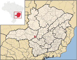
Campos Altos
Encyclopedia
Minas Gerais
Minas Gerais is one of the 26 states of Brazil, of which it is the second most populous, the third richest, and the fourth largest in area. Minas Gerais is the Brazilian state with the largest number of Presidents of Brazil, the current one, Dilma Rousseff, being one of them. The capital is the...
. Its population as of 2007 was estimated to be 13,184 people living in a total area of 719 km². The city belongs to the mesoregion of Triângulo Mineiro and Alto Paranaíba and to the micro-region of Araxá. It became a municipality in 1944.
Campos Altos is located at an elevation of 1,050 meters, 85 km. east of Araxá
Araxá
Araxá is a city and municipality in southwest Minas Gerais state, Brazil. The population was 87,764 inhabitants and the area of the municipality is 1,283 km², with 345 km² making up the urban perimeter.-Geography:...
on highway BR-216. The distance to the state capital, Belo Horizonte
Belo Horizonte
Belo Horizonte is the capital of and largest city in the state of Minas Gerais, located in the southeastern region of Brazil. It is the third largest metropolitan area in the country...
, is 264 km. Neighboring municipalities are: Rio Paranaíba
Rio Paranaíba
Rio Paranaíba is a Brazilian municipality located in the northwest of the state of Minas Gerais. Its population as of 2007 was 10,809 people living in a total area of 1,353 km². The city belongs to the mesoregion of Triângulo Mineiro e Alto Paranaíba and to the microregion of Patos de Minas...
(N), São Gotardo
São Gotardo
São Gotardo is a Brazilian municipality located in the northwest of the state of Minas Gerais. Its population as of 2007 was 30,757 people and its land area is 854 km2. The city belongs to the mesoregion of Triângulo Mineiro e Alto Paranaíba and to the microregion of Patos de Minas...
(NE), Santa Rosa da Serra
Santa Rosa da Serra
Santa Rosa da Serra is a Brazilian municipality located in the northwest of the state of Minas Gerais. Its population as of 2007 was 3,261 people living in a total area of 296 km². The city belongs to the mesoregion of Triângulo Mineiro e Alto Paranaíba and to the microregion of Patos de Minas...
(E), Córrego Danta
Córrego Danta
Córrego Danta is a town located in the state of Minas Gerais, Brazil.Córrego Danta was once the district of another city, Luz, until it became autonomous on January 1, 1949...
, (SE) Tapiraí
Tapiraí
Tapiraí is a municipality in the state of São Paulo in Brazil. The population in 2004 was 10,025 and the area is 757 km². The elevation is 875 m. The city is located in a UNESCO Biosphere Reserve...
(S), Pratinha
Pratinha
Pratinha is a Brazilian municipality located in the west of the state of Minas Gerais. Its population as of 2007 was 3,236 people living in a total area of 619 km². The city belongs to the meso-region of Triângulo Mineiro and Alto Paranaíba and to the micro-region of Araxá...
(SW), and Ibiá
Ibiá
Ibiá is a Brazilian municipality located in the west of the state of Minas Gerais. Its population as of 2007 was estimated to be 22,069 people living in a total area of 2,707 km². The city belongs to the mesoregion of Triângulo Mineiro and Alto Paranaíba and to the micro-region of Araxá...
(W).
The Ferrovia da Centro Atlântica, a railroad line used for cargo, passes through the town.
The GDP in 2005 was approximately R$133 million, with 53 million reais from services, 4 million reais from industry, and 69 million reais from agriculture. There were 549 rural producers on 48,000 hectares of land. The land is very fertile and agricultural production is high. 168 farms had tractors (2006). Approximately 2,000 persons were dependent on agriculture. The main crops are coffee (8,500 hectares planted in 2006)) while soybeans, potatoes, wheat, and corn were also grown. There were 25,000 head of cattle (2006). There were 2 banks (2007): Banco Itaú, Banco do Brasil
and Sicoob/Crediagro. There were 1,988 automobiles (2007), giving a ratio of 6 inhabitants per automobile.
There were 8 health clinics and 1 hospital with 37 beds (2005). Patients with more serious health conditions are transported to Araxá, which is connected by good roads. Educational needs were met by 3 primary schools, 1 middle school, and 6 pre-primary schools.
- Municipal Human Development IndexHuman Development IndexThe Human Development Index is a composite statistic used to rank countries by level of "human development" and separate "very high human development", "high human development", "medium human development", and "low human development" countries...
: 0.786 (2000) - State ranking: 90 out of 853 municipalities as of 2000
- National ranking: 901 out of 5,138 municipalities as of 2000
- Literacy rate: 87%
- Life expectancy: 74 (average of males and females)
In 2000 the per capita monthly income of R$251.00 was below the state and national average of R$276.00 and R$297.00 respectively.
The highest ranking municipality in Minas Gerais in 2000 was Poços de Caldas
Poços de Caldas
Poços de Caldas is a city and municipality in south-western Minas Gerais state, Brazil, in the microregion of the same name. Its estimated population in 2009 was 151,449 inhabitants...
with 0.841, while the lowest was Setubinha
Setubinha
Setubinha is a municipality in the northeast of the Brazilian state of Minas Gerais. As of 2007 the population was 10,834 in a total area of 536 km². The elevation is 729 metres. It is part of the IBGE statistical microregion of Teófilo Otoni...
with 0.568. Nationally the highest was São Caetano do Sul
São Caetano do Sul
São Caetano do Sul is a city in São Paulo state in Brazil, located in the Greater São Paulo Metropolitan Area. It is the city with the highest per capita income in Brazil and it also has the highest Human Development Index .-Geography:São Caetano do Sul is located on a plateau that is part of the...
in São Paulo with 0.919, while the lowest was Setubinha. In more recent statistics (considering 5,507 municipalities) Manari in the state of Pernambuco
Pernambuco
Pernambuco is a state of Brazil, located in the Northeast region of the country. To the north are the states of Paraíba and Ceará, to the west is Piauí, to the south are Alagoas and Bahia, and to the east is the Atlantic Ocean. There are about of beaches, some of the most beautiful in the...
has the lowest rating in the country--0,467--putting it in last place.