
Calhoun, Kentucky
Encyclopedia
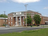
Calhoun is a city in McLean County
, Kentucky
, United States
. The population was 836 at the 2000 census. It is the county seat
of McLean County
. It is included in the Owensboro, Kentucky
Metropolitan Statistical Area
. The city is named for one-term Congressman
John Calhoun.
, the longest river entirely in the Commonwealth of Kentucky, and is home to the Army Corps of Engineers' Lock and Dam #2.
According to the United States Census Bureau
, the city has a total area of 0.7 square miles (1.8 km²), of which 0.7 square miles (1.8 km²) is land and 0.04 square mile (0.1035995244 km²) (2.86%) is water.
. It has been the county seat of McLean County since the county's formation in 1854.
, there were 836 people, 357 households and 210 families residing in the city. The population density
was 1,231.1 per square mile (474.7/km²). There were 395 housing units at an average density of 581.7 per square mile (224.3/km²). The racial makeup of the city was 98.80% White, 0.60% African American, 0.12% Native American, 0.24% from other races
, and 0.24% from two or more races. Hispanic or Latino of any race were 0.60% of the population.
There were 357 households of which 24.4% had children under the age of 18 living with them, 45.1% were married couples
living together, 11.2% had a female householder with no husband present, and 40.9% were non-families. 38.1% of all households were made up of individuals and 18.5% had someone living alone who was 65 years of age or older. The average household size was 2.11 and the average family size was 2.77.
18.8% of the population were under the age of 18, 6.8% from 18 to 24, 23.4% from 25 to 44, 22.0% from 45 to 64, and 28.9% who were 65 years of age or older. The median age was 46 years. For every 100 females there were 73.8 males. For every 100 females age 18 and over, there were 68.9 males.
The median household income
was $23,438 and the median family income was $32,386. Males had a median income of $31,500 versus $16,719 for females. The per capita income
for the city was $22,520. About 11.8% of families and 19.1% of the population were below the poverty line, including 21.1% of those under age 18 and 20.4% of those age 65 or over.
McLean County, Kentucky
McLean County is a county located in the U.S. state of Kentucky; its population was 9,938 in the 2000 Census. McLean County's county seat is at Calhoun....
, Kentucky
Kentucky
The Commonwealth of Kentucky is a state located in the East Central United States of America. As classified by the United States Census Bureau, Kentucky is a Southern state, more specifically in the East South Central region. Kentucky is one of four U.S. states constituted as a commonwealth...
, United States
United States
The United States of America is a federal constitutional republic comprising fifty states and a federal district...
. The population was 836 at the 2000 census. It is the county seat
County seat
A county seat is an administrative center, or seat of government, for a county or civil parish. The term is primarily used in the United States....
of McLean County
McLean County, Kentucky
McLean County is a county located in the U.S. state of Kentucky; its population was 9,938 in the 2000 Census. McLean County's county seat is at Calhoun....
. It is included in the Owensboro, Kentucky
Owensboro, Kentucky
Owensboro is the fourth largest city by population in the U.S. state of Kentucky. It is the county seat of Daviess County. It is located on U.S. Route 60 about southeast of Evansville, Indiana, and is the principal city of the Owensboro, Kentucky, Metropolitan Statistical Area. The city's...
Metropolitan Statistical Area
Owensboro metropolitan area
The Owensboro Metropolitan Statistical Area, as defined by the United States Census Bureau, is an area consisting of three counties in Kentucky, anchored by the city of Owensboro. As of the 2000 census, the MSA had a population of 109,875 In the 2010 Census the population was 114,752...
. The city is named for one-term Congressman
United States House of Representatives
The United States House of Representatives is one of the two Houses of the United States Congress, the bicameral legislature which also includes the Senate.The composition and powers of the House are established in Article One of the Constitution...
John Calhoun.
Geography
Calhoun is located at 37°32′19"N 87°15′34"W (37.538633, -87.259414), on the Green RiverGreen River (Kentucky)
The Green River is a tributary of the Ohio River that rises in Lincoln County in south-central Kentucky. Tributaries of the Green River include the Barren River, the Nolin River, the Pond River and the Rough River...
, the longest river entirely in the Commonwealth of Kentucky, and is home to the Army Corps of Engineers' Lock and Dam #2.
According to the United States Census Bureau
United States Census Bureau
The United States Census Bureau is the government agency that is responsible for the United States Census. It also gathers other national demographic and economic data...
, the city has a total area of 0.7 square miles (1.8 km²), of which 0.7 square miles (1.8 km²) is land and 0.04 square mile (0.1035995244 km²) (2.86%) is water.
History
The city was founded by Captain Henry Rhoads in 1788 as Rhoadsville, and was also known as Fort Vienna to protect a bend in the Green RiverGreen River (Kentucky)
The Green River is a tributary of the Ohio River that rises in Lincoln County in south-central Kentucky. Tributaries of the Green River include the Barren River, the Nolin River, the Pond River and the Rough River...
. It has been the county seat of McLean County since the county's formation in 1854.
Demographics
At the 2000 censusCensus
A census is the procedure of systematically acquiring and recording information about the members of a given population. It is a regularly occurring and official count of a particular population. The term is used mostly in connection with national population and housing censuses; other common...
, there were 836 people, 357 households and 210 families residing in the city. The population density
Population density
Population density is a measurement of population per unit area or unit volume. It is frequently applied to living organisms, and particularly to humans...
was 1,231.1 per square mile (474.7/km²). There were 395 housing units at an average density of 581.7 per square mile (224.3/km²). The racial makeup of the city was 98.80% White, 0.60% African American, 0.12% Native American, 0.24% from other races
Race (United States Census)
Race and ethnicity in the United States Census, as defined by the Federal Office of Management and Budget and the United States Census Bureau, are self-identification data items in which residents choose the race or races with which they most closely identify, and indicate whether or not they are...
, and 0.24% from two or more races. Hispanic or Latino of any race were 0.60% of the population.
There were 357 households of which 24.4% had children under the age of 18 living with them, 45.1% were married couples
Marriage
Marriage is a social union or legal contract between people that creates kinship. It is an institution in which interpersonal relationships, usually intimate and sexual, are acknowledged in a variety of ways, depending on the culture or subculture in which it is found...
living together, 11.2% had a female householder with no husband present, and 40.9% were non-families. 38.1% of all households were made up of individuals and 18.5% had someone living alone who was 65 years of age or older. The average household size was 2.11 and the average family size was 2.77.
18.8% of the population were under the age of 18, 6.8% from 18 to 24, 23.4% from 25 to 44, 22.0% from 45 to 64, and 28.9% who were 65 years of age or older. The median age was 46 years. For every 100 females there were 73.8 males. For every 100 females age 18 and over, there were 68.9 males.
The median household income
Median household income
The median household income is commonly used to generate data about geographic areas and divides households into two equal segments with the first half of households earning less than the median household income and the other half earning more...
was $23,438 and the median family income was $32,386. Males had a median income of $31,500 versus $16,719 for females. The per capita income
Per capita income
Per capita income or income per person is a measure of mean income within an economic aggregate, such as a country or city. It is calculated by taking a measure of all sources of income in the aggregate and dividing it by the total population...
for the city was $22,520. About 11.8% of families and 19.1% of the population were below the poverty line, including 21.1% of those under age 18 and 20.4% of those age 65 or over.