

Buenópolis
Encyclopedia
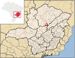
Minas Gerais
Minas Gerais is one of the 26 states of Brazil, of which it is the second most populous, the third richest, and the fourth largest in area. Minas Gerais is the Brazilian state with the largest number of Presidents of Brazil, the current one, Dilma Rousseff, being one of them. The capital is the...
. Its population as of 2007 was 9,522 living in a total area of 1,610 km². The city belongs to the statistical mesoregion
Mesoregion (Brazil)
Mesoregions are subdivisions of Brazilian states, grouping together various municipalities in proximity and with common characteristics. They were created by the Brazilian Institute of Geography and Statistics for statistical purposes and do not, therefore, constitute an administrative area....
of Central Mineira and to the statistical microregion
Microregion (Brazil)
Microregions are legally defined administrative areas in Brazil consisting of groups of municipalities bordering urban areas. Microregions are grouped together into mesoregions....
of Curvelo
Curvelo
Curvelo is a city and municipality in the state of Minas Gerais, Brazil. It is located in the geodesic centre of Minas Gerais, 170 km. north of the capital, Belo Horizonte, and connected to the capital by highways MG 135 and BR 040. Its estimated population is 74.409 inhabitants and the...
. It became a municipality in 1938.
Buenópolis is located at an elevation of 700 meters on highway BR-135. The nearest major population center is Montes Claros
Montes Claros
Montes Claros is a city located in northern Minas Gerais state, in Brazil. The estimated population in 2010 was 412,284 inhabitants and the total area of the municipality was 3,470 km²...
. The town began with the building of the railroad from Belo Horizonte to Montes Claros in 1910. The name is derived from the name of the state governor at that time, Júlio Bueno Brandão.
The distance to Curvelo
Curvelo
Curvelo is a city and municipality in the state of Minas Gerais, Brazil. It is located in the geodesic centre of Minas Gerais, 170 km. north of the capital, Belo Horizonte, and connected to the capital by highways MG 135 and BR 040. Its estimated population is 74.409 inhabitants and the...
is 138 km; and the distance to the state capital, Belo Horizonte
Belo Horizonte
Belo Horizonte is the capital of and largest city in the state of Minas Gerais, located in the southeastern region of Brazil. It is the third largest metropolitan area in the country...
, is 272 km. Neighboring municipalities are: Augusto de Lima
Augusto de Lima, Minas Gerais
Augusto de Lima is a Brazilian municipality located in the northeast of the state of Minas Gerais. Its population as of 2007 was 4,589 living in a total area of 1,250 km². The city belongs to the statistical mesoregion of Central Mineira and to the statistical microregion of Curvelo. It became a...
, Joaquim Felício
Joaquim Felício
Joaquim Felício is a Brazilian municipality located in the northeast of the state of Minas Gerais. Its population as of 2007 was 3,937 living in a total area of 791 km². The city belongs to the statistical mesoregion of Central Mineira and to the statistical microregion of Curvelo. It became a...
, Diamantina, Bocaiúva
Bocaiúva
Bocaiúva is a Brazilian municipality located in the northwest of the state of Minas Gerais. Its population as of 2007 was 44,657 people living in a total area of 3,232 km². The city belongs to the mesoregion of North of Minas and to the microregion of Bocaiúva...
, and Lassance
Lassance
Lassance is a Brazilian municipality located in the north of the state of Minas Gerais. In 2007 the population was 6,458 in a total area of 3,213 km². It became a municipality in 1953.-Location and Distances:...
.
The main economic activities are services and agriculture. The GDP in 2005 was R$39 million, with 24 million from services, 2 million from industry, and 10 million from agriculture. There were 354 rural producers on 14,000 hectares of land. Only 8 farms had tractors (2006). Approximately 800 persons were dependent on agriculture. The main crops were mangoes, sugarcane, beans, and corn. There were 27,000 head of cattle (2006). There was 1 bank (2007) and 666 automobiles (366 motorcycles), giving a ratio of 14 inhabitants per automobile.
There were 3 health clinics in 2005. Patients with more serious health conditions are transported to Bocaiúva, Montes Claros or Curvelo. Educational needs were met by 16 primary schools, 2 middle schools, and 9 pre-primary schools.
- Municipal Human Development IndexHuman Development IndexThe Human Development Index is a composite statistic used to rank countries by level of "human development" and separate "very high human development", "high human development", "medium human development", and "low human development" countries...
: 0.679 (2000) - State ranking: 642 out of 853 municipalities as of 2000
- National ranking: 3,319 out of 5,138 municipalities as of 2000
- Literacy rate: 77%
- Life expectancy: 65 (average of males and females)
In 2000 the per capita income of R$149.00 was well below the state and national average of R$276.00 and R$297.00 respectively.
The highest ranking municipality in Minas Gerais in 2000 was Poços de Caldas
Poços de Caldas
Poços de Caldas is a city and municipality in south-western Minas Gerais state, Brazil, in the microregion of the same name. Its estimated population in 2009 was 151,449 inhabitants...
with 0.841, while the lowest was Setubinha
Setubinha
Setubinha is a municipality in the northeast of the Brazilian state of Minas Gerais. As of 2007 the population was 10,834 in a total area of 536 km². The elevation is 729 metres. It is part of the IBGE statistical microregion of Teófilo Otoni...
with 0.568. Nationally the highest was São Caetano do Sul
São Caetano do Sul
São Caetano do Sul is a city in São Paulo state in Brazil, located in the Greater São Paulo Metropolitan Area. It is the city with the highest per capita income in Brazil and it also has the highest Human Development Index .-Geography:São Caetano do Sul is located on a plateau that is part of the...
in São Paulo with 0.919, while the lowest was Setubinha. In more recent statistics (considering 5,507 municipalities) Manari in the state of Pernambuco
Pernambuco
Pernambuco is a state of Brazil, located in the Northeast region of the country. To the north are the states of Paraíba and Ceará, to the west is Piauí, to the south are Alagoas and Bahia, and to the east is the Atlantic Ocean. There are about of beaches, some of the most beautiful in the...
has the lowest rating in the country--0,467--putting it in last place.
See also
- List of municipalities in Minas Gerais