
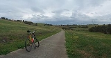
Broadmeadows Valley Trail
Encyclopedia
The Broadmeadows Valley Trail is a shared use path for cyclists
and pedestrian
s in the outer northern suburbs of Melbourne
, Victoria
, Australia
.
While in Craigieburn
consider a side trip to Mount Ridley or a return trip via the Craigieburn Bypass Trail
.
Follow Aitken Creek for 1.3 km until stymied by yet another golf course. The trail turns left and stops immediately at Axminster Drv. Proceed in a westerly direction up Axminster Drv, which immediately swings round to the south. It soon forms a path made out of the ends of a series of cull de sacs. About a 1 km from Aitken Creek a small wetland appears. Follow the trail here until a large solitary palm
comes into view. Head for the palm
, then continue along a short goat track on its far side, that crosses a narrow easement. Pick up the path on the other side of the easement.
Now in Roxburgh Park
, the path winds round some streets and crosses an open section and then runs between some contemporary terrace like houses. It breaks into an open park area, where the path forms a figure of eight. At the south end of the park, it passes through a distinct line of trees running west east and crosses a large power transmission line easement. While possible, do not go east at this point. Continue in a southerly direction.
From here the path runs for another 8 km through a section that is easy to navigate and arrives at Barry Rd in Westmeadows
. Passing by a couple of ovals on the left, the path reaches a footbridge about 0.4 km from Barry Rd. Cross the bridge and arrive at the Moonee Ponds Creek Trail
.
North end at 37.606673°S 144.940289°E.
South end at 37.683859°S 144.903064°E.
Cycling
Cycling, also called bicycling or biking, is the use of bicycles for transport, recreation, or for sport. Persons engaged in cycling are cyclists or bicyclists...
and pedestrian
Pedestrian
A pedestrian is a person traveling on foot, whether walking or running. In some communities, those traveling using roller skates or skateboards are also considered to be pedestrians. In modern times, the term mostly refers to someone walking on a road or footpath, but this was not the case...
s in the outer northern suburbs of Melbourne
Melbourne
Melbourne is the capital and most populous city in the state of Victoria, and the second most populous city in Australia. The Melbourne City Centre is the hub of the greater metropolitan area and the Census statistical division—of which "Melbourne" is the common name. As of June 2009, the greater...
, Victoria
Victoria (Australia)
Victoria is the second most populous state in Australia. Geographically the smallest mainland state, Victoria is bordered by New South Wales, South Australia, and Tasmania on Boundary Islet to the north, west and south respectively....
, Australia
Australia
Australia , officially the Commonwealth of Australia, is a country in the Southern Hemisphere comprising the mainland of the Australian continent, the island of Tasmania, and numerous smaller islands in the Indian and Pacific Oceans. It is the world's sixth-largest country by total area...
.
While in Craigieburn
Craigieburn, Victoria
Craigieburn is a suburb in Melbourne, Victoria, Australia, 26 km north from Melbourne's central business district. Its Local Government Area is the City of Hume. At the 2006 Census, Craigieburn had a population of 20,784....
consider a side trip to Mount Ridley or a return trip via the Craigieburn Bypass Trail
Craigieburn Bypass Trail
The Craigieburn Bypass Trail , is a shared use path for cyclists and pedestrians in the outer northern suburbs of Melbourne, Victoria, Australia...
.
Following the Path
The north end of the trail is most readily accessed from Craigieburn railway station. The trail starts at the intersection of Hothlyn Drive and Aitken Creek.Follow Aitken Creek for 1.3 km until stymied by yet another golf course. The trail turns left and stops immediately at Axminster Drv. Proceed in a westerly direction up Axminster Drv, which immediately swings round to the south. It soon forms a path made out of the ends of a series of cull de sacs. About a 1 km from Aitken Creek a small wetland appears. Follow the trail here until a large solitary palm
Canary Island Date Palm
Phoenix canariensis is a species in the palm family Arecaceae, native to the Canary Islands. It is a relative of Phoenix dactylifera, the true date palm....
comes into view. Head for the palm
Canary Island Date Palm
Phoenix canariensis is a species in the palm family Arecaceae, native to the Canary Islands. It is a relative of Phoenix dactylifera, the true date palm....
, then continue along a short goat track on its far side, that crosses a narrow easement. Pick up the path on the other side of the easement.
Now in Roxburgh Park
Roxburgh Park, Victoria
Roxburgh Park is a suburb in Melbourne, Victoria, Australia, 20 km north from Melbourne's central business district. Its Local Government Area is the City of Hume...
, the path winds round some streets and crosses an open section and then runs between some contemporary terrace like houses. It breaks into an open park area, where the path forms a figure of eight. At the south end of the park, it passes through a distinct line of trees running west east and crosses a large power transmission line easement. While possible, do not go east at this point. Continue in a southerly direction.
From here the path runs for another 8 km through a section that is easy to navigate and arrives at Barry Rd in Westmeadows
Westmeadows, Victoria
Westmeadows is a suburb in Melbourne, Victoria, Australia, 17 km north from Melbourne's central business district. Its Local Government Area is the City of Hume. At the 2006 Census, Westmeadows had a population of 5,857....
. Passing by a couple of ovals on the left, the path reaches a footbridge about 0.4 km from Barry Rd. Cross the bridge and arrive at the Moonee Ponds Creek Trail
Moonee Ponds Creek Trail
The Moonee Ponds Creek Trail is a shared use path for cyclists and pedestrians, which follows the Moonee Ponds Creek through the northern suburbs of Melbourne, Victoria, Australia.-Following the path:...
.
Connections
- The electrified railway service to Craigieburn railway station was opened on 30 September 2007, together with a new station at Roxburgh Park at Somerton Rd - Roxburgh Park railway stationRoxburgh Park railway stationRoxburgh Park is a suburban railway station located on the Craigieburn railway line on Thomas Brunton Parade in Roxburgh Park, Victoria, Australia...
. The Craigieburn service was previously by Sprinter Railcars.Sprinter (Victorian train)The Sprinter is a high speed diesel railcar train manufactured by Goninan for use on interurban and semi-regional rail services in Victoria, Australia... - Dead end in the north at Hothlyn Drv.
- Meets the Shankland Trail near Shankland Bvd
- And further south the Moonee Ponds Creek TrailMoonee Ponds Creek TrailThe Moonee Ponds Creek Trail is a shared use path for cyclists and pedestrians, which follows the Moonee Ponds Creek through the northern suburbs of Melbourne, Victoria, Australia.-Following the path:...
.
North end at 37.606673°S 144.940289°E.
South end at 37.683859°S 144.903064°E.