
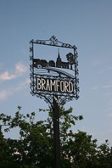
Bramford
Encyclopedia
Ipswich
Ipswich is a large town and a non-metropolitan district. It is the county town of Suffolk, England. Ipswich is located on the estuary of the River Orwell...
, Suffolk
Suffolk
Suffolk is a non-metropolitan county of historic origin in East Anglia, England. It has borders with Norfolk to the north, Cambridgeshire to the west and Essex to the south. The North Sea lies to the east...
, in the Mid Suffolk
Mid Suffolk
Mid Suffolk is a local government district in Suffolk, England. Its council is based in Needham Market, and the largest town is Stowmarket.The district was formed on 1 April 1974 by the merger of the Borough of Eye, Stowmarket urban district, Gipping Rural District, Hartismere Rural District and...
administrative district. Recorded in the Domesday Book
Domesday Book
Domesday Book , now held at The National Archives, Kew, Richmond upon Thames in South West London, is the record of the great survey of much of England and parts of Wales completed in 1086...
as "Brunfort" or "Branfort". The River Gipping
River Gipping
The River Gipping is the source river for the River Orwell in the county of Suffolk in East Anglia, England, which gave its name to the former Gipping Rural District and the village of Gipping....
(the source of the River Orwell
River Orwell
The River Orwell flows through the county of Suffolk in England. Its source river, above the tidal limit at Stoke Bridge, is known as the River Gipping. It broadens into an estuary at Ipswich where the Ipswich dock has operated since the 7th century and then flows into the North Sea at Felixstowe...
), runs at the bottom of the village and was a busy navigable waterway during the 19th century. A lock is still on the east of side of the village.
The village has two churches; (one Anglican, St Mary the Virgin viewable from Bramford Bridge in the southeast of the village and one Methodist) in the north west of the village on the B1067 road. Bramford railway station
Bramford railway station
-External links:*...
was originally on the Eastern Union Railway
Eastern Union Railway
The Eastern Union Railway was an early English railway, initially sanctioned by Act of Parliament on 19 July 1844, with authorised capital of £200,000 to build from Ipswich to Colchester. Further Acts of 21 July 1845 and 26 June 1846 authorised further increases in capital of £50,000 and £20,000...
but closed in 1955.
The village is served by a variety of shops and services; a primary school (southwest), two pubs (the Angel and the Cock), a sports ground, a bowls club and other social groups, including a football club which has a first and reserve team. There is a private care village which is called Cherryfields made up of several bungalows and flats situated up Gippingstone Road in the centre of Bramford, opposite the Co-op. Bramford also has its own Royal British Legion club.
Nearby villages include Sproughton
Sproughton
Sproughton is a village in Suffolk, England, just to the west of Ipswich and is in the Babergh administrative district.It has a church, a primary school, a pub and various groups.The River Gipping runs through the village....
, Somersham
Somersham, Suffolk
Somersham is a village and civil parish in the Mid Suffolk district of Suffolk in eastern England. Located around five miles northwest of Ipswich, in 2005 its population was 710.There are two churches in the village:St...
and Little Blakenham
Little Blakenham
Little Blakenham is a village and civil parish in the Mid Suffolk district of Suffolk in eastern England. Located around two miles north-west of Ipswich and a mile south-west of its larger sister village Great Blakenham, in 2005 its population was 310. The parish also contains the hamlets of...
.