
Belleview, Florida
Encyclopedia
Belleview is a city in Marion County
, Florida
. The population was 3,478 at the 2000 census. According to the U.S Census estimates of 2009, the city had a population of 4,483. http://www.census.gov/popest/cities/tables/SUB-EST2005-04-12.csv It is part of the Ocala
Metropolitan Statistical Area. The name, Belleview, which means beautiful view, came from one of the original settlers whose daughter was named “Belle”. "The City with Small Town Charm" is the city’s motto which genuinely reflects the feeling of the city.
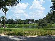
, one of Belleview's first recorded land owners was a transplanted South Carolinian, J. F. Pelot Sr. In 1854, he settled on a farm
about three miles west of where the current Belleview City Hall is located. Prior to Pelot's arrival, the area around Lake Lillian was a popular resting place for Native American
bands including the Seminole
tribe under Osceola
.
In April of 1839, United States soldiers held talks with a group of Seminoles
on an over-night excursion somewhere near Lake Lillian, which was called Nine Mile Pond at the time. The name came about because the pond was located nine miles south of Fort King in present-day Ocala
.
Further evidence of Native Americans in the Lake Lillian area came during the 1930s when a dredging of the lake unearthed arrowheads
and other artifacts. "When Lake Lillian was dredged back in the '30s to make it more round, we picked up arrowheads by the buckets-full," said Frank Pelot III, in a 1986 Star-Banner
story by Elaine Hamaker.
When the Florida Railway and Navigation Company railroad arrived in the county during 1882, a new development firm called the Marion Land and Improvement Company was formed to promote and sell the land around Lake Lillian. Lake Lillian has had several names including Nine Mile Pond, Butlers Pond, and even Roach's Pond which was when the land around the lake was owned by early settler King Roach. It is not known how or when the name Lake Lillian came to pass. By 1886, it was referred to as Lake Lillian in a booklet about Belleview published by the Marion Land and Improvement Company. According to Belleview history expert Gene Scroggie, the name Lillian was thought to belong to the wife of one of the men who formed the Marion Land and Improvement Company. One story passed down about the name of the town, Belleview, was Pelot named it after his daughter Belle. But according to a history of the town written in 1950, the name was derived by the founders in 1884 from a combination of French word "belle" and "view", to mean beautiful vistas to be seen around the fledgling town.
Belleview was called "The City of Oaks" in "The Story of Belleview" written by former Belleview Chamber of Commerce President Vincent Razzano in the late 1950s. The area was considered "a health haven in the midst of natural and attractive scenery, rolling terrain, fertile soil and mild equable climate". Its attractiveness to northerners in feeble health seeking a place for winter residence was soon recognized. The Lakeview Hotel, then known as the Hotel Sanitatia, was owned and operated by Dr. H. Knight. Its desirability attracted men of prominent standing in all walks of life."
John F. Dunn was listed as a major stockholder in the Marion Land and Improvement Company. He was an lawyer
and banker in Ocala and a stockholder in the Dunnellon Short Railway. He was also involved with the development of Heather Island on Lake Weir
. Dunn would also head the development of the community of Dunnellon in the 1880s and was deeply involved in the phosphate boom in Marion County during the 1890s. The President of the company was the Hon. C. L. Robinson, an attorney from Jacksonville. Ocala merchant E.W. Agnew was the vice president, Dunn was the treasurer, and the Rev. H. Woodward, formerly of Keene, NH, and a Methodist minister, was the secretary. Others reportedly holding stock in the company were Dr. Harvey Knight, of Lowell, Mass., who later opened a sanitarium and hotel, C.A. Babb, and Ocala's C. W. Campbell.
Bray writes in "Salty Crackers" that, "the local government, made up mostly of northerners removed many features common to small southern towns, for instance the free roaming hogs through the streets. Admirable sanitary regulations were being adopted and were strictly enforced." Another thing the New England founders prohibited was the imbibing of alcoholic beverages. In fact, they wrote the prohibition laws into the original deed restrictions for the land sold.
From 1851-1882, the Concord Stage Line used Lake Lillian as watering stop before changing the teams and getting food for the passengers at a station on the top of a hill about two miles south of town. The route south from Jacksonville to Tampa included stops at Palatka, Orange Springs, Orange Lake, Ocala, Camp Izard, Augusta, Melendex, Pierceville, and Fort Taylor. The route followed the old military road established after the U.S. gained the territory of Florida during the 1820s and 1830s. Today that road is U.S. 301. Another route out of Belleview to the south, according to Bray, was the Old Wire Road. "The International Ocean Telegraph strung its wires along this route. This became Western Union and Florida Railway and Navigation Company became Florida Central and Peninsular Railway and the Seaboard Coastline."
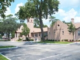
By 1880, the area, around what would become Belleview, had a population of about 350 people. By comparison, Ocala had more than 2,600; Weirsdale (then Foster's Pond) had 28; Summerfield had 50; and Miami had 150. The town was founded in 1884 and was incorporated and held its first election on May 8, 1885. Sixty-three people voted, 44 of them for Alfred Stetson, who became the first mayor of Belleview. With the arrival of more and more people came the need for schools, a library, police and fire service, a church, funeral home, a cemetery and a city hall. The first city hall was a frame building built in 1884 by the Marion Land and Improvement Company. It included a bell tower and stage. On Feb. 12, 1925, the building burned to the ground after a fish fry. A second city hall was built on the site of the first one, but on April 8, 1935, it also burned to ground, catching fire when shards from a fire built by a local Methodist minister, raking and burning leaves blew into the bell tower. The Belleview Fire Department, of the period, was an all-volunteer outfit with one forty gallon water tank with a hose, mounted on two iron wheels and it was hand-drawn. With insurance money and help from Works Progress Administration workers during the New Deal, a third city hall, constructed with limestone from the area, was built between 1935-1940.
Belleview was just a year old when the first library group was formed by Professor George Gary Bush. He located the site of the current library building and had books in his home for public use until the building was completed. The group raised $500 in order to purchase a site. The library was also located in the offices of the Belleview Blade and later in the lobby of the Belleview Hotel, paying $3.75 a month rent. Two lots were donated by the Marion Land and Improvement Company and the land was fenced until construction could begin. W.W. Cole did the original masonry work for $25. The library was completed and dedicated on March 19, 1908. The Belleview Library still stands today as the second oldest library building in the state of Florida; that building serving as the lobby of the expanded library today.
The Blade was among the earliest newspapers in Belleview. Its editor was George P.E. Hart. Later newspapers included the Belleview Newsletter, the Belleview News and the Voice of South Marion.
The first Belleview Grammar School was a large two-room building complete with bell tower. Prior to that, classes were held in the city hall building. In 1913, a Miss Callie was the teacher for the primary grades and a Professor Rickards, who was also a surveyor for the Atlantic Coast Line Railway from Ocala to Leesburg, taught the older students. A growing population prompted a move back into city hall for some classes. But, in 1926, a new five-room school building was built. The old school was dismantled and reassembled as the Santos School for black students; that building still stands. The present city hall was the site of the third school built in 1926 of Spanish design. It housed grades one through 12. By the early 1950s, only grades one through eight attended school in Belleview, the older students took a bus to Ocala or Summerfield to attend high school. The present Belleview Elementary School was built in 1962 on 15 acres donated by Sham Sani, President of Belleview Heights Inc. The city purchased the site of the old school in 1963, and converted it into a city hall building. But by 1974, continued population growth forced some classes back into the city hall building. The new high school and middle school were built in the early 1990s and are among the best facilities in Marion County, even with the portable classrooms necessary to handle the ever-expanding population.
Belleview was also the site of a college, founded by the previously-mentioned George Bush in 1889. Bush, who came to Belleview from New England, had one other teacher on staff. He was Hezekiah Butterworth, who also served as the editor of the nationally-circulated Youth's Companion. The college was in operation for just three years, with only two graduates, one of them Bush's daughter.
Religious life in Belleview centered around several churches. The Church of Nazarene, originally built in 1900 as a Methodist Church, is the oldest church building still standing. Different denominations arranged for a joint pastorate by two clergymen. In 1904, the Methodist minister would arrive from Island Hope and flag the night train to stop with a burning newspaper for the return trip.
Belleview has had three railroad depots, all located near the present-day County Road 25 crosses the railroad tracks at Baseline Road just east of U.S. 441. The first depot was built around 1884 and was noted for its decorative "gingerbread" woodwork. It was a tradition for year-around residents to greet the winter residents in the fall and to see them off again in the spring when they returned home. A second and larger depot, complete with loading dock, was built in 1910 on the same site. A third depot, nearly the same size as the second one but just for freight, was built in the 1950s. This depot was later moved to land near city hall on U.S. 441 to house the Belleview and South Marion Chamber of Commerce. "Woodeater" was the name given to one of the first trains to run through Belleview. But on May 26, 1953, the "Silver Meteor" with a diesel engine rolled through town at 80 mph. Mail arrived by rail, being thrown off the passing train. Outgoing mail was grabbed off a mail arm on the side of the tracks as the train rolled through town.
During the 1920s, fire destroyed almost all of the wood buildings in the center of town. Only the Masonic Hall, which housed the post office, was spared and it still stands to this day. That building is located on Front Street. A second post office was built on the corner of Magnolia and Southeast Hames Road in 1954. A third post office was built in the 1960s, right next door to the second one on Hames Rd.
Today's post office was built during the early 1990s and is located on Southeast 110th Street just west of U.S. 441.
Industry in the 1930s included an ax handle factory that was later converted into a tomato canning factory. Wilke's Canning Company also canned boiled peanuts and shipped their products to wholesalers. Before that, around 1912, there was a saw mill south of the railroad tracks. Timber was readily available and logs hauled from three or four miles away by teams of oxen were cut and shipped out by rail. Another important industry for the area was turpentine distilling. Land owners would rent their pine-covered property to still operators to extract turpentine and rosins for the naval stores business in the first 40 years of the 20th century. Belleview was also known for its citrus, producing more than 250,000 bushels of fruit each year until freezes in the late 1890s forced many growers out of the business. Chicken farming was another agricultural industry to develop around Belleview by the 1920s. Several large poultry farms located in and around the town were started by several immigrants of Polish decent who came to the area from Michigan. Later, during the 1930s and 1940s, cattle ranching became popular as tick-borne diseases were being controlled with a state-sponsored irradication program and a fence law was passed by the state legislature in 1949 ending the open range in Florida.
By 1900, Florida was already a popular destination for winter tourists. The Dixie Highway, which was developed between 1915 and 1927, had divisions running down the east coast (present-day U.S. 1) and the center of the state (present-day U.S. 441) was an important route for early "Tin Can Tourists" to reach the southern part of the Sunshine State. In the early 1900s, what would later become the Dixie Highway was just a narrow dirt road in Belleview. Marion County would use prisoner labor working on chain gangs, cutting tree limbs away from road's edge and repairing potholes with lime rock and clay. Now, it is U.S. 27-301-441 from north Marion County to Belleview, where 301 splits off. The current County Road 484 was a bicycle path in 1913, heading west out of Belleview according to Bray. Between two and three miles out of town was a cutoff, Southeast 120th Street today, which went west towards Eichelberger Cave, located near present-day County Road 467. Mrs. Charles Temere would lead Sunday afternoon excursions to the cave. Once there, they would light torches and enter the cave, which had two large rooms. The second room was so large it had a balcony-like natural formations above it. There were steps leading through a narrow passage back to the springs. Indians had inhabited the caves, and the young people of Marion County continued to explore it until the early 1970s when it was dug up for the lime deposits located around it.
According to the United States Census Bureau
, the city has a total area of 1.8 square miles (4.7 km²), all land.
 As of the census
of 2000, there were 3,478 people, 1,600 households, and 956 families residing in the city. The population density
was 1,905.5 inhabitants per square mile (733.8/km²). There were 1,806 housing units at an average density of 989.5 per square mile (381.0/km²). The racial makeup of the city was 91.14% White, 4.23% African American, 0.46% Native American, 0.58% Asian, 2.10% from other races
, and 1.50% from two or more races. Hispanic or Latino of any race were 7.68% of the population.
There were 1,600 households out of which 22.5% had children under the age of 18 living with them, 41.8% were married couples
living together, 14.4% had a female householder with no husband present, and 40.2% were non-families. 34.6% of all households were made up of individuals and 19.7% had someone living alone who was 65 years of age or older. The average household size was 2.14 and the average family size was 2.72.
In the city the population was spread out with 20.2% under the age of 18, 8.3% from 18 to 24, 23.5% from 25 to 44, 20.4% from 45 to 64, and 27.5% who were 65 years of age or older. The median age was 43 years. For every 100 females there were 87.7 males. For every 100 females age 18 and over, there were 82.3 males.
The median income for a household in the city was $26,250, and the median income for a family was $33,701. Males had a median income of $27,500 versus $18,250 for females. The per capita income
for the city was $18,241. About 8.8% of families and 12.3% of the population were below the poverty line, including 12.8% of those under age 18 and 7.4% of those age 65 or over.
Marion County, Florida
Marion County is a county located in the U.S. state of Florida. The U.S. Census Bureau 2006 estimate for the county is 316,183. Its county seat is Ocala....
, Florida
Florida
Florida is a state in the southeastern United States, located on the nation's Atlantic and Gulf coasts. It is bordered to the west by the Gulf of Mexico, to the north by Alabama and Georgia and to the east by the Atlantic Ocean. With a population of 18,801,310 as measured by the 2010 census, it...
. The population was 3,478 at the 2000 census. According to the U.S Census estimates of 2009, the city had a population of 4,483. http://www.census.gov/popest/cities/tables/SUB-EST2005-04-12.csv It is part of the Ocala
Ocala, Florida
Ocala is a city in Marion County, Florida. As of 2007, the population recorded by the U.S. Census Bureau was 53,491. It is the county seat of Marion County, and the principal city of the Ocala, Florida Metropolitan Statistical Area, which had an estimated 2007 population of 324,857.-History:Ocala...
Metropolitan Statistical Area. The name, Belleview, which means beautiful view, came from one of the original settlers whose daughter was named “Belle”. "The City with Small Town Charm" is the city’s motto which genuinely reflects the feeling of the city.
History
Like many parts of Marion County, FloridaMarion County, Florida
Marion County is a county located in the U.S. state of Florida. The U.S. Census Bureau 2006 estimate for the county is 316,183. Its county seat is Ocala....
, one of Belleview's first recorded land owners was a transplanted South Carolinian, J. F. Pelot Sr. In 1854, he settled on a farm
Farm
A farm is an area of land, or, for aquaculture, lake, river or sea, including various structures, devoted primarily to the practice of producing and managing food , fibres and, increasingly, fuel. It is the basic production facility in food production. Farms may be owned and operated by a single...
about three miles west of where the current Belleview City Hall is located. Prior to Pelot's arrival, the area around Lake Lillian was a popular resting place for Native American
Native Americans in the United States
Native Americans in the United States are the indigenous peoples in North America within the boundaries of the present-day continental United States, parts of Alaska, and the island state of Hawaii. They are composed of numerous, distinct tribes, states, and ethnic groups, many of which survive as...
bands including the Seminole
Seminole
The Seminole are a Native American people originally of Florida, who now reside primarily in that state and Oklahoma. The Seminole nation emerged in a process of ethnogenesis out of groups of Native Americans, most significantly Creeks from what is now Georgia and Alabama, who settled in Florida in...
tribe under Osceola
Osceola
Osceola, also known as Billy Powell , became an influential leader with the Seminole in Florida. He was of Creek, Scots-Irish and English parentage, and had migrated to Florida with his mother after the defeat of the Creek in 1814.Osceola led a small band of warriors in the Seminole resistance...
.
In April of 1839, United States soldiers held talks with a group of Seminoles
Seminole
The Seminole are a Native American people originally of Florida, who now reside primarily in that state and Oklahoma. The Seminole nation emerged in a process of ethnogenesis out of groups of Native Americans, most significantly Creeks from what is now Georgia and Alabama, who settled in Florida in...
on an over-night excursion somewhere near Lake Lillian, which was called Nine Mile Pond at the time. The name came about because the pond was located nine miles south of Fort King in present-day Ocala
Ocala, Florida
Ocala is a city in Marion County, Florida. As of 2007, the population recorded by the U.S. Census Bureau was 53,491. It is the county seat of Marion County, and the principal city of the Ocala, Florida Metropolitan Statistical Area, which had an estimated 2007 population of 324,857.-History:Ocala...
.
Further evidence of Native Americans in the Lake Lillian area came during the 1930s when a dredging of the lake unearthed arrowheads
Arrowhead
An arrowhead is a tip, usually sharpened, added to an arrow to make it more deadly or to fulfill some special purpose. Historically arrowheads were made of stone and of organic materials; as human civilization progressed other materials were used...
and other artifacts. "When Lake Lillian was dredged back in the '30s to make it more round, we picked up arrowheads by the buckets-full," said Frank Pelot III, in a 1986 Star-Banner
Star-Banner
The Star-Banner is the daily newspaper in Ocala, Florida, United States and serves Marion County and the surrounding communities. Owned by the New York Times Company, the Star-Banner has a daily circulation of about 43,000, and is the 19th largest newspaper in the state of Florida.- History :The...
story by Elaine Hamaker.
When the Florida Railway and Navigation Company railroad arrived in the county during 1882, a new development firm called the Marion Land and Improvement Company was formed to promote and sell the land around Lake Lillian. Lake Lillian has had several names including Nine Mile Pond, Butlers Pond, and even Roach's Pond which was when the land around the lake was owned by early settler King Roach. It is not known how or when the name Lake Lillian came to pass. By 1886, it was referred to as Lake Lillian in a booklet about Belleview published by the Marion Land and Improvement Company. According to Belleview history expert Gene Scroggie, the name Lillian was thought to belong to the wife of one of the men who formed the Marion Land and Improvement Company. One story passed down about the name of the town, Belleview, was Pelot named it after his daughter Belle. But according to a history of the town written in 1950, the name was derived by the founders in 1884 from a combination of French word "belle" and "view", to mean beautiful vistas to be seen around the fledgling town.
Belleview was called "The City of Oaks" in "The Story of Belleview" written by former Belleview Chamber of Commerce President Vincent Razzano in the late 1950s. The area was considered "a health haven in the midst of natural and attractive scenery, rolling terrain, fertile soil and mild equable climate". Its attractiveness to northerners in feeble health seeking a place for winter residence was soon recognized. The Lakeview Hotel, then known as the Hotel Sanitatia, was owned and operated by Dr. H. Knight. Its desirability attracted men of prominent standing in all walks of life."
John F. Dunn was listed as a major stockholder in the Marion Land and Improvement Company. He was an lawyer
Lawyer
A lawyer, according to Black's Law Dictionary, is "a person learned in the law; as an attorney, counsel or solicitor; a person who is practicing law." Law is the system of rules of conduct established by the sovereign government of a society to correct wrongs, maintain the stability of political...
and banker in Ocala and a stockholder in the Dunnellon Short Railway. He was also involved with the development of Heather Island on Lake Weir
Lake Weir
-External links:* *...
. Dunn would also head the development of the community of Dunnellon in the 1880s and was deeply involved in the phosphate boom in Marion County during the 1890s. The President of the company was the Hon. C. L. Robinson, an attorney from Jacksonville. Ocala merchant E.W. Agnew was the vice president, Dunn was the treasurer, and the Rev. H. Woodward, formerly of Keene, NH, and a Methodist minister, was the secretary. Others reportedly holding stock in the company were Dr. Harvey Knight, of Lowell, Mass., who later opened a sanitarium and hotel, C.A. Babb, and Ocala's C. W. Campbell.
Bray writes in "Salty Crackers" that, "the local government, made up mostly of northerners removed many features common to small southern towns, for instance the free roaming hogs through the streets. Admirable sanitary regulations were being adopted and were strictly enforced." Another thing the New England founders prohibited was the imbibing of alcoholic beverages. In fact, they wrote the prohibition laws into the original deed restrictions for the land sold.
From 1851-1882, the Concord Stage Line used Lake Lillian as watering stop before changing the teams and getting food for the passengers at a station on the top of a hill about two miles south of town. The route south from Jacksonville to Tampa included stops at Palatka, Orange Springs, Orange Lake, Ocala, Camp Izard, Augusta, Melendex, Pierceville, and Fort Taylor. The route followed the old military road established after the U.S. gained the territory of Florida during the 1820s and 1830s. Today that road is U.S. 301. Another route out of Belleview to the south, according to Bray, was the Old Wire Road. "The International Ocean Telegraph strung its wires along this route. This became Western Union and Florida Railway and Navigation Company became Florida Central and Peninsular Railway and the Seaboard Coastline."
By 1880, the area, around what would become Belleview, had a population of about 350 people. By comparison, Ocala had more than 2,600; Weirsdale (then Foster's Pond) had 28; Summerfield had 50; and Miami had 150. The town was founded in 1884 and was incorporated and held its first election on May 8, 1885. Sixty-three people voted, 44 of them for Alfred Stetson, who became the first mayor of Belleview. With the arrival of more and more people came the need for schools, a library, police and fire service, a church, funeral home, a cemetery and a city hall. The first city hall was a frame building built in 1884 by the Marion Land and Improvement Company. It included a bell tower and stage. On Feb. 12, 1925, the building burned to the ground after a fish fry. A second city hall was built on the site of the first one, but on April 8, 1935, it also burned to ground, catching fire when shards from a fire built by a local Methodist minister, raking and burning leaves blew into the bell tower. The Belleview Fire Department, of the period, was an all-volunteer outfit with one forty gallon water tank with a hose, mounted on two iron wheels and it was hand-drawn. With insurance money and help from Works Progress Administration workers during the New Deal, a third city hall, constructed with limestone from the area, was built between 1935-1940.
Belleview was just a year old when the first library group was formed by Professor George Gary Bush. He located the site of the current library building and had books in his home for public use until the building was completed. The group raised $500 in order to purchase a site. The library was also located in the offices of the Belleview Blade and later in the lobby of the Belleview Hotel, paying $3.75 a month rent. Two lots were donated by the Marion Land and Improvement Company and the land was fenced until construction could begin. W.W. Cole did the original masonry work for $25. The library was completed and dedicated on March 19, 1908. The Belleview Library still stands today as the second oldest library building in the state of Florida; that building serving as the lobby of the expanded library today.
The Blade was among the earliest newspapers in Belleview. Its editor was George P.E. Hart. Later newspapers included the Belleview Newsletter, the Belleview News and the Voice of South Marion.
The first Belleview Grammar School was a large two-room building complete with bell tower. Prior to that, classes were held in the city hall building. In 1913, a Miss Callie was the teacher for the primary grades and a Professor Rickards, who was also a surveyor for the Atlantic Coast Line Railway from Ocala to Leesburg, taught the older students. A growing population prompted a move back into city hall for some classes. But, in 1926, a new five-room school building was built. The old school was dismantled and reassembled as the Santos School for black students; that building still stands. The present city hall was the site of the third school built in 1926 of Spanish design. It housed grades one through 12. By the early 1950s, only grades one through eight attended school in Belleview, the older students took a bus to Ocala or Summerfield to attend high school. The present Belleview Elementary School was built in 1962 on 15 acres donated by Sham Sani, President of Belleview Heights Inc. The city purchased the site of the old school in 1963, and converted it into a city hall building. But by 1974, continued population growth forced some classes back into the city hall building. The new high school and middle school were built in the early 1990s and are among the best facilities in Marion County, even with the portable classrooms necessary to handle the ever-expanding population.
Belleview was also the site of a college, founded by the previously-mentioned George Bush in 1889. Bush, who came to Belleview from New England, had one other teacher on staff. He was Hezekiah Butterworth, who also served as the editor of the nationally-circulated Youth's Companion. The college was in operation for just three years, with only two graduates, one of them Bush's daughter.
Religious life in Belleview centered around several churches. The Church of Nazarene, originally built in 1900 as a Methodist Church, is the oldest church building still standing. Different denominations arranged for a joint pastorate by two clergymen. In 1904, the Methodist minister would arrive from Island Hope and flag the night train to stop with a burning newspaper for the return trip.
Belleview has had three railroad depots, all located near the present-day County Road 25 crosses the railroad tracks at Baseline Road just east of U.S. 441. The first depot was built around 1884 and was noted for its decorative "gingerbread" woodwork. It was a tradition for year-around residents to greet the winter residents in the fall and to see them off again in the spring when they returned home. A second and larger depot, complete with loading dock, was built in 1910 on the same site. A third depot, nearly the same size as the second one but just for freight, was built in the 1950s. This depot was later moved to land near city hall on U.S. 441 to house the Belleview and South Marion Chamber of Commerce. "Woodeater" was the name given to one of the first trains to run through Belleview. But on May 26, 1953, the "Silver Meteor" with a diesel engine rolled through town at 80 mph. Mail arrived by rail, being thrown off the passing train. Outgoing mail was grabbed off a mail arm on the side of the tracks as the train rolled through town.
During the 1920s, fire destroyed almost all of the wood buildings in the center of town. Only the Masonic Hall, which housed the post office, was spared and it still stands to this day. That building is located on Front Street. A second post office was built on the corner of Magnolia and Southeast Hames Road in 1954. A third post office was built in the 1960s, right next door to the second one on Hames Rd.
Today's post office was built during the early 1990s and is located on Southeast 110th Street just west of U.S. 441.
Industry in the 1930s included an ax handle factory that was later converted into a tomato canning factory. Wilke's Canning Company also canned boiled peanuts and shipped their products to wholesalers. Before that, around 1912, there was a saw mill south of the railroad tracks. Timber was readily available and logs hauled from three or four miles away by teams of oxen were cut and shipped out by rail. Another important industry for the area was turpentine distilling. Land owners would rent their pine-covered property to still operators to extract turpentine and rosins for the naval stores business in the first 40 years of the 20th century. Belleview was also known for its citrus, producing more than 250,000 bushels of fruit each year until freezes in the late 1890s forced many growers out of the business. Chicken farming was another agricultural industry to develop around Belleview by the 1920s. Several large poultry farms located in and around the town were started by several immigrants of Polish decent who came to the area from Michigan. Later, during the 1930s and 1940s, cattle ranching became popular as tick-borne diseases were being controlled with a state-sponsored irradication program and a fence law was passed by the state legislature in 1949 ending the open range in Florida.
By 1900, Florida was already a popular destination for winter tourists. The Dixie Highway, which was developed between 1915 and 1927, had divisions running down the east coast (present-day U.S. 1) and the center of the state (present-day U.S. 441) was an important route for early "Tin Can Tourists" to reach the southern part of the Sunshine State. In the early 1900s, what would later become the Dixie Highway was just a narrow dirt road in Belleview. Marion County would use prisoner labor working on chain gangs, cutting tree limbs away from road's edge and repairing potholes with lime rock and clay. Now, it is U.S. 27-301-441 from north Marion County to Belleview, where 301 splits off. The current County Road 484 was a bicycle path in 1913, heading west out of Belleview according to Bray. Between two and three miles out of town was a cutoff, Southeast 120th Street today, which went west towards Eichelberger Cave, located near present-day County Road 467. Mrs. Charles Temere would lead Sunday afternoon excursions to the cave. Once there, they would light torches and enter the cave, which had two large rooms. The second room was so large it had a balcony-like natural formations above it. There were steps leading through a narrow passage back to the springs. Indians had inhabited the caves, and the young people of Marion County continued to explore it until the early 1970s when it was dug up for the lime deposits located around it.
Geography
Belleview is located at 29.061488°N 82.054941°W.According to the United States Census Bureau
United States Census Bureau
The United States Census Bureau is the government agency that is responsible for the United States Census. It also gathers other national demographic and economic data...
, the city has a total area of 1.8 square miles (4.7 km²), all land.
Demographics
Census
A census is the procedure of systematically acquiring and recording information about the members of a given population. It is a regularly occurring and official count of a particular population. The term is used mostly in connection with national population and housing censuses; other common...
of 2000, there were 3,478 people, 1,600 households, and 956 families residing in the city. The population density
Population density
Population density is a measurement of population per unit area or unit volume. It is frequently applied to living organisms, and particularly to humans...
was 1,905.5 inhabitants per square mile (733.8/km²). There were 1,806 housing units at an average density of 989.5 per square mile (381.0/km²). The racial makeup of the city was 91.14% White, 4.23% African American, 0.46% Native American, 0.58% Asian, 2.10% from other races
Race (United States Census)
Race and ethnicity in the United States Census, as defined by the Federal Office of Management and Budget and the United States Census Bureau, are self-identification data items in which residents choose the race or races with which they most closely identify, and indicate whether or not they are...
, and 1.50% from two or more races. Hispanic or Latino of any race were 7.68% of the population.
There were 1,600 households out of which 22.5% had children under the age of 18 living with them, 41.8% were married couples
Marriage
Marriage is a social union or legal contract between people that creates kinship. It is an institution in which interpersonal relationships, usually intimate and sexual, are acknowledged in a variety of ways, depending on the culture or subculture in which it is found...
living together, 14.4% had a female householder with no husband present, and 40.2% were non-families. 34.6% of all households were made up of individuals and 19.7% had someone living alone who was 65 years of age or older. The average household size was 2.14 and the average family size was 2.72.
In the city the population was spread out with 20.2% under the age of 18, 8.3% from 18 to 24, 23.5% from 25 to 44, 20.4% from 45 to 64, and 27.5% who were 65 years of age or older. The median age was 43 years. For every 100 females there were 87.7 males. For every 100 females age 18 and over, there were 82.3 males.
The median income for a household in the city was $26,250, and the median income for a family was $33,701. Males had a median income of $27,500 versus $18,250 for females. The per capita income
Per capita income
Per capita income or income per person is a measure of mean income within an economic aggregate, such as a country or city. It is calculated by taking a measure of all sources of income in the aggregate and dividing it by the total population...
for the city was $18,241. About 8.8% of families and 12.3% of the population were below the poverty line, including 12.8% of those under age 18 and 7.4% of those age 65 or over.