
Barrmill
Encyclopedia
Barrmill is a small village in North Ayrshire
, Scotland about a mile and a half a mile east of Beith
on the road to Lugton
. Locally it is known as the Barr.
The village that developed had a population of 300 in 1876 and 600 in 1951, when the threadmaking industry had just ceased, although the workers still lived in company houses and were transported daily to the threadmaking factory at Kilbirnie. This mill was founded in the mid-19th century to make linen thread, much used at the time for boot and shoe making, and for sailmaking; an offshoot of the much larger linen thread mills at Kilbirnie. The largest of the mill buildings was a three-storeyed, flat-roofed mill, with a fireproof interior with brick arches on cast iron columns. In front is a section of a range of single-storeyed, north-lit sheds. In 1965 the buildings were being used as a fertiliser factory. The mill buildings have been demolished, but the offices still survive.
The limestone works was closed in 1972. The whinstone quarries of Messrs. King & Co. employed a considerable number of men in 1951, but even then the quarries were almost worked out. Giffen coal pit (No 1) lay close to Bankhead Moss as shown on the 1897 OS map, closing not long afterwards as the following OS maps cease showing it.
The 1912 OS map marks the quoiting
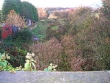
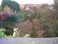
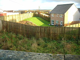
ground which was located in what is now the park, close to the old railway embankment; a mission hall is also shown, located just the other side of the railway bridge over the Beith branchline. In 2006 a new housing estate was created on the site of the old Barrmill railway station and goods yard.
The 1890 OS map
marks a 'Sout Bar' on the road through Barrmill. This may be the site of a Toll Bar as the name 'Sout' in Scots means a leap, applied when a vehicle leaps up as if struck a hidden stone; possibly a feature of the toll caused this.
Birsieknowe was located in the grounds of what is now DM Beith (2010) and the old coal pit here closed due to flooding beyond the capacity of the pumps in 1913; it had been active in the 1890s. A commemorative plaque was placed at the site.
 Barrmill railway station
was the only intermediate station on the line from Lugton to Beith Town railway station and opened on 26 June 1873, and closed permanently to passengers on 5 November 1962. Freight services continued on the line until 1964.
Bellcraig and Crawford Terrace form a small hamlet close to Barrmill. The Braefoot Building stood on the other, north side of the road, owned by Merry & Cunningham the ironmasters. The building was demolished in 1956 and the residents moved to new housing in Beith. The Mack family were onetime residents.
These houses, some of which housed quarry workers, lie close to a 20th century limestone quarry nearby, now abandoned and filled with water. The area had many small limestone and ironstone quarries. Dockra and Broadstone quarries are quite nearby. Around 30 people were employed here in the 1930s.
and were buried in a triangular 'Cholera pit' plot at the base of Jamesill Hill, south-west of the village. The tradition is that the disease was passed on from a group of gipsies camped on Whin Hill that local boys had gone out to meet. Troops were regularly placed to prevent entry or exit during cholera outbreaks and normal burial in Beith was impossible and impractical, given the number of deaths. The burial site was fenced off and bordered by trees, kept in order by the Crawford Bros. from the factory until they died. It has been neglected since then.
An ironstone quarry was also located at the site and the ore, crushed on site, was taken down the 'bogey line' via Brackenhills railway station
on the Glasgow & South Western railway line to the old Glengarnock steelworks, owned by the Glengarnock Iron & Steel Co.Ltd. The works closed in 1921, however the waste bings remained for many years. The 'Beith Supplement and Advertiser' reported in 1912 that after a two month long strike at Glengarnock Steelworks the ironstone works at Dockra would be re-opening.
, munitions store, for the Royal Navy
. It now processes and stores Spearfish
, Storm Shadow
, Tomahawk
and Brimstone
missiles. The railway is no longer used for transporting items to the depot, the last trains running in 1996. Locals relate how the engine drivers used to park their train at the overbridge and walk up to the shop to get a drink and a snack. The line saw the occasional MOD passenger train when conferences or inspections were being held at the 'Admiralty'.
There were five farms which were taken over by the Ministry of Defence for them to establish the Royal Naval Armaments Depot. Boyd's of Drumbuie, Jacks o' the Ward; Crawfords o' the Scoup; Harpers o' the White Spot; and Blairs of the Bugstone, Boyd of the Bellcraig, Gillies of Gatend and a number of railworkers and farm workers who lived in Patrick Row which was located on Barkip Road near to what is now the main entrance to the depot. Bellcraigs House near Barmill Road was also demolished, the site being marked in 2011 by surviving flowering cherry trees. In 1942 something like 1200 acres (4.9 km²) taken to establish the depot.
and was feud out to various local millers and farmers in the 17th-century. Close records that Drumbuie Farm incorporates an early 18th-century two storey house, originally thatched, which was built around 1736 for Hugh Patrick, this being stated on a plaque on the 1815 addition. Drumbuie Mill stood nearby on the Dusk Water, however no physical remains are now extant as it was largely destroyed by the construction of the railway, now closed.
Drumbuie
The Biggart Memorial Home for Cripple Children in Prestwick was built in 1905 as a memorial to Robert and Mary Biggart of Drumbuie by their children.
(SSSI) and a Special Area of Conservation
(SAC), making it significant in the European context.
The moss lies entirely within the DM Beith site and therefore access is restricted. Giffen Colliery, bing and freight railway line were once located on the southern side of the moss as shown by the old OS maps of the area; a railway also cut across the northern edge of the moss, however the main part of the moss has been largely untouched by industry although it is grazed by farm animals. The site is monitored by Scottish Natural Heritage
(SNH).
The 'Dusk Rovers' were a local football team that played on a pitch located on a field near the old Giffen Viaduct and Dusk water; allowing the ploy of losing the ball into the Dusk Water or onto the nearby railway if the game was not going well.
The Giffen railway viaduct was demolished in the 1980s; locals knew it as the 'Navvies Brig'.
In 2010 a Barrmill Communities Projects Initiatives (BCPI) group was set up by the Community and District Association and the NAC Ranger Service to improve the appearance of the Barrmill, Greenhills, and Burnhouse villages. One achievement was the creation of the Veil Grove amenity within Barrmill Park. In 2011 the Save the Children Fund employed an Environmental Artist to create living willow shelters in Barrmill Park.
The Black Loch was a shallow loch situated near Nettlehirst
House and the old Giffen Viaduct; it was once used for curling. The site was filled with earth and is now overgrown.
The quoiting ground was located at the site of the present day playground. Many teams from elsewhere in Ayrshire came here to compete and the unofficial betting sometimes resulted in heated exchanges. Peter Wilson played for Celtic and Scotland in the 1920s and he was also a noted quoiting progedy, defeating many top players to win a tournament held to raise funds for the Red Cross.
In late 2010 the local shop was restored to its original appearance with the entrance moved back to the original position, etc.
North Ayrshire
North Ayrshire is one of 32 council areas in Scotland with a population of roughly 136,000 people. It is located in the south-west region of Scotland, and borders the areas of Inverclyde to the north, Renfrewshire to the north-east and East Ayrshire and South Ayrshire to the East and South...
, Scotland about a mile and a half a mile east of Beith
Beith
Beith is a small town situated in the Garnock Valley in North Ayrshire, Scotland approximately 20-miles south-west of Glasgow. The town is situated on the crest of a hill and was known originally as the "Hill o' Beith" after its Court Hill.-History:-Name:Beith's name is thought to emanate from...
on the road to Lugton
Lugton
Lugton is a small village or hamlet in East Ayrshire, Scotland with a population of 80 people. The A736 road runs through on its way from Glasgow, to the north, to Irvine in North Ayrshire. Uplawmoor is the first settlement on this 'Lochlibo Road' to the north and Burnhouse is to the south...
. Locally it is known as the Barr.
History
General Roy's survey of 1747 - 55 shows only the farm of High Barr. A village grew up here due to the employment provided by the several limestone quarries that were present at one time, the Dockra Ironstone pit that was located near the railway line down from Dockra quarry in 1912, and other local industries.The village that developed had a population of 300 in 1876 and 600 in 1951, when the threadmaking industry had just ceased, although the workers still lived in company houses and were transported daily to the threadmaking factory at Kilbirnie. This mill was founded in the mid-19th century to make linen thread, much used at the time for boot and shoe making, and for sailmaking; an offshoot of the much larger linen thread mills at Kilbirnie. The largest of the mill buildings was a three-storeyed, flat-roofed mill, with a fireproof interior with brick arches on cast iron columns. In front is a section of a range of single-storeyed, north-lit sheds. In 1965 the buildings were being used as a fertiliser factory. The mill buildings have been demolished, but the offices still survive.
The limestone works was closed in 1972. The whinstone quarries of Messrs. King & Co. employed a considerable number of men in 1951, but even then the quarries were almost worked out. Giffen coal pit (No 1) lay close to Bankhead Moss as shown on the 1897 OS map, closing not long afterwards as the following OS maps cease showing it.
The 1912 OS map marks the quoiting
Quoits
Quoits is a traditional game which involves the throwing of metal, rope or rubber rings over a set distance, usually to land over or near a spike . The sport of quoits encompasses several distinct variations.-The history of quoits:The history of quoits is disputed...
ground which was located in what is now the park, close to the old railway embankment; a mission hall is also shown, located just the other side of the railway bridge over the Beith branchline. In 2006 a new housing estate was created on the site of the old Barrmill railway station and goods yard.
The 1890 OS map
Ordnance Survey
Ordnance Survey , an executive agency and non-ministerial government department of the Government of the United Kingdom, is the national mapping agency for Great Britain, producing maps of Great Britain , and one of the world's largest producers of maps.The name reflects its creation together with...
marks a 'Sout Bar' on the road through Barrmill. This may be the site of a Toll Bar as the name 'Sout' in Scots means a leap, applied when a vehicle leaps up as if struck a hidden stone; possibly a feature of the toll caused this.
Birsieknowe was located in the grounds of what is now DM Beith (2010) and the old coal pit here closed due to flooding beyond the capacity of the pumps in 1913; it had been active in the 1890s. A commemorative plaque was placed at the site.
Barrmill Railway station
Barrmill railway station
Barrmill railway station was a railway station serving the village of Barrmill, North Ayrshire, Scotland. The station was originally part of the Glasgow, Barrhead and Kilmarnock Joint Railway.- History :...
was the only intermediate station on the line from Lugton to Beith Town railway station and opened on 26 June 1873, and closed permanently to passengers on 5 November 1962. Freight services continued on the line until 1964.
Bellcraig and Braefoot
Bellcraig House stood near the old entrance to Bogston House and was destroyed by quarrying for whinstone. In 1844 John Ritchie of Bellcraigs House died.Bellcraig and Crawford Terrace form a small hamlet close to Barrmill. The Braefoot Building stood on the other, north side of the road, owned by Merry & Cunningham the ironmasters. The building was demolished in 1956 and the residents moved to new housing in Beith. The Mack family were onetime residents.
These houses, some of which housed quarry workers, lie close to a 20th century limestone quarry nearby, now abandoned and filled with water. The area had many small limestone and ironstone quarries. Dockra and Broadstone quarries are quite nearby. Around 30 people were employed here in the 1930s.
Cholera outbreak
In the 1830s 40 locals died from choleraCholera
Cholera is an infection of the small intestine that is caused by the bacterium Vibrio cholerae. The main symptoms are profuse watery diarrhea and vomiting. Transmission occurs primarily by drinking or eating water or food that has been contaminated by the diarrhea of an infected person or the feces...
and were buried in a triangular 'Cholera pit' plot at the base of Jamesill Hill, south-west of the village. The tradition is that the disease was passed on from a group of gipsies camped on Whin Hill that local boys had gone out to meet. Troops were regularly placed to prevent entry or exit during cholera outbreaks and normal burial in Beith was impossible and impractical, given the number of deaths. The burial site was fenced off and bordered by trees, kept in order by the Crawford Bros. from the factory until they died. It has been neglected since then.
Dockra
Extensive limestone quarrying took place at Dockra with a mineral line running down to join with the Beith to Lugton line. Limekilns were located at the site, as were gunpowder magazines, a mine manager's house, a large bing, etc. The quarry is now flooded, but not infilled.An ironstone quarry was also located at the site and the ore, crushed on site, was taken down the 'bogey line' via Brackenhills railway station
Brackenhills railway station
Brackenhills railway station was a railway station approximately one mile south-west of the town of Beith, North Ayrshire, Scotland, part of the Lanarkshire and Ayrshire Railway.- History :...
on the Glasgow & South Western railway line to the old Glengarnock steelworks, owned by the Glengarnock Iron & Steel Co.Ltd. The works closed in 1921, however the waste bings remained for many years. The 'Beith Supplement and Advertiser' reported in 1912 that after a two month long strike at Glengarnock Steelworks the ironstone works at Dockra would be re-opening.
DM Beith
A large Defence Munitions (DM) centre is located near Barrmill. The site was originally developed in 1943 as a conventional Royal Naval Armaments DepotRoyal Naval Armaments Depot
A Royal Naval Armament Depot was a group of armament depots dedicated to supplying the needs of the Royal Navy as well as the Royal Air Force, British Army and foreign/commonwealth governments; they were sister depots of Royal Naval Cordite Factories, Royal Naval Torpedo and Royal Naval Mine Depots...
, munitions store, for the Royal Navy
Royal Navy
The Royal Navy is the naval warfare service branch of the British Armed Forces. Founded in the 16th century, it is the oldest service branch and is known as the Senior Service...
. It now processes and stores Spearfish
Spearfish torpedo
The Spearfish torpedo is the heavy torpedo used by the submarines of the Royal Navy. It can be guided by wire or by autonomous active or passive sonar, and provides both anti-submarine warfare and anti-surface ship warfare capability.It replaces the unreliable Tigerfish torpedo, which was...
, Storm Shadow
Storm Shadow
Storm Shadow is a British, French and Italian air-launched cruise missile, manufactured by MBDA. Storm Shadow is the British name for the weapon; in French service it is called SCALP EG...
, Tomahawk
BGM-109 Tomahawk
The Tomahawk is a long-range, all-weather, subsonic cruise missile. Introduced by General Dynamics in the 1970s, it was designed as a medium- to long-range, low-altitude missile that could be launched from a surface platform. It has been improved several times and, by way of corporate divestitures...
and Brimstone
Brimstone
Brimstone is an alternative name for sulfur. It may also refer to:* Fire and brimstone, an idiomatic expression of signs of God's wrath in the Bible* Brimstone , a DC Comics character...
missiles. The railway is no longer used for transporting items to the depot, the last trains running in 1996. Locals relate how the engine drivers used to park their train at the overbridge and walk up to the shop to get a drink and a snack. The line saw the occasional MOD passenger train when conferences or inspections were being held at the 'Admiralty'.
There were five farms which were taken over by the Ministry of Defence for them to establish the Royal Naval Armaments Depot. Boyd's of Drumbuie, Jacks o' the Ward; Crawfords o' the Scoup; Harpers o' the White Spot; and Blairs of the Bugstone, Boyd of the Bellcraig, Gillies of Gatend and a number of railworkers and farm workers who lived in Patrick Row which was located on Barkip Road near to what is now the main entrance to the depot. Bellcraigs House near Barmill Road was also demolished, the site being marked in 2011 by surviving flowering cherry trees. In 1942 something like 1200 acres (4.9 km²) taken to establish the depot.
Drumbuie
Drumbuie House, built in 1702, is one of the oldest inhabited houses in the Beith area and has been the home of the Boyd family for at least three generations. Drumbuie was part of the Barony of GiffenBarony and Castle of Giffen
The Barony of Giffen and its associated 15th-century castle were in the parish of Beith in the former District of Cunninghame, now North Ayrshire. The site may be spelled Giffen or Giffin and lay within the Lordship of Giffin, which included the Baronies of Giffen, Trearne, Hessilhead, Broadstone,...
and was feud out to various local millers and farmers in the 17th-century. Close records that Drumbuie Farm incorporates an early 18th-century two storey house, originally thatched, which was built around 1736 for Hugh Patrick, this being stated on a plaque on the 1815 addition. Drumbuie Mill stood nearby on the Dusk Water, however no physical remains are now extant as it was largely destroyed by the construction of the railway, now closed.
Drumbuie
The Biggart Memorial Home for Cripple Children in Prestwick was built in 1905 as a memorial to Robert and Mary Biggart of Drumbuie by their children.
Bankhead Moss
This is a good example of a lowland raised bog or mire. Bankhead is a Site of Special Scientific InterestSite of Special Scientific Interest
A Site of Special Scientific Interest is a conservation designation denoting a protected area in the United Kingdom. SSSIs are the basic building block of site-based nature conservation legislation and most other legal nature/geological conservation designations in Great Britain are based upon...
(SSSI) and a Special Area of Conservation
Special Area of Conservation
A Special Area of Conservation is defined in the European Union's Habitats Directive , also known as the Directive on the Conservation of Natural Habitats and of Wild Fauna and Flora...
(SAC), making it significant in the European context.
The moss lies entirely within the DM Beith site and therefore access is restricted. Giffen Colliery, bing and freight railway line were once located on the southern side of the moss as shown by the old OS maps of the area; a railway also cut across the northern edge of the moss, however the main part of the moss has been largely untouched by industry although it is grazed by farm animals. The site is monitored by Scottish Natural Heritage
Scottish Natural Heritage
Scottish Natural Heritage is a Scottish public body. It is responsible for Scotland's natural heritage, especially its natural, genetic and scenic diversity. It advises the Scottish Government and acts as a government agent in the delivery of conservation designations, i.e...
(SNH).
Matthew Anderson
Matthew, known as the 'Policemen-Poet of Ayrshire', was posted to Barrmill for a number of years, leaving for Kilmarnock in June 1896. He wrote a number of poems about the district, such as 'Farewell to Barrmill', 'The Braes o'Barrmill', and 'Night at Barrmill.'Micro-history
The news that the war in South Africa has at last been brought to an end by the surrender of the Boers was known in Barrmill in June 1902 when the early papers arrived. At Barrmill the villagers gave full vent to their joy by knocking off at the breakfast hour and compelling the master at Greenhills to set the scholars free.The 'Dusk Rovers' were a local football team that played on a pitch located on a field near the old Giffen Viaduct and Dusk water; allowing the ploy of losing the ball into the Dusk Water or onto the nearby railway if the game was not going well.
The Giffen railway viaduct was demolished in the 1980s; locals knew it as the 'Navvies Brig'.
In 2010 a Barrmill Communities Projects Initiatives (BCPI) group was set up by the Community and District Association and the NAC Ranger Service to improve the appearance of the Barrmill, Greenhills, and Burnhouse villages. One achievement was the creation of the Veil Grove amenity within Barrmill Park. In 2011 the Save the Children Fund employed an Environmental Artist to create living willow shelters in Barrmill Park.
The Black Loch was a shallow loch situated near Nettlehirst
Nettlehirst
Nettlehirst was a small mansion house and estate in the Parish of Beith, near Barrmill in North Ayrshire, Scotland. The house was built in 1844 and burned down in 1932.-Nettlehirst House and estate:...
House and the old Giffen Viaduct; it was once used for curling. The site was filled with earth and is now overgrown.
The quoiting ground was located at the site of the present day playground. Many teams from elsewhere in Ayrshire came here to compete and the unofficial betting sometimes resulted in heated exchanges. Peter Wilson played for Celtic and Scotland in the 1920s and he was also a noted quoiting progedy, defeating many top players to win a tournament held to raise funds for the Red Cross.
In late 2010 the local shop was restored to its original appearance with the entrance moved back to the original position, etc.
See also
- Broadstone Castle and Barony, Ayrshire
- Barony and Castle of GiffenBarony and Castle of GiffenThe Barony of Giffen and its associated 15th-century castle were in the parish of Beith in the former District of Cunninghame, now North Ayrshire. The site may be spelled Giffen or Giffin and lay within the Lordship of Giffin, which included the Baronies of Giffen, Trearne, Hessilhead, Broadstone,...
- Speir's schoolSpeir's schoolSpier's school, at Beith, in North Ayrshire, Scotland, NS 35355327, KA15 1LU, was opened in 1888 and closed in 1972. The school, now demolished, was built using Ballochmyle red sandstone and was reminiscent of the ancient Glasgow University. The school motto was 'Quod verum tutum'...
History of Broadstone - Giffen railway stationGiffen railway stationGiffen railway station was a railway station approximately one mile south-west of the village of Barrmill, North Ayrshire, Scotland. The station was part of the Lanarkshire and Ayrshire Railway.- History :...
External links
- Alex Sanderson's recollections of Barrmill.
- Barrmillvillage.co.uk Barrmill Community Website