
Bannered routes of U.S. Route 23
Encyclopedia
Several bannered routes of U.S. Route 23 exist. In order from south to north they are as follows.
. Starting at the exit 9 interchange from I-26/US 23
, it briefly links with US 19
before taking a left turn towards Tennessee
. There is no control city for the route as it only connects the communities of California, Faust, and access to the Wolf Laurel gated community and ski resort. The route reunites with I-26/US 23
at the exit 3 interchange. Signage of this alternate route goes by an "A" right of number instead of "ALT" or "Alternate" banner on top (this is the same style used by other alternate routes in Western North Carolina
).
. It was first designated on November 28, 1962 as a business route of US 23. It travels concurrently with both BL I-94 and M-14
over portions of its routing.
In 1962, with the completion of the US 23 freeway in the area, BUS US 23 was designated over the former routing in Ann Arbor. It utilized a portion of the 1958 freeway from the Huron River
north to the US 23 freeway. In 1965, M-14 was relocated and the concurrency with BUS US 23 was shortened.
The northern terminus of BUS US 23 is at the western interchange of US 23 and M-14
north of downtown Ann Arbor. The southern terminus is at the interchange with US 23 between Ann Arbor and Ypsilanti
. This interchange also includes BL I-94 and M-17
.
. It was first designated on September 16, 1958 as a business loop route of US 23. The original routing followed Owen Road and Shiawassee Street into downtown Fenton, before following LeRoy Street (a former routing of US-23) for about four blocks, then following Silver Lake Road back to the US-23 freeway. The loop was rerouted in 1961 with the completion of the US 23 freeway in Genesee
and Livingston
counties. The southern portion of the loop was separated in 1975 with the creation of a pedestrian mall and the turnback of two blocks of Leroy St. in downtown Fenton. The southern portion of the loop was left as a state trunkline, but unsigned. From that point until around 2004, only the Silver Lake Road portion was signed as Business US-23; guide signage from the US-23 freeway never indicated the presence of the business route, however. The Owen Road/Shiawassee Street portion was eventually signed in 2004, approximately two years before the route was decommissioned. Leroy St. was reopened to auto traffic in 2004, but it was not turned over to the Michigan Department of Transportation
to reconnect the existing spur to the unsigned southern portion. The entire trunkline, both signed and unsigned was turned back to local control on December 7, 2006.
. It was co-signed with US-10
(present-day Genesee Street) into downtown Saginaw, then followed M-13 northerly to present-day I-75
exit 153. This business route later became a BUS I-75 designation, which was decommissioned in 1971.
. It was first designated on November 12, 1940 as M-65
, and on January 28, 1942 as a business route of US 23.
In 1940, the shoreline routing of US 23 from Rogers City to Cheboygan
was opened. Until the designation of BUS US 23 in 1942, the former US 23 was partially designated M-65
. Other sections of BUS US 23 were M-91
.
The northern terminus of BUS US 23 is at the intersection with US 23 northwest of downtown Rogers City. The southern terminus is at the intersection with US 23 south of Rogers City.
existed between 1939 and 1968.
existed between 1962 and 1971. In its short history, it was utilized simply as a connector route to a completed section of I-40
, west of Asheville
.
existed between 1949 and 1960. Today, the route is known as US 23 Business.
between Saginaw and Bay City
along present-day M-13, with the former route being redesignated US 23A before taking the M-47
designation only a year later. The former US 23A designation is now a part of M-84
between those two cities.
 Alternate US 23, or ALT US 23, was a 24.8 mile (39.9 km) redesignation of a stretch of US 23 in Michigan
from Monitor Township
near Kawkawlin to about 4 miles (6.4 km) south of Standish
. It was established on 10 6, 1967 In 1967, a stretch of what would later become part of the I-75
freeway was opened between the above 2 mentioned towns, and US 23 was designated on the new road. After the former US 23 was given the ALT US 23 designation, AASHTO, although it has no enforcement authority, did not approve of having two types of US 23's running parallel so close with each other, and after about a year, ALT US 23 became an extension of M-13
. The freeway portion from I-75 to Kawkawlin became Connector M-13
.
Cochran business loop
U.S. Route 23 Business is a 4 miles (6.4 km) route that goes through downtown Cochran. It is in concurrency with State Route 87 Business.Sylva business loop
U.S. Route 23 Business, established in 1974, is a 3.9 miles (6.3 km) route goes through downtown Dillsboro and Sylva, via Haywood Road, Main Street/Mill Street, and Asheville Highway.Waynesville business loop
U.S. Route 23 Business, established in 1968, is a 6.1 miles (9.8 km) route goes through downtown Waynesville, via Hyatt Creek Road, Main Street, and Asheville Road.Asheville business loop
U.S. Route 23 Business, established in 1960, is a 2.3 miles (3.7 km) business route (co-signed with US 19 Business) currently starts on Haywood Road then go north on I-26/I-240 (exit 2) back to the main US 23 (exit 3). Historically, US 23 Business continued along Haywood Road, connecting to Clingman Avenue and then to Patton Avenue/US 23. In 1961, it extended over Patton Avenue through downtown Asheville when US 23 moved onto the East-West Freeway. In 1962, it was rerouted to its current alignment from Haywood Road to Hanover Street (now I-26/I-240).Wolf Laurel alternate route
U.S. Route 23 Alternate, established in 2006, is an 8 miles (12.9 km) route follows the old US 23 route through northern Madison CountyMadison County, North Carolina
-Demographics:As of the census of 2000, there were 19,635 people, 8,000 households, and 5,592 families residing in the county. The population density was 44 people per square mile . There were 9,722 housing units at an average density of 22 per square mile...
. Starting at the exit 9 interchange from I-26/US 23
U.S. Route 23 in North Carolina
U.S. Route 23 is an north–south United States highway that runs for from the Georgia state line, near Dillard, to the Tennessee state line, near Flag Pond.-Route description:...
, it briefly links with US 19
U.S. Route 19 in North Carolina
U.S. Route 19 in North Carolina traverses approximately across Western North Carolina; from the Georgia state line, at the community of Bellview, to the Tennessee state line, at the town of Elk Park. The designation from US 19 to U.S. Route 19E happens in Cane River, where US 19W splits from the...
before taking a left turn towards Tennessee
Tennessee
Tennessee is a U.S. state located in the Southeastern United States. It has a population of 6,346,105, making it the nation's 17th-largest state by population, and covers , making it the 36th-largest by total land area...
. There is no control city for the route as it only connects the communities of California, Faust, and access to the Wolf Laurel gated community and ski resort. The route reunites with I-26/US 23
U.S. Route 23 in North Carolina
U.S. Route 23 is an north–south United States highway that runs for from the Georgia state line, near Dillard, to the Tennessee state line, near Flag Pond.-Route description:...
at the exit 3 interchange. Signage of this alternate route goes by an "A" right of number instead of "ALT" or "Alternate" banner on top (this is the same style used by other alternate routes in Western North Carolina
Western North Carolina
Western North Carolina is the region of North Carolina which includes the Appalachian Mountains, thus it is often known geographically as the state's Mountain Region. It is sometimes included with upstate South Carolina as the "Western Carolinas", which is also counted as a single media market...
).
Ann Arbor business loop
BUS US 23 is a 7.42 mile (11.94 km) business route running in Ann ArborAnn Arbor, Michigan
Ann Arbor is a city in the U.S. state of Michigan and the county seat of Washtenaw County. The 2010 census places the population at 113,934, making it the sixth largest city in Michigan. The Ann Arbor Metropolitan Statistical Area had a population of 344,791 as of 2010...
. It was first designated on November 28, 1962 as a business route of US 23. It travels concurrently with both BL I-94 and M-14
M-14 (Michigan highway)
M-14 is a east–west state trunkline highway in the southeastern portion of the US state of Michigan. Entirely freeway, it connects Ann Arbor with Detroit by way of connecting with I-96.-Route description:...
over portions of its routing.
In 1962, with the completion of the US 23 freeway in the area, BUS US 23 was designated over the former routing in Ann Arbor. It utilized a portion of the 1958 freeway from the Huron River
Huron River (Michigan)
The Huron River is a river in southeastern Michigan, rising out of the Huron Swamp in Indian Springs Metropark in northern Oakland County and flowing into Lake Erie on the boundary between Wayne County and Monroe County...
north to the US 23 freeway. In 1965, M-14 was relocated and the concurrency with BUS US 23 was shortened.
The northern terminus of BUS US 23 is at the western interchange of US 23 and M-14
M-14 (Michigan highway)
M-14 is a east–west state trunkline highway in the southeastern portion of the US state of Michigan. Entirely freeway, it connects Ann Arbor with Detroit by way of connecting with I-96.-Route description:...
north of downtown Ann Arbor. The southern terminus is at the interchange with US 23 between Ann Arbor and Ypsilanti
Ypsilanti, Michigan
Ypsilanti is a city in Washtenaw County in the U.S. state of Michigan. As of the 2000 census, the city population was 22,362. The city is bounded to the north by the Charter Township of Superior and on the west, south, and east by the Charter Township of Ypsilanti...
. This interchange also includes BL I-94 and M-17
M-17 (Michigan highway)
M-17 is a long state trunkline highway in the U.S. state of Michigan, connecting the cities of Ypsilanti and Ann Arbor in Washtenaw County. It was once part of a highway that spanned the southern Lower Peninsula of Michigan before the creation of the U.S. Highway System in 1926...
.
Fenton business loop
BUS US 23 in Fenton was a business loop serving the city of Fenton, MichiganFenton, Michigan
Fenton is a city in the U.S. state of Michigan that lies mostly in Genesee County. As of the 2010 census, the city population was 11,756. The city was incorporated from Fenton Township in Genesee County, and the city and township are administratively autonomous.-History:In the 1970s, the city...
. It was first designated on September 16, 1958 as a business loop route of US 23. The original routing followed Owen Road and Shiawassee Street into downtown Fenton, before following LeRoy Street (a former routing of US-23) for about four blocks, then following Silver Lake Road back to the US-23 freeway. The loop was rerouted in 1961 with the completion of the US 23 freeway in Genesee
Genesee County, Michigan
-Interstates:* I-69* I-75* I-475-Michigan State Trunklines:* M-13* M-15* M-21* M-54* M-57-Demographics:As of the census of 2000, there were 436,141 people, 169,825 households, and 115,990 families residing in the county. The population density was 682 people per square mile . There were 183,630...
and Livingston
Livingston County, Michigan
-Demographics:As of the census of 2000, there were 156,951 people, 55,384 households, and 43,531 families residing in the county. The population density was 276 people per square mile . There were 58,919 housing units at an average density of 104 per square mile...
counties. The southern portion of the loop was separated in 1975 with the creation of a pedestrian mall and the turnback of two blocks of Leroy St. in downtown Fenton. The southern portion of the loop was left as a state trunkline, but unsigned. From that point until around 2004, only the Silver Lake Road portion was signed as Business US-23; guide signage from the US-23 freeway never indicated the presence of the business route, however. The Owen Road/Shiawassee Street portion was eventually signed in 2004, approximately two years before the route was decommissioned. Leroy St. was reopened to auto traffic in 2004, but it was not turned over to the Michigan Department of Transportation
Michigan Department of Transportation
The Michigan Department of Transportation is a constitutional government agency in the US state of Michigan. The primary purpose of MDOT is to maintain the Michigan State Trunkline Highway System which includes all Interstate, US and state highways in Michigan with the exception of the Mackinac...
to reconnect the existing spur to the unsigned southern portion. The entire trunkline, both signed and unsigned was turned back to local control on December 7, 2006.
Saginaw business loop
BUS US 23 followed a former routing of US-23 through downtown Saginaw, MichiganSaginaw, Michigan
Saginaw is a city in the U.S. state of Michigan and the seat of Saginaw County. The city of Saginaw was once a thriving lumber town and manufacturing center. Saginaw and Saginaw County lie in the Flint/Tri-Cities region of Michigan...
. It was co-signed with US-10
U.S. Route 10 in Michigan
US Highway 10 is a part of the United States Numbered Highway System that runs from West Fargo, North Dakota, to the Lower Peninsula of the US state of Michigan. The highway enters the state on the SS Badger crossing Lake Michigan at Ludington and ends at Bay City.US 10 was created as part of...
(present-day Genesee Street) into downtown Saginaw, then followed M-13 northerly to present-day I-75
Interstate 75 in Michigan
Interstate 75 is a part of the Interstate Highway System and runs from Miami, Florida to Sault Ste. Marie in the Upper Peninsula of Michigan. I-75 enters the state from Ohio in the south, just to the north of Toledo. It runs generally north through Detroit, Pontiac and Bay City, crossing the...
exit 153. This business route later became a BUS I-75 designation, which was decommissioned in 1971.
Rogers City business loop
BUS US 23 is a 4.07 mile (6.55 km) business route running in Rogers CityRogers City, Michigan
-Commercial airports:The nearest commercial airports are Alpena County Regional Airport an Cherry Capital Airport -US Highway Business Loops:* BUS US 23-Intercounty Highways:* F-21-Demographics:...
. It was first designated on November 12, 1940 as M-65
M-65 (Michigan highway)
M-65 is a state trunkline highway in the US state of Michigan. The highway runs between termini on US Highway 23 near Omer and Rogers City in the northeastern Lower Peninsula of the state. M-65 runs inland through several small communities in the region, passing through forests and fields along...
, and on January 28, 1942 as a business route of US 23.
In 1940, the shoreline routing of US 23 from Rogers City to Cheboygan
Cheboygan, Michigan
Cheboygan is a city in the U.S. state of Michigan. As of the 2000 census, the city population was 5,295. It is the county seat of Cheboygan County....
was opened. Until the designation of BUS US 23 in 1942, the former US 23 was partially designated M-65
M-65 (Michigan highway)
M-65 is a state trunkline highway in the US state of Michigan. The highway runs between termini on US Highway 23 near Omer and Rogers City in the northeastern Lower Peninsula of the state. M-65 runs inland through several small communities in the region, passing through forests and fields along...
. Other sections of BUS US 23 were M-91
M-91 (Michigan highway)
M-91 is a largely north–south state trunkline highway in the Lower Peninsula of the US state of Michigan. It runs from Belding to south of Lakeview. Its length exists entirely within Ionia and Montcalm counties. It is all undivided surface route...
.
The northern terminus of BUS US 23 is at the intersection with US 23 northwest of downtown Rogers City. The southern terminus is at the intersection with US 23 south of Rogers City.
Waynesville alternate route
U.S. Route 23 Alternate in WaynesvilleWaynesville, North Carolina
Waynesville is a town in and the county seat of Haywood County, North Carolina, United States. It is the largest town in Haywood County and the largest in Western North Carolina west of Asheville. Waynesville is located about or 50 km southwest of Asheville between the Great Smoky and Blue...
existed between 1939 and 1968.
Canton alternate route
U.S. Route 23 Alternate near CantonCanton, North Carolina
Canton is the second largest town in Haywood County, North Carolina, United States. It is located about west of Asheville, North Carolina and is part of the Asheville Metropolitan Statistical Area. The town is named after the city of Canton, Ohio.- History :...
existed between 1962 and 1971. In its short history, it was utilized simply as a connector route to a completed section of I-40
Interstate 40 in North Carolina
Interstate 40 runs through the state of North Carolina from the Tennessee state line in the west to its eastern terminus in Wilmington.-Pigeon River Gorge:...
, west of Asheville
Asheville, North Carolina
Asheville is a city in and the county seat of Buncombe County, North Carolina, United States. It is the largest city in Western North Carolina, and the 11th largest city in North Carolina. The City is home to the United States National Climatic Data Center , which is the world's largest active...
.
Asheville alternate route
U.S. Route 23 Alternate in AshevilleAsheville, North Carolina
Asheville is a city in and the county seat of Buncombe County, North Carolina, United States. It is the largest city in Western North Carolina, and the 11th largest city in North Carolina. The City is home to the United States National Climatic Data Center , which is the world's largest active...
existed between 1949 and 1960. Today, the route is known as US 23 Business.
Saginaw alternate route
In 1929, US 23 was moved to the opposite side of the Saginaw RiverSaginaw River
The Saginaw River is a river in the U.S. state of Michigan. It is formed by the confluence of the Tittabawassee and Shiawassee rivers southwest of Saginaw. It flows northward into the Saginaw Bay of Lake Huron just northeast of Bay City. The watershed area is .The river is an important shipping...
between Saginaw and Bay City
Bay City, Michigan
Bay City is a city in the U.S. state of Michigan located near the base of the Saginaw Bay on Lake Huron. As of the 2010 census, the city's population was 34,932, and is the principal city of the Bay City Metropolitan Statistical Area, which is included in the Saginaw-Bay City-Saginaw Township North...
along present-day M-13, with the former route being redesignated US 23A before taking the M-47
M-47 (Michigan highway)
M-47 is a north–south state trunkline highway in the US state of Michigan. It runs near Saginaw and Midland in the Tri-Cities area of the Lower Peninsula. The highway runs through suburban and agricultural areas to connect the two cities with the airport in the area. The northernmost section of...
designation only a year later. The former US 23A designation is now a part of M-84
M-84 (Michigan highway)
M-84 is a state trunkline highway in the Lower Peninsula of the US state of Michigan. It was originally part of M-47 until that road was relocated onto what was formerly US 10 from Saginaw Township to east of Midland...
between those two cities.
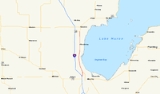
Standish alternate route
Michigan
Michigan is a U.S. state located in the Great Lakes Region of the United States of America. The name Michigan is the French form of the Ojibwa word mishigamaa, meaning "large water" or "large lake"....
from Monitor Township
Monitor Township, Michigan
Monitor Charter Township is a charter township of Bay County in the U.S. state of Michigan. The township's population was 10,037 as of the 2000 census and is included in the Bay City Metropolitan Statistical Area.-Geography:...
near Kawkawlin to about 4 miles (6.4 km) south of Standish
Standish, Michigan
Standish is a city in the U.S. state of Michigan. As of the 2000 census, the city population was 1,581. It is the county seat of Arenac County.The town was platted by John D. Standish in 1871...
. It was established on 10 6, 1967 In 1967, a stretch of what would later become part of the I-75
Interstate 75
Interstate 75 is a major north–south Interstate Highway in the Great Lakes and Southeastern regions of the United States. It travels from State Road 826 and State Road 924 in Hialeah, Florida to Sault Ste. Marie, Michigan, at the Ontario, Canada, border...
freeway was opened between the above 2 mentioned towns, and US 23 was designated on the new road. After the former US 23 was given the ALT US 23 designation, AASHTO, although it has no enforcement authority, did not approve of having two types of US 23's running parallel so close with each other, and after about a year, ALT US 23 became an extension of M-13
M-13 (Michigan highway)
M-13 is a north–south state trunkline highway that runs through the Saginaw Bay region of the US state of Michigan. It runs from Interstate 69 south of Lennon to US Highway 23 near Standish. The southern section of the trunkline runs long a pair of county lines in a rural area dominated by farm...
. The freeway portion from I-75 to Kawkawlin became Connector M-13
M-13 Connector (Michigan highway)
M-13 Connector is a state trunkline highway running connecting Interstate 75/US Highway 23 to M-13 near the community of Kawkawlin, just north of Bay City. The Michigan Department of Transportation internally calls the road Connector 13...
.