

B4058 road
Encyclopedia
The B4058 is a minor road in southwest England. It starts in Eastville
, a suburb of Bristol and ends at Nailsworth
in the Cotswolds
, passing through the counties of Bristol
, South Gloucestershire
and Gloucestershire
.
 The B4058's southern terminus is with the A432 in Eastville, a suburb of Bristol From there it heads north to where it meets the M32 motorway
at junction 2, whence it continues north, through Stapleton
, Broomhill and Frenchay
before meeting the A4174 ring road, on the outskirts of Frenchay.
North of the ring road the B4058, called Winterbourne Hill, passes through Hambrook
, then into Winterbourne
, where it becomes High Street. After Winterbourne, the road is known as Bristol Road; it passes through Frampton Cotterell
and Iron Acton
. After Iron Acton the road becomes the B4059 on towards Yate
and Engine Common
. The B4058 turns right and heads north, through Rangeworthy
, Bagstone
, Cromhall
and Charfield
, where it passes into Gloucestershire. From there it continues to Wotton under Edge. After Wotton the road continues through the Cotswolds to its northern terminus at Nailsworth
Eastville, Bristol
Eastville is the name of both a council ward in the city of Bristol in the United Kingdom and a suburb of the city that lies within that ward. The Eastville ward covers the areas of Eastville, Crofts End , Stapleton and part of Fishponds...
, a suburb of Bristol and ends at Nailsworth
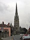
Nailsworth
Nailsworth is a town in Gloucestershire, England, lying in one of the Stroud Valleys in the Cotswolds. It has a population of around 6,600 people and lies on the A46 road....
in the Cotswolds
Cotswolds
The Cotswolds are a range of hills in west-central England, sometimes called the Heart of England, an area across and long. The area has been designated as the Cotswold Area of Outstanding Natural Beauty...
, passing through the counties of Bristol
Bristol
Bristol is a city, unitary authority area and ceremonial county in South West England, with an estimated population of 433,100 for the unitary authority in 2009, and a surrounding Larger Urban Zone with an estimated 1,070,000 residents in 2007...
, South Gloucestershire
South Gloucestershire
South Gloucestershire is a unitary district in the ceremonial county of Gloucestershire, in South West England.-History:The district was created in 1996, when the county of Avon was abolished, by the merger of former area of the districts of Kingswood and Northavon...
and Gloucestershire
Gloucestershire
Gloucestershire is a county in South West England. The county comprises part of the Cotswold Hills, part of the flat fertile valley of the River Severn, and the entire Forest of Dean....
.
Route
M32 motorway
The M32 is a motorway in South Gloucestershire and Bristol, England. It provides a link from Bristol city centre to the M4 and is part of the Bristol Parkway. At about , it is one of Britain's shortest motorways...
at junction 2, whence it continues north, through Stapleton
Stapleton, Bristol
Stapleton is an area in the north-eastern suburbs of the city of Bristol, England. The name is colloquially used today to describe the ribbon village along Bell Hill and Park Road in the Frome Valley. It borders Eastville to the South and Begbrook and Frenchay to the North...
, Broomhill and Frenchay
Frenchay
Frenchay is a suburb of Bristol, England, to the north east of the city, but located mainly in South Gloucestershire and the Civil Parish of Winterbourne....
before meeting the A4174 ring road, on the outskirts of Frenchay.
North of the ring road the B4058, called Winterbourne Hill, passes through Hambrook
Hambrook
Hambrook is a village in South Gloucestershire, England, just outside the outskirts of the city of Bristol. It lies between the two larger communities of Winterbourne and Frenchay and is part of the Civil Parish of Winterbourne...
, then into Winterbourne
Winterbourne, Gloucestershire
Winterbourne is a large village in South Gloucestershire, England. It had a population of 8,623 in the 2001 census. It sits as the centre of the Civil Parish of Winterbourne which encompasses the neighbouring communities of Winterbourne Down, Hambrook and Frenchay...
, where it becomes High Street. After Winterbourne, the road is known as Bristol Road; it passes through Frampton Cotterell
Frampton Cotterell
Frampton Cotterell is a village and parish, in South Gloucestershire, south west England on the River Frome. The village is continuous with Winterbourne to the south-west and Coalpit Heath to the east. The parish borders Iron Acton to the north and Westerleigh to the south-east, the large town of...
and Iron Acton
Iron Acton
Iron Acton is a village and civil parish in South Gloucestershire, England. The village is about west of Yate and about northeast of the centre of Bristol. The B4058 road used to pass through the village but now by-passes it just to the north....
. After Iron Acton the road becomes the B4059 on towards Yate
Yate
Yate is a town in South Gloucestershire, England, at the southwest extremity of the Cotswold Hills, 12 miles northeast of the city of Bristol. At the 2001 census the population was 21,789. The town of Chipping Sodbury is continuous with Yate to the east...
and Engine Common
Engine Common
Engine Common is a village in South Gloucestershire, England.-External links:...
. The B4058 turns right and heads north, through Rangeworthy
Rangeworthy
Rangeworthy is a semi-rural farming village in South Gloucestershire, England, nearby communities include Falfield and Charfield.The village lies between Iron Acton and Bagstone, along the B4058 road. It is a long village divided by a road with a well used village hall, pub, hotel, Indian...
, Bagstone
Bagstone
Bagstone is a village in South Gloucestershire, England. On the B4058 between Rangeworthy and Cromhall...
, Cromhall
Cromhall
Cromhall is a village in South Gloucestershire, England. It lies between Bagstone and Charfield on the B4058. It also borders LeyhillCromhall is about 1 mile from Falfield on the A38 Tortworth turn off. Tortworth Estate is owned by Lord Morton, Earl of Ducie. The village of Cromhall is spread out...
and Charfield
Charfield
Charfield is a village and civil parish in South Gloucestershire, England lying near the Little Avon River and south-west of the town of Wotton-under-Edge....
, where it passes into Gloucestershire. From there it continues to Wotton under Edge. After Wotton the road continues through the Cotswolds to its northern terminus at Nailsworth