
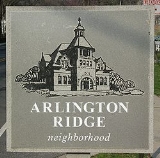
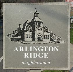
Arlington Ridge
Encyclopedia
| Quick Facts | |
|---|---|
| State | Virginia Virginia The Commonwealth of Virginia , is a U.S. state on the Atlantic Coast of the Southern United States. Virginia is nicknamed the "Old Dominion" and sometimes the "Mother of Presidents" after the eight U.S. presidents born there... |
| County | Arlington County Arlington County, Virginia Arlington County is a county in the Commonwealth of Virginia. The land that became Arlington was originally donated by Virginia to the United States government to form part of the new federal capital district. On February 27, 1801, the United States Congress organized the area as a subdivision of... |
| USPS Zipcode ZIP Code ZIP codes are a system of postal codes used by the United States Postal Service since 1963. The term ZIP, an acronym for Zone Improvement Plan, is properly written in capital letters and was chosen to suggest that the mail travels more efficiently, and therefore more quickly, when senders use the... |
22202 |
| Police District | 2D |
| Parking Zones | 01, 1B, 1C |
| Civic Associations | Arlington Ridge Civic Association |
| Firestation | Station 5 – Jefferson District / Aurora Highlands |
| Library | Aurora Hills Library |
| Parks | 19th Road South Park; Fort Scott Park; Oakcrest Park; South Ives Streen Park; James W. Haley Park; Prospect Hills Park |
Unincorporated area
In law, an unincorporated area is a region of land that is not a part of any municipality.To "incorporate" in this context means to form a municipal corporation, a city, town, or village with its own government. An unincorporated community is usually not subject to or taxed by a municipal government...
in Arlington County
Arlington County, Virginia
Arlington County is a county in the Commonwealth of Virginia. The land that became Arlington was originally donated by Virginia to the United States government to form part of the new federal capital district. On February 27, 1801, the United States Congress organized the area as a subdivision of...
, Virginia, United States. It is bordered on the north by The Pentagon
The Pentagon
The Pentagon is the headquarters of the United States Department of Defense, located in Arlington County, Virginia. As a symbol of the U.S. military, "the Pentagon" is often used metonymically to refer to the Department of Defense rather than the building itself.Designed by the American architect...
, on the west by the Army Navy Country Club, and on the south the City of Alexandria
Alexandria, Virginia
Alexandria is an independent city in the Commonwealth of Virginia. As of 2009, the city had a total population of 139,966. Located along the Western bank of the Potomac River, Alexandria is approximately six miles south of downtown Washington, D.C.Like the rest of northern Virginia, as well as...
. The main thoroughfare is the eponymous Arlington Ridge Road, a mansion-lined boulevard that, due to its high elevation, offers picturesque views of Washington D.C. and the surrounding areas. Also known simply as "The Ridge", this community is home to two historical points of interest: the Hume School
Hume School
The Hume School is an 1891 former school building in the Arlington Ridge neighborhood in Arlington County, Virginia. It is the oldest school building in Arlington County It has been the home of the Arlington Historical Society since 1960...
(National Register of Historic Places
National Register of Historic Places
The National Register of Historic Places is the United States government's official list of districts, sites, buildings, structures, and objects deemed worthy of preservation...
), currently the site of the Arlington Country Historical Society and Museum, and Fort Scott (Historic District), currently the site of Fort Scott Park.
Geography
A low rise above the adjoining terrain, Arlington Ridge ran from just above the city of Alexandria to a position northward directly across the Potomac from Georgetown. The ridge included land later leveled for construction of the Pentagon and Shirley Highway. Geologists believe the ridge may have been the shoreline of the Potomac during flood stage thousands of years ago.Hume School
The Hume School was built in 1891 and is the oldest school building in Arlington County. An active school until 1958, it is now the home of the Arlington Historical Society. It is listed in the National Register of Historic Places.The Little Tea House
The Little Tea House Restaurant, located on Arlington Ridge Road, opened in 1920 and remained there until 1963 when it was demolished to make room for a high-rise apartment building. During its heyday, many famous people ate at the restaurant, including Eleanor Roosevelt, Amelia Earhart, and Oliver Wendell Holmes. Known for its lovely gardens and views, it was also one of the first places in Arlington where racially mixed groups could meet. Gertrude Crocker, who started the restaurant, was active in women's issues throughout her life and started the restaurant so she could be independent and her own "boss." When Mrs. Crocker leased, and later sold, the business to Gertrude Allison, it became known for a period as Allison's Little Tea House.A postcard produced for the Little Tea House described the restaurant with this caption:
1301 South Arlington Ridge Road. Reminiscent of early American days with its brass and copper antiques, its shelves of rare old cook books, its tinkling Swiss music box, Allison's Little Tea House has been devoted for the past quarter of a century to the art of gracious eating.
The only remaining remnant of the Little Tea House that is visible today is a small stone tower located at the intersection South Lynn Street, now used as a small maintenance building for an adjacent swimming pool.
Prospect Hill
.At the northern terminus of Arlington Ridge lies Prospect Hill, an Arlington County historic site. The sign here reads:
The mansion which formerly stood here was built in 1841 by James Roach, a prosperous contractor who supplied most of the brick and stone used in the construction of the Aqueduct Bridge and Alexandria Canal (under construction 1833–1843) and the Alexandria, Loudoun, and Hampshire Railroad (under construction 1853–1859). His property, which extended to Roach’s Run, was ruined and vandalized during the construction of Fort Runyon and Fort Albany in 1861. His mansion was demolished in 1965.
Prospect Hill's vantage immediately overlooking the Pentagon (and the Washington D.C. skyline beyond) makes it a popular location for photographers. After the September 11 attacks, this spot offered a clear view of the Pentagon's damaged side. Many of the pictures that appeared around the world showing the still smoldering Pentagon were taken from this spot. Immediately after the disaster, a makeshift memorial consisting of wreaths and flowers was also established here.
Prospect Hill's strategic elevation overlooking the Old Georgetown Road and the Green Valley made it an ideal location for a defensive post during the Civil war. Consequently, it was selected as the site for Fort Albany.
Fort Albany
Located atop Prospect Hill was Fort Albany, a civil war fort established as part of the original defenses of Washington. Although no remains of the fort exist, the location is a designated Arlington County historic site. A sign here reads:Immediately to the northwest stood Fort Albany, a bastioned earthwork built in May, 1861, to command the approach to the Long Bridge by way of the Columbia Turnpike. It had a perimeter of 429 yards and emplacements for 12 guns. Even after Forts Richardson and Craig were built, 1300 yards to the west and north respectively, the heavy guns of Fort Albany served to support them, and to dominate them if they were captured. The ground on which the Fort stood was cut away during the construction of the Henry G. Shirley Memorial Highway, in 1942.
Fort Scott
Built by the Union Army in May 1861, Fort Scott was built as a detached lunette to guard the south flank of the defenses of Washington. It was named for General Winfield Scott, then General-in-Chief of the Army. One of many forts build to safeguard the capital, it was subsequently relegated to an interior position by the construction of the defenses of Alexandria about 1/4 miles to the west. The Fort had a perimeter of 313 yards and emplacements for 8 guns.The fort is designated as an Historic District.
Revolutionary war
Separating the Arlington Ridge community from the Army Navy Country Club lies Army Navy Drive, formerly known as Old Georgetown Road. In September 1781, American troops under the command of General George Washington and French troops under General Rochambeau marched southward from New Jersey over this section of Old Georgetown Road en route to Yorktown, Virginia, where they defeated the British in the decisive battle of the American Revolution.Facts
Arlington Ridge boasts several unique distinctions in the history of the Civil War:- First piece of Confederate-occupied territory captured by the Union Army
- Longest-held Confederate territory during the course of the war
- Final encampment for much of the Union Army
Seizure of The Ridge
Because of its high elevation and close proximity to the capital (a little over 3 miles to the then-uncompleted Washington monumentWashington Monument
The Washington Monument is an obelisk near the west end of the National Mall in Washington, D.C., built to commemorate the first U.S. president, General George Washington...
), Arlington Ridge offered a natural strategic point necessary for securing the defense of Washington. If confederate forces were able to secure The Ridge, mortars would easily be able to shell the capital. On May 23, 1861, Virginia citizens voted 3 to 1 in favor of secession. At dawn the next day, May 24, Union troops crossed the Potomac to seize Arlington Heights.
To the south of The Ridge, leading the 11th New York Zouave regiment, Col. Elmer Ephraim Ellsworth
Elmer E. Ellsworth
-External links:* * * * * *...
was charged with seizing the city of Alexandria. Advancing uncontested through the streets, Elssworth ordered some of his men to take the railroad station and a few others to secure the telegraph office. On the way, he espied a Confederate flag flying from the Marshall House Inn
Marshall House (Alexandria, Virginia)
The Marshall House stood on the corner of King Street, and South Pitt Street Alexandria, Virginia.-History:James W. Jackson was killed by Union troops after he shot and killed Col. Elmer Ephraim Ellsworth...
. Ellsworth and a group of others entered the inn and ran up the stairs to remove the flag. Ellsworth cut the flag down, however, on the way down the stairs, he was shot and killed by the owner of the inn, James W. Jackson
James W. Jackson
James W. Jackson was an ardent secessionist and the proprietor of the Marshall House, an inn located in the City of Alexandria during the time of the Civil War. During the capture of Alexandria Jackson used an English-made double-barrel shotgun to kill Col...
. Jackson was subsequently shot and killed by Cpl. Francis E. Brownell
Francis E. Brownell
Francis Edwin Brownell was a soldier and recipient of the Medal of Honor for killing James W. Jackson, murderer of Col. Elmer E. Ellsworth, colonel of the 11th New York Volunteer Infantry Regiment...
, who was later rewarded for his actions.
To the north of the Ridge, Col. Orlando B. Wilcox led the 1st Michigan Regiment. Landing in what is now the area presently occupied by Arlington National Cemetery
Arlington National Cemetery
Arlington National Cemetery in Arlington County, Virginia, is a military cemetery in the United States of America, established during the American Civil War on the grounds of Arlington House, formerly the estate of the family of Confederate general Robert E. Lee's wife Mary Anna Lee, a great...
, Wilcox and his men quickly descended upon the Lee/Custis House
Arlington House, The Robert E. Lee Memorial
Arlington House, The Robert E. Lee Memorial, formerly named the Custis-Lee Mansion, is a Greek revival style mansion located in Arlington, Virginia, USA that was once the home of Confederate General Robert E. Lee. It overlooks the Potomac River, directly across from the National Mall in Washington,...
, the estate owned by Gen. Robert E. Lee
Robert E. Lee
Robert Edward Lee was a career military officer who is best known for having commanded the Confederate Army of Northern Virginia in the American Civil War....
, who had resigned his commission from the Union Army only a few weeks earlier on April 20. Wilcox next advanced south and met up with Ellsworth's men to secure Arlington heights, completing the first successful campaign to recapture confederate territory during the war.
Once under federal control, Union engineers hastily began constructing a series of fortifications to protect the capital. These forts became the first line of defense for Washington, establishing the beginning of the so called Arlington Line
Arlington Line
The Arlington Line was a series of fortifications erected in present-day Arlington County, Virginia, to protect the City of Washington during the American Civil War....
. At the southern end of this line, a fort was constructed on the highest point of The Ridge. This fort, named Fort Scott
Fort Scott (Arlington, Virginia)
Named for General Winfield Scott, who was then General-in-Chief of the Union Army, Fort Scott was a detached lunette constructed in May 1861 to guard the south flank of the defenses of Washington during the American Civil War...
, is now the site of the current park that bears the same name.
Final encampment
At the conclusion of the war, on May 23/24, 1865, a two day military parade was held in Washington, D.C.. Nearly all of the major Union armies took part in the parade, and they bivouacked on Arlington Ridge. Mustering-out commenced once the parade ended, and so for many union soldiers, the last official campsite was on The Ridge.Arlington Ridge Road
Formerly the Alexandria-Georgetown Road, Arlington Ridge Road currently extends from South Glebe Road to Army Navy Drive, which itself was formerly known as Old Georgetown Road. Prior to the construction of The PentagonThe Pentagon
The Pentagon is the headquarters of the United States Department of Defense, located in Arlington County, Virginia. As a symbol of the U.S. military, "the Pentagon" is often used metonymically to refer to the Department of Defense rather than the building itself.Designed by the American architect...
and Shirley Highway
Henry G. Shirley Memorial Highway
The Henry G. Shirley Memorial Highway consists of a portion of Interstates 95 and 395 in the U.S. state of Virginia. Shirley Highway was the first limited-access freeway in Virginia...
(later re-designated Interstate 395
Interstate 395 (District of Columbia-Virginia)
Interstate 395 in Washington, D.C., and Virginia is a 13 mile long spur route that begins at a junction with Interstate 95 in Springfield, Virginia and ends in northwest Washington, D.C. It passes underneath the National Mall near the United States Capitol and ends at a junction with U.S...
), Arlington Ridge Road was a major county thoroughfare that extended through to Rosslyn.
From the 1890s until the 1920s, the Northern Virginia electric railway
Northern Virginia trolleys
The earliest electric railway, or streetcar line, in Northern Virginia opened in 1892. At their peak, when merged into a single interurban system , the successors of this and several other lines ran between downtown Washington, D.C., Rosslyn and Arlington Junction – present day Crystal City...
operated trolleys in Arlington. One of the lines that made up this system, the East Arlington Branch Line, traveled along most of its route along a section of Arlington Ridge Road that is now within Arlington National Cemetery.
In January 1934 the Commissioner of Public Roads prepared a report on the situation for the National Capital Parks and Planning Commission. This report resulted in a plan for a system of arterial highways in the area that would, among other things, allow expansion and protection of the Arlington National Cemetery by elimination of the adjacent segment of Arlington Ridge Road, which at that time, constituted the eastern boundary of the Arlington National Cemetery. Although approved by the Commission in 1934, little was done to realize the plan.
In March 1941, a revised general layout was prepared that was largely the same but also included a new route to the south, later known as the Shirley Highway
Henry G. Shirley Memorial Highway
The Henry G. Shirley Memorial Highway consists of a portion of Interstates 95 and 395 in the U.S. state of Virginia. Shirley Highway was the first limited-access freeway in Virginia...
. The section of Shirley Highway from VA-7 to the beginning of the Pentagon Road Network at Arlington Ridge Road, started out as a Virginia Department of Highways project. Development accelerated as the U.S. entered World War II, and the fate of Arlington Ridge Road was sealed when it was shortened to its present length.
A final reduction change came about in the 1980s when the remaining stretch of Arlington Ridge Road was reduced from four lanes to two, accompanied by installation of standard 4-foot sidewalks and grass easements.
U.S. Supreme Court Decision Allowing Zoned Parking
The nearby urban development of Crystal City has large number of daily commuters. Either to avoid paying for parking, or because of lack of space, it was common for these commuters to park on residential streets in the nearby Arlington Ridge and Aurora Hills communities. This daily flood of out-of-town strangers into formerly tranquil and isolated neighborhoods caused many problems. Starting in 1968, the Arlington Ridge and Aurora Hills civic associations petitioned Arlington County for help with the situation. A zoned parking ordinance was established, the intent of which was:to reduce hazardous traffic conditions resulting from the use of streets within areas zoned for residential uses for the parking of vehicles by persons using districts zoned for commercial or industrial uses . . .; to protect those districts from polluted air, excessive noise, and trash and refuse caused by the entry of such vehicles; to protect the residents of those districts from unreasonable burdens in gaining access to their residences; to preserve the character of those districts as residential districts; to promote efficiency in the maintenance of those streets in a clean and safe condition; to preserve the value of the property in those districts; and to preserve the safety of children and other pedestrians and traffic safety, and the peace, good order, comfort, convenience and welfare of the inhabitants of the County.
Crystal City successfully challenged these restrictions in court for many years. Finally, in 1977, a landmark decision by the United States Supreme Court
Supreme Court of the United States
The Supreme Court of the United States is the highest court in the United States. It has ultimate appellate jurisdiction over all state and federal courts, and original jurisdiction over a small range of cases...
settled the issue once and for all. (See ARLINGTON COUNTY BOARD v. RICHARDS, 1977, No. 76-1418.) As a result of this decision, communities nationwide are now able to preserve the peace and tranquility of their own neighborhood streets thanks to the activism of the people of Arlington Ridge and Aurora Hills.
No Way Out
The opening sequence to the 1987 film No Way Out features a long aerial shot that begins on the National MallNational Mall
The National Mall is an open-area national park in downtown Washington, D.C., the capital of the United States. The National Mall is a unit of the National Park Service , and is administered by the National Mall and Memorial Parks unit...
, flies over The Pentagon
The Pentagon
The Pentagon is the headquarters of the United States Department of Defense, located in Arlington County, Virginia. As a symbol of the U.S. military, "the Pentagon" is often used metonymically to refer to the Department of Defense rather than the building itself.Designed by the American architect...
, and then trails down Arlington Ridge Road to end at a house where Kevin Costner
Kevin Costner
Kevin Michael Costner is an American actor, singer, musician, producer, director, and businessman. He has been nominated for three BAFTA Awards, won two Academy Awards, and two Golden Globe Awards. Costner's roles include Lt. John J...
’s character is being held for questioning. Along with the more famous national landmarks, a clear shot of the Hume School is clearly visible in the sequence.
See also
- Hume SchoolHume SchoolThe Hume School is an 1891 former school building in the Arlington Ridge neighborhood in Arlington County, Virginia. It is the oldest school building in Arlington County It has been the home of the Arlington Historical Society since 1960...
- List of Arlington County Historic Districts
- Fort AlbanyFort Albany (Arlington, Virginia)Fort Albany was a bastioned earthwork built by the Union Army in Arlington County in Virginia. It was built in 1861 as part of the defense of Washington during the American Civil War.The fort...
- Fort ScottFort Scott (Arlington, Virginia)Named for General Winfield Scott, who was then General-in-Chief of the Union Army, Fort Scott was a detached lunette constructed in May 1861 to guard the south flank of the defenses of Washington during the American Civil War...
External links
- Arlington Ridge Civic Association (ARCA)
- http://www.arlingtonhistoricalsociety.org/ Arlington County Historical Society
- http://web.archive.org/web/20091027013225/http://geocities.com/humealumni/ The Hume School Alumni Collection
- http://2100.hardcorpsinc.net The Tragic Shooting at 2100 S. Arlington Ridge Road