
Appin
Encyclopedia
Appin is a remote coastal district of the Scottish
West Highlands
bounded west by Loch Linnhe
, south by Loch Creran
, east by the districts of Benderloch
and Lorne, and north by Loch Leven
. It lies north-east to south-west, and measures 14 miles (22.5 km) in length by 7 miles (11.3 km) in breadth.
The district is mainly in Argyll and Bute
, with a coastal strip to the north, along Loch Leven, within the Highland
council area
.
The scenery of the coast is extremely beautiful - a combination of seascapes and rugged and mountainous country inland - and Appin forms part of the Lynn of Lorn National Scenic Area
, one of 40 in Scotland. The principal hills are double peaks of Beinn a' Bheithir
- 3362 feet (1,024.7 m) and 3284 feet (1,001 m) - and Creag Ghorm- 2372 feet (723 m) - in the north, and Fraochaidh 2883 feet (878.7 m), Meall Bàn 2148 feet (654.7 m) and Beinn Mhic na Céisich 2093 feet (637.9 m) near the western flank of Glen Creran. The chief rivers are the Coe
and Laroch, flowing into Loch Leven, the Duror and Salachan flowing into Loch Linnhe, and the Iola and Creran flowing into Loch Creran
. The leading industries are forestry and tourism, lead mining and slate quarrying and being of former importance but the superquarry Glensanda
, in Morvern
, on the opposite bank of Loch Linnhe provides employment. Ballachulish
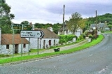
, Duror, Portnacroish, Appin and Port Appin are the principal villages. Appin was the country of a branch of the Stuarts.
The A828 road
runs along the coast of Appin. A passenger-only ferry to the island of Lismore
runs from Port Appin. The district formerly had a railway, but the Caledonian Railway
company’s branch line from Connel
to Ballachulish was closed in 1966.
This is where the famous Appin Murder
took place in 1752.
Scotland
Scotland is a country that is part of the United Kingdom. Occupying the northern third of the island of Great Britain, it shares a border with England to the south and is bounded by the North Sea to the east, the Atlantic Ocean to the north and west, and the North Channel and Irish Sea to the...
West Highlands
Scottish Highlands
The Highlands is an historic region of Scotland. The area is sometimes referred to as the "Scottish Highlands". It was culturally distinguishable from the Lowlands from the later Middle Ages into the modern period, when Lowland Scots replaced Scottish Gaelic throughout most of the Lowlands...
bounded west by Loch Linnhe
Loch Linnhe
Loch Linnhe is a sea loch on the west coast of Scotland....
, south by Loch Creran
Loch Creran
Loch Creran is a sea loch in Argyll, on the west coast of Scotland. It is about long from its head at Invercreran to its mouth on the Lynn of Lorne, part of Loch Linnhe. The loch separates the areas of Benderloch to the south and Appin to the north. The island of Eriska lies at the mouth of the...
, east by the districts of Benderloch
Benderloch
Benderloch is a village in Argyll and Bute, Scotland.Benderloch lies on the A828 road in the coastal area of Appin, Argyll, Scotland. Its railway station closed in 1966.Benderloch forms part of the Lynn of Lorn National Scenic Area, one of 40 in Scotland....
and Lorne, and north by Loch Leven
Loch Leven (Highlands)
Loch Leven 'is a sea loch on the west coast of Scotland. It is spelled Loch Lyon in Timothy Pont's map of the areaand is pronounced Li' un. There is a Leven in Lennox and another in Glen Lyon similarly pronounced...
. It lies north-east to south-west, and measures 14 miles (22.5 km) in length by 7 miles (11.3 km) in breadth.
The district is mainly in Argyll and Bute
Argyll and Bute
Argyll and Bute is both one of 32 unitary council areas; and a Lieutenancy area in Scotland. The administrative centre for the council area is located in Lochgilphead.Argyll and Bute covers the second largest administrative area of any Scottish council...
, with a coastal strip to the north, along Loch Leven, within the Highland
Highland (council area)
Highland is a council area in the Scottish Highlands and is the largest local government area in both Scotland and the United Kingdom as a whole. It shares borders with the council areas of Moray, Aberdeenshire, Perth and Kinross, and Argyll and Bute. Their councils, and those of Angus and...
council area
Council Area
A Council Area is one of the areas defined in Schedule 1 of the Local Government etc. Act 1994 and is under the control of one of the local authorities in Scotland created by that Act.-Legislation :1889...
.
The scenery of the coast is extremely beautiful - a combination of seascapes and rugged and mountainous country inland - and Appin forms part of the Lynn of Lorn National Scenic Area
National Scenic Area
National Scenic Area is a designation for areas of natural beauty used by more than one nation.* National Scenic Area * National Scenic Area * National scenic areas in Taiwan* National Scenic Area...
, one of 40 in Scotland. The principal hills are double peaks of Beinn a' Bheithir
Beinn a' Bheithir
Beinn a' Bheithir is a mountain lying to the south of Ballachulish, on the south side of Loch Leven in the Scottish Highlands. It boasts two Munro summits: the higher peak Sgorr Dhearg lies about east of Sgorr Dhonuill ....
- 3362 feet (1,024.7 m) and 3284 feet (1,001 m) - and Creag Ghorm- 2372 feet (723 m) - in the north, and Fraochaidh 2883 feet (878.7 m), Meall Bàn 2148 feet (654.7 m) and Beinn Mhic na Céisich 2093 feet (637.9 m) near the western flank of Glen Creran. The chief rivers are the Coe
River Coe
The River Coe rises at the north-eastern base of Buachaille Etive Beag and flows west along Glen Coe, Scotland. After dramatic waterfalls at the Pass of Glen Coe. It runs through the small Loch Achtriochtan before it turns north west...
and Laroch, flowing into Loch Leven, the Duror and Salachan flowing into Loch Linnhe, and the Iola and Creran flowing into Loch Creran
Loch Creran
Loch Creran is a sea loch in Argyll, on the west coast of Scotland. It is about long from its head at Invercreran to its mouth on the Lynn of Lorne, part of Loch Linnhe. The loch separates the areas of Benderloch to the south and Appin to the north. The island of Eriska lies at the mouth of the...
. The leading industries are forestry and tourism, lead mining and slate quarrying and being of former importance but the superquarry Glensanda
Glensanda
Glensanda was a Viking settlement at the mouth of Glen Sanda on the Morvern peninsula within south west Lochaber, overlooking the Isle of Lismore and Loch Linnhe in the western Highlands of Scotland....
, in Morvern
Morvern
Morvern is a peninsula in south west Lochaber, on the west coast of Scotland. The name is derived from the Gaelic A' Mhorbhairne . The highest point is the summit of the Corbett Creach Bheinn which reaches in elevation....
, on the opposite bank of Loch Linnhe provides employment. Ballachulish
Ballachulish
The village of Ballachulish in Lochaber, Highland, Scotland, is centred around former slate quarries. The name Ballachulish was more correctly applied to the area now called North Ballachulish, to the north of Loch Leven, but was usurped for the quarry villages at East Laroch and West Laroch,...
, Duror, Portnacroish, Appin and Port Appin are the principal villages. Appin was the country of a branch of the Stuarts.
The A828 road
A828 road
The A828 road is a primary route along the western coast of ScotlandAt its northern end the A828 meets the A82 at South Ballachulish and it runs to a junction with the A85 at Connel; the total length being some . It passes through Highland and Argyll and Bute council areas...
runs along the coast of Appin. A passenger-only ferry to the island of Lismore
Lismore, Scotland
Lismore is a partially Gaelic speaking island in the Inner Hebrides of Scotland. This fertile, low-lying island was once a major centre of Celtic Christianity, with a monastery founded by Saint Moluag and the seat of the Bishop of Argyll.-Geography:...
runs from Port Appin. The district formerly had a railway, but the Caledonian Railway
Caledonian Railway
The Caledonian Railway was a major Scottish railway company. It was formed in the early 19th century and it was absorbed almost a century later into the London, Midland and Scottish Railway, in the 1923 railway grouping, by means of the Railways Act 1921...
company’s branch line from Connel
Connel
Connel is a village in Argyll and Bute, Scotland. It is situated on the southern shore of Loch Etive. The Lusragan Burn flows through the village and into the loch....
to Ballachulish was closed in 1966.
This is where the famous Appin Murder
Appin Murder
The Appin Murder occurred on May 14, 1752 near Appin in the north-west of Scotland, and it resulted in what is often held to be a notorious miscarriage of justice...
took place in 1752.
Notable residents
- Elizabeth MacquarieElizabeth MacquarieElizabeth Macquarie was the second wife of Lachlan Macquarie who served as Governor of New South Wales from 1810 to 1821. She played a significant role in the establishment of the colony and is recognised in the naming of numerous Australian landmarks including Mrs Macquarie's Chair, Campbelltown...
(nee Campbell), wife of the fifth governorLachlan MacquarieMajor-General Lachlan Macquarie CB , was a British military officer and colonial administrator. He served as the last autocratic Governor of New South Wales, Australia from 1810 to 1821 and had a leading role in the social, economic and architectural development of the colony...
of New South WalesNew South WalesNew South Wales is a state of :Australia, located in the east of the country. It is bordered by Queensland, Victoria and South Australia to the north, south and west respectively. To the east, the state is bordered by the Tasman Sea, which forms part of the Pacific Ocean. New South Wales...
, was born in the area. During his term the governor named the towns of AppinAppin, New South WalesAppin is a town in the Macarthur Region of New South Wales, Australia in Wollondilly Shire. It is situated about 16 kilometres south of Campbelltown and 35 kilometres north west of Wollongong.-Early history:...
and AirdsAirds, New South WalesAirds is a suburb of Sydney, in the state of New South Wales, Australia. Airds is located 56 kilometres south-west of the Sydney central business district, in the local government area of the City of Campbelltown and is part of the Macarthur region....
after his wife's birthplace and her family's estate respectively. The Female Orphan School in ParramattaParramatta, New South WalesParramatta is a suburb of Sydney, in the state of New South Wales, Australia. It is located in Greater Western Sydney west of the Sydney central business district on the banks of the Parramatta River. Parramatta is the administrative seat of the Local Government Area of the City of Parramatta...
is said to have been modelled on the estate's main house.