

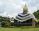
Amphoe Warin Chamrap
Encyclopedia
Warin Chamrap is a district (Amphoe
) in the western part of Ubon Ratchathani Province
, northeastern Thailand
.
, Sawang Wirawong
, Na Yia
, Det Udom
, Samrong
of Ubon Ratchathani Province and Kanthararom
of Sisaket Province
.
The important water resource is the Mun River
.
Since 1938, Warin Chamrap has been the eastern terminus of the northeastern railway line from Bangkok's central Hua Lamphong Railway Station via the Nakhon Ratchasima Railway Station.
 Ubon Ratchathani University
is located in Warin Chamrap district.
), which are further subdivided into 185 villages (muban
). The town (thesaban mueang) Warin Chamrap covers the whole tambon Warin Chamrap. There are two more townships (thesaban tambon) - Saen Suk covers the whole tambon Saen Suk, and Huai Kha Yung covers parts of tambon Huai Kha Yung. There are further 15 Tambon administrative organizations (TAO).
Missing numbers are tambon which now form the districts Samrong and Sawang Wirawong.
Amphoe
An amphoe is the second level administrative subdivision of Thailand. Usually translated as district, amphoe make up the provinces, and are analogous to a county seat...
) in the western part of Ubon Ratchathani Province
Ubon Ratchathani Province
-History:The area was part of the Khmer Empire. Before the late eighteenth century, this area evidently was outside Siamese or Thai Ayutthaya Kingdom....
, northeastern Thailand
Thailand
Thailand , officially the Kingdom of Thailand , formerly known as Siam , is a country located at the centre of the Indochina peninsula and Southeast Asia. It is bordered to the north by Burma and Laos, to the east by Laos and Cambodia, to the south by the Gulf of Thailand and Malaysia, and to the...
.
Geography
Neighboring districts are (from the north clockwise) Mueang Ubon RatchathaniAmphoe Mueang Ubon Ratchathani
Mueang Ubon Ratchathani is the capital district of Ubon Ratchathani Province, northeastern Thailand.-History:The district was originally named Buphapala Nikhom...
, Sawang Wirawong
Amphoe Sawang Wirawong
Sawang Wirawong is a district in the central part of Ubon Ratchathani Province, northeastern Thailand.-History:Sawang Wirawong was separated from Warin Chamrap district to create a minor district on April 1 1995....
, Na Yia
Amphoe Na Yia
Na Yia is a district in the central part of Ubon Ratchathani Province, northeastern Thailand.-History:Na Yia was separated from Det Udom district to create a minor district on May 31 1993....
, Det Udom
Amphoe Det Udom
Det Udom is a district in the southern part of Ubon Ratchathani Province, northeastern Thailand.-Geography:Neighboring districts are Samrong, Warin Chamrap, Na Yia, Phibun Mangsahan, Buntharik, Na Chaluai, Nam Yuen, Nam Khun, Thung Si Udom of Ubon Ratchathani Province and Benchalak of Sisaket...
, Samrong
Amphoe Samrong
Samrong is a district in the western part of Ubon Ratchathani Province, northeastern Thailand.-History:The minor district Samrong was created on April 15 1985, when the six tambon Samrong, Khok Kong, Nong Hai, Kho Noi, Non Ka Len and Khok Sawang were split off from Warin Chamrap district...
of Ubon Ratchathani Province and Kanthararom
Amphoe Kanthararom
Kanthararom is a district in the northeastern part of Sisaket Province, northeastern Thailand.-History:The district was established in 1897, then named Uthai Sisaket . It was renamed to Kanthararom in 1913...
of Sisaket Province
Sisaket Province
Sisaket , is one of the north-eastern provinces of Thailand. Neighboring provinces are Surin, Roi Et, Yasothon and Ubon Ratchathani. To the south it borders Oddar Meancheay and Preah Vihear of Cambodia.-Geography:...
.
The important water resource is the Mun River
Mun River
The Mun River , sometimes spelled Moon River, is a tributary of the Mekong river. It carries approximately 21,000 cubic kilometres of water per year.-Geography:...
.
History
In 1913 the district was renamed from Thaksin Ubon (ทักษิณอุบล) to Warin Chamrap.Since 1938, Warin Chamrap has been the eastern terminus of the northeastern railway line from Bangkok's central Hua Lamphong Railway Station via the Nakhon Ratchasima Railway Station.
Education
Ubon Ratchathani University
Ubon Ratchathani University was established as a campus of Khon Kaen University, Thailand, in 1987. It gained independent university status in 1990.-History :...
is located in Warin Chamrap district.
Administration
The district is subdivided into 16 subdistricts (tambonTambon
Tambon is a local government unit in Thailand. Below district and province , they form the third administrative subdivision level. As of the 2009 there are 7255 tambon, not including the 169 khwaeng of Bangkok, which are set at the same administrative level, thus every district contains 8-10 tambon...
), which are further subdivided into 185 villages (muban
Muban
Muban is the lowest administrative subdivision of Thailand. Usually translated as village, they are the subdivision of tambon. As of 2008, there are 74944 administrative villages in Thailand. As of the 1990 census, the average village consisted of 144 households or 746 persons.A muban does not...
). The town (thesaban mueang) Warin Chamrap covers the whole tambon Warin Chamrap. There are two more townships (thesaban tambon) - Saen Suk covers the whole tambon Saen Suk, and Huai Kha Yung covers parts of tambon Huai Kha Yung. There are further 15 Tambon administrative organizations (TAO).
| No. | Name | Thai name | Villages | Inh. Population A population is all the organisms that both belong to the same group or species and live in the same geographical area. The area that is used to define a sexual population is such that inter-breeding is possible between any pair within the area and more probable than cross-breeding with individuals... |
|
|---|---|---|---|---|---|
| 1. | Warin Chamrap | วารินชำราบ | |||
| 30,725 | |||||
| 2. | That | ธาตุ | 10 | 5,372 | |
| 4. | Tha Lat | ท่าลาด | 12 | 6,940 | |
| 5. | Non Non | โนนโหนน | 12 | 6,435 | |
| 7. | Khu Mueang | คูเมือง | 12 | 7,436 | |
| 8. | Sa Saming | สระสมิง | 16 | 7,795 | |
| 10. | Kham Nam Saep | คำน้ำแซบ | 9 | 8,412 | |
| 11. | Bung Wai | บุ่งหวาย | 20 | 10,390 | |
| 15. | Kham Khwang | คำขวาง | 8 | 7,263 | |
| 16. | Pho Yai | โพธิ์ใหญ่ | 13 | 7,476 | |
| 18. | Saen Suk | แสนสุข | 20 | 22,375 | |
| 20. | Nong Kin Phen | หนองกินเพล | 9 | 6,704 | |
| 21. | Non Phueng | โนนผึ้ง | 10 | 6,653 | |
| 22. | Mueang Si Khai | เมืองศรีไค | 10 | 8,071 | |
| 24. | Huai Khayung | ห้วยขะยูง | 13 | 6,443 | |
| 26. | Bung Mai | บุ่งไหม | 11 | 7,865 |
Missing numbers are tambon which now form the districts Samrong and Sawang Wirawong.