

Amphoe Singhanakhon
Encyclopedia
Singhanakhon is a district (Amphoe
) in the northern part of Songkhla Province
, southern Thailand
.
, Hat Yai
, Khuan Niang
of Songkhla Province, Pak Phayun
of Phatthalung Province
and Sathing Phra
of Songkhla Province again. To the east is the Gulf of Thailand
.
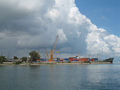
The district is located between Thale Luang and Songkhla Lake
.
. It was upgraded to a full district on July 19 1991.
 The district is subdivided into 11 subdistricts (tambon
), which are further subdivided into 77 villages (muban
). Singhanakhon is a township (thesaban tambon) which covers parts of tambon Ching Kho and Thamnop and the whole tambon Hua Khao and Sathing Mo. There are further 9 Tambon administrative organizations (TAO).
Amphoe
An amphoe is the second level administrative subdivision of Thailand. Usually translated as district, amphoe make up the provinces, and are analogous to a county seat...
) in the northern part of Songkhla Province
Songkhla Province
Songkhla is one of the southern provinces of Thailand. Neighboring provinces are Satun, Phatthalung, Nakhon Si Thammarat, Pattani and Yala. To the south it borders Kedah and Perlis of Malaysia....
, southern Thailand
Thailand
Thailand , officially the Kingdom of Thailand , formerly known as Siam , is a country located at the centre of the Indochina peninsula and Southeast Asia. It is bordered to the north by Burma and Laos, to the east by Laos and Cambodia, to the south by the Gulf of Thailand and Malaysia, and to the...
.
Geography
Neighboring districts are (from the south clockwise) Mueang SongkhlaAmphoe Mueang Songkhla
Mueang Songkhla is the capital district of Songkhla Province, southern Thailand.-Geography:Neighboring districts are Chana, Na Mom, Hat Yai and Singhanakhon of Songkhla Province...
, Hat Yai
Amphoe Hat Yai
-Geography:Neighboring districts are Khuan Kalong of Satun Province, and Rattaphum, Bang Klam, Khuan Niang, Singhanakhon, Mueang Songkhla, Na Mom, Chana, Sadao and Khlong Hoi Khong....
, Khuan Niang
Amphoe Khuan Niang
-History:The minor district was established on January 2 1985 by splitting off four tambon from Rattaphum district. It was upgraded to a full district on May 21 1990.-Geography:...
of Songkhla Province, Pak Phayun
Amphoe Pak Phayun
Pak Phayun is a district of Phatthalung Province, southern Thailand.-Geography:Neighboring districts are Pa Bon and Bang Kaeo of Phatthalung Province, Krasae Sin, Sathing Phra, Singhanakhon and Khuan Niang of Songkhla Province.To the east of the district is the Thale Luang lake, which through a...
of Phatthalung Province
Phatthalung Province
Phatthalung is one of the southern provinces of Thailand. Neighboring provinces are Nakhon Si Thammarat, Songkhla, Satun and Trang.-Geography:...
and Sathing Phra
Amphoe Sathing Phra
Sathing Phra is a district in the northern part of Songkhla Province, southern Thailand.-Geography:Neighboring districts are Singhanakhon of Songkhla Province, Pak Phayun of Phatthalung Province, Krasae Sin and Ranot of Songkhla Province again...
of Songkhla Province again. To the east is the Gulf of Thailand
Gulf of Thailand
The Gulf of Thailand , also known in to Malays as Teluk Siam literally meant Gulf of Siam, is a shallow arm of the South China Sea.-Geography:...
.
The district is located between Thale Luang and Songkhla Lake
Songkhla Lake
The Songkhla lake is the largest natural lake in Thailand, located on the Malay peninsula in the southern part of the country. Covering an area of 1,040 km² it borders the provinces of Songkhla and Phatthalung. Despite being called a lake, this water surface is actually a lagoon complex...
.
History
The minor district (King Amphoe) was created on February 15 1988, when 11 tambon were split off from Mueang Songkhla districtAmphoe Mueang Songkhla
Mueang Songkhla is the capital district of Songkhla Province, southern Thailand.-Geography:Neighboring districts are Chana, Na Mom, Hat Yai and Singhanakhon of Songkhla Province...
. It was upgraded to a full district on July 19 1991.
Administration
Tambon
Tambon is a local government unit in Thailand. Below district and province , they form the third administrative subdivision level. As of the 2009 there are 7255 tambon, not including the 169 khwaeng of Bangkok, which are set at the same administrative level, thus every district contains 8-10 tambon...
), which are further subdivided into 77 villages (muban
Muban
Muban is the lowest administrative subdivision of Thailand. Usually translated as village, they are the subdivision of tambon. As of 2008, there are 74944 administrative villages in Thailand. As of the 1990 census, the average village consisted of 144 households or 746 persons.A muban does not...
). Singhanakhon is a township (thesaban tambon) which covers parts of tambon Ching Kho and Thamnop and the whole tambon Hua Khao and Sathing Mo. There are further 9 Tambon administrative organizations (TAO).
| No. | Name | Thai name | Villages | Inh. Population A population is all the organisms that both belong to the same group or species and live in the same geographical area. The area that is used to define a sexual population is such that inter-breeding is possible between any pair within the area and more probable than cross-breeding with individuals... |
|
|---|---|---|---|---|---|
| 1. | Ching Kho | ชิงโค | 10 | 10,920 | |
| 2. | Sathing Mo | สทิงหม้อ | 6 | 15,361 | |
| 3. | Thamnop | ทำนบ | 7 | 4,458 | |
| 4. | Ram Daeng | รำแดง | 7 | 2,734 | |
| 5. | Wat Khanun | วัดขนุน | 8 | 7,937 | |
| 6. | Chalae | ชะแล้ | 5 | 2,868 | |
| 7. | Pak Ro | ปากรอ | 6 | 2,571 | |
| 8. | Pa Khat | ป่าขาด | 5 | 2,846 | |
| 9. | Hua Khao | หัวเขา | 8 | 14,567 | |
| 10. | Bang Khiat | บางเขียด | 5 | 3,500 | |
| 11. | Muang Ngam | ม่วงงาม | 10 | 11,519 |