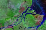
All Topics  
Amazon River


   Email Print
   Bookmark   Link


Amazon River


The Amazon River (; ) of South America is the largest river
List of rivers by length

This is a list of the longest rivers on Earth. It includes river systems over 1,000 kilometers....
 in the world by volume, with a total river flow greater than the next top eight largest rivers combined. The Amazon, which has the largest drainage basin
Drainage basin

A drainage basin is an extent of land where water from rain or snow melt drains downhill into a body of water, such as a river, lake, reservoir, estuary, wetland, sea or ocean....
 in the world, accounts for approximately one fifth of the world's total river flow. During the wet season The Amazon is - wide. Because of its vast dimensions, it is sometimes called The River Sea.


Discussion
Ask a question about 'Amazon River'
Start a new discussion about 'Amazon River'
Answer questions from other users
Full Discussion Forum


Recent Posts


Encyclopedia


The Amazon River (; ) of South America is the largest river
List of rivers by length

This is a list of the longest rivers on Earth. It includes river systems over 1,000 kilometers....
 in the world by volume, with a total river flow greater than the next top eight largest rivers combined. The Amazon, which has the largest drainage basin
Drainage basin

A drainage basin is an extent of land where water from rain or snow melt drains downhill into a body of water, such as a river, lake, reservoir, estuary, wetland, sea or ocean....
 in the world, accounts for approximately one fifth of the world's total river flow. During the wet season The Amazon is - wide. Because of its vast dimensions, it is sometimes called The River Sea. At no point is the Amazon crossed by bridge
Bridge

A bridge is a structure built to span a gorge, valley, road, Rail tracks, river, body of water, or any other physical obstacle, for the purpose of providing passage over the obstacle....
s. This is only partly because of its huge dimensions—in fact, for most of its length the Amazon is not so wide that a modern bridge could not span it—but more because, for most of its length, the river flows through tropical rainforest
Amazon Rainforest

The Amazon rainforest , also known as Amazonia, or the Amazon jungle, is a Tropical and subtropical moist broadleaf forests that covers most of the Amazon Basin of South America....
, where there are few road
Road

A road is an identifiable Road number, way or Trail between Location . Roads are typically smoothed, Pavement , or otherwise prepared to allow easy travel; though they need not be, and historically many roads were simply recognizable routes without any formal construction or Maintenance, repair and operations....
s and even fewer cities
City

A city is an urban area with a high population density and a particular administrative, legal, or historical status.Large industrialized cities generally have advanced systems for sanitation, utilities, land usage, house, and transportation and more....
.

While the Amazon is clearly the largest river in the world by most measures, the current consensus within the geographic community
Geographer

A geographer is a scientist whose area of study is geography, the study of Earth's physical natural environment and human habitat .Though geographers are historically known as people who make maps, map making is actually the field of study of cartography, a subset of geography....
 holds that the Amazon is the second longest river, just slightly shorter than the Nile
Nile

The Nile is a major north-flowing river in Africa, generally regarded as the List of rivers by length in the world.The Nile has two major tributary, the White Nile and Blue Nile, the latter being the source of most of the Nile's water and silt, but the former being the longer of the two....
. However, some scientists, particularly from Brazil
Brazil

Brazil , officially the Federative Republic of Brazil , is a country in South America. It is the List of countries and outlying territories by total area country by geographical area, occupying nearly half of South America, the List of countries by population country, and the fourth most populous democracy in the world....
 and Peru
Peru

Peru , officially the Republic of Peru , is a country in western South America. It is bordered on the north by Ecuador and Colombia, on the east by Brazil, on the southeast by Bolivia, on the south by Chile, and on the west by the Pacific Ocean....
, dispute this (see section below
Amazon River

The Amazon River of South America is the list of rivers by length in the world by volume, with a total river flow greater than the next top eight largest rivers combined....
).

Drainage area

The Amazon basin, the largest drainage basin in the world, covers some 40 percent of South America, an area of approximately 6,915,000 square kilometres (2,670,000 sq mi) . It gathers its waters from 5 degrees north latitude
5th parallel north

The 5th parallel north is a circle of latitude that is 5 degree true north of the Earth equator.Starting at the Prime Meridian and heading eastwards, the parallel 5? north passes through:...
 to 20 degrees south latitude
20th parallel south

The 20th parallel south is a circle of latitude that is 20 degree south of the Earth equator.Starting at the Prime Meridian and heading eastwards, the parallel 20? south passes through:...
. Its most remote sources are found on the inter-Andean
Andes

The Andes form the world's longest exposed mountain range. They lie as a continuous chain of highland along the western coast of South America. The range is over 7,000 km long, 200-700 km wide , and of an average height of about 4,000 m ....
 plateau, just a short distance from the Pacific Ocean
Pacific Ocean

The Pacific Ocean is the largest of the Earth's oceanic divisions. Its name is derived from the Latin name Mare Pacificum, "peaceful sea", bestowed upon it by the Portugal explorer Ferdinand Magellan....
.

The area covered by the water of the Amazon River and its tributaries more than triples over the course of a year. In an average dry season
Dry season

The dry season is a term commonly used when describing the weather in the tropics. The weather in the tropics is dominated by the tropical rain belt, which oscillation from the northern to the southern tropics over the course of the year....
 110,000 square kilometre
Square kilometre

Square kilometre , symbol km2, is a decimal multiple of the SI Units of measurement of surface area, the square metre, one of the SI derived units....
s (42,000 sq mi) of land are water-covered, while in the wet season
Wet season

Rainy season is the time of year, covering one or more months, when most of the average annual rainfall in a region falls. The term green season is also sometimes used as a euphemism by tourist authorities....
 the flooded area of the Amazon Basin rises to 350,000 square kilometres (135,000 sq mi) .

The quantity of water released by the Amazon to the Atlantic Ocean
Atlantic Ocean

The Atlantic Ocean is the second-largest of the world's oceanic divisions; with a total area of about 106.4 million square kilometres . It covers approximately one-fifth of the Earth's surface....
 is enormous: up to 300,000 m³ per second in the rainy season. The Amazon is responsible for a fifth of the total volume of fresh water
Fresh Water

Fresh Water is the debut album by Australian rock and blues singer Alison McCallum, released in 1972. Rare for an Australian artist at the time, it came in a gatefold sleeve....
 entering the oceans worldwide. Offshore of the mouth of the Amazon, potable water can be drawn from the ocean while still out of sight of the coastline, and the salinity of the ocean is notably lower five hundred kilometres out to sea.

Origins of the river

Amazon Origin At Mismi
The Upper Amazon has a series of major river systems in Peru
Peru

Peru , officially the Republic of Peru , is a country in western South America. It is bordered on the north by Ecuador and Colombia, on the east by Brazil, on the southeast by Bolivia, on the south by Chile, and on the west by the Pacific Ocean....
 and Ecuador
Ecuador

Ecuador , officially the , literally, "Republic of the equator") is a representative democratic republic in South America, bordered by Colombia on the north, by Peru on the east and south, and by the Pacific Ocean to the west....
, some of which flow into the Marañón
Marañón River

The Mara??n River rises about 160 km to the northeast of Lima, Peru, flows through a deeply-eroded Andes valley in a northwesterly direction, along the eastern base of the Cordillera of the Andes, as far as 5 degrees 36' southern latitude; then it makes a great bend to the northeast, and cuts through the inland Andes, until at the Pongo de...
 and others directly into the Amazon proper. Among others, these include the following rivers: Morona
Morona

The Morona is a tributary to the Amazon River, and flows parallel to the Pastaza River and immediately to the west of it, and is the last stream of any importance on the northern side of the Amazon before reaching the Pongo de Manseriche....
, Pastaza
Pastaza River

The Pastaza is a large tributary to the Amazon River.It has its headwaters in the province of Tungurahua, where the Tambo River joins the Latacunga River, near the foot of the Volcano Tungurahua, flowing south-east towards the Amazon basin....
, Nucuray, Urituyacu, Chambira
Chambira

The Chambira River is a major tributary river of the Mara??n River, and has been the traditional territory of the Urarina peoples for at least the past 350 years, if not much longer....
, Tigre
Tigre

Tigre may mean:...
, Nanay
Nanay

The Nanay River is tributary river to the Amazon River, west of the Napo River in Peru. The Nanay is one of the three rivers that surround the jungle city of Iquitos, making it an island....
, Napo
Napo

Napo may refer to* Napo District, Peru,*Napo River, Ecuador*Napo Province, Ecuador...
, Huallaga
Huallaga

Huallaga may refer to:*Locations in Peru:**Huallaga Province**Huallaga River**'Huallaga Valley...
, and Ucayali
Ucayali

The Ucayali River, which rises about 110 km north of Lake Titicaca, is a branch of the Amazon River near the Madeira River.The R?o Ucayali, together with Apur?mac River, Ene River, and Tambo River, is today considered the main headwater of the Amazon River, totalling a length of 2,669.9 km from the source of the Apur?mac at...
. The headstreams of the Marañón—which for many years had been seen as the origin of the Amazon—flow from high above central Peru's Lake Lauricocha, from the glaciers in what is known as the Nevado de Yarupa. Rushing through waterfalls and gorges in an area of the high jungle called the pongo
Pongo (geography)

A pongo is a type of canyon or narrow gorge along rivers in Peru, especially on the Mara??n River and its affluents, in the Amazonas Region....
s
, the Marañón River flows about 1,600 kilometres (1,000 mi) from west-central to northeast Peru before it combines with the Ucayali River, just below the provincial town of Nauta
Nauta

Nauta is a bustling small town situated in the northeastern area of the Peruvian Amazon Rainforest roughly 100km south of the Province's capital, Iquitos....
, to form the Amazon River.

The most distant source of the Amazon was firmly established in 1996, 2001 and 2007 as a glacial stream on a snowcapped 5,597 m (18,363 ft) peak called Nevado Mismi
Nevado Mismi

Nevado Mismi is a 5,597 m  mountain peak of volcano origin located in the Andes mountain range of Peru....
 in the Peruvian Andes
Andes

The Andes form the world's longest exposed mountain range. They lie as a continuous chain of highland along the western coast of South America. The range is over 7,000 km long, 200-700 km wide , and of an average height of about 4,000 m ....
, roughly 160 km (100 mi) west of Lake Titicaca and 700 km (430 mi) southeast of Lima. The waters from Nevado Mismi flow into the Quebradas Carhuasanta
Carhuasanta

The Quebrada Carhuasanta is located in the Apur?mac Region of Peru. It is known as the source of the Amazon River. The brook is fed by the winter snows of Nevado Mismi, , some 6,400 kilometres from the Atlantic Ocean....
 and Apacheta, which flow into the Río Apurímac which is a tributary of the Ucayali
Ucayali

The Ucayali River, which rises about 110 km north of Lake Titicaca, is a branch of the Amazon River near the Madeira River.The R?o Ucayali, together with Apur?mac River, Ene River, and Tambo River, is today considered the main headwater of the Amazon River, totalling a length of 2,669.9 km from the source of the Apur?mac at...
 which later joins the Marañón
Marañón River

The Mara??n River rises about 160 km to the northeast of Lima, Peru, flows through a deeply-eroded Andes valley in a northwesterly direction, along the eastern base of the Cordillera of the Andes, as far as 5 degrees 36' southern latitude; then it makes a great bend to the northeast, and cuts through the inland Andes, until at the Pongo de...
 to form the Amazon proper. (While this is the point at which most geographers place the beginning of the Amazon proper, in Brazil the river is known at this point as the Solimões
Solimões

Solim?es is the name often given to early stretches of the Amazon River from the border of Brazil and Peru to its confluence with the Rio Negro ....
 das Águas
). Soon thereafter the darkly colored waters of the Rio Negro meet the sandy colored Rio Solimões, and for over 6 km these waters run side by side without mixing.

After the confluence of Río Apurímac and Ucayali
Ucayali

The Ucayali River, which rises about 110 km north of Lake Titicaca, is a branch of the Amazon River near the Madeira River.The R?o Ucayali, together with Apur?mac River, Ene River, and Tambo River, is today considered the main headwater of the Amazon River, totalling a length of 2,669.9 km from the source of the Apur?mac at...
, the river leaves Andean terrain and is instead surrounded by flood plain. From this point to the Marañón
Marañón River

The Mara??n River rises about 160 km to the northeast of Lima, Peru, flows through a deeply-eroded Andes valley in a northwesterly direction, along the eastern base of the Cordillera of the Andes, as far as 5 degrees 36' southern latitude; then it makes a great bend to the northeast, and cuts through the inland Andes, until at the Pongo de...
, some 1,600 km (990 mi) , the forested banks are just out of water, and are inundated long before the river attains its maximum flood-line. The low river banks are interrupted by only a few hills, and the river enters the enormous Amazon Rainforest
Amazon Rainforest

The Amazon rainforest , also known as Amazonia, or the Amazon jungle, is a Tropical and subtropical moist broadleaf forests that covers most of the Amazon Basin of South America....
.

The river systems and flood plains in Brazil, Peru, Ecuador, Colombia and Venezuela whose waters drain into the Solimões and its tributaries are called the "Upper Amazon". The Amazon River proper runs mostly through Brazil and Peru, and it has tributaries reaching into Venezuela, Colombia, Ecuador, and Bolivia.

Flooding

Amazon River Nasa
Not all of the Amazon's tributaries flood at the same time of the year. Many branches begin flooding in November, and may continue to rise until June. The rise of the Rio Negro starts in February or March, and it also begins to recede in June. The Madeira rises and falls two months earlier than most of the rest of the Amazon.

The average depth of the river in the height of the rainy season is 40 m (131 ft) and the average width can be nearly 40 km (25 mi) .

The main river (which is between approximately one and six miles (10 km) wide) is navigable for large ocean steamers to Manaus
Manaus

Manaus is a city in Brazil, the capital of Amazonas state. It is situated at the confluence of the Rio Negro and River Solim?es rivers. It is the most populous city of Amazonas, according to the statistics of Brazilian Institute of Geography and Statistics and is a popular tourism destination....
, 1,500 kilometres (930 mi) upriver from the mouth. Smaller ocean vessels of 3,000 tons or 9,000 tons and 5.5 metres (18 ft) draft
Draft (hull)

The draft of a ship's Hull is the vertical distance between the waterline and the bottom of the hull , with the thickness of the hull included; in the case of not being included the draft outline would be obtained....
 can reach as far as Iquitos, Peru, 3,600 kilometres (2,240 mi) from the sea. Smaller riverboats can reach 780 kilometres (485 mi) higher as far as Achual Point. Beyond that, small boats frequently ascend to the Pongo de Manseriche
Pongo de Manseriche

The Pongo de Manseriche is a gorge in northwest Peru. The Mara??n River runs through this gorge before it reaches the Amazon Basin.The Pongo de Manseriche is 3 miles long, located at 4? 27' 30" south latitude and 77? 34' 51" west longitude, just below the mouth of the Rio Santiago, and between it and the old missionary station of Borja....
, just above Achual Point.

Towards the sea

Amazon River Delta Nasa
At some points, for long distances, the river divides into two main streams with inland and lateral channels
Channel (geography)

In physical geography, a channel is the physical confine of a river, slough or ocean strait consisting of a bed and banks.A channel is also the natural or man-made deeper course through a reef, bar , bay, or any shallow body of water....
, all connected by a complicated system of natural canal
Canal

Canals are artificial channels for water. There are two types of canals: Aqueduct canals, which are used for the conveyance and delivery of water, and waterways, which are navigable transportation canals used for passage of goods and people, often connected to existing lakes, rivers, or oceans....
s, cutting the low, flat igapo lands, which are never more than 5 metres (16 ft) above low river, into many islands.

From the village of Canaria at the great bend of the Amazon to the Negro, only very low land is found, resembling that at the mouth of the river. Vast areas of land in this region are submerged at high water, above which only the upper part of the trees of the sombre forests appear. Near the mouth of the Rio Negro to Serpa, nearly opposite the river Madeira, the banks of the Amazon are low, until approaching Manaus, they rise to become rolling hills. At Óbidos, a bluff 17 m (56 ft) above the river is backed by low hills. The lower Amazon seems to have once been a gulf
Headlands and bays

Headlands and bays are two related features of the coastal environment....
 of the Atlantic Ocean
Atlantic Ocean

The Atlantic Ocean is the second-largest of the world's oceanic divisions; with a total area of about 106.4 million square kilometres . It covers approximately one-fifth of the Earth's surface....
, the waters of which washed the cliffs near Óbidos.

Only about 10% of the water discharged by the Amazon enters the mighty stream downstream of Óbidos, very little of which is from the northern slope of the valley. The drainage area of the Amazon basin above Óbidos city is about 5 million square kilometres (2,000,000 sq mi), and, below, only about 1 million square kilometres (400,000 sq mi or around 20%), exclusive of the 1.4 million square kilometres (540,000 sq mi) of the Tocantins basin.

In the lower reaches of the river, the north bank consists of a series of steep, table-topped hills extending for about 240 kilometres (149 mi) from opposite the mouth of the Xingu as far as Monte Alegre
Monte Alegre

There are several places that have the name Monte Alegre in Brazil:*Campina do Monte Alegre, S?o Paulo *Monte Alegre, Par?*Monte Alegre, Rio Grande do Norte...
. These hills are cut down to a kind of terrace
Terrace (agriculture)

In agriculture, a terrace is a leveled section of a hilly cultivated area, designed as a method of soil conservation to slow or prevent the rapid surface runoff of irrigation water....
 which lies between them and the river.

Monte Alegre reaches an altitude of several hundred meters. On the south bank, above the Xingu, an almost-unbroken line of low bluffs
Hill

A hill is a landform that extends above the surrounding terrain, in a limited area. Hills often have a distinct Summit , although in areas with Escarpment a hill may refer to a particular section of scarp slope without a well-defined summit ....
 bordering the flood-plain extends nearly to Santarem, in a series of gentle curves before they bend to the south-west, and, abutting upon the lower Tapajos, merge into the bluffs which form the terrace margin of the Tapajos river valley.

Mouth of the river

Mouths of Amazon Geocover 1990
The Amazon estuary
Estuary

An estuary is a semi-enclosed coastal body of water with one or more rivers or streams flowing into it, and with a free connection to the open sea....
 is some 330 kilometres (210 mi) wide. The width of the mouth of the river is usually measured from Cabo do Norte to Punto Patijoca. But this includes the ocean outlet, 60 km (40 mi) wide, of the Para river, which should be deducted, as this stream is only the lower reach of the Tocantins. It also includes the ocean frontage of Marajó
Marajó

Maraj? is an island located at the mouth of the Amazon River in Brazil. It is part of the state of Par?. With a land area of 47 573 km? , it is the largest island to be completely surrounded by freshwater in the world....
, an island lying in the mouth of the Amazon. This means that the Amazon is wider at its mouth than the entire length of the Thames in England
England

native_name =|conventional_long_name = England|common_name = England|image_flag = Flag of England.svg|image_coat = England COA.svg|symbol_type = Royal Coat of Arms...
.

Tidal bore

Following the coast, a little to the north of Cabo do Norte, and for 160 kilometres (100 mi) along its Guiana margin up the Amazon, is a belt of half-submerged islands and shallow sandbanks. Here the tidal phenomenon called the bore
Tidal bore

A tidal bore is a tide phenomenon in which the leading edge of the incoming tide forms a wave of water that travel up a river or narrow bay against the direction of the current....
, or pororoca
Pororoca

The pororoca is a tidal bore, with waves up to 4 meters high that travel as much as 13 kilometers inland upstream on the Amazon River. Its name comes from the indigenous Tupi language, where it translates into "great destructive noise"....
, occurs, where the depths are not over 7 metres (23 ft). The tidal bore starts with a roar, constantly increasing, and advances at the rate of from with a breaking wall of water from high. The bore is the reason the Amazon does not have a protruding delta
River delta

A delta is a landform that is created at the mouth of a river where that river flows into an ocean, sea, estuary, lake, reservoir, flat arid area, or another river....
; the ocean rapidly carries away the vast volume of silt
Silt

Silt is soil or Rock derived granular material of a Particle size between sand and clay. Silt may occur as a soil or as suspended sediment in a surface water body....
 carried by the Amazon, making it impossible for a delta to grow past the shoreline. It also has a very large tide sometimes reaching 6 metres (20 ft) and has become a popular spot for river surfing
River surfing

River surfing is the sport of surfing either standing waves or tidal bores in rivers. Claims for its origins include a 1955 ride of 1.5 miles along the tidal bore of the River Severn....
.

Wildlife


More than one third of all species
Species

In biology, a species is one of the basic units of biological classification and a taxonomic rank. A species is often defined as a group of organisms capable of interbreeding and producing fertile offspring....
 in the world live in the Amazon Rainforest
Amazon Rainforest

The Amazon rainforest , also known as Amazonia, or the Amazon jungle, is a Tropical and subtropical moist broadleaf forests that covers most of the Amazon Basin of South America....
, a giant tropical forest and river basin with an area that stretches more than 5.4 million square kilometres (2,100,000 sq mi) and is among the richest tropical forests in the world. The Amazon River has over 3,000 recognized species of fish
Fish

A fish is any marine biology vertebrate animal that is typically ectothermic , covered with scale , and equipped with two sets of paired fins and several unpaired fins....
 and that number is still growing. Some estimates go as high as 5,000.

Along with the Orinoco
Orinoco

The Orinoco is one of the longest rivers in South America at 2,140 km, . Its drainage basin, sometimes called the Orinoquia covers 880,000 km?, 76.3% in Venezuela with the rest in Colombia....
, the river is one of the main habitats of the Boto
Boto

The Amazon River Dolphin, alternately Bufeo, Bufeo Colorado, Boto, Boto Rosa, Boutu, Nay, Tonina, or Pink River Dolphin is a freshwater river dolphin endemic to the Orinoco, Amazon and Araguaia/Tocantins River River systems of Brazil, Bolivia, Peru, Ecuador, Colombia and Venezuela....
, also known as the Amazon River Dolphin. The largest species of river dolphin, it can grow to lengths of up to 2.6 metres (9 ft). The boto is the subject of a very famous legend in Brazil, about a dolphin that turns into a human.

Also present in large numbers are the notorious piranha
Piranha

A piranha or pira?a is a member of a family of omnivorous freshwater fish which live in South American rivers. In Venezuelan rivers they are called caribes....
, carnivorous fish which congregate in large schools, and may attack livestock and even humans. However, only a few species attack humans, and many are solely fish-eaters, and do not school.

The bull shark
Bull shark

The bull shark, Carcharhinus leucas, also known as the bull whaler, Zambezi shark or unofficially known as Zambi in Africa and Nicaragua shark in Nicaragua, is a shark common worldwide in warm, shallow waters along coasts and in rivers....
 (Carcharhinus leucas) has been reported 4,000 km (2,220 miles) up the Amazon River at Iquitos
Iquitos

Iquitos is the largest city in the Peruvian rainforest, with a population of 370,962. It is the capital of Loreto Region and Maynas Province. It is generally considered the most populous city in the world that cannot be reached by road....
 in Peru
Peru

Peru , officially the Republic of Peru , is a country in western South America. It is bordered on the north by Ecuador and Colombia, on the east by Brazil, on the southeast by Bolivia, on the south by Chile, and on the west by the Pacific Ocean....
. The arapaima
Arapaima

The arapaima, pirarucu, or paiche is a South American tropical fresh water fish. It is one of the largest fresh water fish in the world....
, or pirarucu (Arapaima gigas) is a South American tropical freshwater fish
Freshwater fish

Fresh water fish are fish that spend some or all of their lives in fresh water, such as rivers and lakes, with a salinity of less than 0.05%....
. It is one of the largest freshwater fish in the world, reportedly with a maximum length in excess of 3 m (9.8 ft) and weight up to 200 kg (440 lb). Another Amazonian freshwater fish is the arowana
Arowana

Arowanas, also known as aruanas or arawanas are fresh water bony fish of the family Osteoglossidae, sometimes known as "bonytongues"....
 (Osteoglossum bicirrhosum) which is also a predator and very similar to the arapaima, but reaches a length of maximum 120 centimetres.

The Anaconda
Anaconda

An anaconda is a large, non-venomous snake found in tropical South America. Although the name actually applies to a group of snakes, it is often used to refer only to one species in particular, the common or green anaconda, Eunectes murinus, which is one of the largest snakes in the world....
 snake is found in shallow waters in the Amazon basin. One of the world's largest species of snake
Snake

Snakes are elongate legless carnivore reptiles of the suborder Serpentes that can be distinguished from legless lizards by their lack of eyelids and external ears....
, the Anaconda spends most of its time in the water, with just its nostril
Nostril

A nostril is one of the two channels of the nose, from the point where they bifurcate to the external opening. In birds and mammals, they contain branched bones or cartilages called turbinates, whose function is to warm air on inhalation and remove moisture on exhalation....
s above the surface.

The river supports thousands of species of fish, as well as crabs, algae, and turtles.

Colonial encounter and Amazonia

During what many archaeologists call the formative period, Amazonian societies were deeply involved in the emergence of South America's highland agrarian
Agriculture

Agriculture refers to the production of food and goods through farming and forestry. Agriculture was the key development that led to the rise of civilization, with the animal husbandry of domestication animals and plants creating food surpluses that enabled the development of more Population density and Social stratification societies....
 systems, and possibly contributed directly to the social and religious fabric constitutive of the Andean civilizational orders.

In 1500, Vicente Yañez Pinzón
Vicente Yáñez Pinzón

Vicente Y??ez Pinz?n was a Spain navigator, exploration, and conquistador. Along with his older brother Mart?n Alonso Pinz?n, he sailed with Christopher Columbus on the first voyage to the New World in 1492, as captain of Ni?a....
 was the first European to sail into the river. Pinzón called the river flow Río Santa María de la Mar Dulce, later shortened to Mar Dulce (literally, sweet sea, because of its freshwater pushing out into the ocean). For 350 years after the first European encounter of the Amazon by Pinzón, the Portuguese portion of the basin remained an untended former food gathering and planned agricultural landscape occupied by the indigenous peoples who survived the arrival of European diseases. There is ample evidence for complex large-scale, pre-Columbian social formations, including chiefdoms, in many areas of Amazonia (particularly the inter-fluvial regions) and even large towns and cities. For instance the pre-Columbian culture on the island of Marajo
Marajó

Maraj? is an island located at the mouth of the Amazon River in Brazil. It is part of the state of Par?. With a land area of 47 573 km? , it is the largest island to be completely surrounded by freshwater in the world....
 may have developed social stratification
Social stratification

In sociology and anthropology, social stratification is the hierarchy arrangement of social classes, castes and strata within a society. While these hierarchies are not universal to all societies, they are the norm among state-level cultures ....
 and supported a population of 100,000 people. The Native Americans of the Amazon rain forest may have used Terra preta
Terra preta

Terra preta refers to expanses of very dark, fertile anthropogenic soils found in the Amazon Basin. It owes its name to its very high charcoal content....
 to make the land suitable for the large scale agriculture needed to support large populations and complex social formations such as chiefdoms.

One of Gonzalo Pizarro
Gonzalo Pizarro

Gonzalo Pizarro y Alonso was a Spain conquistador and younger half-brother of Francisco Pizarro, the conqueror of the Inca Empire. Illegitimate son of Captain Gonzalo Pizarro y Rodr?guez de Aguilar who as colonel of infantry served in the Italian Wars under Gonzalo Fern?ndez de C?rdoba, and in Navarre, with some distinction, and Mar?a A...
's lieutenants, Francisco de Orellana
Francisco de Orellana

Francisco de Orellana was a Spain explorer and conquistador. He completed the first known navigation through the length of the Amazon River. He named this river and founded Guayaquil....
, during his 1541 expedition, east of Quito
Quito

San Francisco de Quito, most often called Quito, is the Capital city of Ecuador in northwestern South America. It is located in north-central Ecuador in the Guayllabamba river basin, on the eastern slopes of Pichincha , an active stratovolcano in the Andes mountains....
 into the South America
South America

South America is the southern continent of the Americas, situated entirely in the Western Hemisphere and mostly in the Southern Hemisphere, with a relatively small portion in the Northern Hemisphere....
n interior in search of El Dorado
El Dorado

El Dorado is a legend that began with the story of a South American tribal chief who covered himself with gold dust and would dive into a lake of pure mountain water....
 and the Country of the Cinnamon
Cinnamon

Cinnamon is a small evergreen tree 10?15 metres tall, belonging to the family Lauraceae, and is native to Sri Lanka.The leaf are ovate-oblong in shape, 7?18 cm long....
 was ordered to explore the Coca River
Coca River

The Coca River is a river in eastern Ecuador. It is a tributary of the Napo River. The two rivers join in Puerto Francisco de Orellana....
 and return when the river ended. When they arrived to the confluence to the Napo River
Napo River

The Napo is a tributary to the Amazon River that rises in Ecuador on the flanks of the volcanoes of Antisana, Sincholagua and Cotopaxi.Before it reaches the plains it receives a great number of small streams from impenetrable, saturated and much broken mountainous districts, where the dense and varied vegetation seems to fight for every...
, his men menaced to mutiny if they did not continue. On 26 December 1541, he accepted to be elected chief of the new expedition and to conquest new lands in name of the king. The 49 men began to build a bigger ship for riverine navigation. During their navigation on Napo River they were threatened constantly by the Omaguas. They reached Negro River on 3 June 1542 and finally arrived to the Amazon River, that was so named because they were attacked by fierce female warriors like the mythological Amazons
Amazons

The Amazons , ) are a nation of all-female warriors in Classical and Greek mythology, who were possibly historical. Herodotus placed them in a region bordering Scythia in Sarmatians....
. The icamiabas Indians dominated the area close to the Amazon River, rich in gold. When Orellana went down the river in search of gold, descends Andes
Andes

The Andes form the world's longest exposed mountain range. They lie as a continuous chain of highland along the western coast of South America. The range is over 7,000 km long, 200-700 km wide , and of an average height of about 4,000 m ....
 (in 1541), the river was still called Grande Rio, Mar Dulce or Rio da Canela (Cinnamon), because of the great trees of cinnamon located there. The belligerent victory of the icamiabas against the Spanish invaders was such that the fact was narrated to the king Carlos V, whom, inspired by the Greek Amazons, baptized the river as Amazon.

In what is currently Brazil
Brazil

Brazil , officially the Federative Republic of Brazil , is a country in South America. It is the List of countries and outlying territories by total area country by geographical area, occupying nearly half of South America, the List of countries by population country, and the fourth most populous democracy in the world....
, Ecuador
Ecuador

Ecuador , officially the , literally, "Republic of the equator") is a representative democratic republic in South America, bordered by Colombia on the north, by Peru on the east and south, and by the Pacific Ocean to the west....
, Bolivia
Bolivia

The Republic of Bolivia , named after Sim?n Bol?var, is a landlocked country in central South America. It is bordered by Brazil on the north and east, Paraguay and Argentina on the south, and Chile and Peru on the west....
, Colombia
Colombia

Colombia , officially the Republic of Colombia , is a country in north-western South America. Colombia is bordered to the east by Venezuela and Brazil; to the south by Ecuador and Peru; to the north by the Caribbean Sea; to the north west by Panama; and to the west by the Pacific Ocean....
, Peru
Peru

Peru , officially the Republic of Peru , is a country in western South America. It is bordered on the north by Ecuador and Colombia, on the east by Brazil, on the southeast by Bolivia, on the south by Chile, and on the west by the Pacific Ocean....
, and Venezuela
Venezuela

Venezuela , officially the Bolivarian Republic of Venezuela , is a country on the northern coast of South America.The country comprises a continental mainland and numerous islands located off the Venezuelan coastline in the Caribbean Sea....
 a number of colonial
Colonisation

Colonisation occurs whenever any one or more species populates a new area. The term, which is derived from the Latin colere, "to inhabit, cultivate, frequent, practice, tend, guard, respect," originally related to humans....
 and religious settlements were established along the banks of primary rivers and tributaries for the purpose of trade, slaving and evangelization among the indigenous peoples of the vast rain forest.

The total population of the Brazilian portion of the Amazon basin in 1850 was perhaps 300,000, of whom about two-thirds comprised by Europeans and slaves, the slaves amounting to about 25,000. In Brazil, the principal commercial city, Para (now Belém
Belém

Bel?m is a city on the banks of the Amazon estuary, in the northern part of Brazil. It is the capital of the state of Par?. It is the entrance gate to the Amazon with a busy port, airport and coach station....
), had from 10,000 to 12,000 inhabitants, including slaves. The town of Manáos, now Manaus
Manaus

Manaus is a city in Brazil, the capital of Amazonas state. It is situated at the confluence of the Rio Negro and River Solim?es rivers. It is the most populous city of Amazonas, according to the statistics of Brazilian Institute of Geography and Statistics and is a popular tourism destination....
, at the mouth of the Rio Negro, had from 1,000 to 1,500 population. All the remaining villages, as far up as Tabatinga
Tabatinga

Tabatinga is a municipality in the Tres Fronteras area of Northwestern Brazil. It is located in the States of Brazil of Amazonas . Its population was 45,293 and its area is 3,225 km?....
, on the Brazilian frontier of Peru, were relatively small.

Post colonial history

On 6 September 1850, the emperor, Peter II
Pedro II of Brazil

Pedro II, , or Dom Pedro de Alc?ntara; December 2, 1825 December 5, 1891) was the second and last Emperor of Brazil, having ruled for almost 50 years....
, sanctioned a law authorizing steam navigation on the Amazon, and gave the Baron of Mauá (Irineu Evangilista de Sousa) the task of putting it into effect. He organized the "Compania de Navigacao e Commercio do Amazonas" at Rio de Janeiro in 1852; and in the following year it commenced operations with three small steamers, the Monarch, the Marajó and Rio Negro.

At first, navigation was principally confined to the main river; and even in 1857 a modification of the government contract only obliged the company to a monthly service between Pará and Manaus, with steamers of 200 tons cargo capacity, a second line to make six round voyages a year between Manaus and Tabatinga, and a third, two trips a month between Para and Cameta. This was the first step in opening up the vast interior.

The success of the venture called attention to the opportunities for economic exploitation of the Amazon, and a second company soon opened commerce on the Madeira, Purus and Negro; a third established a line between Pará and Manaus; and a fourth found it profitable to navigate some of the smaller streams. In that same period, the Amazonas Company was increasing its fleet. Meanwhile, private individuals were building and running small steam craft of their own on the main river as well as on many of its tributaries.

On 31 July 1867 the government of Brazil, constantly pressed by the maritime powers and by the countries encircling the upper Amazon basin, especially Peru
Peru

Peru , officially the Republic of Peru , is a country in western South America. It is bordered on the north by Ecuador and Colombia, on the east by Brazil, on the southeast by Bolivia, on the south by Chile, and on the west by the Pacific Ocean....
, decreed the opening of the Amazon to all flags; but limited this to certain defined points: Tabatinga—on the Amazon; Cameta—on the Tocantins; Santarem—on the Tapajos; Borba—on the Madeira and Manáos—on the Rio Negro. The Brazilian decree took effect on 7 September 1867.

Thanks in part to the mercantile development associated with steam boat navigation, coupled with the internationally driven demand for natural rubber
Rubber

Natural rubber is an elastomer?an Elasticity_ hydrocarbon polymer?that was originally derived from a milky colloidal suspension, or latex , found in the sap of some plants....
 (1880-1920), Manáos (now Manaus), Para (Brazil
Brazil

Brazil , officially the Federative Republic of Brazil , is a country in South America. It is the List of countries and outlying territories by total area country by geographical area, occupying nearly half of South America, the List of countries by population country, and the fourth most populous democracy in the world....
), and Iquitos
Iquitos

Iquitos is the largest city in the Peruvian rainforest, with a population of 370,962. It is the capital of Loreto Region and Maynas Province. It is generally considered the most populous city in the world that cannot be reached by road....
, Peru
Peru

Peru , officially the Republic of Peru , is a country in western South America. It is bordered on the north by Ecuador and Colombia, on the east by Brazil, on the southeast by Bolivia, on the south by Chile, and on the west by the Pacific Ocean....
 became thriving, cosmopolitan centers of commerce and spectacular—albeit illusory—modern "urban growth". This was particularly the case for Iquitos
Iquitos

Iquitos is the largest city in the Peruvian rainforest, with a population of 370,962. It is the capital of Loreto Region and Maynas Province. It is generally considered the most populous city in the world that cannot be reached by road....
 during its late 19th and early 20th century Rubber Bonanza zenith when this dynamic boom-town was known abroad as the St. Louis
St. Louis, Missouri

St. Louis is an independent city in the U.S. state of Missouri, located near the confluence of the Mississippi River and the Missouri River. St....
 of the Amazon.

The first direct foreign trade with Manáos was commenced around 1874. Local trade along the river was carried on by the English successors to the Amazonas Company—the Amazon Steam Navigation Company—as well as numerous small steamboats, belonging to companies and firms engaged in the rubber trade, navigating the Negro, Madeira, Purfis and many other tributaries, such as the Marañón to ports as distant as Nauta
Nauta

Nauta is a bustling small town situated in the northeastern area of the Peruvian Amazon Rainforest roughly 100km south of the Province's capital, Iquitos....
, Peru
Peru

Peru , officially the Republic of Peru , is a country in western South America. It is bordered on the north by Ecuador and Colombia, on the east by Brazil, on the southeast by Bolivia, on the south by Chile, and on the west by the Pacific Ocean....
. The Amazon Steam Navigation Company had 38 vessels.

By the turn of the 20th century, the principal exports of the Amazon Basin were india-rubber
Rubber

Natural rubber is an elastomer?an Elasticity_ hydrocarbon polymer?that was originally derived from a milky colloidal suspension, or latex , found in the sap of some plants....
, cacao
Cacao

Cacao , or the cocoa plant, is a small evergreen tree in the family Sterculiaceae , native to the deep tropical region of the Americas. There are two prominent competing hypotheses about the origins of the original wild Theobroma cacao tree....
, Brazil nut
Brazil Nut

The Brazil nut is a South American tree in the family Lecythidaceae, and also the name of the tree's commercially harvested edible seed.The Brazil nut tree is the only species in the monotypic genus Bertholletia....
s and a few other products of minor importance, such as pelts and exotic forest produce (resin
Resin

Resin is a hydrocarbon secretion of many plants, particularly Pinophyta. It is valued for its chemical constituents and uses, such as varnishes and adhesives, as an important source of raw materials for organic synthesis, or for incense and perfume....
s, barks, woven hammocks, prized bird feathers, live animals, etc.) and extracted goods (lumber
Lumber

Lumber or timber is wood in any of its stages from logging through readiness for use as structural material for construction, or wood pulp for paper production....
, gold
Gold

Gold is a chemical element with the symbol Au and atomic number 79. It is a highly sought-after precious metal, having been used as money, as a store of value, in jewelry, in sculpture, and for ornamentation since the beginning of recorded history....
, etc.).

20th century concerns

Four centuries after the European discovery of the Amazon river, the total cultivated area in its basin was probably less than 65 square kilometres (25 sq mi), excluding the limited and crudely cultivated areas among the mountains at its extreme headwaters. This situation changed dramatically during the 20th century.

Manaus Amazon Nasa
Wary of foreign exploitation of the nation's resources, Brazilian governments in the 1940s set out to develop the interior, away from the seaboard where foreigners owned large tracts of land. The original architect of this expansion was President Getúlio Vargas
Getúlio Vargas

Get?lio Dornelles Vargas served as President of Brazil of Brazil from 1930 to 1945 and from 1951 until his suicide in 1954....
, the demand for rubber from the Allied forces in World War II
World War II

World War II, or the Second World War , was a global military conflict which involved a Participants in World War II, including all of the great powers, organised into two opposing military alliances: the Allies of World War II and the Axis powers....
 providing funding for the drive.

The construction of the new capital Brasilia
Brasília

Bras?lia is the Capital of Brazil. The city and its District are located in the Central-West Region, Brazil of the country, along a plateau known as Planalto Central....
 in the interior in 1960 also contributed to the opening up of the Amazon basin. A large scale colonization program saw families from north-eastern Brazil relocated to the forests, encouraged by promises of cheap land. Many settlements grew along the road from Brasilia to Belém
Belém

Bel?m is a city on the banks of the Amazon estuary, in the northern part of Brazil. It is the capital of the state of Par?. It is the entrance gate to the Amazon with a busy port, airport and coach station....
, but rainforest soil proved difficult to cultivate.

Still, long-term development plans continued. Roads were cut through the forests, and in 1970, the work on Trans-Amazon highway network began. The network's three pioneering highways were completed within ten years, connecting all the major cities of the Brazilian Amazon interior.

Dispute regarding length

While debate as to whether the Amazon or the Nile is the world's longest river has gone on for many years, the historic consensus of geographic authorities has been to regard the Amazon as the second longest river in the world, with the Nile being the longest. However, the Amazon has been measured by different geographers as being anywhere between 6,259 and 6,800 kilometres long. The Nile is reported to be anywhere from 5,499 to 6,690 kilometres The differences in these measurements often result from the use of different definitions.

A study by Brazilian scientists claimed that the Amazon is actually longer than the Nile. Using Nevado Mismi
Nevado Mismi

Nevado Mismi is a 5,597 m  mountain peak of volcano origin located in the Andes mountain range of Peru....
, which in 2001 was labeled by the National Geographic Society
National Geographic Society

The National Geographic Society , headquartered in Washington, D.C. in the United States, is one of the largest non-profit scientific and educational institutions in the world....
 as the Amazon's source, these scientists have made new calculations of the Amazon's length. They now estimate that the Amazon is longer than the Nile, and Guido Gelli, director of science at the Brazilian Institute of Geography and Statistics (IBGE
IBGE

The Brazilian Institute of Geography and Statistics or IBGE , is the agency responsible for statistical, geographic, cartography, geodetic and Natural environment information in Brazil....
), told the Brazilian TV network Globo
Rede Globo

Rede Globo is a Brazilian Television broadcasting, owned by media conglomerate Organiza??es Globo. The network is currently one of the largest in The Americas and the fourth largest in the world, watched by 120 million people daily....
 in June 2007 that it could be considered as a fact that the Amazon was the longest river in the world. However, other geographers have had access to the same data since 2001, and a consensus has yet to emerge to support the claims of these Brazilian scientists.

Major tributaries


The Amazon has over 1,000 tributaries
Tributary

A tributary is a stream or river which flows into a Mainstem river. A tributary does not flow directly into a sea. Tributaries and the mainstem river serve to drain the surrounding drainage basin of its surface water and groundwater by leading the water out into an ocean or some other large body of water....
 in total, 17 of which are over 1,000 kilometers. Some of the more notable:

  • Branco
    Branco River

    The Rio Branco is the principal Tributary of the Rio Negro from the north; it is enriched by many streams from the sierras which separate Venezuela and Guyana from Brazil....
  • Casiquiare canal
    Casiquiare canal

    The Casiquiare river is a distributary of the upper Orinoco River, which flows southward into the Rio Negro . As such, it forms a unique natural canal between the Orinoco and Amazon River river systems; it is the largest river on the planet that links two major river systems, a so-called bifurcation ....
  • Huallaga
    Huallaga River

    The Huallaga River is a tributary of the Mara??n River, part of the Amazon Basin. Old names for this river include Guallaga and Rio de los Motilones....
  • Putumayo (or Içá River)
  • Javary
    Javary

    The Javary River, the boundary between Brazil and Peru, is an Amazon River tributary river. It is supposed to be navigable by canoe for 900 miles above its mouth to its sources among the Ucayali highlands, but only 260 were found suitable for steam navigation....
  • Jurua
    Jurua

    The Juru? River is a southern tributary river of the Amazon River west of the Purus River, sharing with this the bottom of the immense inland Amazon depression, and having all the characteristics of the Purus as regards curvature, sluggishness and general features of the low, half-flooded forest country it traverses....
  • Madeira
    Madeira River

    The Madeira River is a major waterway in South America, approximately 3,380 km long. Madeira is the longest tributary of Amazon river.The mean inter-annual precipitations on the great basins vary from 750 to 3000 mm, the entire upper Madeira basin receiving 1705 mm/yr....
  • Marañón
    Marañón River

    The Mara??n River rises about 160 km to the northeast of Lima, Peru, flows through a deeply-eroded Andes valley in a northwesterly direction, along the eastern base of the Cordillera of the Andes, as far as 5 degrees 36' southern latitude; then it makes a great bend to the northeast, and cuts through the inland Andes, until at the Pongo de...
  • Morona
    Morona

    The Morona is a tributary to the Amazon River, and flows parallel to the Pastaza River and immediately to the west of it, and is the last stream of any importance on the northern side of the Amazon before reaching the Pongo de Manseriche....
  • Nanay
    Nanay

    The Nanay River is tributary river to the Amazon River, west of the Napo River in Peru. The Nanay is one of the three rivers that surround the jungle city of Iquitos, making it an island....
  • Napo
    Napo River

    The Napo is a tributary to the Amazon River that rises in Ecuador on the flanks of the volcanoes of Antisana, Sincholagua and Cotopaxi.Before it reaches the plains it receives a great number of small streams from impenetrable, saturated and much broken mountainous districts, where the dense and varied vegetation seems to fight for every...
  • Negro
  • Pastaza
    Pastaza River

    The Pastaza is a large tributary to the Amazon River.It has its headwaters in the province of Tungurahua, where the Tambo River joins the Latacunga River, near the foot of the Volcano Tungurahua, flowing south-east towards the Amazon basin....
  • Purus
    Purus

    The Purus is a river in South America. Its drainage basin is 63,166 km?. The mean discharge is 8,400 m?/s.It enters the Amazon River west of the Madeira River, which it parallels as far south as the falls of the latter stream....
  • Tambo
  • Tapajós
    Tapajós

    The Tapaj?s, a Brazil river running through a humid and hot valley, pours into the Amazon River 500 miles above Par? and is about 1200 miles long....
  • Tigre
    Tigre River

    For other uses please see TigreThe Tigre River is a Peruvian tributary of the Amazon River west of the Nanay, and is navigable for 125 miles from its confluence with the Amazon....
  • Tocantins
    Tocantins River

    The Tocantins is a river, the central fluvial artery of Brazil. It runs from south to north for about . It is not really a branch of the Amazon River, although usually so considered, since its waters flow into the Atlantic Ocean alongside those of the Amazon....
  • Trombetas
    Trombetas

    The Trombetas is a river on the northern side of the Amazon River. Its confluence with the Amazon is just north of the town of ?bidos, Par? in Brazil....
  • Ucayali
    Ucayali

    The Ucayali River, which rises about 110 km north of Lake Titicaca, is a branch of the Amazon River near the Madeira River.The R?o Ucayali, together with Apur?mac River, Ene River, and Tambo River, is today considered the main headwater of the Amazon River, totalling a length of 2,669.9 km from the source of the Apur?mac at...
  • Xingu
    Xingu River

    The Xingu River is a 900-mile long, river in northeast Brazil; it is a southeast tributary of the Amazon River.There was little known about the Xingu River, until it was explored in 1887 by Karl von den Steinen from Cuiab?....
  • Yapura
    Japurá River

    The Japur? River or Caquet? River is a river about long rising as the Caquet? River in the Andes in the Southwest of Colombia. It flows southeast into Brazil, where it is called the Japur?....


  • Longest rivers in the Amazon system

    1. 6,992 km (4,345 mi) - Amazon, South America
    2. 3,379 km (2,100 mi) - Purus
      Purus

      The Purus is a river in South America. Its drainage basin is 63,166 km?. The mean discharge is 8,400 m?/s.It enters the Amazon River west of the Madeira River, which it parallels as far south as the falls of the latter stream....
      , Peru
      Peru

      Peru , officially the Republic of Peru , is a country in western South America. It is bordered on the north by Ecuador and Colombia, on the east by Brazil, on the southeast by Bolivia, on the south by Chile, and on the west by the Pacific Ocean....
       / Brazil
      Brazil

      Brazil , officially the Federative Republic of Brazil , is a country in South America. It is the List of countries and outlying territories by total area country by geographical area, occupying nearly half of South America, the List of countries by population country, and the fourth most populous democracy in the world....
      , (2,948 km) (3,210 km)
    3. 3,239 km (2,013 mi) - Madeira
      Madeira River

      The Madeira River is a major waterway in South America, approximately 3,380 km long. Madeira is the longest tributary of Amazon river.The mean inter-annual precipitations on the great basins vary from 750 to 3000 mm, the entire upper Madeira basin receiving 1705 mm/yr....
      , Bolivia
      Bolivia

      The Republic of Bolivia , named after Sim?n Bol?var, is a landlocked country in central South America. It is bordered by Brazil on the north and east, Paraguay and Argentina on the south, and Chile and Peru on the west....
       / Brazil
      Brazil

      Brazil , officially the Federative Republic of Brazil , is a country in South America. It is the List of countries and outlying territories by total area country by geographical area, occupying nearly half of South America, the List of countries by population country, and the fourth most populous democracy in the world....
    4. 2,820 km (1,752 mi) - Yapura
      Japurá River

      The Japur? River or Caquet? River is a river about long rising as the Caquet? River in the Andes in the Southwest of Colombia. It flows southeast into Brazil, where it is called the Japur?....
      , Colombia
      Colombia

      Colombia , officially the Republic of Colombia , is a country in north-western South America. Colombia is bordered to the east by Venezuela and Brazil; to the south by Ecuador and Peru; to the north by the Caribbean Sea; to the north west by Panama; and to the west by the Pacific Ocean....
       / Brazil
      Brazil

      Brazil , officially the Federative Republic of Brazil , is a country in South America. It is the List of countries and outlying territories by total area country by geographical area, occupying nearly half of South America, the List of countries by population country, and the fourth most populous democracy in the world....
    5. 2,750 km (1,709 mi) - Tocantins
      Tocantins River

      The Tocantins is a river, the central fluvial artery of Brazil. It runs from south to north for about . It is not really a branch of the Amazon River, although usually so considered, since its waters flow into the Atlantic Ocean alongside those of the Amazon....
      , Brazil
      Brazil

      Brazil , officially the Federative Republic of Brazil , is a country in South America. It is the List of countries and outlying territories by total area country by geographical area, occupying nearly half of South America, the List of countries by population country, and the fourth most populous democracy in the world....
      , (2,416 km) (2,640 km)
    6. 2,575 km (1,600 mi) - Araguaia
      Araguaia River

      The Araguaia River or, in Portuguese, Rio Araguaia is one of the major rivers of Brazil, and the principal tributary of the Tocantins River....
      , Brazil
      Brazil

      Brazil , officially the Federative Republic of Brazil , is a country in South America. It is the List of countries and outlying territories by total area country by geographical area, occupying nearly half of South America, the List of countries by population country, and the fourth most populous democracy in the world....
       (tributary of Tocantins)
    7. 2,410 km (1,498 mi) - Juruá
      Jurua

      The Juru? River is a southern tributary river of the Amazon River west of the Purus River, sharing with this the bottom of the immense inland Amazon depression, and having all the characteristics of the Purus as regards curvature, sluggishness and general features of the low, half-flooded forest country it traverses....
      , Peru
      Peru

      Peru , officially the Republic of Peru , is a country in western South America. It is bordered on the north by Ecuador and Colombia, on the east by Brazil, on the southeast by Bolivia, on the south by Chile, and on the west by the Pacific Ocean....
       / Brazil
      Brazil

      Brazil , officially the Federative Republic of Brazil , is a country in South America. It is the List of countries and outlying territories by total area country by geographical area, occupying nearly half of South America, the List of countries by population country, and the fourth most populous democracy in the world....
    8. 2,250 km (1,398 mi) - Niger, South America
    9. 2,100 km (1,305 mi) - Xingu
      Xingu River

      The Xingu River is a 900-mile long, river in northeast Brazil; it is a southeast tributary of the Amazon River.There was little known about the Xingu River, until it was explored in 1887 by Karl von den Steinen from Cuiab?....
      , Brazil
      Brazil

      Brazil , officially the Federative Republic of Brazil , is a country in South America. It is the List of countries and outlying territories by total area country by geographical area, occupying nearly half of South America, the List of countries by population country, and the fourth most populous democracy in the world....
    10. 1,900 km (1,181 mi) - Tapajós
      Tapajós

      The Tapaj?s, a Brazil river running through a humid and hot valley, pours into the Amazon River 500 miles above Par? and is about 1200 miles long....
      , Brazil
      Brazil

      Brazil , officially the Federative Republic of Brazil , is a country in South America. It is the List of countries and outlying territories by total area country by geographical area, occupying nearly half of South America, the List of countries by population country, and the fourth most populous democracy in the world....
    11. 1,749 km (1,087 mi) - Guaporé
      Guaporé

      Guapor? may refer to:*Guapor? River in Brazil*Guapor?, Rio Grande do Sul in Brazil*The former name of Rond?nia...
      , Brazil
      Brazil

      Brazil , officially the Federative Republic of Brazil , is a country in South America. It is the List of countries and outlying territories by total area country by geographical area, occupying nearly half of South America, the List of countries by population country, and the fourth most populous democracy in the world....
       / Bolivia
      Bolivia

      The Republic of Bolivia , named after Sim?n Bol?var, is a landlocked country in central South America. It is bordered by Brazil on the north and east, Paraguay and Argentina on the south, and Chile and Peru on the west....
       (tributary of Madeira)
    12. 1,600 km (1,030 mi) - Ucayali River, Peru
      Peru

      Peru , officially the Republic of Peru , is a country in western South America. It is bordered on the north by Ecuador and Colombia, on the east by Brazil, on the southeast by Bolivia, on the south by Chile, and on the west by the Pacific Ocean....
    13. 1,575 km (979 mi) - Içá (Putumayo), South America
    14. 1,415 km (879 mi) - Marañón
      Marañón River

      The Mara??n River rises about 160 km to the northeast of Lima, Peru, flows through a deeply-eroded Andes valley in a northwesterly direction, along the eastern base of the Cordillera of the Andes, as far as 5 degrees 36' southern latitude; then it makes a great bend to the northeast, and cuts through the inland Andes, until at the Pongo de...
      , Peru
      Peru

      Peru , officially the Republic of Peru , is a country in western South America. It is bordered on the north by Ecuador and Colombia, on the east by Brazil, on the southeast by Bolivia, on the south by Chile, and on the west by the Pacific Ocean....
       / Ecuador
      Ecuador

      Ecuador , officially the , literally, "Republic of the equator") is a representative democratic republic in South America, bordered by Colombia on the north, by Peru on the east and south, and by the Pacific Ocean to the west....
    15. 1,300 km (808 mi) - Iriri
      Iriri River

      The Iriri River is a tributary of the Xingu River in Brazil, in the state of Par?. It is 1,300 km long making it the 115th longest river in the world and the 15th longest in the Amazon Basin....
      , Brazil
      Brazil

      Brazil , officially the Federative Republic of Brazil , is a country in South America. It is the List of countries and outlying territories by total area country by geographical area, occupying nearly half of South America, the List of countries by population country, and the fourth most populous democracy in the world....
       (tributary of Xingu)
    16. 1,240 km (771 mi) - Juruena
      Juruena River

      The Juruena River is a river in west-central Brazil, in the state of Mato Grosso. The river is the site of the Juruena National Park as well as the Salto Augusto Falls....
      , Brazil
      Brazil

      Brazil , officially the Federative Republic of Brazil , is a country in South America. It is the List of countries and outlying territories by total area country by geographical area, occupying nearly half of South America, the List of countries by population country, and the fourth most populous democracy in the world....
       (tributary of Tapajós)
    17. 1,200 km (746 mi) - Tapajós
      Tapajós

      The Tapaj?s, a Brazil river running through a humid and hot valley, pours into the Amazon River 500 miles above Par? and is about 1200 miles long....
      , Brazil
      Brazil

      Brazil , officially the Federative Republic of Brazil , is a country in South America. It is the List of countries and outlying territories by total area country by geographical area, occupying nearly half of South America, the List of countries by population country, and the fourth most populous democracy in the world....
    18. 1,130 km (702 mi) - Madre de Dios
      Madre de Dios River

      The Madre de Dios River, homonymous to the Peruvian Madre de Dios region it runs through, then becomes the Beni River in Bolivia and then turns northward into Brazil, where it is called the Madeira River....
      , Peru
      Peru

      Peru , officially the Republic of Peru , is a country in western South America. It is bordered on the north by Ecuador and Colombia, on the east by Brazil, on the southeast by Bolivia, on the south by Chile, and on the west by the Pacific Ocean....
       / Bolivia
      Bolivia

      The Republic of Bolivia , named after Sim?n Bol?var, is a landlocked country in central South America. It is bordered by Brazil on the north and east, Paraguay and Argentina on the south, and Chile and Peru on the west....
       (tributary of Madeira)
    19. 1,100 km (684 mi) - Huallaga
      Huallaga River

      The Huallaga River is a tributary of the Mara??n River, part of the Amazon Basin. Old names for this river include Guallaga and Rio de los Motilones....
      , Peru
      Peru

      Peru , officially the Republic of Peru , is a country in western South America. It is bordered on the north by Ecuador and Colombia, on the east by Brazil, on the southeast by Bolivia, on the south by Chile, and on the west by the Pacific Ocean....
       (tributary of Marañón
      Marañón

      Mara??n may refer to:* Mara??n, Navarre, a town and municipality in Spain* Mara??n River, in Peru* Mara??n Province, in Peru* Valle del Mara??n, a valley in Peru...
      )


    External links

    • Youtube (31 July 2006)
    • Peace Palace Library