
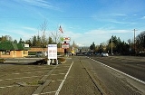
Aloha, Oregon
Encyclopedia
Aloha is a census-designated place
and an unincorporated
community in Washington County
, Oregon
, United States
. As of the 2010 Census, the population was 49,425.
, the origin of the name Aloha is disputed. Some sources say it was named by Robert Caples, a railroad worker, but it is unknown why the name was chosen. Aloha post office was established in 1912. In 1983 Joseph H. Buck claimed that his uncle, the first postmaster, Julius Buck, named the office "Aloah" after a small resort on Lake Winnebago
in Wisconsin
. Supposedly the last two letters were transposed by the Post Office Department
during the application process. The local pronunciation, however, has remained Ah-lowwa rather than Ah-lo-ha.
, the CDP has a total area of 7.4 square miles (19.2 km²), all of it land.
of 2000, there were 41,741 people, 14,228 households, and 10,841 families residing in the community. The population density
was 5,660.5 people per square mile (2,186.7/km²). There were 14,851 housing units at an average density of 2,013.9 per square mile (778.0/km²). The racial makeup of the CDP was 79.40% White, 1.35% African American, 0.78% Native American, 7.69% Asian, 0.37% Pacific Islander, 6.70% from other races
, and 3.72% from two or more races. Hispanic or Latino of any race were 12.93% of the population.
There were 14,228 households out of which 42.9% had children under the age of 18 living with them, 59.4% were married couples
living together, 11.6% had a female householder with no husband present, and 23.8% were non-families. 16.9% of all households were made up of individuals and 3.5% had someone living alone who was 65 years of age or older. The average household size was 2.92 and the average family size was 3.28.
In the community the population is spread out with 29.8% under the age of 18, 9.1% from 18 to 24, 35.0% from 25 to 44, 20.3% from 45 to 64, and 5.7% who were 65 years of age or older. The median age was 31 years. For every 100 females there were 101.5 males. For every 100 females age 18 and over, there were 99.8 males.
The median income for a household in the community is $52,299, and the median income for a family was $56,566. Males had a median income of $40,369 versus $29,921 for females. The per capita income
for the community is $19,685. About 5.6% of families and 7.9% of the population were below the poverty line, including 9.4% of those under age 18 and 5.2% of those age 65 or over.
Census-designated place
A census-designated place is a concentration of population identified by the United States Census Bureau for statistical purposes. CDPs are delineated for each decennial census as the statistical counterparts of incorporated places such as cities, towns and villages...
and an unincorporated
Unincorporated area
In law, an unincorporated area is a region of land that is not a part of any municipality.To "incorporate" in this context means to form a municipal corporation, a city, town, or village with its own government. An unincorporated community is usually not subject to or taxed by a municipal government...
community in Washington County
Washington County, Oregon
- Major highways :* Interstate 5* Interstate 205* U.S. Route 26* Oregon Route 6* Oregon Route 8* Oregon Route 10* Oregon Route 47* Oregon Route 99W* Oregon Route 210* Oregon Route 217* Oregon Route 219-Demographics:...
, Oregon
Oregon
Oregon is a state in the Pacific Northwest region of the United States. It is located on the Pacific coast, with Washington to the north, California to the south, Nevada on the southeast and Idaho to the east. The Columbia and Snake rivers delineate much of Oregon's northern and eastern...
, United States
United States
The United States of America is a federal constitutional republic comprising fifty states and a federal district...
. As of the 2010 Census, the population was 49,425.
History
The community attempted to incorporate in 1984, but the regional boundary commission halted the effort after determining the community could not provide the needed municipal services of a city.Name etymology
According to Oregon Geographic NamesOregon Geographic Names
Oregon Geographic Names is an authoritative compilation of the origin and meaning of place names in the U.S. state of Oregon. , the book is in its seventh edition and is compiled and edited by Lewis L. McArthur, who took over from his father, Lewis A. McArthur, as of the fourth edition...
, the origin of the name Aloha is disputed. Some sources say it was named by Robert Caples, a railroad worker, but it is unknown why the name was chosen. Aloha post office was established in 1912. In 1983 Joseph H. Buck claimed that his uncle, the first postmaster, Julius Buck, named the office "Aloah" after a small resort on Lake Winnebago
Lake Winnebago
Lake Winnebago is a freshwater lake in eastern Wisconsin, United States. It is the largest lake entirely within the state.-Statistics:...
in Wisconsin
Wisconsin
Wisconsin is a U.S. state located in the north-central United States and is part of the Midwest. It is bordered by Minnesota to the west, Iowa to the southwest, Illinois to the south, Lake Michigan to the east, Michigan to the northeast, and Lake Superior to the north. Wisconsin's capital is...
. Supposedly the last two letters were transposed by the Post Office Department
United States Post Office Department
The Post Office Department was the name of the United States Postal Service when it was a Cabinet department. It was headed by the Postmaster General....
during the application process. The local pronunciation, however, has remained Ah-lowwa rather than Ah-lo-ha.
Geography
According to the United States Census BureauUnited States Census Bureau
The United States Census Bureau is the government agency that is responsible for the United States Census. It also gathers other national demographic and economic data...
, the CDP has a total area of 7.4 square miles (19.2 km²), all of it land.
Demographics
As of the censusCensus
A census is the procedure of systematically acquiring and recording information about the members of a given population. It is a regularly occurring and official count of a particular population. The term is used mostly in connection with national population and housing censuses; other common...
of 2000, there were 41,741 people, 14,228 households, and 10,841 families residing in the community. The population density
Population density
Population density is a measurement of population per unit area or unit volume. It is frequently applied to living organisms, and particularly to humans...
was 5,660.5 people per square mile (2,186.7/km²). There were 14,851 housing units at an average density of 2,013.9 per square mile (778.0/km²). The racial makeup of the CDP was 79.40% White, 1.35% African American, 0.78% Native American, 7.69% Asian, 0.37% Pacific Islander, 6.70% from other races
Race (United States Census)
Race and ethnicity in the United States Census, as defined by the Federal Office of Management and Budget and the United States Census Bureau, are self-identification data items in which residents choose the race or races with which they most closely identify, and indicate whether or not they are...
, and 3.72% from two or more races. Hispanic or Latino of any race were 12.93% of the population.
There were 14,228 households out of which 42.9% had children under the age of 18 living with them, 59.4% were married couples
Marriage
Marriage is a social union or legal contract between people that creates kinship. It is an institution in which interpersonal relationships, usually intimate and sexual, are acknowledged in a variety of ways, depending on the culture or subculture in which it is found...
living together, 11.6% had a female householder with no husband present, and 23.8% were non-families. 16.9% of all households were made up of individuals and 3.5% had someone living alone who was 65 years of age or older. The average household size was 2.92 and the average family size was 3.28.
In the community the population is spread out with 29.8% under the age of 18, 9.1% from 18 to 24, 35.0% from 25 to 44, 20.3% from 45 to 64, and 5.7% who were 65 years of age or older. The median age was 31 years. For every 100 females there were 101.5 males. For every 100 females age 18 and over, there were 99.8 males.
The median income for a household in the community is $52,299, and the median income for a family was $56,566. Males had a median income of $40,369 versus $29,921 for females. The per capita income
Per capita income
Per capita income or income per person is a measure of mean income within an economic aggregate, such as a country or city. It is calculated by taking a measure of all sources of income in the aggregate and dividing it by the total population...
for the community is $19,685. About 5.6% of families and 7.9% of the population were below the poverty line, including 9.4% of those under age 18 and 5.2% of those age 65 or over.