2008 Saint John River Flood
Encyclopedia
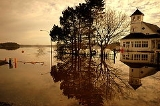
The 2008 Saint John River flood was considered the worst flooding of the Saint John River in 35 years. Flood levels reached 27 feet and 4 inches in Fredericton on May 1, almost reaching the previous record of 28 feet and 3 inches, set in 1973. Fifty streets in Fredericton area were closed as a result of the flooding. The flooding caused severe damage in areas of northern Maine
and western New Brunswick
.
By May 3, the Canadian Red Cross
had registered 680 residents who had been forced to evacuate from their homes.
Maine
Maine is a state in the New England region of the northeastern United States, bordered by the Atlantic Ocean to the east and south, New Hampshire to the west, and the Canadian provinces of Quebec to the northwest and New Brunswick to the northeast. Maine is both the northernmost and easternmost...
and western New Brunswick
New Brunswick
New Brunswick is one of Canada's three Maritime provinces and is the only province in the federation that is constitutionally bilingual . The provincial capital is Fredericton and Saint John is the most populous city. Greater Moncton is the largest Census Metropolitan Area...
.
By May 3, the Canadian Red Cross
Canadian Red Cross
The Canadian Red Cross Society is a Canadian humanitarian charitable organization and one of 186 national Red Cross and Red Crescent societies....
had registered 680 residents who had been forced to evacuate from their homes.

