
Williamstown, Kentucky
Encyclopedia
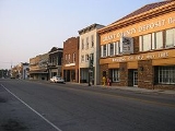
Williamstown is a city in Grant
county in the U.S. state
of Kentucky
. The population was 3,227 as of the 2000 census. It is the county seat
of Grant County.
When Grant County was formed in 1820, William Arnold offered land for the county seat. Arnold was a veteran of the Revolutionary War and settled the area in 1795. The town built there was named after him when it incorporated in 1825.
The county grew slowly, reaching a population of just 281 by 1870. The Cincinnati Southern Railway was built through the county in 1877, and Williamstown Lake
was created in 1957. Finally, I-75 was built in the 1960s.
According to the United States Census Bureau
, the city has a total area of 16.5 square miles (42.7 km²), of which, 16.0 square miles (41.3 km²) of it is land and 0.5 square miles (1.4 km²) of it (3.22%) is water.
of 2000, there were 3,227 people, 1,279 households, and 879 families residing in the city. The population density
was 202.2 people per square mile (78.1/km²). There were 1,375 housing units at an average density of 86.2 per square mile (33.3/km²). The racial makeup of the city was 97.95% White, 0.06% African American, 0.12% Native American, 0.43% Asian, 0.22% Pacific Islander, 0.81% from other races
, and 0.40% from two or more races. Hispanic or Latino of any race were 1.46% of the population.
There were 1,279 households out of which 32.0% had children under the age of 18 living with them, 52.3% were married couples
living together, 13.1% had a female householder with no husband present, and 31.2% were non-families. 28.4% of all households were made up of individuals and 15.9% had someone living alone who was 65 years of age or older. The average household size was 2.45 and the average family size was 2.98.
In the city the population was spread out with 25.8% under the age of 18, 8.5% from 18 to 24, 28.6% from 25 to 44, 20.4% from 45 to 64, and 16.6% who were 65 years of age or older. The median age was 35 years. For every 100 females there were 85.5 males. For every 100 females age 18 and over, there were 82.3 males.
The median income for a household in the city was $33,750, and the median income for a family was $44,808. Males had a median income of $31,466 versus $21,492 for females. The per capita income
for the city was $17,945. About 10.9% of families and 15.4% of the population were below the poverty line, including 16.1% of those under age 18 and 20.1% of those age 65 or over.
Grant County, Kentucky
Grant County is a county located in the U.S. state of Kentucky. It was formed in 1820. As of 2000, the population was 22,384. Its county seat is Williamstown...
county in the U.S. state
U.S. state
A U.S. state is any one of the 50 federated states of the United States of America that share sovereignty with the federal government. Because of this shared sovereignty, an American is a citizen both of the federal entity and of his or her state of domicile. Four states use the official title of...
of Kentucky
Kentucky
The Commonwealth of Kentucky is a state located in the East Central United States of America. As classified by the United States Census Bureau, Kentucky is a Southern state, more specifically in the East South Central region. Kentucky is one of four U.S. states constituted as a commonwealth...
. The population was 3,227 as of the 2000 census. It is the county seat
County seat
A county seat is an administrative center, or seat of government, for a county or civil parish. The term is primarily used in the United States....
of Grant County.
When Grant County was formed in 1820, William Arnold offered land for the county seat. Arnold was a veteran of the Revolutionary War and settled the area in 1795. The town built there was named after him when it incorporated in 1825.
The county grew slowly, reaching a population of just 281 by 1870. The Cincinnati Southern Railway was built through the county in 1877, and Williamstown Lake
Williamstown Lake
Williamstown Lake is a reservoir in Grant County, Kentucky. It was created in 1955 by impounding the South Fork of Grassy Creek....
was created in 1957. Finally, I-75 was built in the 1960s.
Geography
Williamstown is located at 38°38′28"N 84°33′39"W (38.641184, -84.560920).According to the United States Census Bureau
United States Census Bureau
The United States Census Bureau is the government agency that is responsible for the United States Census. It also gathers other national demographic and economic data...
, the city has a total area of 16.5 square miles (42.7 km²), of which, 16.0 square miles (41.3 km²) of it is land and 0.5 square miles (1.4 km²) of it (3.22%) is water.
Demographics
As of the censusCensus
A census is the procedure of systematically acquiring and recording information about the members of a given population. It is a regularly occurring and official count of a particular population. The term is used mostly in connection with national population and housing censuses; other common...
of 2000, there were 3,227 people, 1,279 households, and 879 families residing in the city. The population density
Population density
Population density is a measurement of population per unit area or unit volume. It is frequently applied to living organisms, and particularly to humans...
was 202.2 people per square mile (78.1/km²). There were 1,375 housing units at an average density of 86.2 per square mile (33.3/km²). The racial makeup of the city was 97.95% White, 0.06% African American, 0.12% Native American, 0.43% Asian, 0.22% Pacific Islander, 0.81% from other races
Race (United States Census)
Race and ethnicity in the United States Census, as defined by the Federal Office of Management and Budget and the United States Census Bureau, are self-identification data items in which residents choose the race or races with which they most closely identify, and indicate whether or not they are...
, and 0.40% from two or more races. Hispanic or Latino of any race were 1.46% of the population.
There were 1,279 households out of which 32.0% had children under the age of 18 living with them, 52.3% were married couples
Marriage
Marriage is a social union or legal contract between people that creates kinship. It is an institution in which interpersonal relationships, usually intimate and sexual, are acknowledged in a variety of ways, depending on the culture or subculture in which it is found...
living together, 13.1% had a female householder with no husband present, and 31.2% were non-families. 28.4% of all households were made up of individuals and 15.9% had someone living alone who was 65 years of age or older. The average household size was 2.45 and the average family size was 2.98.
In the city the population was spread out with 25.8% under the age of 18, 8.5% from 18 to 24, 28.6% from 25 to 44, 20.4% from 45 to 64, and 16.6% who were 65 years of age or older. The median age was 35 years. For every 100 females there were 85.5 males. For every 100 females age 18 and over, there were 82.3 males.
The median income for a household in the city was $33,750, and the median income for a family was $44,808. Males had a median income of $31,466 versus $21,492 for females. The per capita income
Per capita income
Per capita income or income per person is a measure of mean income within an economic aggregate, such as a country or city. It is calculated by taking a measure of all sources of income in the aggregate and dividing it by the total population...
for the city was $17,945. About 10.9% of families and 15.4% of the population were below the poverty line, including 16.1% of those under age 18 and 20.1% of those age 65 or over.