
Wessington Springs, South Dakota
Encyclopedia
Wessington Springs is a city in Jerauld County
, South Dakota
, United States
. The population was 956 at the 2010 census. It is the county seat
of Jerauld County
.
According to the United States Census Bureau
, the city has a total area of 1.8 square miles (4.6 km²), all of it land.
Wessington Springs has been assigned the ZIP code
57382 and the FIPS place code 70220.
The town was the home of Wessington Springs College
, an institution of higher learning that existed from 1887 until 1968.
of 2000, there were 1,011 people, 505 households, and 285 families residing in the city. The population density
was 572.9 people per square mile (221.8/km²). There were 580 housing units at an average density of 328.6 per square mile (127.2/km²). The racial makeup of the city was 99.01% White, 0.40% Native American, 0.20% Asian, and 0.40% from two or more races. Hispanic or Latino of any race were 0.30% of the population.
There were 505 households out of which 16.4% had children under the age of 18 living with them, 48.3% were married couples
living together, 5.3% had a female householder with no husband present, and 43.4% were non-families. 39.6% of all households were made up of individuals and 26.7% had someone living alone who was 65 years of age or older. The average household size was 1.92 and the average family size was 2.50.
In the city the population was spread out with 15.4% under the age of 18, 5.1% from 18 to 24, 15.6% from 25 to 44, 23.3% from 45 to 64, and 40.5% who were 65 years of age or older. The median age was 55 years. For every 100 females there were 82.2 males. For every 100 females age 18 and over, there were 79.2 males.
The median income for a household in the city was $31,736, and the median income for a family was $40,962. Males had a median income of $28,929 versus $18,333 for females. The per capita income
for the city was $23,108. About 3.4% of families and 7.2% of the population were below the poverty line, including 11.0% of those under age 18 and 8.1% of those age 65 or over.
Jerauld County, South Dakota
As of the census of 2000, there were 2,295 people, 987 households, and 651 families residing in the county. The population density was 4 people per square mile . There were 1,167 housing units at an average density of 2 per square mile . The racial makeup of the county was 99.00% White,...
, South Dakota
South Dakota
South Dakota is a state located in the Midwestern region of the United States. It is named after the Lakota and Dakota Sioux American Indian tribes. Once a part of Dakota Territory, South Dakota became a state on November 2, 1889. The state has an area of and an estimated population of just over...
, United States
United States
The United States of America is a federal constitutional republic comprising fifty states and a federal district...
. The population was 956 at the 2010 census. It is the county seat
County seat
A county seat is an administrative center, or seat of government, for a county or civil parish. The term is primarily used in the United States....
of Jerauld County
Jerauld County, South Dakota
As of the census of 2000, there were 2,295 people, 987 households, and 651 families residing in the county. The population density was 4 people per square mile . There were 1,167 housing units at an average density of 2 per square mile . The racial makeup of the county was 99.00% White,...
.
Geography
Wessington Springs is located at 44°4′55"N 98°34′13"W (44.081842, -98.570244).According to the United States Census Bureau
United States Census Bureau
The United States Census Bureau is the government agency that is responsible for the United States Census. It also gathers other national demographic and economic data...
, the city has a total area of 1.8 square miles (4.6 km²), all of it land.
Wessington Springs has been assigned the ZIP code
ZIP Code
ZIP codes are a system of postal codes used by the United States Postal Service since 1963. The term ZIP, an acronym for Zone Improvement Plan, is properly written in capital letters and was chosen to suggest that the mail travels more efficiently, and therefore more quickly, when senders use the...
57382 and the FIPS place code 70220.
History
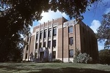
The Wessington Springs townsite was founded in 1880 and platted in 1882, early in the era of agricultural settlement in the region. The town's boom era began in 1903, when a branch line of the Milwaukee Road railroad was constructed into the town from the east.The town was the home of Wessington Springs College
Wessington Springs College
Wessington Springs College was an institution of higher learning located in Wessington Springs, Jerauld County, South Dakota. The college, affiliated with the Free Methodist Church, was founded in 1887 as "Wessington Springs Seminary." It was renamed "Wessington Springs Junior College" in 1918,...
, an institution of higher learning that existed from 1887 until 1968.
Demographics
As of the censusCensus
A census is the procedure of systematically acquiring and recording information about the members of a given population. It is a regularly occurring and official count of a particular population. The term is used mostly in connection with national population and housing censuses; other common...
of 2000, there were 1,011 people, 505 households, and 285 families residing in the city. The population density
Population density
Population density is a measurement of population per unit area or unit volume. It is frequently applied to living organisms, and particularly to humans...
was 572.9 people per square mile (221.8/km²). There were 580 housing units at an average density of 328.6 per square mile (127.2/km²). The racial makeup of the city was 99.01% White, 0.40% Native American, 0.20% Asian, and 0.40% from two or more races. Hispanic or Latino of any race were 0.30% of the population.
There were 505 households out of which 16.4% had children under the age of 18 living with them, 48.3% were married couples
Marriage
Marriage is a social union or legal contract between people that creates kinship. It is an institution in which interpersonal relationships, usually intimate and sexual, are acknowledged in a variety of ways, depending on the culture or subculture in which it is found...
living together, 5.3% had a female householder with no husband present, and 43.4% were non-families. 39.6% of all households were made up of individuals and 26.7% had someone living alone who was 65 years of age or older. The average household size was 1.92 and the average family size was 2.50.
In the city the population was spread out with 15.4% under the age of 18, 5.1% from 18 to 24, 15.6% from 25 to 44, 23.3% from 45 to 64, and 40.5% who were 65 years of age or older. The median age was 55 years. For every 100 females there were 82.2 males. For every 100 females age 18 and over, there were 79.2 males.
The median income for a household in the city was $31,736, and the median income for a family was $40,962. Males had a median income of $28,929 versus $18,333 for females. The per capita income
Per capita income
Per capita income or income per person is a measure of mean income within an economic aggregate, such as a country or city. It is calculated by taking a measure of all sources of income in the aggregate and dividing it by the total population...
for the city was $23,108. About 3.4% of families and 7.2% of the population were below the poverty line, including 11.0% of those under age 18 and 8.1% of those age 65 or over.