
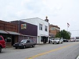
Wayne, West Virginia
Encyclopedia
Wayne County, West Virginia
As of the census of 2000, there were 42,903 people, 17,239 households, and 12,653 families residing in the county. The population density was 85 people per square mile . There were 19,107 housing units at an average density of 38 per square mile...
, West Virginia
West Virginia
West Virginia is a state in the Appalachian and Southeastern regions of the United States, bordered by Virginia to the southeast, Kentucky to the southwest, Ohio to the northwest, Pennsylvania to the northeast and Maryland to the east...
, United States
United States
The United States of America is a federal constitutional republic comprising fifty states and a federal district...
. The population was 1,105 at the 2000 census. It is the county seat
County seat
A county seat is an administrative center, or seat of government, for a county or civil parish. The term is primarily used in the United States....
of Wayne County
Wayne County, West Virginia
As of the census of 2000, there were 42,903 people, 17,239 households, and 12,653 families residing in the county. The population density was 85 people per square mile . There were 19,107 housing units at an average density of 38 per square mile...
. Wayne is a part of the Huntington-Ashland, WV-KY-OH, Metropolitan Statistical Area
Huntington-Ashland, WV-KY-OH, Metropolitan Statistical Area
The Huntington-Ashland-Ironton metropolitan area is a United States metropolitan area that includes five counties in West Virginia, Kentucky and Ohio. As of the 2000 census, the MSA had a population of 288,649. A July 1, 2009 estimate placed the population at 285,624. The MSA is nestled along the...
. As of the 2000 census, the MSA had a population of 288,649.
Wayne was established in 1842, by the same act of the Virginia General Assembly
Virginia General Assembly
The Virginia General Assembly is the legislative body of the Commonwealth of Virginia, and the oldest legislative body in the Western Hemisphere, established on July 30, 1619. The General Assembly is a bicameral body consisting of a lower house, the Virginia House of Delegates, with 100 members,...
that created Wayne County. The county was named for General "Mad Anthony" Wayne
Anthony Wayne
Anthony Wayne was a United States Army general and statesman. Wayne adopted a military career at the outset of the American Revolutionary War, where his military exploits and fiery personality quickly earned him a promotion to the rank of brigadier general and the sobriquet of Mad Anthony.-Early...
. The town was initially known by the name "Trout's Hill," after Abraham Trout, who donated the land upon which the county's courthouse
Courthouse
A courthouse is a building that is home to a local court of law and often the regional county government as well, although this is not the case in some larger cities. The term is common in North America. In most other English speaking countries, buildings which house courts of law are simply...
was built. The Wayne Courthouse Post Office was established in 1842 also. The town was known simultaneously as Trout's Hill and Wayne Courthouse for many years. The town was incorporated in 1882 as Fairview, but was still commonly known as Wayne Courthouse. The population in 1882 was 157. In 1891, the Norfolk & Western Railroad was constructed up Twelve Pole Creek. The railroad placed the name "Wayne" on its schedule and the name caught on. The name was officially changed to Wayne in 1911.
| 1st Name | 2nd Name | 3rd Name | 4th Name |
|---|---|---|---|
| Trout's Hill | Wayne Court House | Fairview | Wayne |
| 1842-ca 1860 | 1842–1892 | 1860–1892 | 1892–present |
| Population 1882 | 1890 | 1910 | 1946 | 1947 | 1979 | 2000 |
|---|---|---|---|---|---|---|
| 157 | 361 | 884 | abt 800 | abt 1000 | abt 1500 | 1105 |
Geography
Wayne is located at 38°13′42"N 82°26′26"W (38.228417, -82.440577), along Twelvepole CreekTwelvepole Creek
Twelvepole Creek is a river located in Wayne County, West Virginia. It is part of the Mississippi River watershed, by way of the Ohio River.-Course:...
, at an elevation of 707 feet (215 m).
According to the United States Census Bureau
United States Census Bureau
The United States Census Bureau is the government agency that is responsible for the United States Census. It also gathers other national demographic and economic data...
, the town has a total area of 0.6 square miles (1.7 km²), all land.it was founded in 1789
Demographics
As of the censusCensus
A census is the procedure of systematically acquiring and recording information about the members of a given population. It is a regularly occurring and official count of a particular population. The term is used mostly in connection with national population and housing censuses; other common...
of 2000, there were 1,105 people, 486 households, and 322 families residing in the town. The population density
Population density
Population density is a measurement of population per unit area or unit volume. It is frequently applied to living organisms, and particularly to humans...
was 1,698.1 inhabitants per square mile (656.4/km²). There were 561 housing units at an average density of 862.1 per square mile (333.2/km²). The racial makeup of the town was 98.01% White, 0.09% African American, 0.27% Native American, 0.18% Asian, 0.36% from other races
Race (United States Census)
Race and ethnicity in the United States Census, as defined by the Federal Office of Management and Budget and the United States Census Bureau, are self-identification data items in which residents choose the race or races with which they most closely identify, and indicate whether or not they are...
, and 1.09% from two or more races. Hispanic or Latino of any race were 0.45% of the population.
There were 486 households out of which 30.0% had children under the age of 18 living with them, 48.8% were married couples
Marriage
Marriage is a social union or legal contract between people that creates kinship. It is an institution in which interpersonal relationships, usually intimate and sexual, are acknowledged in a variety of ways, depending on the culture or subculture in which it is found...
living together, 14.0% had a female householder with no husband present, and 33.7% were non-families. 31.3% of all households were made up of individuals and 15.4% had someone living alone who was 65 years of age or older. The average household size was 2.23 and the average family size was 2.77.
In the town the population was spread out with 22.6% under the age of 18, 9.6% from 18 to 24, 29.0% from 25 to 44, 22.4% from 45 to 64, and 16.4% who were 65 years of age or older. The median age was 37 years. For every 100 females there were 87.6 males. For every 100 females age 18 and over, there were 83.5 males.
The median income for a household in the town was $20,242, and the median income for a family was $24,750. Males had a median income of $27,292 versus $23,500 for females. The per capita income
Per capita income
Per capita income or income per person is a measure of mean income within an economic aggregate, such as a country or city. It is calculated by taking a measure of all sources of income in the aggregate and dividing it by the total population...
for the town was $11,626. About 25.3% of families and 30.3% of the population were below the poverty line, including 32.6% of those under age 18 and 20.6% of those age 65 or over.