
Warburton Highway
Encyclopedia
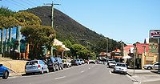
Warburton Highway is a 35 kilometre west-east highway
starting on the eastern fringes of Melbourne
, Victoria (Australia)
at the Maroondah Highway
just after Lilydale, connecting Melbourne to the Yarra Valley
wine region and its towns. The entire road is within the Shire of Yarra Ranges
local government area. It is a single carriageway
for its entire length and was completely sealed in 1941.
Warburton Highway continutes east of Warburton
as Woods Point Road, .
.
Highway
A highway is any public road. In American English, the term is common and almost always designates major roads. In British English, the term designates any road open to the public. Any interconnected set of highways can be variously referred to as a "highway system", a "highway network", or a...
starting on the eastern fringes of Melbourne
Melbourne
Melbourne is the capital and most populous city in the state of Victoria, and the second most populous city in Australia. The Melbourne City Centre is the hub of the greater metropolitan area and the Census statistical division—of which "Melbourne" is the common name. As of June 2009, the greater...
, Victoria (Australia)
Victoria (Australia)
Victoria is the second most populous state in Australia. Geographically the smallest mainland state, Victoria is bordered by New South Wales, South Australia, and Tasmania on Boundary Islet to the north, west and south respectively....
at the Maroondah Highway
Maroondah Highway
Maroondah Highway , is a major east-west thoroughfare in the eastern suburbs of Melbourne and a highway servicing the lower alpine region Victoria, Australia.-History:...
just after Lilydale, connecting Melbourne to the Yarra Valley
Yarra Valley
The Yarra Valley is the name given to the region surrounding the Yarra River in Victoria, Australia. The river originates approximately 90 kilometres east of the City of Melbourne and flows towards it and out into Port Phillip Bay...
wine region and its towns. The entire road is within the Shire of Yarra Ranges
Shire of Yarra Ranges
The Yarra Ranges Shire is a Local Government Area in Victoria, Australia, located in the outer eastern and northeastern suburbs of Melbourne extending into the Yarra Valley and Dandenong Ranges...
local government area. It is a single carriageway
Single carriageway
A single carriageway is a road with 1, 2 or more lanes arranged within a single carriageway with no central reservation to separate opposing flows of traffic. Two-lane road or two-lane highway are single carriageway with one lane for each direction...
for its entire length and was completely sealed in 1941.
Warburton Highway continutes east of Warburton
Warburton, Victoria
Warburton is a town in Victoria, Australia, 72 km east from Melbourne's central business district. Its Local Government Area is the Shire of Yarra Ranges. At the 2006 Census, Warburton had a population of 2288....
as Woods Point Road,
.Major intersections and towns
Warburton Highway  |
|||
| Westbound | Distance to Melbourne (km) |
Distance to Warburton (km) |
Eastbound |
 Traffic Lights (clockwise from highway) Traffic Lights (clockwise from highway) Maroondah Highway Maroondah Highway Maroondah Highway , is a major east-west thoroughfare in the eastern suburbs of Melbourne and a highway servicing the lower alpine region Victoria, Australia.-History:...  to Lilydale to LilydaleLilydale, Victoria Lilydale is a suburb of Melbourne, Victoria, Australia, 35 km north-east from Melbourne's central business district situated in the Olinda Creek valley. At the 2006 Census, Lilydale had a population of 13,887... and Melbourne Maroondah Highway Maroondah Highway Maroondah Highway , is a major east-west thoroughfare in the eastern suburbs of Melbourne and a highway servicing the lower alpine region Victoria, Australia.-History:...  to Yarra Glen to Yarra GlenYarra Glen, Victoria Yarra Glen is a town in Victoria, Australia, 40 km north-east from Melbourne's central business district. Its Local Government Area is the Shire of Yarra Ranges... and Yea Yea, Victoria Yea is a town in Victoria, Australia. It is in the Shire of Murrindindi local government area. Located north-east of Melbourne via the Melba Highway, Yea sits at the junction with the Goulburn Valley Highway, and above sea-level. At the 2006 Census, Yea had a population of 1,052.- History :The... |
|||
| End Warburton Highway |
44 | 34 | Start Warburton Highway |
| Wandin North Wandin North, Victoria Wandin North is a suburb in Melbourne, Victoria, Australia, 40 km north-east from Melbourne's central business district. Its Local Government Area is the Shire of Yarra Ranges. At the 2006 Census, Wandin North had a population of 1655.-History:... |
51 | 27 | Wandin North Wandin North, Victoria Wandin North is a suburb in Melbourne, Victoria, Australia, 40 km north-east from Melbourne's central business district. Its Local Government Area is the Shire of Yarra Ranges. At the 2006 Census, Wandin North had a population of 1655.-History:... |
| Mount Evelyn Mount Evelyn, Victoria Mount Evelyn is a suburb in Melbourne, Victoria, Australia, 37 km north-east from Melbourne's central business district. Its Local Government Area is the Shire of Yarra Ranges. At the 2006 Census, Mount Evelyn had a population of 9100.-History:... , Montrose Montrose, Victoria Montrose is a suburb in Melbourne, Victoria, Australia, 33 km east from Melbourne's central business district. Its Local Government Area is the Shire of Yarra Ranges. At the 2006 Census, Montrose had a population of 6464.... Clegg Road  .svg.png) |
51.5 | 26.5 | Mount Evelyn Mount Evelyn, Victoria Mount Evelyn is a suburb in Melbourne, Victoria, Australia, 37 km north-east from Melbourne's central business district. Its Local Government Area is the Shire of Yarra Ranges. At the 2006 Census, Mount Evelyn had a population of 9100.-History:... Clegg Road |
| Seville Seville, Victoria Seville is a suburb to the east of Melbourne, the capital city of Victoria, Australia, along Warburton Highway. Its Local Government Area is the Shire of Yarra Ranges and sits within the Yarra Valley wine region. It is serviced by Metlink bus 683 from Chirnside Park to Warburton via Lilydale... |
52.8 | 25.2 | Seville Seville, Victoria Seville is a suburb to the east of Melbourne, the capital city of Victoria, Australia, along Warburton Highway. Its Local Government Area is the Shire of Yarra Ranges and sits within the Yarra Valley wine region. It is serviced by Metlink bus 683 from Chirnside Park to Warburton via Lilydale... |
| Monbulk Monbulk, Victoria Monbulk is a satellite town & suburb of Melbourne located 42 km east from Melbourne's central business district. Its Local Government Area is the Shire of Yarra Ranges. At the 2006 Census, Monbulk had a population of 2715.-History:... Monbulk-Seville Road  |
53 | 25 | Monbulk Monbulk, Victoria Monbulk is a satellite town & suburb of Melbourne located 42 km east from Melbourne's central business district. Its Local Government Area is the Shire of Yarra Ranges. At the 2006 Census, Monbulk had a population of 2715.-History:... Monbulk-Seville Road |
| Woori Yallock Woori Yallock, Victoria Woori Yallock is a town in Victoria, Australia, 56 km east of Melbourne's central business district. Its Local Government Area is the Shire of Yarra Ranges... |
59.6 | 18.4 | Woori Yallock Woori Yallock, Victoria Woori Yallock is a town in Victoria, Australia, 56 km east of Melbourne's central business district. Its Local Government Area is the Shire of Yarra Ranges... |
| Healesville Healesville, Victoria Healesville is a town in Victoria, Australia, 52 km north-east from Melbourne's central business district. Its Local Government Area is the Shire of Yarra Ranges... , Toolangi Healesville-Koo Wee Rup Road  |
Healesville Healesville, Victoria Healesville is a town in Victoria, Australia, 52 km north-east from Melbourne's central business district. Its Local Government Area is the Shire of Yarra Ranges... , Toolangi Healesville-Koo Wee Rup Road |
||
| Cockatoo Cockatoo, Victoria Cockatoo is a town in Victoria, Australia, 48 km south-east from Melbourne's central business district. Its Local Government Area is the Shire of Cardinia. At the 2006 Census, Cockatoo had a population of 4,560.... , Pakenham Pakenham, Victoria Pakenham is a satellite suburb of Melbourne on the edge of the West Gippsland region of Victoria, Australia, south-east from Melbourne's central business district. Its Local Government Area is Cardinia Shire. At the 2006 Census, Pakenham had a population of 19,644... , Koo Wee Rup Koo Wee Rup, Victoria Koo Wee Rup is a town in Victoria, Australia, 63 km south-east from Melbourne's central business district. Its Local Government Area is the Shire of Cardinia... Healesville-Koo Wee Rup Road .svg.png) |
59.7 | 18.3 | Cockatoo Cockatoo, Victoria Cockatoo is a town in Victoria, Australia, 48 km south-east from Melbourne's central business district. Its Local Government Area is the Shire of Cardinia. At the 2006 Census, Cockatoo had a population of 4,560.... , Pakenham Pakenham, Victoria Pakenham is a satellite suburb of Melbourne on the edge of the West Gippsland region of Victoria, Australia, south-east from Melbourne's central business district. Its Local Government Area is Cardinia Shire. At the 2006 Census, Pakenham had a population of 19,644... , Koo Wee Rup Koo Wee Rup, Victoria Koo Wee Rup is a town in Victoria, Australia, 63 km south-east from Melbourne's central business district. Its Local Government Area is the Shire of Cardinia... Healesville-Koo Wee Rup Road |
| Launching Place Launching Place, Victoria Launching Place is a town in Victoria, Australia, 54 km east from Melbourne's central business district. Its Local Government Area is the Shire of Yarra Ranges... |
63.5 | 14.5 | Launching Place Launching Place, Victoria Launching Place is a town in Victoria, Australia, 54 km east from Melbourne's central business district. Its Local Government Area is the Shire of Yarra Ranges... |
| Gembrook Gembrook, Victoria Gembrook is a town in Victoria, Australia, 54 km south-east from Melbourne's central business district. Its Local Government Area is the Shire of Cardinia... , Pakenham Pakenham, Victoria Pakenham is a satellite suburb of Melbourne on the edge of the West Gippsland region of Victoria, Australia, south-east from Melbourne's central business district. Its Local Government Area is Cardinia Shire. At the 2006 Census, Pakenham had a population of 19,644... Gembrook-Launching Place Road  |
64.5 | 13.5 | Gembrook Gembrook, Victoria Gembrook is a town in Victoria, Australia, 54 km south-east from Melbourne's central business district. Its Local Government Area is the Shire of Cardinia... , Pakenham Pakenham, Victoria Pakenham is a satellite suburb of Melbourne on the edge of the West Gippsland region of Victoria, Australia, south-east from Melbourne's central business district. Its Local Government Area is Cardinia Shire. At the 2006 Census, Pakenham had a population of 19,644... Gembrook-Launching Place Road |
| Healesville Healesville, Victoria Healesville is a town in Victoria, Australia, 52 km north-east from Melbourne's central business district. Its Local Government Area is the Shire of Yarra Ranges... , Mount Donna Buang Mount Donna Buang Located approximately 80 km from Melbourne, Mount Donna Buang in Victoria, Australia, at is the closest snowfield to Melbourne.In winter, it usually receives snow suitable for snowplay and tobogganing, and during the non winter months the area is well visited by bushwalkers... Don Road  |
65.5 | 12.5 | Healesville Healesville, Victoria Healesville is a town in Victoria, Australia, 52 km north-east from Melbourne's central business district. Its Local Government Area is the Shire of Yarra Ranges... , Mount Donna Buang Mount Donna Buang Located approximately 80 km from Melbourne, Mount Donna Buang in Victoria, Australia, at is the closest snowfield to Melbourne.In winter, it usually receives snow suitable for snowplay and tobogganing, and during the non winter months the area is well visited by bushwalkers... Don Road |
| Yarra Junction Yarra Junction, Victoria Yarra Junction is a town in Victoria, Australia, east from Melbourne's central business district. It sits at the junction of the Yarra and Little Yarra Rivers. Its Local Government Area is the Shire of Yarra Ranges... |
68 | 10 | Yarra Junction Yarra Junction, Victoria Yarra Junction is a town in Victoria, Australia, east from Melbourne's central business district. It sits at the junction of the Yarra and Little Yarra Rivers. Its Local Government Area is the Shire of Yarra Ranges... |
| Noojee Noojee, Victoria Noojee is a town in the Gippsland region of Victoria, Australia, located north of Warragul and east of Melbourne, in the Baw Baw local government area. At the 2006 census, Noojee and the surrounding area had a population of 261.... , Warragul Warragul, Victoria Warragul is a rural centre with a population of 12,943 people east-southeast of Melbourne in Victoria. Warragul lies between the Strzelecki Ranges to the south and the Mount Baw Baw Plateau of the Great Dividing Range to the north... , Korumburra Korumburra, Victoria Korumburra is a town in the Australian state of Victoria. It is located on the South Gippsland Highway, kilometres south-east of Melbourne, in the South Gippsland Shire local government area.... , Mount Baw Baw Mount Baw Baw Mount Baw Baw is a mountain in Victoria, Australia. Mount Baw Baw Alpine Resort is an Unincorporated area of Victoria surrounded by the Shire of Baw Baw.-Location:... Yarra Junction-Noojee Road  |
67.1 | 9.9 | Noojee Noojee, Victoria Noojee is a town in the Gippsland region of Victoria, Australia, located north of Warragul and east of Melbourne, in the Baw Baw local government area. At the 2006 census, Noojee and the surrounding area had a population of 261.... , Warragul Warragul, Victoria Warragul is a rural centre with a population of 12,943 people east-southeast of Melbourne in Victoria. Warragul lies between the Strzelecki Ranges to the south and the Mount Baw Baw Plateau of the Great Dividing Range to the north... , Korumburra Korumburra, Victoria Korumburra is a town in the Australian state of Victoria. It is located on the South Gippsland Highway, kilometres south-east of Melbourne, in the South Gippsland Shire local government area.... , Mount Baw Baw Mount Baw Baw Mount Baw Baw is a mountain in Victoria, Australia. Mount Baw Baw Alpine Resort is an Unincorporated area of Victoria surrounded by the Shire of Baw Baw.-Location:... Yarra Junction-Noojee Road |
| Warburton Warburton, Victoria Warburton is a town in Victoria, Australia, 72 km east from Melbourne's central business district. Its Local Government Area is the Shire of Yarra Ranges. At the 2006 Census, Warburton had a population of 2288.... |
78 | 0 | Warburton Warburton, Victoria Warburton is a town in Victoria, Australia, 72 km east from Melbourne's central business district. Its Local Government Area is the Shire of Yarra Ranges. At the 2006 Census, Warburton had a population of 2288.... |
| Mount Donna Buang Mount Donna Buang Located approximately 80 km from Melbourne, Mount Donna Buang in Victoria, Australia, at is the closest snowfield to Melbourne.In winter, it usually receives snow suitable for snowplay and tobogganing, and during the non winter months the area is well visited by bushwalkers... , Alexandra Alexandra, Victoria Alexandra is a town in Victoria, Australia. It is located at the junction of the Goulburn Valley Highway and Maroondah Highway , 26 kilometres west of Eildon, in the Shire of Murrindindi local government area... Donna Buang Road  |
77 | -- | Mount Donna Buang Mount Donna Buang Located approximately 80 km from Melbourne, Mount Donna Buang in Victoria, Australia, at is the closest snowfield to Melbourne.In winter, it usually receives snow suitable for snowplay and tobogganing, and during the non winter months the area is well visited by bushwalkers... , Alexandra Alexandra, Victoria Alexandra is a town in Victoria, Australia. It is located at the junction of the Goulburn Valley Highway and Maroondah Highway , 26 kilometres west of Eildon, in the Shire of Murrindindi local government area... Donna Buang Road |
| Start Warburton Highway from Woods Point Road |
End Warburton Highway continues as Woods Point Road to Reefton Reefton, Victoria Reefton is a bounded rural locality in Victoria, Australia, on the Warburton Woods Point Road. Its Local Government Area is the Shire of Yarra Ranges. At the 2006 Census, Reefton had a population of 325. The Upper Yarra Reservoir lies within the locality.... / Marysville Marysville, Victoria Marysville is a small town, 34 kilometres north-east of Healesville, in the Shire of Murrindindi in Victoria, Australia. The town, which previously had a population of around 500 people, was devastated by the Murrindindi Mill bushfire on 7 February 2009. On 19 February 2009 the official death toll... |
||
External links
- Warburton Highway (Yarra Valley Tourism Association)
See also
- Highways in AustraliaHighways in AustraliaThis is a list of highways in Australia, listed alphabetically along with each highway's route number and location. Note that some highways service more than one state or territory.-Route numbering systems:...
- Highways in VictoriaHighways in VictoriaThe Highways in Victoria are the highest density in any state in Australia. Unlike Australia's other mainland states where vast areas are very sparsely inhabited "outback", there are population centres spread out over most of the state, with only the far north-west and the Victorian Alps lacking...