
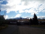
Walkerville, Montana
Encyclopedia
Walkerville is a town in Silver Bow County
, Montana
, United States
. The population was 675 at the 2010 census. Walkerville is a suburb of Butte
.
Part of Walkerville is included in the Butte-Anaconda Historic District
. Walkerville represents some of the earliest mines in the district and preserves the early mining camp flavor present in the 1890s to 1910s.
, which surrounds it.
According to the United States Census Bureau
, the town has a total area of 2.2 square miles (5.7 km²), all of it land.
of 2000, there were 714 people, 297 households, and 195 families residing in the town. The population density
was 325.1 people per square mile (125.3/km²). There were 343 housing units at an average density of 156.2 per square mile (60.2/km²). The racial makeup of the town was 94.26% White, 0.14% African American, 4.06% Native American, 0.28% Asian, 0.70% from other races
, and 0.56% from two or more races. Hispanic or Latino of any race were 3.22% of the population.
There were 297 households out of which 31.3% had children under the age of 18 living with them, 49.5% were married couples
living together, 11.1% had a female householder with no husband present, and 34.3% were non-families. 30.6% of all households were made up of individuals and 11.4% had someone living alone who was 65 years of age or older. The average household size was 2.40 and the average family size was 3.00.
In the town the population was spread out with 25.5% under the age of 18, 8.7% from 18 to 24, 27.3% from 25 to 44, 25.5% from 45 to 64, and 13.0% who were 65 years of age or older. The median age was 37 years. For every 100 females there were 97.8 males. For every 100 females age 18 and over, there were 102.3 males.
The median income for a household in the town was $28,009, and the median income for a family was $29,861. Males had a median income of $27,404 versus $19,063 for females. The per capita income
for the town was $14,156. About 9.9% of families and 12.1% of the population were below the poverty line, including 18.8% of those under age 18 and 5.0% of those age 65 or over.
Silver Bow County, Montana
-National protected areas:*Beaverhead National Forest *Deerlodge National Forest -Demographics:As of the census of 2000, there were 34,606 people, 14,432 households, and 8,933 families residing in the county. The population density was 48 people per square mile . There were 16,176 housing units at...
, Montana
Montana
Montana is a state in the Western United States. The western third of Montana contains numerous mountain ranges. Smaller, "island ranges" are found in the central third of the state, for a total of 77 named ranges of the Rocky Mountains. This geographical fact is reflected in the state's name,...
, United States
United States
The United States of America is a federal constitutional republic comprising fifty states and a federal district...
. The population was 675 at the 2010 census. Walkerville is a suburb of Butte
Butte, Montana
Butte is a city in Montana and the county seat of Silver Bow County, United States. In 1977, the city and county governments consolidated to form the sole entity of Butte-Silver Bow. As of the 2010 census, Butte's population was 34,200...
.
Part of Walkerville is included in the Butte-Anaconda Historic District
Butte-Anaconda Historic District
Butte-Anaconda Historic District is a historic district that spans parts of Walkerville, Butte and Anaconda, Montana. It has the most resources of any U.S...
. Walkerville represents some of the earliest mines in the district and preserves the early mining camp flavor present in the 1890s to 1910s.
Geography
Walkerville is located at 46°1′48"N 112°32′18"W (46.029963, -112.538348). It is the only part of Silver Bow County not within the city of ButteButte, Montana
Butte is a city in Montana and the county seat of Silver Bow County, United States. In 1977, the city and county governments consolidated to form the sole entity of Butte-Silver Bow. As of the 2010 census, Butte's population was 34,200...
, which surrounds it.
According to the United States Census Bureau
United States Census Bureau
The United States Census Bureau is the government agency that is responsible for the United States Census. It also gathers other national demographic and economic data...
, the town has a total area of 2.2 square miles (5.7 km²), all of it land.
Demographics
As of the censusCensus
A census is the procedure of systematically acquiring and recording information about the members of a given population. It is a regularly occurring and official count of a particular population. The term is used mostly in connection with national population and housing censuses; other common...
of 2000, there were 714 people, 297 households, and 195 families residing in the town. The population density
Population density
Population density is a measurement of population per unit area or unit volume. It is frequently applied to living organisms, and particularly to humans...
was 325.1 people per square mile (125.3/km²). There were 343 housing units at an average density of 156.2 per square mile (60.2/km²). The racial makeup of the town was 94.26% White, 0.14% African American, 4.06% Native American, 0.28% Asian, 0.70% from other races
Race (United States Census)
Race and ethnicity in the United States Census, as defined by the Federal Office of Management and Budget and the United States Census Bureau, are self-identification data items in which residents choose the race or races with which they most closely identify, and indicate whether or not they are...
, and 0.56% from two or more races. Hispanic or Latino of any race were 3.22% of the population.
There were 297 households out of which 31.3% had children under the age of 18 living with them, 49.5% were married couples
Marriage
Marriage is a social union or legal contract between people that creates kinship. It is an institution in which interpersonal relationships, usually intimate and sexual, are acknowledged in a variety of ways, depending on the culture or subculture in which it is found...
living together, 11.1% had a female householder with no husband present, and 34.3% were non-families. 30.6% of all households were made up of individuals and 11.4% had someone living alone who was 65 years of age or older. The average household size was 2.40 and the average family size was 3.00.
In the town the population was spread out with 25.5% under the age of 18, 8.7% from 18 to 24, 27.3% from 25 to 44, 25.5% from 45 to 64, and 13.0% who were 65 years of age or older. The median age was 37 years. For every 100 females there were 97.8 males. For every 100 females age 18 and over, there were 102.3 males.
The median income for a household in the town was $28,009, and the median income for a family was $29,861. Males had a median income of $27,404 versus $19,063 for females. The per capita income
Per capita income
Per capita income or income per person is a measure of mean income within an economic aggregate, such as a country or city. It is calculated by taking a measure of all sources of income in the aggregate and dividing it by the total population...
for the town was $14,156. About 9.9% of families and 12.1% of the population were below the poverty line, including 18.8% of those under age 18 and 5.0% of those age 65 or over.