

Varzelândia
Encyclopedia
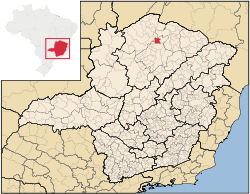
Minas Gerais
Minas Gerais is one of the 26 states of Brazil, of which it is the second most populous, the third richest, and the fourth largest in area. Minas Gerais is the Brazilian state with the largest number of Presidents of Brazil, the current one, Dilma Rousseff, being one of them. The capital is the...
. As of 2007 the population was 19,137 in a total area of 804 km². It became a municipality in 1962.
Location
Varzelândia is located at an elevation of 608 meters between the São Francisco RiverSão Francisco River
The São Francisco is a river in Brazil. With a length of , it is the longest river that runs entirely in Brazilian territory, and the fourth longest in South America and overall in Brazil...
and Brasília de Minas
Brasília de Minas
Brasília de Minas is a Brazilian municipality located in the north of the state of Minas Gerais. In 2007 the population was 42,165 in a total area of 1,398 km². It became a municipality in 1923....
. It is connected by state highway (partially paved) to São Romão
São Romão
São Romão is a Brazilian municipality located in the north of the state of Minas Gerais. In 2007 the population was 9,080 in a total area of 2,432 km². It became a municipality in 1943.-Location and Distances:...
on the São Francisco River
São Francisco River
The São Francisco is a river in Brazil. With a length of , it is the longest river that runs entirely in Brazilian territory, and the fourth longest in South America and overall in Brazil...
. It belongs to the statistical microregion of Montes Claros
Montes Claros
Montes Claros is a city located in northern Minas Gerais state, in Brazil. The estimated population in 2010 was 412,284 inhabitants and the total area of the municipality was 3,470 km²...
. Neighboring municipalities are Verdelândia
Verdelândia
Verdelândia is a municipality in the north of the Brazilian state of Minas Gerais. As of 2007 the population was 8,029 in a total area of 1,452 km². It became a municipality in 1997.-Location:...
, São João da Ponte
São João da Ponte
São João da Ponte is a municipality in the north of the Brazilian state of Minas Gerais. As of 2007, the population numbered 26,091 within the total area of 1,849 km². The elevation is 561 meters. It became a municipality in 1943....
, Ibiracatu
Ibiracatu
Ibiracatu is a Brazilian municipality located in the north of the state of Minas Gerais. In 2007 the population was 5,898 in a total area of 359 km². It became a municipality in 1995.-Location and distances:...
, and Jaíba
Jaíba
Jaíba is a municipality in the north of the Brazilian state of Minas Gerais. As of 2007 the population was 30,386 in a total area of 2,733 km². The elevation is 475 meters. It became a municipality in 1993. The postal code is 39508-000....
.
Distances
- Belo HorizonteBelo HorizonteBelo Horizonte is the capital of and largest city in the state of Minas Gerais, located in the southeastern region of Brazil. It is the third largest metropolitan area in the country...
: 584 km. - Montes ClarosMontes ClarosMontes Claros is a city located in northern Minas Gerais state, in Brazil. The estimated population in 2010 was 412,284 inhabitants and the total area of the municipality was 3,470 km²...
: 120 km. - São João da PonteSão João da PonteSão João da Ponte is a municipality in the north of the Brazilian state of Minas Gerais. As of 2007, the population numbered 26,091 within the total area of 1,849 km². The elevation is 561 meters. It became a municipality in 1943....
: 24 km.
Economic activities
The most important economic activities are cattle raising, commerce, and subsistence agriculture. The GDP in 2005 was R$ 51,176,000. Varzelândia is in the bottom tier of municipalities in the state with regard to economic and social development. It suffers from isolation, poor soils, and periodic drought. As of 2007 there was 01 banking agency in the town. There was a small retail commerce serving the surrounding area of cattle and agricultural lands. In the rural area there were 1,552 establishments employing about 6,200 workers. Only 26 of the farms had tractors. There were 469 automobiles in all of the municipality. There were 28,000 head of cattle in 2006. The crops with a planted area of more than 100 hectares were beans, sugarcane, manioc, and corn.Health and education
In the health sector there were 08 clinics and 01 hospital with 28 beds. In the educational sector there were 32 primary schools and 04 middle schools.- Municipal Human Development IndexHuman Development IndexThe Human Development Index is a composite statistic used to rank countries by level of "human development" and separate "very high human development", "high human development", "medium human development", and "low human development" countries...
: 0.631 (2000) - State ranking: 790 out of 853 municipalities as of 2000
- National ranking: 4,109 out of 5,138 municipalities as of 2000
The highest ranking municipality in Minas Gerais in 2000 was Poços de Caldas
Poços de Caldas
Poços de Caldas is a city and municipality in south-western Minas Gerais state, Brazil, in the microregion of the same name. Its estimated population in 2009 was 151,449 inhabitants...
with 0.841, while the lowest was Setubinha
Setubinha
Setubinha is a municipality in the northeast of the Brazilian state of Minas Gerais. As of 2007 the population was 10,834 in a total area of 536 km². The elevation is 729 metres. It is part of the IBGE statistical microregion of Teófilo Otoni...
with 0.568. Nationally the highest was São Caetano do Sul
São Caetano do Sul
São Caetano do Sul is a city in São Paulo state in Brazil, located in the Greater São Paulo Metropolitan Area. It is the city with the highest per capita income in Brazil and it also has the highest Human Development Index .-Geography:São Caetano do Sul is located on a plateau that is part of the...
in São Paulo with 0.919, while the lowest was Setubinha. In more recent statistics (considering 5,507 municipalities) Manari in the state of Pernambuco
Pernambuco
Pernambuco is a state of Brazil, located in the Northeast region of the country. To the north are the states of Paraíba and Ceará, to the west is Piauí, to the south are Alagoas and Bahia, and to the east is the Atlantic Ocean. There are about of beaches, some of the most beautiful in the...
has the lowest rating in the country—0,467—putting it in last place.
- Literacy rate: 65%
- Life expectancy: 67 (average of males and females)
- Urbanization rate: 44.50%
- Percentage of urban houses connected to sewage system: 18.70
- Infant mortality rate: 5.92
See also
- List of municipalities in Minas Gerais