

Van Keulenfjorden
Encyclopedia
Spitsbergen
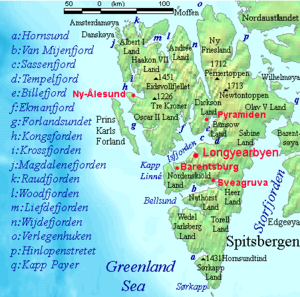
Spitsbergen is the largest and only permanently populated island of the Svalbard archipelago in Norway. Constituting the western-most bulk of the archipelago, it borders the Arctic Ocean, the Norwegian Sea and the Greenland Sea...
separting Nathorst Land
Nathorst Land
Nathorst Land is the land area between Van Keulenfjorden and Van Mijenfjorden on Spitsbergen, Svalbard.The area is named after Alfred Gabriel Nathorst....
to the north and Wedel Jarlsberg Land
Wedel Jarlsberg Land
Wedel Jarlsberg Land is the land area between Van Keulenfjorden and Hornsund on the southwestern part of Spitsbergen, Svalbard. The area is largely covered with glaciers, and is completely within the Sør-Spitsbergen National Park. Wedel Jarlsberg Land is named after Baron Fritz Wedel Jarlsberg....
to the south. Van Keulenfjorden is separated from Bellsund
Bellsund
Bellsund is a 20 km long sound on the west coast of Spitsbergen, part of the Svalbard archipelago.-History:Bellsund was first seen by William Barents in 1596. He simply referred to it as Inwyck . In 1610 Jonas Poole explored Bellsund, giving the fjord the name it retains to this day. He named it...
by Forsbladodden in the north and Richardodden to the south.
History
WhalingWhaling
Whaling is the hunting of whales mainly for meat and oil. Its earliest forms date to at least 3000 BC. Various coastal communities have long histories of sustenance whaling and harvesting beached whales...
occurred here at least as early as 1613, when a little pinnace
Pinnace (ship's boat)
As a ship's boat the pinnace is a light boat, propelled by sails or oars, formerly used as a "tender" for guiding merchant and war vessels. In modern parlance, pinnace has come to mean a boat associated with some kind of larger vessel, that doesn't fit under the launch or lifeboat definitions...
from St. Jean de Luz was said to have been behind Eders Island
Eholmen
Eholmen is a 1.5km long island in the divide between Bellsund and Van Keulenfjorden, on the west coast of Spitsbergen. It is the southwesternmost point of Nathorst Land.-References:* Norwegian Polar Institute...
(at the mouth of Van Keulenfjorden). Van Keulenfjorden was originally called Sardam (Zaandam) Bay by the Dutch, and is labeled as such on maps from 1620 to 1710, when Cornelis Giles and Outger Rep (c. 1710) added the name Van Keulens baaytje to the anchorage behind Eders Island. The bay was named in honor of their publisher, Gerard van Keulen. William Scoresby
William Scoresby
William Scoresby , was an English Arctic explorer, scientist and clergyman.-Early years:Scoresby was born in the village of Cropton near Pickering 26 miles south of Whitby in Yorkshire. His father, William Scoresby , made a fortune in the Arctic whale fishery...
(1820), thinking the name applied to the fjord as a whole, labeled it Van Keulens Bay. This mistake has been repeated by map-makers to the present day.