

Utah State Route 55
Encyclopedia
State Route 55 is a short highway
that loops around the town of Price
in central Utah
, beginning and ending at US-6/US-191 in a span of three miles (5 km). US-6 Business is cosigned with the route.
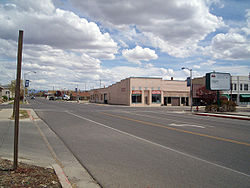 From its western terminus at the offramp of US-6/US-191, the highway goes east on 100 North. At its junction 300 East, it turns south briefly before returning east on Main Street. It continues on Main Street, which veers to the south until meeting again with another grade-separated intersection.
to the south boundary of Cedar Breaks National Monument
. It maintained this designation until its subsequent deletion in 1969.
!County
!Location
!Mile
!Junction
!Notes
|-
Highway
A highway is any public road. In American English, the term is common and almost always designates major roads. In British English, the term designates any road open to the public. Any interconnected set of highways can be variously referred to as a "highway system", a "highway network", or a...
that loops around the town of Price
Price, Utah
Price is a city in Carbon County, Utah, United States. The city is home to the USU-College of Eastern Utah, as well as the large USU Eastern Prehistoric Museum affiliated with the college. Price is located within short distances from both Nine Mile Canyon and the Manti-La Sal National Forest...
in central Utah
Utah
Utah is a state in the Western United States. It was the 45th state to join the Union, on January 4, 1896. Approximately 80% of Utah's 2,763,885 people live along the Wasatch Front, centering on Salt Lake City. This leaves vast expanses of the state nearly uninhabited, making the population the...
, beginning and ending at US-6/US-191 in a span of three miles (5 km). US-6 Business is cosigned with the route.
Route description
Previous route
When SR-55 was first formed in 1927, it ran from SR-14Utah State Route 14
State Route 14 is a state highway in southern Utah, running for in Iron and Kane Counties from Cedar City to Long Valley Junction. The highway has been designated the Markagaunt High Plateau Scenic Byway as part of the Utah Scenic Byways program....
to the south boundary of Cedar Breaks National Monument
Cedar Breaks National Monument
Cedar Breaks National Monument is a U.S. National Monument located in the U.S. state of Utah near Cedar City. Cedar Breaks is a natural amphitheater canyon, stretching across , with a depth of over . The elevation of the rim of the canyon is over above sea level.The eroded rock of the canyon is...
. It maintained this designation until its subsequent deletion in 1969.
Current route
In 1975 the route was formed again, this time forming a partial loop around SR-27, now US-6/US-191. Since then, the route has not been changed.Major intersections
{|class=wikitable!County
!Location
!Mile
!Junction
!Notes
|-