
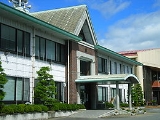
Uguisuzawa, Miyagi
Encyclopedia
was a town
located in Kurihara District, Miyagi
, Japan
.
On April 1, 2005, Uguisuzawa was merged with the towns of Ichihasama, Kannari, Kurikoma
, Semine, Shiwahime, Takashimizu, Tsukidate and Wakayanagi
, and the village of Hanayama, all from Kurihara District
, to form the new city of Kurihara
.
 Uguisuzawa was located on the border between the Ōu Mountains
and the Sendai plain. Nihasama River starts here and runs through the village. Namari River is a branch of Nihasama. Namari (lead) was named after the Hosokura Mine of the upper stream and the lower valley of Nihasama was rice paddy, so the history of Uguisuzawa records some disputes between miners and farmers.
Uguisuzawa Village dates from the Edo Period
. It was given town status on April 1, 1951. It was rare in Japan for such a village to not be subsumed in a municipality. But finally on April 1, 2005 Uguisuzawa disappeared as a municipality and became part of Kurihara.
In 2003, the town hads an estimated population
of 3,098 and a population density
of 83.21 persons per km². The total area is 37.23 km².
Towns of Japan
A town is a local administrative unit in Japan. It is a local public body along with prefecture , city , and village...
located in Kurihara District, Miyagi
Kurihara District, Miyagi
Kurihara District was a district in Japan belonging to Mutsu Province or the Miyagi Prefecture. Established in the 8th century AD as Korehari or Koreharu District and abolished in 2005, the territory is identical to the city of Kurihara today....
, Japan
Japan
Japan is an island nation in East Asia. Located in the Pacific Ocean, it lies to the east of the Sea of Japan, China, North Korea, South Korea and Russia, stretching from the Sea of Okhotsk in the north to the East China Sea and Taiwan in the south...
.
On April 1, 2005, Uguisuzawa was merged with the towns of Ichihasama, Kannari, Kurikoma
Kurikoma, Miyagi
was a town in Kurihara District, Miyagi, Japan. Established in 1955 with the consolidation of six municipalities, it was abolished in a merger forming the larger Kurihara City in 2005. The municipal area was 244.36 km² and the population was 13,736 in 2005....
, Semine, Shiwahime, Takashimizu, Tsukidate and Wakayanagi
Wakayanagi, Miyagi
was a town located in Kurihara District, Miyagi, Japan.On April 1, 2005, Wakayanagi was merged with the towns of Ichihasama, Kannari, Kurikoma, Semine, Shiwahime, Takashimizu, Tsukidate and Uguisuzawa, and the village of Hanayama, all from Kurihara District, to form the new city of Kurihara.In...
, and the village of Hanayama, all from Kurihara District
Kurihara District, Miyagi
Kurihara District was a district in Japan belonging to Mutsu Province or the Miyagi Prefecture. Established in the 8th century AD as Korehari or Koreharu District and abolished in 2005, the territory is identical to the city of Kurihara today....
, to form the new city of Kurihara
Kurihara, Miyagi
is a city located in Miyagi Prefecture, Japan. As of 2008, the city has an estimated population of 77,012 and a population density of 95.7 persons per km². The total area is 804.93 km². Previously a district consisting of nine towns and one village, on April 1, 2005, the towns and village...
.
Ou Mountains
The are a mountain range in the Tōhoku region of Honshū, Japan. The range is the longest range in Japan and stretch south from the Natsudomari Peninsula of Aomori Prefecture to the Nasu volcanoes at the northern boundary of the Kantō region. Though long, the range is only about wide...
and the Sendai plain. Nihasama River starts here and runs through the village. Namari River is a branch of Nihasama. Namari (lead) was named after the Hosokura Mine of the upper stream and the lower valley of Nihasama was rice paddy, so the history of Uguisuzawa records some disputes between miners and farmers.
Uguisuzawa Village dates from the Edo Period
Edo period
The , or , is a division of Japanese history which was ruled by the shoguns of the Tokugawa family, running from 1603 to 1868. The political entity of this period was the Tokugawa shogunate....
. It was given town status on April 1, 1951. It was rare in Japan for such a village to not be subsumed in a municipality. But finally on April 1, 2005 Uguisuzawa disappeared as a municipality and became part of Kurihara.
In 2003, the town hads an estimated population
Population
A population is all the organisms that both belong to the same group or species and live in the same geographical area. The area that is used to define a sexual population is such that inter-breeding is possible between any pair within the area and more probable than cross-breeding with individuals...
of 3,098 and a population density
Population density
Population density is a measurement of population per unit area or unit volume. It is frequently applied to living organisms, and particularly to humans...
of 83.21 persons per km². The total area is 37.23 km².