

Tonopah Basin
Encyclopedia
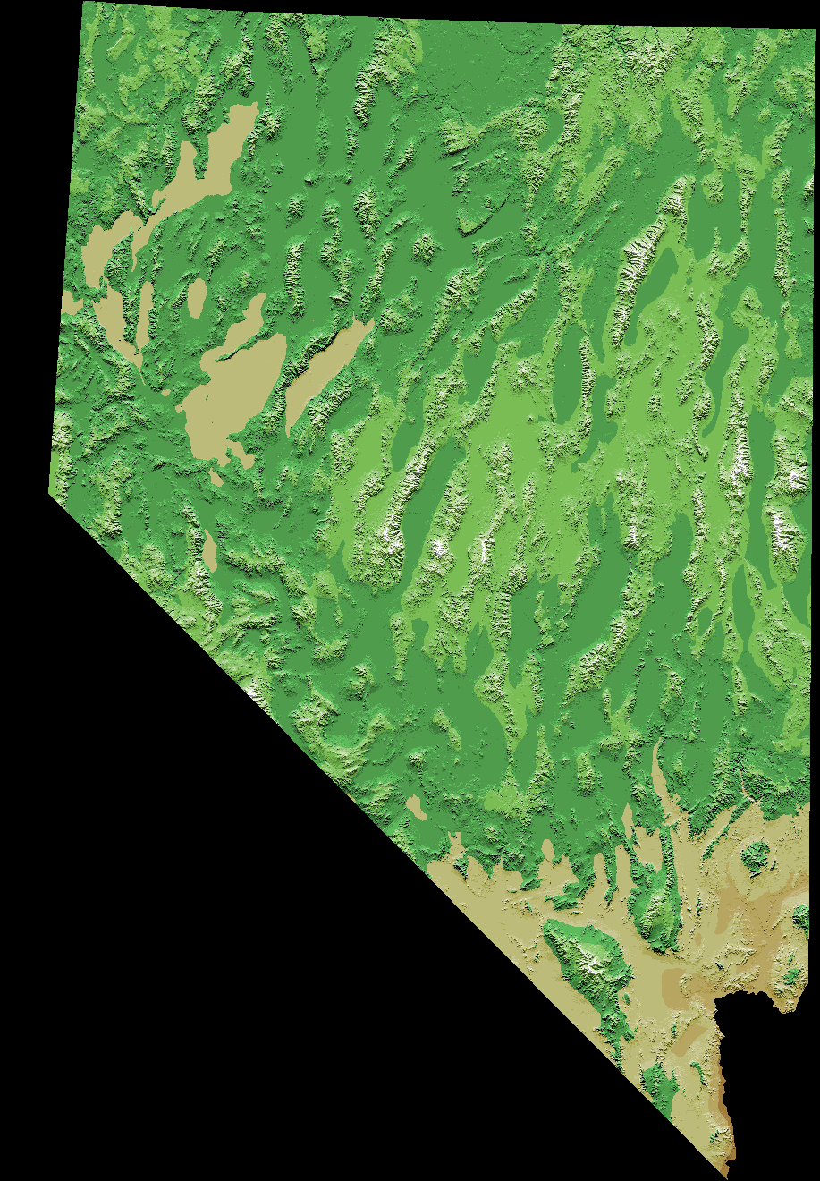
The Tonopah Basin is one of the Central Nevada Desert Basins that extends from the band of arid footslopes along the north side of the Mojave Desert
Mojave Desert
The Mojave Desert occupies a significant portion of southeastern California and smaller parts of central California, southern Nevada, southwestern Utah and northwestern Arizona, in the United States...
(e.g., between Sarcobatus Flat
Sarcobatus Flat
Sarcobatus Flat is one of the Central Nevada Desert Basinsthat, along with Cactus Flat, is an eponym for the larger Cactus-Sarcobatus Watershed. The flat is in the Tonopah Basin and is demarcated from Amargosa Valley of the Mojave Desert to the south by the arid footslopes of the Central Basin and...
and the Amargosa Valley
Amargosa Valley
The Amargosa Valley is a Nevada landform east of the Amargosa Range that is the eponym for the town of Amargosa Valley, Nevada. The Tonopah and Tidewater Railroad ran through the valley from 1906 to 1940.-Solar thermal plant:...
) northward into the Big Smoky Valley
Big Smoky Valley
The Big Smoky Valley is a landform of the Tonopah Basin between the Toiyabe and Toquima mountain ranges. It is about 100 miles in length, and is known by other names : including Great Smoky Valley, Smokey Valley, Smoky Valley, Wen-A-No-Nu-Fee Valley, and Won-A-No-Nu-Fee Valley. The U.S...
and the Railroad Valley
Railroad Valley
Railroad Valley is one of the Central Nevada Desert Basins in the Tonopah Basin and is ~80 miles long north-south and up to 20 miles wide, with some southern areas running southwest to northeast. The southern end of the valley begins near Gray Top Mountain and stretches north all the way to...
. The basin spans longitudes from near Hawthorne, Nevada
Hawthorne, Nevada
Hawthorne is a census-designated place in Mineral County, Nevada, United States. The population was 3,311 at the 2000 census. It is the county seat of Mineral County...
, on the west to the saddle that demarcates the Pahranagat Valley
Pahranagat Valley
The Pahranagat Valley is a Tonopah Basin landform in Lincoln County, Nevada.The more fertile part of Pahranagat Valley is a narrow ribbon of green like an oasis in the vast Nevada desert...
from the Delamar Valley
Delamar Valley
Delamar Valley is one of the Central Nevada Desert Basins and the southern portion of the Dry Lake Watershed, including a low point on the serpentine section of the Great Basin Divide in Nevada....
. Within the perimeter of the basin are separate ecoregions such as three large areas of Tonopah Sagebrush Foothills that surround Tonopah Uplands and a large extension of Central Nevada High Valleys from the north into the basin. The basin has 18 Tonopah Playas (largest in the Railroad Valley east of Lockes, Nevada
Lockes, Nevada
Lockes, also known as Ostorside or Ostonside, is an abandoned location on U.S. Highway 6 in eastern Nye County, Nevada. The site is approximately 73 miles by road Southwest by south of Ely, Nevada and 95 miles by road Northeast by east of Tonopah, Nevada, with the nearest town being Currant, 24...
), and a single wetland fed by the Pahranagat Wash is nearly adjacent to the Mojave. Named sections of the Tonopah Basin include Cactus Flat
Cactus Flat
Cactus Flat is one of the Central Nevada Desert Basins in the Cactus-Sacrobatus Watershed, for which it is an eponym. The flat is the location of the Tonopah Test Range Airport and Tonopah Test Range, a component of the Nevada Test and Training Range used for weapons testing since the 1950s...
, Frenchman Flat
Frenchman Flat
Frenchman Flat is a Tonopah Basin landform used as a nuclear weapons detonation site at the Nevada Test Site , some from Las Vegas, in the United States. Frenchman Flat is a dry lake, an alkaline desert depression which spans Area 5 and Area 11 within NTS...
, Gold Flat, Groom Lake
Groom Lake
Groom Lake is a salt flat in Nevada used for runways of the Nellis Bombing Range Test Site airport on the north of the Area 51 USAF military installation. The lake at elevation is ~ from north to south and from east to west at its widest point...
Valley, Kawich Valley, and Yucca Flat
Yucca Flat
Yucca Flat is a closed desert drainage basin, one of four major nuclear test regions within the Nevada Test Site , and is divided into nine test sections: Areas 1 through 4 and 6 through 10. Yucca Flat is located at the eastern edge of NTS, about ten miles north of Frenchman Flat, and from Las...
.
Tonopah Playas
The Tonopah Playas are 18 Level IV ecoregions that are each bordered by the surrounding Tonopah Basin. The largest is in the Railroad ValleyRailroad Valley
Railroad Valley is one of the Central Nevada Desert Basins in the Tonopah Basin and is ~80 miles long north-south and up to 20 miles wide, with some southern areas running southwest to northeast. The southern end of the valley begins near Gray Top Mountain and stretches north all the way to...
west of Locke, Nevada; and four others on the east of the basin are in Hot Creek Valley (northwest of Warm Springs, Nevada
Warm Springs, Nevada
Warm Springs is an unincorporated community in the Tonopah Basin and Nye County, Nevada, near the mountain pass which divides the Kawich and Hot Creek ranges . It is located at the junction of U.S...
), in the south of Railroad Valley, in Sand Spring Valley, and one farther south near the Mojave. The southernmost is in Sarcobatus Flat
Sarcobatus Flat
Sarcobatus Flat is one of the Central Nevada Desert Basinsthat, along with Cactus Flat, is an eponym for the larger Cactus-Sarcobatus Watershed. The flat is in the Tonopah Basin and is demarcated from Amargosa Valley of the Mojave Desert to the south by the arid footslopes of the Central Basin and...
which has a semicircle of 5 others to the north. The Big Smoky Valley has 2 Tonopah Playas and west of Tonopa, Nevada, are five Tonopah Playas, including one south of Mina, Nevada
Mina, Nevada
Mina is a small community in Mineral County in west-central Nevada on U.S. Route 95 at an elevation of . The 2010 population was 155.-History:...
.