

Timeline of town creation in New York's Capital District
Encyclopedia
The towns and cities of New York's Capital District
were created by the US state of New York
as municipalities in order to give residents more direct say over local government. The Capital District is an 11 county area, which consists of the counties of Albany
, Schenectady
, Rensselaer
, Saratoga
, Schoharie
, Warren
, Washington
, Columbia
, Montgomery
, Fulton
, and Greene
. New York experimented with different types of municipalities before settling upon the current format of towns and cities occupying all the land in a county. Districts were created for Albany
and Tryon
counties in 1772, all were transformed into towns (or divided into multiple towns) in 1788 when all of the state of New York was divided into towns. Two years before that, in 1786, all of what Washington County
encompassed at that time was divided into townships with the same legal status, abilities, and responsibilities as districts with their status as towns confirmed in 1788. Some other forms of government in earlier years included land patents with some municipal rights and boroughs. The following is a time-line showing the creation of the current towns from their predecessors stretching back to the earliest municipal entity over the area. The timelines only represent from which town(s) a particular town was created from and does not represent annexations of territory to and from towns that already existed. All municipalities are towns unless otherwise noted as patent, township, borough, district, or city. Unless otherwise sourced with a footnote all dates of incorporation represent those stated in the 1860 Gazetteer of the State of New York by John H. French.
Capital District
New York's Capital District, also known as the Capital Region, is a region in upstate New York that generally refers to the four counties surrounding Albany, the capital of the state: Albany County, Schenectady County, Rensselaer County, and Saratoga County...
were created by the US state of New York
New York
New York is a state in the Northeastern region of the United States. It is the nation's third most populous state. New York is bordered by New Jersey and Pennsylvania to the south, and by Connecticut, Massachusetts and Vermont to the east...
as municipalities in order to give residents more direct say over local government. The Capital District is an 11 county area, which consists of the counties of Albany
Albany, New York
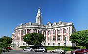
Albany is the capital city of the U.S. state of New York, the seat of Albany County, and the central city of New York's Capital District. Roughly north of New York City, Albany sits on the west bank of the Hudson River, about south of its confluence with the Mohawk River...
, Schenectady
Schenectady, New York
Schenectady is a city in Schenectady County, New York, United States, of which it is the county seat. As of the 2010 census, the city had a population of 66,135...
, Rensselaer
Rensselaer, New York
Rensselaer is a city in Rensselaer County, New York, United States, and is located on the Hudson River directly opposite Albany. As of the 2010 census, the city population was 9,392; in 1920, it was 10,832. The name is from Kiliaen van Rensselaer, the original landowner of the region in New...
, Saratoga
Saratoga County, New York
Saratoga County is a county located in the U.S. state of New York. As of the 2010 census, the population was 219,607. It is part of the Albany-Schenectady-Troy Metropolitan Statistical Area. The county seat is Ballston Spa...
, Schoharie
Schoharie County, New York
As of the census of 2000, there were 31,582 people, 11,991 households and 8,177 families residing in the county. The population density was 51 people per square mile . There were 15,915 housing units at an average density of 26 per square mile...
, Warren
Warren County, New York
Warren County is a county in the U.S. state of New York. It is part of the Glens Falls, New York, Metropolitan Statistical Area. As of the 2010 census, the population was 65,707. It is named in honor of General Joseph Warren, an American Revolutionary War hero of the Battle of Bunker Hill...
, Washington
Washington County, New York
Washington County is a county located in the U.S. state of New York. It is part of the Glens Falls, New York, Metropolitan Statistical Area. As of the 2010 census, the population was 63,216. It was named for the Revolutionary War general George Washington...
, Columbia
Columbia County, New York
Columbia County is a county located in the U.S. state of New York. As of the 2010 census, the population was 63,096. The county seat is Hudson. The name comes from the Latin feminine form of the name of Christopher Columbus, which was at the time of the formation of the county a popular proposal...
, Montgomery
Montgomery County, New York
As of the census of 2000, there were 49,708 people, 20,038 households, and 13,104 families residing in the county. The population density was 123 people per square mile . There were 22,522 housing units at an average density of 56 per square mile...
, Fulton
Fulton County, New York
Fulton County is a county located in the U.S. state of New York. As of the 2010 census, the population was 55,531. Its name is in honor of Robert Fulton, who is widely credited with developing the first commercially successful steamboat...
, and Greene
Greene County, New York
Greene County is a county located in the U.S. state of New York. Its name is in honor of the American Revolutionary War general Nathanael Greene. Its county seat is Catskill...
. New York experimented with different types of municipalities before settling upon the current format of towns and cities occupying all the land in a county. Districts were created for Albany
Albany County, New York
Albany County is a county located in the U.S. state of New York, and is part of the Albany-Schenectady-Troy Metropolitan Statistical Area. The name is from the title of the Duke of York and Albany, who became James II of England . As of the 2010 census, the population was 304,204...
and Tryon
Tryon County, New York
Tryon County, New York was a county in the colonial Province of New York in the British American colonies. It was created from Albany County on March 24, 1772. It was named for William Tryon, the last provincial governor of New York. Its boundaries extended far further than any current county...
counties in 1772, all were transformed into towns (or divided into multiple towns) in 1788 when all of the state of New York was divided into towns. Two years before that, in 1786, all of what Washington County
Washington County, New York
Washington County is a county located in the U.S. state of New York. It is part of the Glens Falls, New York, Metropolitan Statistical Area. As of the 2010 census, the population was 63,216. It was named for the Revolutionary War general George Washington...
encompassed at that time was divided into townships with the same legal status, abilities, and responsibilities as districts with their status as towns confirmed in 1788. Some other forms of government in earlier years included land patents with some municipal rights and boroughs. The following is a time-line showing the creation of the current towns from their predecessors stretching back to the earliest municipal entity over the area. The timelines only represent from which town(s) a particular town was created from and does not represent annexations of territory to and from towns that already existed. All municipalities are towns unless otherwise noted as patent, township, borough, district, or city. Unless otherwise sourced with a footnote all dates of incorporation represent those stated in the 1860 Gazetteer of the State of New York by John H. French.
Albany and Rensselaer counties, with Niskayuna (Schenectady County)
Schoharie and Greene counties, with Duanesburgh (Schenectady County)
Schenectady County, except Niskayuna and Duanesburgh
Saratoga County, and Easton (Washington County)
Washington County, except Easton
Warren County
Columbia County
Fulton, Montgomery, and Hamilton counties, with part of Herkimer County
See also
- List of incorporated places in New York's Capital District
- Toponymies of places in New York's Capital DistrictToponymies of places in New York's Capital DistrictThe toponymies of places in New York's Capital District are a varied lot, from non-English languages such as Native American, Dutch, and German to places named for famous people or families, of either local or national fame.-Settlements:...
- Administrative divisions of New YorkAdministrative divisions of New YorkThe administrative divisions of New York are the various units of government that provide local government services in the state of New York. The state has four types of multi-purpose municipal corporation that provide most local government services, namely: counties, cities, towns, and villages...
- List of cities in New York
- List of towns in New York
- List of villages in New York
- Timeline of town creation in Downstate New YorkTimeline of town creation in Downstate New YorkThe towns and cities of Downstate New York were created by the US state of New York as municipalities in order to give residents more direct say over local government...
- Timeline of town creation in the Hudson ValleyTimeline of town creation in the Hudson ValleyThe towns and cities of the Hudson Valley were created by the US state of New York as municipalities, in order to perform the services of local government. In 1683, prior to the creation of modern towns, the Province of New York was divided into twelve counties for administrative purposes by the...
- Timeline of town creation in Central New YorkTimeline of town creation in Central New YorkThe towns and cities of Central New York were created by the US state of New York as municipalities in order to give residents more direct say over local government...
Further reading
- The Districts of Albany County, New York, 1772-1784 a graphical representation of French's 1860 Gazetter of the State of New York put into maps.
- Welcome to the Columbia County, NY a source listing the original land disbursements (patents) in Columbia County and subsequent town creation.