
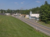
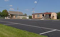
Sunbright, Tennessee
Encyclopedia
Sunbright is a city in Morgan County, Tennessee
, United States
. The population was 577 at the 2000 census.
approximately 25 miles (40.2 km) west of the plateau's Walden Ridge
escarpment. White Oak Creek, which drains Sunbright, is part of the upper watershed of the Big South Fork of the Cumberland River
. The Big South Fork's watershed meets the watershed of the Emory River
atop Pilot Mountain, immediately south of Sunbright. Sunbright is surrounded by low mountains and hills that comprise the fringe of the Cumberland Mountains
.
Sunbright is centered along U.S. Route 27
, which connects the city to Wartburg
and Harriman
to the south and Huntsville, Tennessee
and Lexington, Kentucky
to the north. US-27 intersects Interstate 40
approximately 25 miles (40.2 km) south of Sunbright.
According to the United States Census Bureau
, the city has a total area of 3.8 square miles (9.8 km²), all of it land.
 As of the census
of 2000, there were 577 people, 229 households, and 158 families residing in the city. The population density
was 151.8 people per square mile (58.6/km²). There were 264 housing units at an average density of 69.4 per square mile (26.8/km²). The racial makeup of the city was 98.44% White, 0.17% Native American, 0.87% from other races
, and 0.52% from two or more races. Hispanic or Latino of any race were 0.87% of the population.
There were 229 households out of which 33.6% had children under the age of 18 living with them, 53.7% were married couples
living together, 11.4% had a female householder with no husband present, and 30.6% were non-families. 25.3% of all households were made up of individuals and 10.5% had someone living alone who was 65 years of age or older. The average household size was 2.52 and the average family size was 3.06.
In the city the population was spread out with 26.3% under the age of 18, 9.2% from 18 to 24, 28.1% from 25 to 44, 24.8% from 45 to 64, and 11.6% who were 65 years of age or older. The median age was 35 years. For every 100 females there were 93.0 males. For every 100 females age 18 and over, there were 85.6 males.
The median income for a household in the city was $27,763, and the median income for a family was $31,094. Males had a median income of $28,000 versus $16,944 for females. The per capita income
for the city was $12,102. About 20.0% of families and 24.4% of the population were below the poverty line, including 31.1% of those under age 18 and 27.0% of those age 65 or over.
In 1916, an oil field was discovered in the hills immediately west of Sunbright, and the city thrived for several years as an oil shipping hub.
Tennessee
Tennessee is a U.S. state located in the Southeastern United States. It has a population of 6,346,105, making it the nation's 17th-largest state by population, and covers , making it the 36th-largest by total land area...
, United States
United States
The United States of America is a federal constitutional republic comprising fifty states and a federal district...
. The population was 577 at the 2000 census.
Geography
Sunbright is located at 36°14′51"N 84°40′22"W (36.247369, -84.672692). The city is situated atop the Cumberland PlateauCumberland Plateau
The Cumberland Plateau is the southern part of the Appalachian Plateau. It includes much of eastern Kentucky and western West Virginia, part of Tennessee, and a small portion of northern Alabama and northwest Georgia . The terms "Allegheny Plateau" and the "Cumberland Plateau" both refer to the...
approximately 25 miles (40.2 km) west of the plateau's Walden Ridge
Walden Ridge
Walden Ridge is a mountain ridge and escarpment located in Tennessee, in the United States. It marks the eastern edge of the Cumberland Plateau and is generally considered part of it. Walden Ridge is about long, running generally north-south...
escarpment. White Oak Creek, which drains Sunbright, is part of the upper watershed of the Big South Fork of the Cumberland River
Big South Fork of the Cumberland River
The Big South Fork of the Cumberland River is a river in Tennessee and Kentucky. It is a major drainage feature of the Cumberland Plateau, a major tributary of the Cumberland River system, a world-class whitewater canoeing and kayaking stream, and the major feature of the Big South Fork National...
. The Big South Fork's watershed meets the watershed of the Emory River
Emory River
The Emory River is a stream draining a portion of Tennessee's Cumberland Plateau.-Hydrography:The Emory River rises on the slopes of Frozen Head and Bird Mountain, prominent peaks in that part of the Cumberland Plateau in Morgan County, Tennessee. Frozen Head is the focus of a Tennessee state park...
atop Pilot Mountain, immediately south of Sunbright. Sunbright is surrounded by low mountains and hills that comprise the fringe of the Cumberland Mountains
Cumberland Mountains
The Cumberland Mountains are a mountain range in the southeastern section of the Appalachian Mountains. They are located in southern West Virginia, western Virginia, eastern edges of Kentucky, and eastern middle Tennessee, including the Crab Orchard Mountains...
.
Sunbright is centered along U.S. Route 27
U.S. Route 27
U.S. Route 27 is a north–south United States highway in the southern and midwestern United States. The southern terminus is at US 1 in Miami, Florida. The northern terminus is at Interstate 69 in Fort Wayne, Indiana...
, which connects the city to Wartburg
Wartburg, Tennessee
Wartburg is a city in Morgan County, Tennessee, United States. The population was 890 at the 2000 census. It is the county seat of Morgan County.-Geography:...
and Harriman
Harriman, Tennessee
Harriman is a city in the U.S. state of Tennessee, primarily in Roane County, with a small extension into Morgan County. It is the principal city of and is included in the Harriman Micropolitan Statistical Area, which consists of Roane County and is a component of the Knoxville-Sevierville-La...
to the south and Huntsville, Tennessee
Huntsville, Tennessee
Huntsville is a town in Scott County, Tennessee, United States. The population was 981 at the 2000 census. It is the county seat of Scott County.-Geography:...
and Lexington, Kentucky
Lexington, Kentucky
Lexington is the second-largest city in Kentucky and the 63rd largest in the US. Known as the "Thoroughbred City" and the "Horse Capital of the World", it is located in the heart of Kentucky's Bluegrass region...
to the north. US-27 intersects Interstate 40
Interstate 40
Interstate 40 is the third-longest major east–west Interstate Highway in the United States, after I-90 and I-80. Its western end is at Interstate 15 in Barstow, California; its eastern end is at a concurrency of U.S. Route 117 and North Carolina Highway 132 in Wilmington, North Carolina...
approximately 25 miles (40.2 km) south of Sunbright.
According to the United States Census Bureau
United States Census Bureau
The United States Census Bureau is the government agency that is responsible for the United States Census. It also gathers other national demographic and economic data...
, the city has a total area of 3.8 square miles (9.8 km²), all of it land.
Demographics
Census
A census is the procedure of systematically acquiring and recording information about the members of a given population. It is a regularly occurring and official count of a particular population. The term is used mostly in connection with national population and housing censuses; other common...
of 2000, there were 577 people, 229 households, and 158 families residing in the city. The population density
Population density
Population density is a measurement of population per unit area or unit volume. It is frequently applied to living organisms, and particularly to humans...
was 151.8 people per square mile (58.6/km²). There were 264 housing units at an average density of 69.4 per square mile (26.8/km²). The racial makeup of the city was 98.44% White, 0.17% Native American, 0.87% from other races
Race (United States Census)
Race and ethnicity in the United States Census, as defined by the Federal Office of Management and Budget and the United States Census Bureau, are self-identification data items in which residents choose the race or races with which they most closely identify, and indicate whether or not they are...
, and 0.52% from two or more races. Hispanic or Latino of any race were 0.87% of the population.
There were 229 households out of which 33.6% had children under the age of 18 living with them, 53.7% were married couples
Marriage
Marriage is a social union or legal contract between people that creates kinship. It is an institution in which interpersonal relationships, usually intimate and sexual, are acknowledged in a variety of ways, depending on the culture or subculture in which it is found...
living together, 11.4% had a female householder with no husband present, and 30.6% were non-families. 25.3% of all households were made up of individuals and 10.5% had someone living alone who was 65 years of age or older. The average household size was 2.52 and the average family size was 3.06.
In the city the population was spread out with 26.3% under the age of 18, 9.2% from 18 to 24, 28.1% from 25 to 44, 24.8% from 45 to 64, and 11.6% who were 65 years of age or older. The median age was 35 years. For every 100 females there were 93.0 males. For every 100 females age 18 and over, there were 85.6 males.
The median income for a household in the city was $27,763, and the median income for a family was $31,094. Males had a median income of $28,000 versus $16,944 for females. The per capita income
Per capita income
Per capita income or income per person is a measure of mean income within an economic aggregate, such as a country or city. It is calculated by taking a measure of all sources of income in the aggregate and dividing it by the total population...
for the city was $12,102. About 20.0% of families and 24.4% of the population were below the poverty line, including 31.1% of those under age 18 and 27.0% of those age 65 or over.
History
The Sunbright area was first settled in the early 19th century. It was originally known as "Pine Top", but was renamed "Stapleton" after the Staples family set up the town's first post office in the mid-19th century. When the railroad was constructed through the area in 1879, the Stapleton depot was named "Sunbright," and the name was eventually applied to the entire town.In 1916, an oil field was discovered in the hills immediately west of Sunbright, and the city thrived for several years as an oil shipping hub.