
.gif)
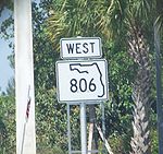
State Road 806 (Florida)
Encyclopedia
State Road 806, locally known as Atlantic Avenue, is the primary east–west highway of Delray Beach
in Palm Beach County, Florida
. Not to be confused with Atlantic Boulevard (SR 814
) 15 miles to the south, Atlantic Avenue extends from US 441-SR 7
eastward to Ocean Boulevard (SR A1A
) just north of Highland Beach
. East of Military Trail
, SR 806 is in Delray Beach; to the west of Military Trail, the road stretches through unincorporated Palm Beach County, starting with Country Club Acres.
Along with Swinton Avenue (one-half mile west of the one-way pair
forming US 1-SR 5
), Atlantic Avenue forms the baseline
for all Delray Beach addresses. While SR 806 is a commercial and commuter
road, several golf course
s have access from Atlantic Avenue between Florida's Turnpike
(SR 91) and Interstate 95
(SR 9
).
(partially unsigned Florida State Road 7) in the outskirts of Delray Beach, Florida
near the Arthur R. Marshall Loxahatchee National Wildlife Refuge. State Road 806 heads eastward along West Atlantic Avenue, a four-lane divided highway through fields and groves before becoming two lanes and entering a more commercial district. The progression of the highway continues for a distance along West Atlantic Avenue, intersecting with several local streets and passing through some large groves. After the intersection with Starkey Road, State Road 806 divides back into six lanes, as it enters an interchange with Florida's Turnpike
(unsigned State Road 91). West Atlantic Avenue first intersects with the entranceway and exit ramp from the turnpike southbound and continues eastward over a stream. After passing under the eight lanes of the Turnpike, State Road 806 reduces to four lanes and intersects with the ramp to the northbound lanes. After leaving the large interchange with the turnpike, the highway continues eastward along the country clubs in Delray Beach, beginning with an intersection to the Lexington Club on the eastbound lanes. After that, State Road 806 continues, passing Eagle Point and soon intersecting with Hagen Ranch Road at a traffic light. The route then passes Kings Point Country Club and to the south of the Villages of Oriole, where the highway continues as four lanes, turning southeastward until intersecting with Jog Road (the northern continuation of State Road 845) in Delray Beach.
 State Road 806 continues eastward from Jog Road along West Atlantic Avenue, crossing through several country clubs as a six-lane highway with a divided median. At El Claire Ranch Road, the highway makes a gradual curve to the northeast, passing through a commercial strip near Lakes of Delray Boulevard. State Road 806 continues northeastward, crossing with Via Flora, where it returns to its eastward progression. Along West Atlantic, the highway crosses through another commercial strip as an alternating four to six lane arterial boulevard. Soon after, the highway intersects with County Road 809 (Military Trail) at a traffic light in the midst of the strip, entering incorporated Delray Beach at the intersection. State Road 806 continues eastward, crossing through more of the country clubs as a four lane boulevard. The highway continues with the divided median and begins to make a short progression to the southeast and soon to the northeast. After the intersection with Northwest 24th Avenue, State Road 806 crosses another body of water and crosses to an intersection with Congress Avenue, the northern extension of State Road 807. After Congress, Atlantic Avenue heads to the northeast and expands to six lanes when approaching the Seaboard Coast Line. After crossing the tracks at-grade, State Road 806 and Atlantic Avenue interchange with Interstate 95
(unsigned State Road 9) in Delray. The highway crosses through the partial cloverleaf and crosses under the ten lanes of Interstate 95.
and its lanes begin to merge as the highway approaches the intersection with Swinton Avenue. At Swinton Avenue, West Atlantic Avenue changes names to East Atlantic, and State Road 806 continues eastward along East Atlantic. At the intersection with North Railroad Avenue, the highway crosses the Florida East Coast Railroad and continues through downtown Delray Beach. At the intersection with Northeast 5th Avenue, State Road 806 intersects with U.S. Route 1
(unsigned State Road 5) southbound and a block later, the northbound lanes. After U.S. Route 1, the highway continues eastward, crossing Veterans Park and crossing the Intracostal Waterway on a large drawbridge. After the drawbridge, East Atlantic Avenue continues eastward, passing several high-rise residences and continues as a four lane boulevard until terminating at an intersection with State Road A1A
(South Ocean Boulevard) in Delray Beach, along the Atlantic Ocean.
, it was Florida State Road 198.
.
Delray Beach, Florida
Delray Beach is a city in Palm Beach County, Florida, USA. As of the 2000 census, the city had a total population of 60,020. As of 2004, the population estimated by the U.S...
in Palm Beach County, Florida
Palm Beach County, Florida
Palm Beach County is the largest county in the state of Florida in total area, and third in population. As of 2010, the county's estimated population was 1,320,134, making it the twenty-eighth most populous in the United States...
. Not to be confused with Atlantic Boulevard (SR 814
State Road 814 (Florida)
State Road 814, also known as Atlantic Boulevard is a major commercial and commuter highway in northern Broward County, Florida. The 13.5-mile-long divided highway extends from the Sawgrass Expressway in Coral Springs, Florida to State Road A1A in Pompano Beach, Florida.Traditionally, the road...
) 15 miles to the south, Atlantic Avenue extends from US 441-SR 7
State Road 7 (Florida)
State Road 7 is a major north–south artery connecting Persimmon Boulevard in The Acreage with US 41/SR 90 in the Little Havana section of Miami...
eastward to Ocean Boulevard (SR A1A
State Road A1A (Florida)
State Road A1A is a Florida State Road that runs mostly along the Atlantic Ocean, with sections from Key West at the southern tip of Florida, to Callahan, just south of Georgia. It is the main road through most oceanfront towns. SR A1A is designated the A1A Scenic and Historic Coastal Highway, a...
) just north of Highland Beach
Highland Beach, Florida
Highland Beach is a town in Palm Beach County, Florida, in the United States. As of 2007, the population recorded by the U.S. Census Bureau was 3,988.-Geography:Highland Beach is located at ....
. East of Military Trail
State Road 809 (Florida)
State Road 809, locally known as Military Trail and Palm Beach County Road 809 is a six-lane divided highway which, like the nearby similar north–south State Road 811 and State Road 845, serves the dual purposes of commuting alternatives to the Florida's Turnpike and Interstate 95 .The...
, SR 806 is in Delray Beach; to the west of Military Trail, the road stretches through unincorporated Palm Beach County, starting with Country Club Acres.
Along with Swinton Avenue (one-half mile west of the one-way pair
One-way pair
A one-way pair, one-way couple, or just couplet is a pair of parallel, usually one-way streets that carry opposite directions of a signed route or major traffic flow, or sometimes opposite directions of a bus or streetcar route....
forming US 1-SR 5
State Road 5 (Florida)
State Road 5 is a mostly-unsigned state highway in the state of Florida. It is mainly signed as U.S. Route 1 from its south end in Key West, Florida to Jacksonville, Florida, and U.S. Route 17 from Jacksonville to the Georgia state line at the Saint Marys River. U.S...
), Atlantic Avenue forms the baseline
Baseline
A baseline is a line that is a base for measurement or for construction; see datum or point of reference .The word baseline may refer to:...
for all Delray Beach addresses. While SR 806 is a commercial and commuter
Commuting
Commuting is regular travel between one's place of residence and place of work or full time study. It sometimes refers to any regular or often repeated traveling between locations when not work related.- History :...
road, several golf course
Golf course
A golf course comprises a series of holes, each consisting of a teeing ground, fairway, rough and other hazards, and a green with a flagstick and cup, all designed for the game of golf. A standard round of golf consists of playing 18 holes, thus most golf courses have this number of holes...
s have access from Atlantic Avenue between Florida's Turnpike
Florida's Turnpike
Florida's Turnpike , designated as the Ronald Reagan Turnpike, and originally known as the Sunshine State Parkway is a north–south toll road that runs through 11 counties in the Florida peninsula, from U.S...
(SR 91) and Interstate 95
Interstate 95 in Florida
Interstate 95 is the main Interstate Highway on the east coast of the United States; it serves the Atlantic coast of Florida. It begins at a partial interchange with U.S. Highway 1 just south of downtown Miami, and heads north past Daytona Beach and Jacksonville to the Georgia state line at the St...
(SR 9
State Road 9 (Florida)
State Road 9 is a state road in the U.S. state of Florida. While SR 9 is mainly used as a "hidden" state designation for Interstate 95 from the Georgia border to the Golden Glades Interchange in Miami Gardens, a 13.7-mile-long signed SR 9 extends to the southwest as I-95 continues southward with...
).
US 441 to Interstate 95
State Road 806 begins at a divided intersection with U.S. Route 441U.S. Route 441 in Florida
U.S. Route 441 in Florida is a north–south United States Highway. It runs from Miami in South Florida northwest to the Georgia border north of the Lake City area....
(partially unsigned Florida State Road 7) in the outskirts of Delray Beach, Florida
Delray Beach, Florida
Delray Beach is a city in Palm Beach County, Florida, USA. As of the 2000 census, the city had a total population of 60,020. As of 2004, the population estimated by the U.S...
near the Arthur R. Marshall Loxahatchee National Wildlife Refuge. State Road 806 heads eastward along West Atlantic Avenue, a four-lane divided highway through fields and groves before becoming two lanes and entering a more commercial district. The progression of the highway continues for a distance along West Atlantic Avenue, intersecting with several local streets and passing through some large groves. After the intersection with Starkey Road, State Road 806 divides back into six lanes, as it enters an interchange with Florida's Turnpike
Florida's Turnpike
Florida's Turnpike , designated as the Ronald Reagan Turnpike, and originally known as the Sunshine State Parkway is a north–south toll road that runs through 11 counties in the Florida peninsula, from U.S...
(unsigned State Road 91). West Atlantic Avenue first intersects with the entranceway and exit ramp from the turnpike southbound and continues eastward over a stream. After passing under the eight lanes of the Turnpike, State Road 806 reduces to four lanes and intersects with the ramp to the northbound lanes. After leaving the large interchange with the turnpike, the highway continues eastward along the country clubs in Delray Beach, beginning with an intersection to the Lexington Club on the eastbound lanes. After that, State Road 806 continues, passing Eagle Point and soon intersecting with Hagen Ranch Road at a traffic light. The route then passes Kings Point Country Club and to the south of the Villages of Oriole, where the highway continues as four lanes, turning southeastward until intersecting with Jog Road (the northern continuation of State Road 845) in Delray Beach.
Interstate 95 in Florida
Interstate 95 is the main Interstate Highway on the east coast of the United States; it serves the Atlantic coast of Florida. It begins at a partial interchange with U.S. Highway 1 just south of downtown Miami, and heads north past Daytona Beach and Jacksonville to the Georgia state line at the St...
(unsigned State Road 9) in Delray. The highway crosses through the partial cloverleaf and crosses under the ten lanes of Interstate 95.
Downtown Delray Beach
After the interchange with Interstate 95, West Atlantic Avenue continues eastward, entering downtown Delray Beach, where the highway begins intersecting with numbered local streets as a four-lane boulevard. The surroundings become a mix of residences and commercial industries until Northwest 6th Avenue, when it becomes purely commercial. State Road 806 passes to the south of the Delray Beach Tennis CenterDelray Beach Tennis Center
Delray Beach Tennis Center is a tennis center in Delray Beach, Florida. Built in 1992, it currently holds 8,200 spectators.It has hosted Fed Cup and Davis Cup matches....
and its lanes begin to merge as the highway approaches the intersection with Swinton Avenue. At Swinton Avenue, West Atlantic Avenue changes names to East Atlantic, and State Road 806 continues eastward along East Atlantic. At the intersection with North Railroad Avenue, the highway crosses the Florida East Coast Railroad and continues through downtown Delray Beach. At the intersection with Northeast 5th Avenue, State Road 806 intersects with U.S. Route 1
U.S. Route 1 in Florida
U.S. Route 1 in Florida runs along the state's east coast from Key West to its crossing of the St. Marys River into Georgia north of Boulogne, and south of Folkston. US 1 was designated through Florida when the U.S. Highway System was established in 1926.US 1 runs in the state of Florida, and...
(unsigned State Road 5) southbound and a block later, the northbound lanes. After U.S. Route 1, the highway continues eastward, crossing Veterans Park and crossing the Intracostal Waterway on a large drawbridge. After the drawbridge, East Atlantic Avenue continues eastward, passing several high-rise residences and continues as a four lane boulevard until terminating at an intersection with State Road A1A
Florida State Road A1A
State Road A1A is a Florida State Road that runs mostly along the Atlantic Ocean, with sections from Key West at the southern tip of Florida, to Callahan, just south of Georgia. It is the main road through most oceanfront towns. SR A1A is designated the A1A Scenic and Historic Coastal Highway, a...
(South Ocean Boulevard) in Delray Beach, along the Atlantic Ocean.
History
State Road 806 was established in the 1945 renumbering as a road extending from US 441/SR 7 to US 1/SR 5 in Delray Beach, and extended to SR A1A at a later point. Prior to the 1945 renumbering1945 Florida State Road renumbering
On June 11, 1945, Florida's state roads were renumbered. The old system numbered routes in the order they were legislated, while the new system used a grid.For more detailed information on where each road was, go to the corresponding page.-See also:...
, it was Florida State Road 198.
Major intersections
The entire route is located in Palm Beach CountyPalm Beach County, Florida
Palm Beach County is the largest county in the state of Florida in total area, and third in population. As of 2010, the county's estimated population was 1,320,134, making it the twenty-eighth most populous in the United States...
.
| Location | Mile | Destination | Notes |
|---|---|---|---|
| 0.00 | Western terminus | ||
| 1.84 | Exit 81 (Florida's Turnpike) | ||
| 3.56 | Jog Road | To | |
| Delray Beach Delray Beach, Florida Delray Beach is a city in Palm Beach County, Florida, USA. As of the 2000 census, the city had a total population of 60,020. As of 2004, the population estimated by the U.S... |
5.16 | ||
| 6.98 | Congress Avenue | To | |
| 7.31 | Exit 52 (Interstate 95) | ||
| 8.59 | |||
| 8.65 | |||
| 9.18 | Eastern terminus | ||