
Rosebery, Tasmania
Encyclopedia
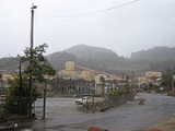
Rosebery is a town on the west coast
of Tasmania
, Australia
. It is situated at the northern end of the West Coast Range, in the shadow of Mount Black
and adjacent to the Pieman River
now Lake Pieman
.
It lies on the Murchison Highway
, 25 kilometres north east of Zeehan
and is part of the Municipality of West Coast Council
. At the 2006 census
, Rosebery had a population of 1,032.
The population of Rosebery declined by 22% in the years between 1996-2001.
Its newer western area on the shore of Lake Pieman is known as Primrose.
town. In 1893, prospector Tom McDonald discovered gold in alluvial wash, along with boulders of zinc-lead sulphide in dense rainforest on the slopes of Mt. Black. McDonald pegged several claims in the name of the Rosebery Prospecting Association, which later became the Rosebery Gold Mining Company. The South Rosebery Mining Company was formed soon after to mine the southern continuation of the orebody.
In 1896, the Rosebery Gold Mining Company was reconstructed as the Tasmanian Copper Company, and the South Rosebery Mining Company became the Primrose Mining Company.
The main mineral found in the orebody was zinc, but due to the lack of a technique to successfully extract the zinc from the ore, little could be done to exploit the orebody. One company formed to experiment in the processing of zinc ores was the Tasmanian Metals Extraction Company (TME) who built a large plant next to the track to Williamsford, completed in 1912. The experiment was unsuccessful and the plant closed in 1914.
The Rosebery mines passed into the hands of the Mount Lyell Mining and Railway company in 1916, and the mines were eventually merged with the Electrolytic Zinc Company of Australasia (EZ), who had discovered an effective method for the extraction of zinc. In 1926, construction of a processing mill at Rosebery began, and in 1931, an aerial ropeway to transport ore from the Hercules Mine near Williamsford was completed. Due to the Great Depression, the Rosebery Mill was not completed until 1936. The Rosebery Mine has operated continuously since then, with 75 year celebrations held during February, 2011. The mine is currently operated by Minerals and Metals Group Ltd (MMG), producing zinc
, lead
, copper
, silver
and gold
.
Prior to the construction of the Murchison Highway
in the 1960s, the town was connected with Burnie
and North West Tasmania via the Emu Bay Railway
.
West Coast, Tasmania
The West Coast of Tasmania is the part of the state that is strongly associated with wilderness, mining and tourism, rough country and isolation...
of Tasmania
Tasmania
Tasmania is an Australian island and state. It is south of the continent, separated by Bass Strait. The state includes the island of Tasmania—the 26th largest island in the world—and the surrounding islands. The state has a population of 507,626 , of whom almost half reside in the greater Hobart...
, Australia
Australia
Australia , officially the Commonwealth of Australia, is a country in the Southern Hemisphere comprising the mainland of the Australian continent, the island of Tasmania, and numerous smaller islands in the Indian and Pacific Oceans. It is the world's sixth-largest country by total area...
. It is situated at the northern end of the West Coast Range, in the shadow of Mount Black
Mount Black
Mount Black is a prominent mountain, high, with a gentle snow-covered slope on its southwest side and a steep rock face on its northwest side, forming a part of the polar escarpment just west of Bennett Platform and the upper reaches of Shackleton Glacier. It was discovered and photographed by R...
and adjacent to the Pieman River
Pieman River
The Pieman River is a river on the West Coast of Tasmania, Australia. It was dammed with the 122m high Reece Dam in 1986 - creating Lake Pieman.-Name:...
now Lake Pieman
Lake Pieman
Lake Pieman is a lake created by the damming of the Pieman River West Coast, Tasmania.It is a long narrow lake following the line of the Pieman River from Reece Dam back to Rosebery and the Bastyan Dam-Further reading:* Tasmania. Hydro-Electric Commission...
.
It lies on the Murchison Highway
Murchison Highway
The Murchison Highway runs from the West Coast of Tasmania to Burnie, and was opened on 13 December 1963. The part of the Highway from Waratah to Burnie was known as the Waratah Highway until 1973 at the latest....
, 25 kilometres north east of Zeehan
Zeehan, Tasmania
Zeehan is a town on the west coast of Tasmania, Australia. It lies southwest of Burnie. At the 2006 census, Zeehan had a population of 845. It is part of the Municipality of West Coast....
and is part of the Municipality of West Coast Council
West Coast Council
The West Coast Council is a Local Government Area of Tasmania. It covers much of the west of Tasmania. It is the largest Local Government Area of Tasmania by area, and the second least densely populated, after the Central Highlands. It takes in the West Coast Range as well as portions of World...
. At the 2006 census
Census in Australia
The Australian census is administered once every five years by the Australian Bureau of Statistics. The most recent census was conducted on 9 August 2011; the next will be conducted in 2016. Prior to the introduction of regular censuses in 1961, they had also been run in 1901, 1911, 1921, 1933,...
, Rosebery had a population of 1,032.
The population of Rosebery declined by 22% in the years between 1996-2001.
Its newer western area on the shore of Lake Pieman is known as Primrose.
History
Like most of the other settlements on the west coast of Tasmania, Rosebery is a miningMining
Mining is the extraction of valuable minerals or other geological materials from the earth, from an ore body, vein or seam. The term also includes the removal of soil. Materials recovered by mining include base metals, precious metals, iron, uranium, coal, diamonds, limestone, oil shale, rock...
town. In 1893, prospector Tom McDonald discovered gold in alluvial wash, along with boulders of zinc-lead sulphide in dense rainforest on the slopes of Mt. Black. McDonald pegged several claims in the name of the Rosebery Prospecting Association, which later became the Rosebery Gold Mining Company. The South Rosebery Mining Company was formed soon after to mine the southern continuation of the orebody.
In 1896, the Rosebery Gold Mining Company was reconstructed as the Tasmanian Copper Company, and the South Rosebery Mining Company became the Primrose Mining Company.
The main mineral found in the orebody was zinc, but due to the lack of a technique to successfully extract the zinc from the ore, little could be done to exploit the orebody. One company formed to experiment in the processing of zinc ores was the Tasmanian Metals Extraction Company (TME) who built a large plant next to the track to Williamsford, completed in 1912. The experiment was unsuccessful and the plant closed in 1914.
The Rosebery mines passed into the hands of the Mount Lyell Mining and Railway company in 1916, and the mines were eventually merged with the Electrolytic Zinc Company of Australasia (EZ), who had discovered an effective method for the extraction of zinc. In 1926, construction of a processing mill at Rosebery began, and in 1931, an aerial ropeway to transport ore from the Hercules Mine near Williamsford was completed. Due to the Great Depression, the Rosebery Mill was not completed until 1936. The Rosebery Mine has operated continuously since then, with 75 year celebrations held during February, 2011. The mine is currently operated by Minerals and Metals Group Ltd (MMG), producing zinc
Zinc
Zinc , or spelter , is a metallic chemical element; it has the symbol Zn and atomic number 30. It is the first element in group 12 of the periodic table. Zinc is, in some respects, chemically similar to magnesium, because its ion is of similar size and its only common oxidation state is +2...
, lead
Lead
Lead is a main-group element in the carbon group with the symbol Pb and atomic number 82. Lead is a soft, malleable poor metal. It is also counted as one of the heavy metals. Metallic lead has a bluish-white color after being freshly cut, but it soon tarnishes to a dull grayish color when exposed...
, copper
Copper
Copper is a chemical element with the symbol Cu and atomic number 29. It is a ductile metal with very high thermal and electrical conductivity. Pure copper is soft and malleable; an exposed surface has a reddish-orange tarnish...
, silver
Silver
Silver is a metallic chemical element with the chemical symbol Ag and atomic number 47. A soft, white, lustrous transition metal, it has the highest electrical conductivity of any element and the highest thermal conductivity of any metal...
and gold
Gold
Gold is a chemical element with the symbol Au and an atomic number of 79. Gold is a dense, soft, shiny, malleable and ductile metal. Pure gold has a bright yellow color and luster traditionally considered attractive, which it maintains without oxidizing in air or water. Chemically, gold is a...
.
Prior to the construction of the Murchison Highway
Murchison Highway
The Murchison Highway runs from the West Coast of Tasmania to Burnie, and was opened on 13 December 1963. The part of the Highway from Waratah to Burnie was known as the Waratah Highway until 1973 at the latest....
in the 1960s, the town was connected with Burnie
Burnie, Tasmania
- Sport :Australian rules football is popular in Burnie. The city's team is the Burnie Dockers Football Club in the Tasmanian State League.Rugby union is also played in Burnie. The local club is the Burnie Rugby Union Club. They are the current Tasmanian Rugby Union Statewide Division Two Premiers...
and North West Tasmania via the Emu Bay Railway
Emu Bay Railway
The Melba Line is a narrow gauge railway on the west coast of Tasmania. The line was originally constructed as a private railway line named the Emu Bay Railway and was one of the longest lasting and successful private railway companies in Australia...
.
Further reading
- 2003 edition - Queenstown: Municipality of Queenstown.
- 1949 edition - Hobart: Davies Brothers. ; ASINAsínAsín is a municipality located in the Cinco Villas comarca of the province of Zaragoza, Aragon, Spain, located a few kilometers west of Orés. According to the 2004 census , the municipality has a population of 106 inhabitants....
B000FMPZ80 - 1924 edition - Queenstown: Mount Lyell Tourist Association. ; ASINAsínAsín is a municipality located in the Cinco Villas comarca of the province of Zaragoza, Aragon, Spain, located a few kilometers west of Orés. According to the 2004 census , the municipality has a population of 106 inhabitants....
B0008BM4XC
External links
- Crib & Cradle - Stay in Authentic Miners Accommodation in the heart of Rosebery.
- Mineral Resources Tasmania - Zinifex Rosebery mine
- Tourist information dated 2004
- Minerals and Metals Group
- 'MMG Rosebery provides feedback on workforce testing' April 2010
- http://www.lead.org.au/
- http://www.lead.org.au/lg%20las%20mr.html
- http://wwwBold text.sourcewatch.org/index.php?title=Toxic_heavy_metals_in_Tasmania