
Resurs DK
Encyclopedia
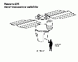
Resurs-DK1 is a commercial Earth observation satellite
capable of transmitting high-resolution imagery (up to 0.9 m) to the ground stations as it passes overhead. The spacecraft is operated by NTs OMZ, Russian Research Center for Earth Operative Monitoring.
The satellite is designed for multi-spectral remote sensing of the Earth's surface aimed at acquiring high-quality visible images in near real-time as well as on-line data delivery via radio link and providing a wide range of consumers with value-added processed data.
. It is a modified version of the military reconnaissance satellite Yantar-4KS1
(Terilen). The spacecraft is three-axis stabilized. The design lifetime is no less than three years, with an expected lifetime of five years. Ground location accuracy is 100 metres (328.1 ft). Onboard storage is 768 gigabits. Data link speed to the ground station is 300 Mbit/s. Maximum daily productivity is 1000000 square kilometres (386,102.2 sq mi).
Resurs is Russian for "Resource". The letters DK are the initials of Dmitry Kozlov
, chief designer of the first satellite of the Yantar-2K
class.
Made by Vavilov State Optical Institute
, Russia. http://soi.spb.ru/r_1251/directions/dir2/optsystems/aerofoto_sys/page1.htm
It is not possible to represent an image in true color because there is no blue band (0.4 - 0.5 µm). However, it is possible to combine red, green and near IR in such way that the appearance of the displayed image resembles a visible colour photograph, i.e. vegetation in green, water in blue, soil in brown. This is not always possible because two similarly coloured objects can have completely different reactions to near IR light.
Green, red and near IR are typically combined to make a traditional false color composite where the near IR is displayed in red, the red is displayed in green, and the green is displayed in blue. This combination is favoured by scientists because near IR is useful for detection of numerous vegetation types. Vegetation appear as redtones, the brighter the red, the healthier the vegetation. Soils with no or sparse vegetation range from white (sand, salt) to greens or browns depending on moisture and organic matter content. Water appears blue, clear water is dark blue to black while shallow waters or waters with high sediment concentrations are lighter blue. Urban areas will appear blue towards gray. Clouds and snow are white.
) sensor arrays, one panchromatic and three multispectral. Each sensor array is composed of 36 "Kruiz" CCD chips. Effective length of the single array is about 36000 pixels. Arrays are grouped in 3 separated lines:
This separation is causing a time delay of the colour images combined from green, red and near IR, so fast moving objects are shown in triplets. Moving object speed and direction can be calculated. All 4 arrays can work simultaneously, so it is possible to combine panchromatic and 3 multispectral images in one pansharpened
color composite.
System use 10-bit ADC
Focal Plane Unit is made by NPO Opteks, Russia http://www.mospravda.ru/issue/2006/12/25/article4205/
sensor. The active imaging area is organized as 1024 vertical columns and 128 horizontal TDI rows. http://spiedl.aip.org/getabs/servlet/GetabsServlet?prog=normal&id=PSISDG005944000001594409000001&idtype=cvips&gifs=yes
Designed jointly by NPO Opteks and ELECTRON-OPTRONIC.
Produced by ELECTRON-OPTRONIC (now is ELAR http://www.npp-elar.ru/)
At the altitude of 604 km
Earth observation satellite
Earth observation satellites are satellites specifically designed to observe Earth from orbit, similar to reconnaissance satellites but intended for non-military uses such as environmental monitoring, meteorology, map making etc....
capable of transmitting high-resolution imagery (up to 0.9 m) to the ground stations as it passes overhead. The spacecraft is operated by NTs OMZ, Russian Research Center for Earth Operative Monitoring.
The satellite is designed for multi-spectral remote sensing of the Earth's surface aimed at acquiring high-quality visible images in near real-time as well as on-line data delivery via radio link and providing a wide range of consumers with value-added processed data.
Spacecraft
The Resurs-DK1 spacecraft was built by the Russian space company TsSKB Progress in Samara, RussiaSamara, Russia
Samara , is the sixth largest city in Russia. It is situated in the southeastern part of European Russia at the confluence of the Volga and Samara Rivers. Samara is the administrative center of Samara Oblast. Population: . The metropolitan area of Samara-Tolyatti-Syzran within Samara Oblast...
. It is a modified version of the military reconnaissance satellite Yantar-4KS1
Yantar (satellite)
Yantar is a series of Russian reconnaissance satellites, which supplemented and eventually replaced the Zenit spacecraft. Kosmos 2175, a Yantar-4K2 or Kobal't spacecraft, was the first satellite to be launched by the Russian Federation following the dissolution of the Soviet Union. Yantar-Terilen...
(Terilen). The spacecraft is three-axis stabilized. The design lifetime is no less than three years, with an expected lifetime of five years. Ground location accuracy is 100 metres (328.1 ft). Onboard storage is 768 gigabits. Data link speed to the ground station is 300 Mbit/s. Maximum daily productivity is 1000000 square kilometres (386,102.2 sq mi).
Resurs is Russian for "Resource". The letters DK are the initials of Dmitry Kozlov
Dmitri Ilyich Kozlov
Dmitry Ilyich Kozlov was a Russian aerospace engineer who founded the Progress State Research and Production Rocket Space Center....
, chief designer of the first satellite of the Yantar-2K
Yantar (satellite)
Yantar is a series of Russian reconnaissance satellites, which supplemented and eventually replaced the Zenit spacecraft. Kosmos 2175, a Yantar-4K2 or Kobal't spacecraft, was the first satellite to be launched by the Russian Federation following the dissolution of the Soviet Union. Yantar-Terilen...
class.
Optical subsystem
- Type: apochromatic telephoto
- Focal lengthFocal lengthThe focal length of an optical system is a measure of how strongly the system converges or diverges light. For an optical system in air, it is the distance over which initially collimated rays are brought to a focus...
: 4000 mm - Objective diameter: 500 mm
- Spectral range: 0.5-0.9 µm
- Mass: 310 kg
Made by Vavilov State Optical Institute
Vavilov State Optical Institute
The Vavilov State Optical Institute in St Petersburg, Russia is the largest research institute in optics in Russia...
, Russia. http://soi.spb.ru/r_1251/directions/dir2/optsystems/aerofoto_sys/page1.htm
Spectral Resolution
- 0.58-0.8 µm panchromaticPanchromaticPanchromatic film is a type of black-and-white photographic film that is sensitive to all wavelengths of visible light. A panchromatic film therefore produces a realistic reproduction of a scene as it appears to the human eye. Almost all modern photographic film is panchromatic, but some types are...
- 0.5-0.6 µm green
- 0.6-0.7 µm red
- 0.7-0.8 µm visible near IR (near infrared)
It is not possible to represent an image in true color because there is no blue band (0.4 - 0.5 µm). However, it is possible to combine red, green and near IR in such way that the appearance of the displayed image resembles a visible colour photograph, i.e. vegetation in green, water in blue, soil in brown. This is not always possible because two similarly coloured objects can have completely different reactions to near IR light.
Green, red and near IR are typically combined to make a traditional false color composite where the near IR is displayed in red, the red is displayed in green, and the green is displayed in blue. This combination is favoured by scientists because near IR is useful for detection of numerous vegetation types. Vegetation appear as redtones, the brighter the red, the healthier the vegetation. Soils with no or sparse vegetation range from white (sand, salt) to greens or browns depending on moisture and organic matter content. Water appears blue, clear water is dark blue to black while shallow waters or waters with high sediment concentrations are lighter blue. Urban areas will appear blue towards gray. Clouds and snow are white.
Focal Plane Unit
Unit features 4 TDI (Time Delay and IntegrationTime Delay and Integration
A time delay and integration charge-coupled device is widely used for observation of high speed moving objects undetectable by classic CCD...
) sensor arrays, one panchromatic and three multispectral. Each sensor array is composed of 36 "Kruiz" CCD chips. Effective length of the single array is about 36000 pixels. Arrays are grouped in 3 separated lines:
- near IR
- panchromatic and red
- green
This separation is causing a time delay of the colour images combined from green, red and near IR, so fast moving objects are shown in triplets. Moving object speed and direction can be calculated. All 4 arrays can work simultaneously, so it is possible to combine panchromatic and 3 multispectral images in one pansharpened
Pansharpened image
Pansharpening is a process of merging high resolution panchromatic and lower resolution multispectral imagery to create a single high resolution color image. Google Maps and nearly every map creating company uses this technique to increase image quality...
color composite.
System use 10-bit ADC
Focal Plane Unit is made by NPO Opteks, Russia http://www.mospravda.ru/issue/2006/12/25/article4205/
CCD
The CCD "Kruiz" is a 1024 pixel x 128 line, high speed TDITime Delay and Integration
A time delay and integration charge-coupled device is widely used for observation of high speed moving objects undetectable by classic CCD...
sensor. The active imaging area is organized as 1024 vertical columns and 128 horizontal TDI rows. http://spiedl.aip.org/getabs/servlet/GetabsServlet?prog=normal&id=PSISDG005944000001594409000001&idtype=cvips&gifs=yes
- Pixel size: 9 x 9 µm
- Number of TDI stages electronically selectable: 128, 64, 32, 16, 8
- Two readout shift registers and two output amplifiers allowing twice faster readout
- Selftest without illumination
- Full well capacity: 120 000 electrons
- Dynamic range: 2500
- Charge transfer efficiency in any direction: more than 0.99998 per transfer
- Maximum quantum efficiency: 0.33 (at 0.72 µm).
Designed jointly by NPO Opteks and ELECTRON-OPTRONIC.
Produced by ELECTRON-OPTRONIC (now is ELAR http://www.npp-elar.ru/)
Panchromatic
At the altitude of 360 km- NadirNadirThe nadir is the direction pointing directly below a particular location; that is, it is one of two vertical directions at a specified location, orthogonal to a horizontal flat surface there. Since the concept of being below is itself somewhat vague, scientists define the nadir in more rigorous...
: 0.9 m - 30 degrees tilt: 1.0 m
At the altitude of 604 km
- NadirNadirThe nadir is the direction pointing directly below a particular location; that is, it is one of two vertical directions at a specified location, orthogonal to a horizontal flat surface there. Since the concept of being below is itself somewhat vague, scientists define the nadir in more rigorous...
: 1.5 m - 30 degrees tilt: 1.7 m
ARINA
Russian research hardware for detection of high-energetic electrons and protons, their identification, detection of high-energetic particles bursts – earthquake signs.- Mass: 9 kg
PAMELA
PAMELA Payload for Antimatter Matter Exploration and Light-nuclei Astrophysics is an attached module built by Italian researchers with international partners. Its purpose is basic physics research of primary cosmic rays.- Mass: 470 kg
Major Current Tasks
- Data supply for resource management and economical activity (inventory of natural resources, topographic and thematic mapping).
- Monitoring of pollution sources of the atmosphere, water and soil with the view of providing Federal and regional environmental authorities with the relevant information to make management decisions.
- On-line monitoring of man-caused and natural emergencies for the purpose of effective planning and timely performing of measures to eliminate damages.
- Supplying home and foreign consumers on a commercial basis.
- Research activities (PAMELA and ARINA experiments).