
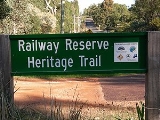
Railway Reserve Heritage Trail
Encyclopedia
Railway Reserves Heritage Trail, also on some maps as Rail reserve heritage trail or Rail reserves historical trail - and frequently referred to locally as the 'Bridle Trail' or 'Bridle Track' , is within the Shire of Mundaring
in Western Australia
.
to Bellevue via Mount Helena
is 40.8 km in length - it constitutes two routes travelling east of Bellevue, see History.
The Eastern extension within this trail, Mount Helena to Wooroloo
is 22.5 km in length.
The Kep Track
continues along the old railway route as far as Northam, and is 75 km in length.
In Kalamunda
there is a Railway heritage trail that follows the alignment of the old Upper Darling Range Railway.
(the WAGR as it was commonly known) ceasing to operate on the Bellevue to Northam railway following the construction of the Standard Gauge Railway in 1966.
The first two attempts at the Eastern Railway from Bellevue
to Chidlow, Western Australia
both constructed before 1900 failed to have sufficiently low gradients for the increasing tonnages on the railway system. The Avon Valley route taken by the new Standard Gauge line, was the third and final attempt to take the railway system out of the metropolitan area across the Darling Scarp
.
The first two Eastern Railway formations were closed by an act of Parliament in the 1960s, and the lands were vested with the Mundaring Council
. As a result most of the removable property of the WAGR - was removed from the reserve. Notably the Mundaring and Darlington concrete railway platforms remain, and approximately three telegraph poles remain along the original formation. Otherwise all rails, sleepers and buildings no longer remain. The Koongamia platform, although in use for only about five years, is currently being re-built.
Interesting exceptions to the removal of railway operations assets are the stationmaster's houses in Mundaring and Glen Forrest - these have been preserved and maintained. The Mundaring house is currently the location of the office of the Mundaring and Hills Historical Society
.
Considerable alterations have been made to the original railway formations by telco, power, road and other authorities. In parts, roads named 'Railway Terrace', and other old roads running parallel to the reserve remain unchanged.
saw 17 Heritage Trails funded by the Commonwealth and Western Australian governments under the Commonwealth State Bicentennial Commemorative Program - as the W.A. Heritage Trail Network.
The Railway Reserves Heritage Trail was developed by the Mundaring Bicentennial Community Committee, and a pamphlet and signage on the trail was funded by this as well. In the pamphlet and on the signage - the main stopping places as annotated, and the details go as far as Wooroloo.
It passes through the John Forrest National Park
and is one of a number of named trails in the park
Considerable funds have been given to the Mundaring shire to maintain the reserve for use by walkers, cyclists and horse riders (hence the Bridle Trail name recurring). However, despite restraints, motor cyclists and others provide a regular hazard.
which is part of the Helena River
catchment, while the second followed Jane Brook which joins the Swan River
at Middle Swan.
Sections of the reserve have important ecological features that contain examples of a range of conditions found in the region.
The whole trail is in effect a vital Wildlife corridor
creating connections between adjacent parks and nature reserves:
First Route or Southern Section
Second Route or Northern Section
It also has named parks and reserves either within or linked in the legal bounds of the land designated as the trail:
, encourages participants to enjoy art, entertainment, local history, activities and the physical challenge along the Trail.
The event was conducted from Wooroloo
to Chidlow
in 2004, Mount Helena
to Parkerville
in 2005, Mundaring
to Darlington
in 2006, Chidlow
to Sawyers Valley
in 2007, Mundaring to Mundaring Weir in 2008, Mundaring to Darlington in 2009 and will take place from Parkerville to Swan View in 2010.
Most road crossings on the trail have signs showing distances to the next number of locations or road crossings.
. It has a map, terrain profile, and a brief history of the two sections/routes.
A newer pamphlet produced by the Mundaring Shire Railway Reserves Heritage Trail is linked with the new website
Shire of Mundaring
The Shire of Mundaring is a Local Government Area on the eastern fringe of metropolitan Perth, the capital of Western Australia. The Shire covers an area of and has a population of 35,097 .-History:...
in Western Australia
Western Australia
Western Australia is a state of Australia, occupying the entire western third of the Australian continent. It is bounded by the Indian Ocean to the north and west, the Great Australian Bight and Indian Ocean to the south, the Northern Territory to the north-east and South Australia to the south-east...
.
Names and sections
The Trail Loop (BellevueBellevue, Western Australia
Bellevue is an eastern suburb of Perth, Western Australia. Its Local Government Areas are the City of Swan and the Shire of Mundaring, and it is located at the foot of the slopes of Greenmount, a landmark on the Darling Scarp that is noted in the earliest of travel journals of the early Swan River...
to Bellevue via Mount Helena
Mount Helena
Mount Helena may refer to:*Mount Helena, Western Australia, a suburb of Perth,*Mount Helena , a mountain in British Columbia.*Mount Helena City Park, a mountain and city park in Montana....
is 40.8 km in length - it constitutes two routes travelling east of Bellevue, see History.
The Eastern extension within this trail, Mount Helena to Wooroloo
Wooroloo, Western Australia
Wooroloo is a town on the outer fringe of the Perth metropolitan area, located off Great Eastern Highway in the eastern part of the Shire of Mundaring. At the 2006 census, Wooroloo had a population of 254.-History:...
is 22.5 km in length.
The Kep Track
Kep Track
The Kep Track is a bicycle, walking and horse track in the Darling Range and further east of Western Australia.It commences at Mundaring Weir and proceeds through Chidlow, Wooroloo, Wundowie, Bakers Hill and Clackline to Northam, for approximately 75 kilometres...
continues along the old railway route as far as Northam, and is 75 km in length.
In Kalamunda
Kalamunda, Western Australia
-Transport:Kalamunda Road serves as a major access road for Perth Airport, and provides the foothills suburbs with access to the Perth central business district....
there is a Railway heritage trail that follows the alignment of the old Upper Darling Range Railway.
History
It was created following the Western Australian Government RailwaysWestern Australian Government Railways
Western Australian Government Railways was most common name of the Western Australian government rail transport authority from 1890 to 1976. It is, in its current form, known as the Public Transport Authority of Western Australia....
(the WAGR as it was commonly known) ceasing to operate on the Bellevue to Northam railway following the construction of the Standard Gauge Railway in 1966.
The first two attempts at the Eastern Railway from Bellevue
Bellevue, Western Australia
Bellevue is an eastern suburb of Perth, Western Australia. Its Local Government Areas are the City of Swan and the Shire of Mundaring, and it is located at the foot of the slopes of Greenmount, a landmark on the Darling Scarp that is noted in the earliest of travel journals of the early Swan River...
to Chidlow, Western Australia
Chidlow, Western Australia
Chidlow is a small community in the Shire of Mundaring approximately 45 kilometres east of Perth, Western Australia.-History:The Chidlow townsite was originally named Chidlow's Well after a small waterhole near the old Northam road. The watering place had been known to travellers for many years and...
both constructed before 1900 failed to have sufficiently low gradients for the increasing tonnages on the railway system. The Avon Valley route taken by the new Standard Gauge line, was the third and final attempt to take the railway system out of the metropolitan area across the Darling Scarp
Darling Scarp
The Darling Scarp, also referred to as the Darling Range or Darling Ranges, is a low escarpment running north-south to the east of the Swan Coastal Plain and Perth, Western Australia...
.
The first two Eastern Railway formations were closed by an act of Parliament in the 1960s, and the lands were vested with the Mundaring Council
Shire of Mundaring
The Shire of Mundaring is a Local Government Area on the eastern fringe of metropolitan Perth, the capital of Western Australia. The Shire covers an area of and has a population of 35,097 .-History:...
. As a result most of the removable property of the WAGR - was removed from the reserve. Notably the Mundaring and Darlington concrete railway platforms remain, and approximately three telegraph poles remain along the original formation. Otherwise all rails, sleepers and buildings no longer remain. The Koongamia platform, although in use for only about five years, is currently being re-built.
Interesting exceptions to the removal of railway operations assets are the stationmaster's houses in Mundaring and Glen Forrest - these have been preserved and maintained. The Mundaring house is currently the location of the office of the Mundaring and Hills Historical Society
Mundaring and Hills Historical Society
The Mundaring and Hills Historical Society is a local history society for the Mundaring Shire based in Mundaring Western Australia.Affiliated with the Royal Western Australian Historical Society, the Society is a vital conduit for the disparate heritage and history issues in the Shire area...
.
Considerable alterations have been made to the original railway formations by telco, power, road and other authorities. In parts, roads named 'Railway Terrace', and other old roads running parallel to the reserve remain unchanged.
Australian Bicentenary
In 1988 the Australian BicentenaryAustralian Bicentenary
The bicentenary of Australia was celebrated in 1970 on the 200th anniversary of Captain James Cook landing and claiming the land, and again in 1988 to celebrate 200 years of permanent European settlement.-1970:...
saw 17 Heritage Trails funded by the Commonwealth and Western Australian governments under the Commonwealth State Bicentennial Commemorative Program - as the W.A. Heritage Trail Network.
The Railway Reserves Heritage Trail was developed by the Mundaring Bicentennial Community Committee, and a pamphlet and signage on the trail was funded by this as well. In the pamphlet and on the signage - the main stopping places as annotated, and the details go as far as Wooroloo.
Current conditions
In some parts the reserve is an important wildlife corridor, while other parts have been degraded by erosion and bushfire damage.It passes through the John Forrest National Park
John Forrest National Park
John Forrest National Park is a national park in the Darling Scarp, 24 km east of Perth, Western Australia. It was the first national park in Western Australia and the second in Australia after Royal National Park.- Name :...
and is one of a number of named trails in the park
Considerable funds have been given to the Mundaring shire to maintain the reserve for use by walkers, cyclists and horse riders (hence the Bridle Trail name recurring). However, despite restraints, motor cyclists and others provide a regular hazard.
Ecology and environmental context
The two earlier routes of the Eastern Railway followed closely the line of two creeks - the first route followed Nyaania CreekNyaania Creek
Nyaania was also a stopping place and locality name associated with the first route of the Eastern Railway between Bellevue and Mundaring in Western Australia-Significance:...
which is part of the Helena River
Helena River
The Helena River is a tributary of the Swan River in Western Australia. The river rises in country east of Mount Dale and moves to the north west to Mundaring Weir, where it is dammed...
catchment, while the second followed Jane Brook which joins the Swan River
Swan River (Western Australia)
The Swan River estuary flows through the city of Perth, in the south west of Western Australia. Its lower reaches are relatively wide and deep, with few constrictions, while the upper reaches are usually quite narrow and shallow....
at Middle Swan.
Sections of the reserve have important ecological features that contain examples of a range of conditions found in the region.
The whole trail is in effect a vital Wildlife corridor
Wildlife corridor
A wildlife corridor or green corridor is an area of habitat connecting wildlife populations separated by human activities . This allows an exchange of individuals between populations, which may help prevent the negative effects of inbreeding and reduced genetic diversity that often occur within...
creating connections between adjacent parks and nature reserves:
First Route or Southern Section
- Greenmount National ParkGreenmount National ParkGreenmount National Park is a national park in the locality of Greenmount Western Australia , 22 km east of Perth.It is one of the smaller National Parks along the Darling Scarp and is a component of the Darling Range National Park....
- adjacent reserve grounds - Greenmount and Boya - Darlington Recreation Ground - Darlington
- Binbrook Park - Darlington
- Glen Forrest Super Block - Glen Forrest
- Strettle Road Reserve - Mahogany Creek
- State Forest - Sawyers Valley
Second Route or Northern Section
- John Forrest National ParkJohn Forrest National ParkJohn Forrest National Park is a national park in the Darling Scarp, 24 km east of Perth, Western Australia. It was the first national park in Western Australia and the second in Australia after Royal National Park.- Name :...
- Swan View and Hovea - Brookside Park - Hovea
- Milligan Park - Stoneville
- Leschenaultia Conservation Reserve - Chidlow
- Beechina Nature Reserve - Beechina
- Beechina North Nature Reserve - Beechina
- Needham Nature Reserve - Wooroloo
It also has named parks and reserves either within or linked in the legal bounds of the land designated as the trail:
- Whybourne Park - Bellevue
- Darlington Station Reserve - Darlington
- M.J. Morgan Reserve - Glen Forrest
- Thomas Park - Glen Forrest
- Sculpture Park - Mundaring
- Jarrah Creek Reserve -Sawyers Valley
- Chidlow Recreation Reserve - Chidlow
Trek The Trail
Trek the Trail is a free walking and cycling event that takes place every September along a section of Railway Reserves Heritage Trail. This annual event, jointly run by the Shire of Mundaring, Mundaring Arts Centre, Mundaring Tourism Association and Mundaring and Hills Historical SocietyMundaring and Hills Historical Society
The Mundaring and Hills Historical Society is a local history society for the Mundaring Shire based in Mundaring Western Australia.Affiliated with the Royal Western Australian Historical Society, the Society is a vital conduit for the disparate heritage and history issues in the Shire area...
, encourages participants to enjoy art, entertainment, local history, activities and the physical challenge along the Trail.
The event was conducted from Wooroloo
Wooroloo, Western Australia
Wooroloo is a town on the outer fringe of the Perth metropolitan area, located off Great Eastern Highway in the eastern part of the Shire of Mundaring. At the 2006 census, Wooroloo had a population of 254.-History:...
to Chidlow
Chidlow, Western Australia
Chidlow is a small community in the Shire of Mundaring approximately 45 kilometres east of Perth, Western Australia.-History:The Chidlow townsite was originally named Chidlow's Well after a small waterhole near the old Northam road. The watering place had been known to travellers for many years and...
in 2004, Mount Helena
Mount Helena, Western Australia
Mount Helena is a rural suburb on the outskirts of Perth in Western Australia, some 35 km from the city, in the Shire of Mundaring. Its population in 2005 was approximately 2,400 people.-History:...
to Parkerville
Parkerville, Western Australia
Parkerville is a suburb in the Shire of Mundaring in Western Australia. Jane Brook flows through Parkerville on its way down to the Swan River through John Forrest National Park.-History:...
in 2005, Mundaring
Mundaring, Western Australia
Mundaring is a suburb located 34 km east of Perth on the Great Eastern Highway. The suburb is located within the Shire of Mundaring.The Aboriginal name of the area 'Mindah-lung', said to mean 'a high place on a high place', was anglicised to become 'Mundaring'.The Mundaring area is also considered...
to Darlington
Darlington, Western Australia
Darlington, Western Australia, is a locality in the Shire of Mundaring on the Darling Scarp, dissected by Nyaania Creek and north of the Helena River.- Location :...
in 2006, Chidlow
Chidlow, Western Australia
Chidlow is a small community in the Shire of Mundaring approximately 45 kilometres east of Perth, Western Australia.-History:The Chidlow townsite was originally named Chidlow's Well after a small waterhole near the old Northam road. The watering place had been known to travellers for many years and...
to Sawyers Valley
Sawyers Valley, Western Australia
Sawyers Valley is sited on the Great Eastern Highway about 40 kilometres from Perth, Western Australia in the Shire of Mundaring.The community began as a sawmill and railway siding to process timber from the forest surrounding the Helena River to the south...
in 2007, Mundaring to Mundaring Weir in 2008, Mundaring to Darlington in 2009 and will take place from Parkerville to Swan View in 2010.
Distances
- Pechey Road , Swan ViewSwan View, Western AustraliaSwan View is an eastern suburb of Perth, Western Australia. Its Local Government Areas are the City of Swan and the Shire of Mundaring, and it is located from Perth in an area known as the Perth Hills on the edge of the Darling Scarp, just to the west of the John Forrest National Park, east of Roe...
00.0 km 40.8 km - Swan View TunnelSwan View TunnelThe Swan View Tunnel is a 340 m railway tunnel located on the southern side of the Jane Brook valley at Swan View, Western Australia on the edge of the Darling Scarp. Currently inactive, due to its location within the John Forrest National Park, the tunnel and its adjacent landscape exist...
eastern entrance 1.2 km 39.6 km - ParkervilleParkerville, Western AustraliaParkerville is a suburb in the Shire of Mundaring in Western Australia. Jane Brook flows through Parkerville on its way down to the Swan River through John Forrest National Park.-History:...
8.9 km 31.9 km - StonevilleStoneville, Western AustraliaStoneville is a suburb east of Perth in the Shire of Mundaring, Western Australia. It is named after Sir Albert Edward Stone, who was Chief Justice of Western Australia when the place was named in 1905. The name was chosen by the local residents who were developing the district for fruit growing...
11.9 km 28.9 km - Mount HelenaMount Helena, Western AustraliaMount Helena is a rural suburb on the outskirts of Perth in Western Australia, some 35 km from the city, in the Shire of Mundaring. Its population in 2005 was approximately 2,400 people.-History:...
15.9 km 24.9 km - Sawyers ValleySawyers Valley, Western AustraliaSawyers Valley is sited on the Great Eastern Highway about 40 kilometres from Perth, Western Australia in the Shire of Mundaring.The community began as a sawmill and railway siding to process timber from the forest surrounding the Helena River to the south...
19.0 km 21.8 km - MundaringMundaring, Western AustraliaMundaring is a suburb located 34 km east of Perth on the Great Eastern Highway. The suburb is located within the Shire of Mundaring.The Aboriginal name of the area 'Mindah-lung', said to mean 'a high place on a high place', was anglicised to become 'Mundaring'.The Mundaring area is also considered...
22.6 km 18.2 km - Coppin Road, Mundaring 24.1 km 16.7 km
- Bailey Road, Glen ForrestGlen Forrest, Western AustraliaGlen Forrest is a suburb within the Shire of Mundaring, south of John Forrest National Park, west of Mahogany Creek, east of Darlington, and north of the Helena River...
27.8 km 15.2 km - Hardey Road, Glen Forrest 29.0 km 11.8 km
- DarlingtonDarlington, Western AustraliaDarlington, Western Australia, is a locality in the Shire of Mundaring on the Darling Scarp, dissected by Nyaania Creek and north of the Helena River.- Location :...
31.7 km 9.1 km - BoyaBoya, Western AustraliaBoya is a locality on the Darling Scarp, in the Shire of Mundaring, Western Australia. On the south side of Greenmount Hill, and just west of Darlington....
34.0 km 6.8 km - Scott Road, GreenmountGreenmount, Western AustraliaGreenmount is a locality and a geographical feature in the Shire of Mundaring, Western Australia, on the edge of the Darling Scarp. It is a vital point in the transport routes from the Swan Coastal Plain into the hinterland of Western Australia....
35.7 km 5.1 km - RSL Hall, BellevueBellevue, Western AustraliaBellevue is an eastern suburb of Perth, Western Australia. Its Local Government Areas are the City of Swan and the Shire of Mundaring, and it is located at the foot of the slopes of Greenmount, a landmark on the Darling Scarp that is noted in the earliest of travel journals of the early Swan River...
35.7 km 3.3 km
Most road crossings on the trail have signs showing distances to the next number of locations or road crossings.
Cycling
As the trail is a shared trail - cyclists, horse riders and pedestrians share the trail - one route suggested by the DPI utilises part of the trailInformation
An older pamphlet produced in conjunction between Trailwest, Bikewest, WAMBA, Mundaring Shire, DEC, and Lotteries West - Bikewest Mountain Bike Maps - Railway Reserve Trail - Midland-Mt Helena-Midland recommends a starting point of the Morrison Road-Pechey Road intersection in Swan ViewSwan View, Western Australia
Swan View is an eastern suburb of Perth, Western Australia. Its Local Government Areas are the City of Swan and the Shire of Mundaring, and it is located from Perth in an area known as the Perth Hills on the edge of the Darling Scarp, just to the west of the John Forrest National Park, east of Roe...
. It has a map, terrain profile, and a brief history of the two sections/routes.
A newer pamphlet produced by the Mundaring Shire Railway Reserves Heritage Trail is linked with the new website
External links
- http://www.railwayreserves.com.au
- http://www.trekthetrail.com.au
- http://www.railtrails.org.au/states/trails.php3?action=trail&trail=49
- http://www.perthtrails.com.au/browse.asp?pg=382&RegionID=2
- http://www.dpi.wa.gov.au/cycling/1515.asp
- http://www.dpi.wa.gov.au/cycling/1927.asp