

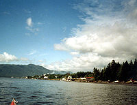
Port Edward, British Columbia
Encyclopedia
British Columbia Coast
The British Columbia Coast or BC Coast is Canada's western continental coastline on the Pacific Ocean. The usage is synonymous with the term West Coast of Canada....
, Canada.
It is situated on the Tsimpsean Peninsula, opposite Ridley Island, 15 km (9 mi) south of Prince Rupert
Prince Rupert, British Columbia
Prince Rupert is a port city in the province of British Columbia, Canada. It is the land, air, and water transportation hub of British Columbia's North Coast, and home to some 12,815 people .-History:...
.
Directions
West of Port Edward is Prince Rupert, British ColumbiaPrince Rupert, British Columbia
Prince Rupert is a port city in the province of British Columbia, Canada. It is the land, air, and water transportation hub of British Columbia's North Coast, and home to some 12,815 people .-History:...
(12). East of Port Edward is Terrace, British Columbia
Terrace, British Columbia
Terrace is a city on the Skeena River in British Columbia, Canada. The Kitselas people, a tribe of the Tsimshian Nation, have lived in the Terrace area for thousands of years. The community population fell between 2001 and 2006 from 12,109 with a regional population of 19,980 to 11,320 and...
(132), Kitimat, British Columbia
Kitimat, British Columbia
Kitimat is a coastal city in northwestern British Columbia, in the Regional District of Kitimat-Stikine. The Kitimat Valley, which includes the adjacent community of Terrace, is the most populous urban district in Northwest British Columbia...
(190), and Prince George, British Columbia
Prince George, British Columbia
Prince George, with a population of 71,030 , is the largest city in northern British Columbia, Canada, and is known as "BC's Northern Capital"...
(705).
Highway 599
Until 2010 there had never been a highway running through Port Edward. However, that has changed, since Google MapsGoogle Maps
Google Maps is a web mapping service application and technology provided by Google, free , that powers many map-based services, including the Google Maps website, Google Ride Finder, Google Transit, and maps embedded on third-party websites via the Google Maps API...
has started showing it on Street View. It was designated in 2010 and ends at the junction of Highway 16.
Economy
At one time sustained by the numerous canneries in the area, many Port Edward residents now work in the forestry and fishing industries, some of whom commute to Prince Rupert.Tourism is also a mainstay of the economy. There is a cannery village museum at Port Edward.