

Planura
Encyclopedia
Minas Gerais
Minas Gerais is one of the 26 states of Brazil, of which it is the second most populous, the third richest, and the fourth largest in area. Minas Gerais is the Brazilian state with the largest number of Presidents of Brazil, the current one, Dilma Rousseff, being one of them. The capital is the...
. As of 2007 the population was 10,289 in a total area of 318 km². It became a municipality in 1962.
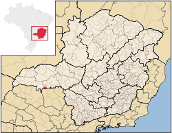
Location
Planura belongs to the statistical micro-region of FrutalFrutal
Frutal is a municipality in the west of the Brazilian state of Minas Gerais. The population, measured in 2010 by the IBGE, is of 53,468 inhabitants. The city has an area of 2,427 km²...
. It is located in the center of the rich region of western Minas Gerais known as the Triângulo Mineiro
Triângulo Mineiro
The Triangle Mineiro Portuguese pronunciation: [tɾiɐɡulu minejru] is an officer in the region west of the state of Minas Gerais, Brazil. The area is 93.500 km ² and is limited by the Serra da Canastra and Marcela, east, south of Sao Paulo, Goias in the north and west of the junction of the rivers...
at an elevation of 492 meters. The Rio Grande River, dammed to form the Represa de Porto Colômiba, forms the southern boundary. Neighboring municipalities are:
- West: FrutalFrutalFrutal is a municipality in the west of the Brazilian state of Minas Gerais. The population, measured in 2010 by the IBGE, is of 53,468 inhabitants. The city has an area of 2,427 km²...
- North: PirajubaPirajubaPirajuba is a municipality in the west of the Brazilian state of Minas Gerais. As of 2007 the population was 3,694 in a total area of 332 km². It became a municipality in 1953.- Etymology :...
- East: Conceição das AlagoasConceição das AlagoasConceição das Alagoas is a Brazilian municipality located in the west of the state of Minas Gerais. Its population as of 2007 was estimated to be 20,426 people living in a total area of 1,348 km². The city belongs to the mesoregion of Triângulo Mineiro and Alto Paranaíba and to the micro-region of...
- South: ColômbiaColômbiaColômbia is a municipality in the northern part of the state of São Paulo in Brazil. The population in 2003 is 6,299 and the area is 731.46 km² The elevation is 492 m. The bounding municipalities are Barretos to the south and Guaíra to the east...
in the state of São PauloSão PauloSão Paulo is the largest city in Brazil, the largest city in the southern hemisphere and South America, and the world's seventh largest city by population. The metropolis is anchor to the São Paulo metropolitan area, ranked as the second-most populous metropolitan area in the Americas and among...
Important distances are:
- Belo HorizonteBelo HorizonteBelo Horizonte is the capital of and largest city in the state of Minas Gerais, located in the southeastern region of Brazil. It is the third largest metropolitan area in the country...
: 578 km - PirajubaPirajubaPirajuba is a municipality in the west of the Brazilian state of Minas Gerais. As of 2007 the population was 3,694 in a total area of 332 km². It became a municipality in 1953.- Etymology :...
: 30 km - FrutalFrutalFrutal is a municipality in the west of the Brazilian state of Minas Gerais. The population, measured in 2010 by the IBGE, is of 53,468 inhabitants. The city has an area of 2,427 km²...
: 37 km - UberabaUberabaUberaba is a city and municipality in the west of the state of Minas Gerais in Brazil. Its population is 296.000 with an area of 4529.7 km², giving a density of 60.71 people per km². It is located on a plateau at an elevation of 785 meters and is in the Uberaba River floodplain...
: 110 km
History
The first settlement began on lands belonging to João Januário da Silva e Oliveira, on the banks of the Rio Grande. The first group of houses was known as Porto do Cemitério, later changing the name to Esplanada. In 1938 it became a district of FrutalFrutal
Frutal is a municipality in the west of the Brazilian state of Minas Gerais. The population, measured in 2010 by the IBGE, is of 53,468 inhabitants. The city has an area of 2,427 km²...
with the name Nova Esplanada. In 1962 it became a municipality. The growth of the town has been due to the building of the Usina Hidrelétrica de Porto Colômbia, in the 1970s. The name is due to the flat lands of the region.
Economic activities
The most important economic activities are cattle raising, commerce, royalties from the Porto Colômba hydroelectric station, and agriculture. The GDP in 2005 was R$433 million, half of which came from industry. Planura is in the top tier of municipalities in the state with regard to economic and social development. As of 2007, there was one banking agency in the town. There was a small retail infrastructure serving the surrounding area of cattle and agricultural lands. There were 1,106 automobiles in all of the municipality, about one for every 10 inhabitants.In the rural area there were 75 establishments occupying 76,000 hectares. About 300 persons were employed in agriculture. 41 of the farms had tractors, a ratio of one in two. There were 6,000 head of cattle in 2006, of which 2,500 head were dairy cows. In permanent crops there were 8,000 ha planted, while in perennial crops 8,300 ha were planted (in 2006). The crops with a planted area of more than 1,000 hectares were sugarcane, corn, and soybeans.
The production of vegetables is aided by the abundance of water in the region, available from the Usina de Porto Colômbia. Planura is one of the largest producers of cucumber, red pepper and tomatoes in the state.
Health and education
In the health sector there were 03 health clinics and no hospital. In the educational sector there were 04 primary schools and 02 middle schools.- Municipal Human Development IndexHuman Development IndexThe Human Development Index is a composite statistic used to rank countries by level of "human development" and separate "very high human development", "high human development", "medium human development", and "low human development" countries...
: 0.779 (2000) - State ranking: 121 out of 853 municipalities as of 2000
- National ranking: 1,088 out of 5,138 municipalities as of 2000
- Literacy rate: 89%
- Life expectancy: 73 (average of males and females)
The highest ranking municipality in Minas Gerais in 2000 was Poços de Caldas
Poços de Caldas
Poços de Caldas is a city and municipality in south-western Minas Gerais state, Brazil, in the microregion of the same name. Its estimated population in 2009 was 151,449 inhabitants...
with 0.841, while the lowest was Setubinha
Setubinha
Setubinha is a municipality in the northeast of the Brazilian state of Minas Gerais. As of 2007 the population was 10,834 in a total area of 536 km². The elevation is 729 metres. It is part of the IBGE statistical microregion of Teófilo Otoni...
with 0.568. Nationally the highest was São Caetano do Sul
São Caetano do Sul
São Caetano do Sul is a city in São Paulo state in Brazil, located in the Greater São Paulo Metropolitan Area. It is the city with the highest per capita income in Brazil and it also has the highest Human Development Index .-Geography:São Caetano do Sul is located on a plateau that is part of the...
in São Paulo with 0.919, while the lowest was Setubinha. In more recent statistics (considering 5,507 municipalities) Manari in the state of Pernambuco
Pernambuco
Pernambuco is a state of Brazil, located in the Northeast region of the country. To the north are the states of Paraíba and Ceará, to the west is Piauí, to the south are Alagoas and Bahia, and to the east is the Atlantic Ocean. There are about of beaches, some of the most beautiful in the...
has the lowest rating in the country—0,467—putting it in last place.
See also
- List of municipalities in Minas Gerais